This page is not an official page of the app or its developer, but an independent editorial publication created for informational and commentary purposes. Unless expressly stated otherwise, neither the app nor its developer is affiliated with, endorsed by, sponsored by, authorized by, or otherwise officially connected with MWM, Apple, Google Play, the app publisher, or the app's developer, and nothing on this page implies that the app was developed using MWM's services. Any trademarks, logos, screenshots, and other content remain the property of their respective owners.

Swiss3D
Transform your iPhone into a high-tech navigation tool. Identify every peak, glacier, and star in immersive AR using professional Swisstopo data. No internet connection required for your next great adventure.
Downloads
0User Rating
Total Ratings
0Publisher
Category
TravelLocales
3Latest Version
13.0.2Size
703.8 MBFirst Released
Nov 6, 2014Explore the Alps with Unrivaled Precision
Swiss3D combines professional-grade topographic data with cutting-edge AR technology to provide a complete, offline guide to the Swiss landscape and night sky.
Offline AR Peak Finder
Identify 15,000+ summits and 54,000 landmarks instantly through your camera, working 100% offline even in the most remote alpine valleys.
Advanced Terrain Metrics
Navigate with confidence using official Swisstopo data to calculate slope steepness, altitude, and precise walking times for your next adventure.
The following screenshots and description are sourced directly from the app's official store listing and are the property of the app developer.
App Store
Screenshots
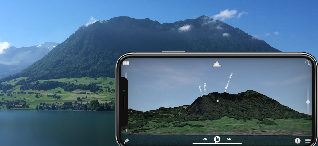
A smartphone using Swiss3D augmented reality mode to identify mountain peaks like Nollen and Horndli against a real landscape background
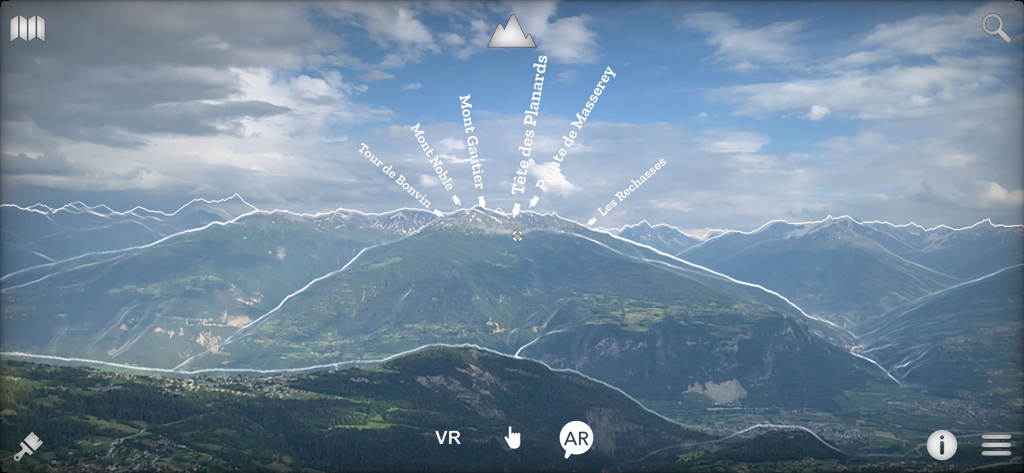
Augmented reality interface showing names of Swiss mountain peaks overlaid on landscape
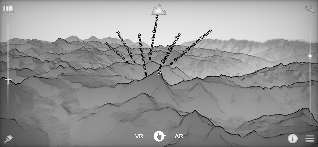
A 3D topographic landscape view in the Swiss3D app identifying various mountain peaks like Dent Blanche
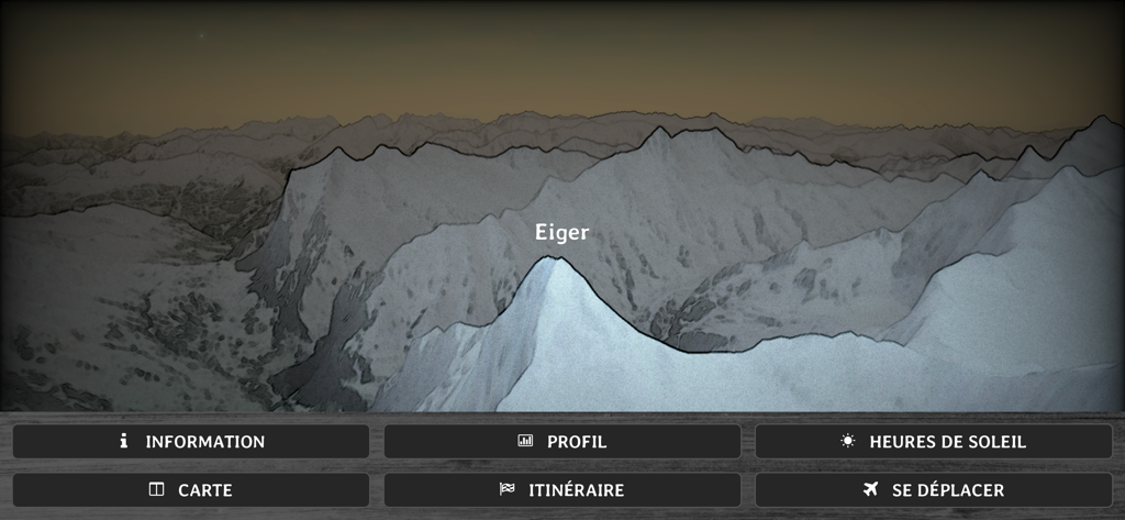
A 3D topographic map showing the Eiger peak in the Swiss Alps
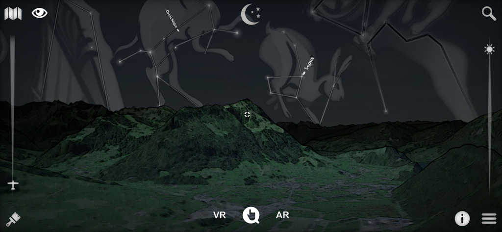
A 3D landscape view of Swiss mountains at night with star constellations and mythological figures overlayed in the sky
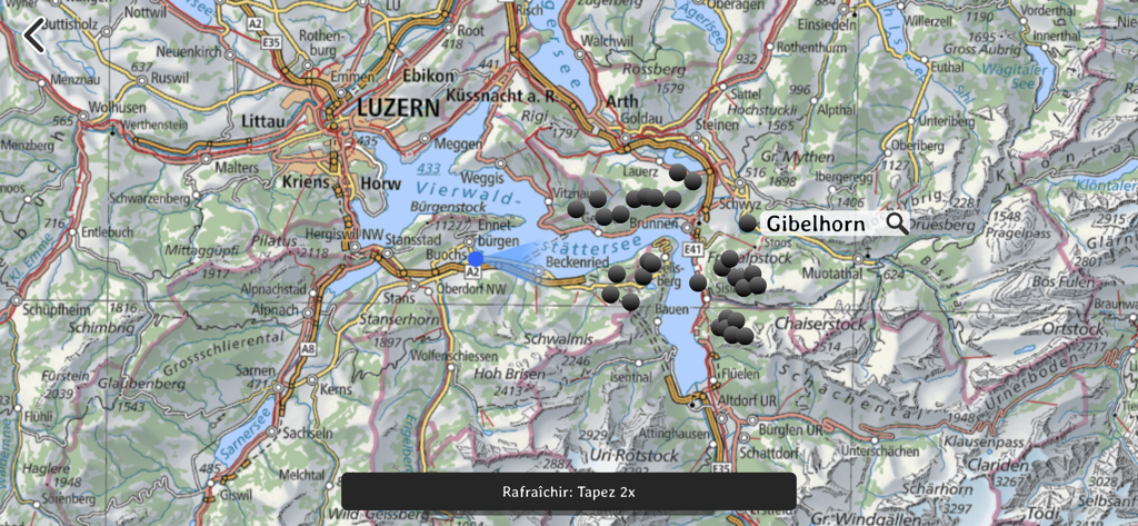
Topographic map view of the Lucerne region and surrounding mountains in the Swiss3D app
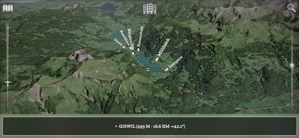
A 3D topographic map view of the Swiss Alps showing mountain peaks and town labels like Giswil and Lungern
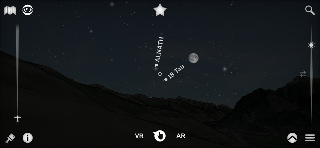
A 3D night view of the Swiss Alps in the Swiss3D app showing labeled stars like Alnath and 18 Tau next to the moon.
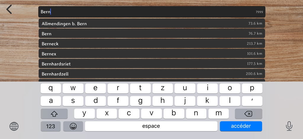
Searching for Bern in the Swiss3D app showing distance-based location results
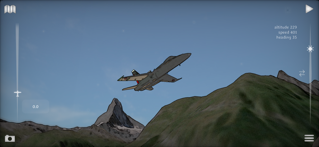
A jet flies over the Matterhorn in the Swiss3D flight simulator mode with flight data display
Description
Download
More Like This
Top-ranked apps in the same category

Uber - Request a ride
Uber Technologies, Inc.

铁路12306
ACADEMY OF RAILWAY SCIENCES CO., ltd.

Airbnb
Airbnb, Inc.

Booking.com: Hotels & Travel
Booking.com B.V.

Grab: Taxi Ride, Food Delivery
GRABTAXI HOLDINGS PTE. LTD.

DiDi China: Ride Hailing
Didi Chuxing (Beijing) Network Platform Technology Co., Ltd

Bolt: Request a Ride
BOLT TECHNOLOGY OU

去哪儿旅行-订酒店机票火车票
Beijing Qunar Information Technology Company Limit

Trip.com: Book Flights, Hotels
Trip.com Travel Singapore Pte. Ltd.
This page is not an official page of the app or its developer, but an independent editorial publication created for informational and commentary purposes. Unless expressly stated otherwise, neither the app nor its developer is affiliated with, endorsed by, sponsored by, authorized by, or otherwise officially connected with MWM, Apple, Google Play, the app publisher, or the app's developer, and nothing on this page implies that the app was developed using MWM's services. Any trademarks, logos, screenshots, and other content remain the property of their respective owners.