This page is not an official page of the app or its developer, but an independent editorial publication created for informational and commentary purposes. Unless expressly stated otherwise, neither the app nor its developer is affiliated with, endorsed by, sponsored by, authorized by, or otherwise officially connected with MWM, Apple, Google Play, the app publisher, or the app's developer, and nothing on this page implies that the app was developed using MWM's services. Any trademarks, logos, screenshots, and other content remain the property of their respective owners.

The Photographer's Ephemeris
The industry-standard planning tool for landscape and outdoor photographers. Visualize the Sun, Moon, and Milky Way with 3D map overlays, AR scouting, and advanced line-of-sight analysis to capture the perfect shot, every time.
Downloads
419K+User Rating
Total Ratings
4K+Publisher
Category
Photo & VideoLocales
4Latest Version
4.15.1Size
95.2 MBFirst Released
Apr 17, 2010Plan the Perfect Light
The industry-standard toolkit for precision-oriented photographers to master natural light and celestial alignments anywhere on Earth.
Terrain-Aware Planning
Determine exactly when the sun or moon will rise from behind local topography for pinpoint accuracy in mountainous regions.
On-Location AR Visualization
Visualize celestial paths in real-time using augmented reality to lock in your composition hours before the perfect moment.
The following screenshots and description are sourced directly from the app's official store listing and are the property of the app developer.
App Store
Screenshots
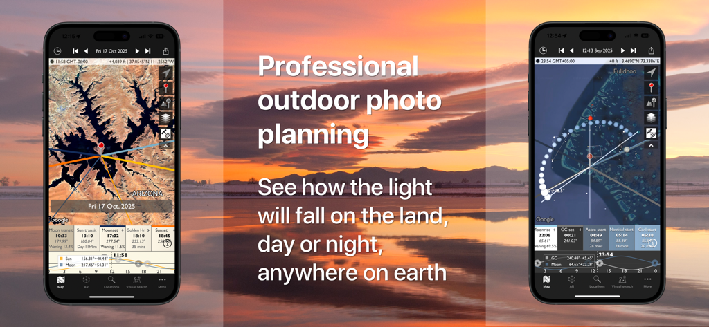
The Photographers Ephemeris mobile app interface showing sun and moon paths on maps for outdoor photography planning
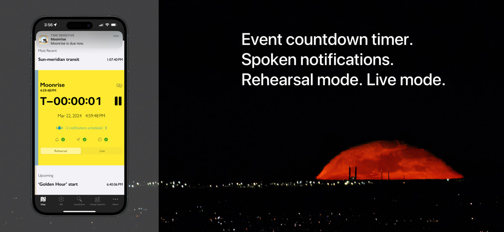
The Photographer's Ephemeris app interface showing a moonrise countdown timer and event notification settings.
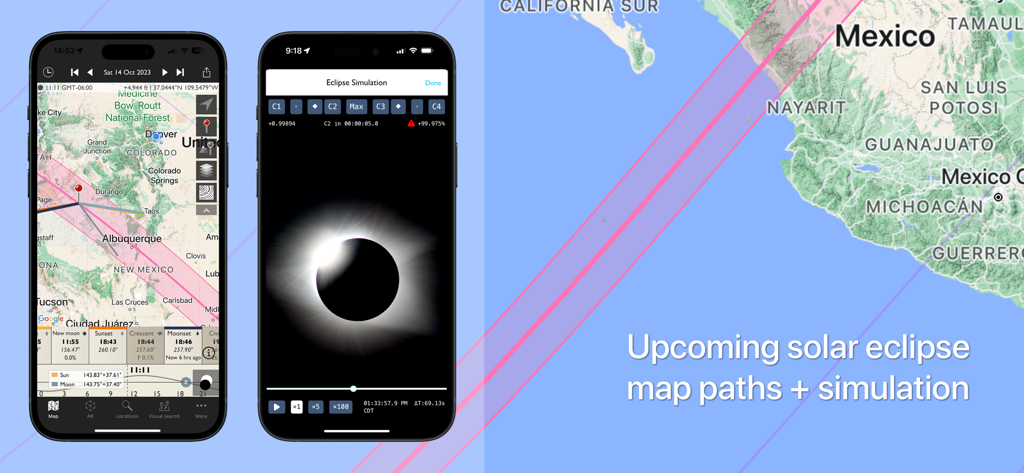
Solar eclipse map paths and visual simulation in The Photographer's Ephemeris mobile app.
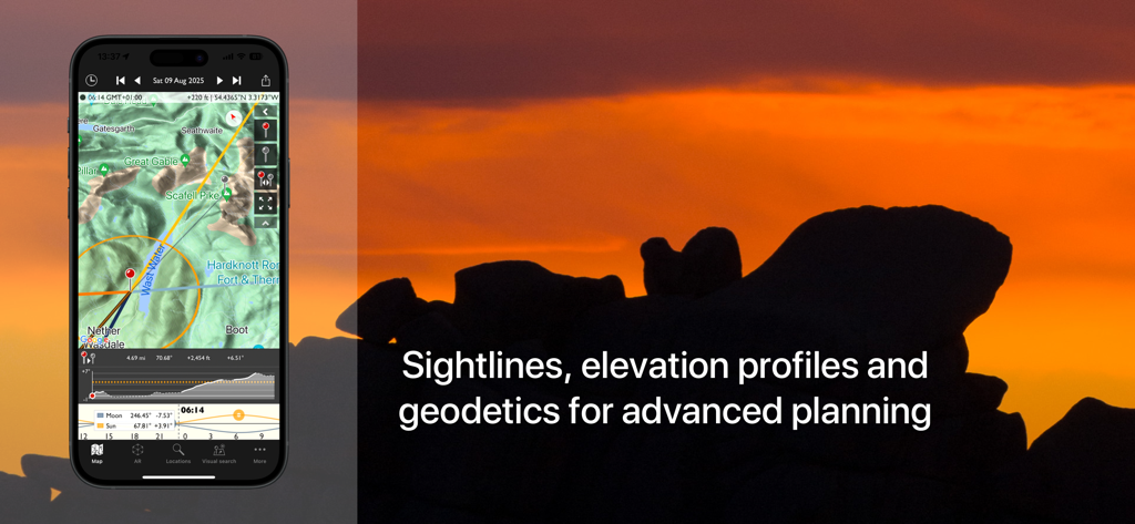
The Photographers Ephemeris app interface showing sightlines and elevation profiles for photography planning during sunset
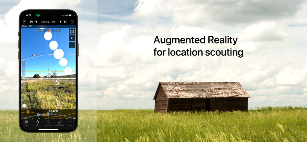
Smartphone displaying the augmented reality feature of The Photographer's Ephemeris app for location scouting over a field with a wooden shack.
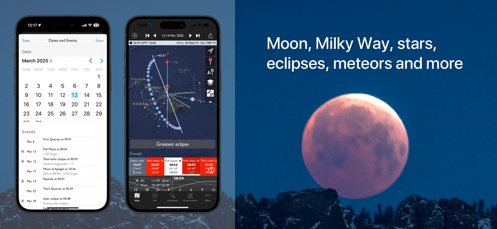
Screenshots of The Photographer's Ephemeris app showing a celestial events calendar and lunar eclipse mapping features.
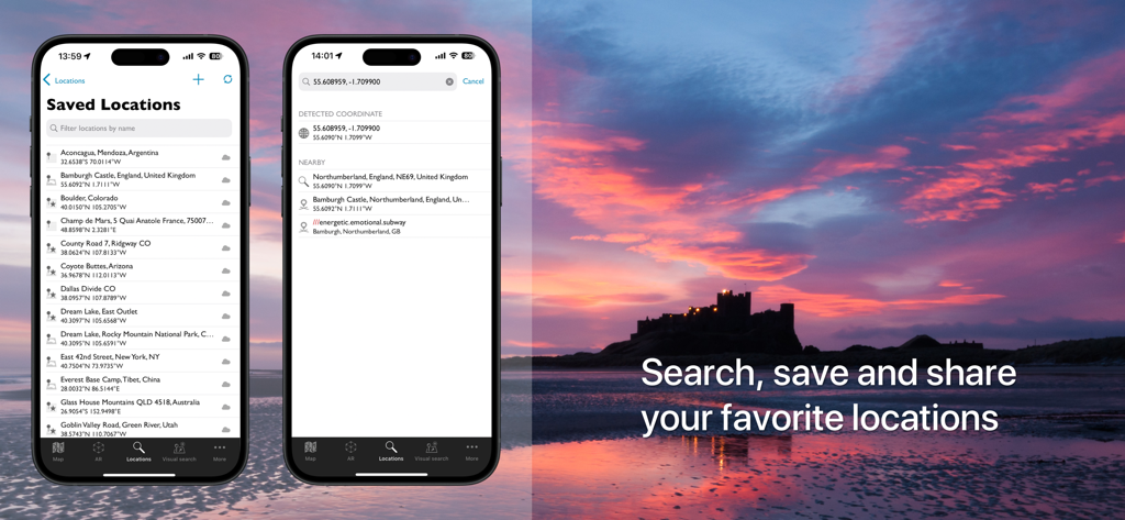
Mobile screens of The Photographer's Ephemeris app displaying saved locations and search features over a sunset landscape
Description
Download
More Like This
Apps with similar features and user experience

Moon Phases and Lunar Calendar
Business City s.r.o.

My Moon Phase - Lunar Calendar
JRustonApps B.V.

The Moon: Calendar Moon Phases
Vitalii Gryniuk

Moonlitt: Moon Phase Tracker
Flipping Hues Srls

Sunrise Sunset Times
Fascinating Projects Pty Ltd

PhotoPills
PhotoPills S.L.

AuroraReach
HuskyCodes Oy

Sun Seeker - Sunlight Tracker
Ajnaware Pty Ltd

Sun Tracker AR
Zuzana Eskinasi
This page is not an official page of the app or its developer, but an independent editorial publication created for informational and commentary purposes. Unless expressly stated otherwise, neither the app nor its developer is affiliated with, endorsed by, sponsored by, authorized by, or otherwise officially connected with MWM, Apple, Google Play, the app publisher, or the app's developer, and nothing on this page implies that the app was developed using MWM's services. Any trademarks, logos, screenshots, and other content remain the property of their respective owners.