This page is not an official page of the app or its developer, but an independent editorial publication created for informational and commentary purposes. Unless expressly stated otherwise, neither the app nor its developer is affiliated with, endorsed by, sponsored by, authorized by, or otherwise officially connected with MWM, Apple, Google Play, the app publisher, or the app's developer, and nothing on this page implies that the app was developed using MWM's services. Any trademarks, logos, screenshots, and other content remain the property of their respective owners.

Turbulence Forecast - Flight+
Turn flight anxiety into peace of mind with professional-grade altitude breakdowns and live pilot reports for your exact route.
Downloads
100+User Rating
Total Ratings
0Publisher
Category
WeatherLocales
8Latest Version
1.5.0Size
16.4 MBFirst Released
Feb 14, 2026Fly with Total Peace of Mind
Whether you are a nervous traveler seeking comfort or a professional needing a steady workspace, our precision tools turn the unknown into a planned itinerary.
Custom Route Intelligence
Enter your flight details to receive a personalized 3-day turbulence forecast mapped specifically to your departure and arrival airports.
Verified Cockpit Data
Access live PIREPs (Pilot Reports) for real-time accounts of air conditions directly from the pilots currently flying your route.
The following screenshots and description are sourced directly from the app's official store listing and are the property of the app developer.
App Store
Screenshots

A calm woman wearing headphones on a flight illustrating fear of flying relief
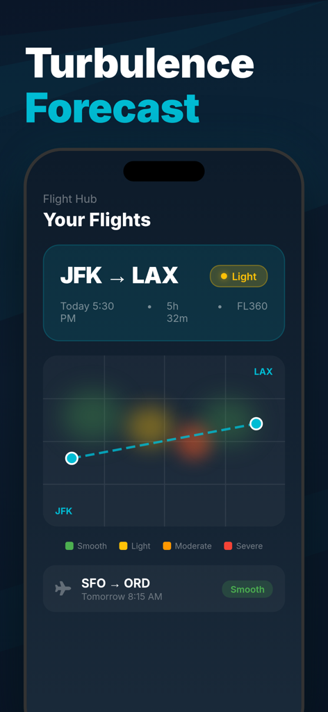
Main dashboard of the Turbulence Forecast app showing a flight route from JFK to LAX with a graphical turbulence intensity map
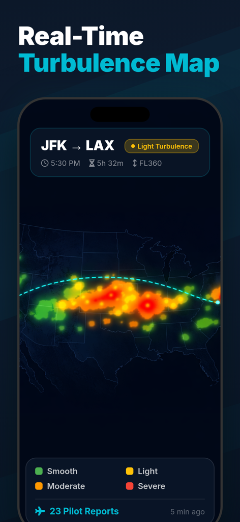
Real-time turbulence map for a flight from JFK to LAX showing intensity levels and pilot reports
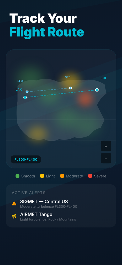
App interface showing a flight route map with turbulence intensity heat zones and active aviation alerts.
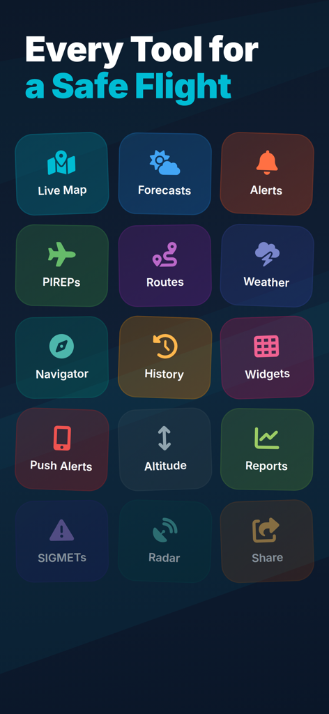
Grid of icons showing flight tools including live maps forecasts and pilot reports for aviation safety
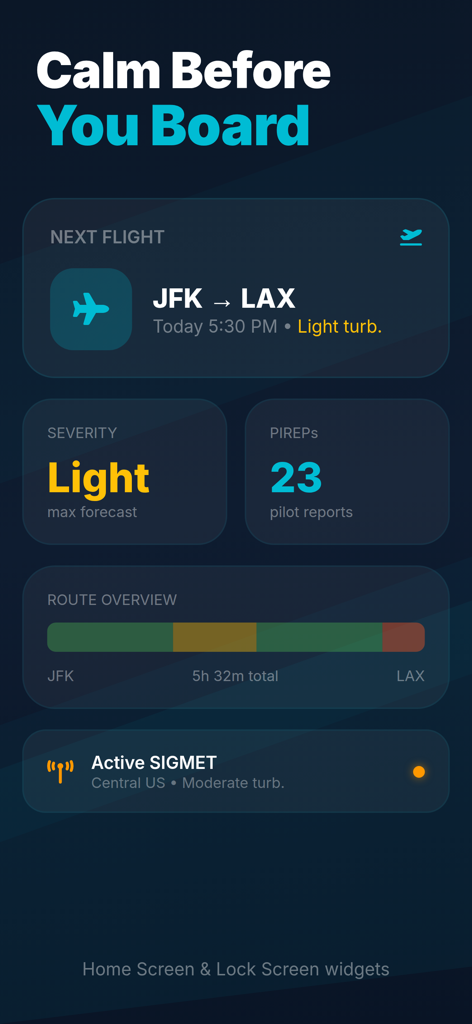
A collection of iOS home screen and lock screen widgets for the Turbulence Forecast app showing flight data from JFK to LAX including severity levels and pilot reports.
Description
Download
More Like This
Top-ranked apps in the same category

墨迹天气-MojiWeather
Beijing MojiFengyun Technology Co.,Ltd.

Windy.com
Windyty, SE

天气预报-精准15日天气预报
Chongqing Caochen Technology Co., Ltd.

The Weather Channel - Radar
The Weather Channel

AccuWeather: Weather Forecast
AccuWeather International, Inc.

Weather & Radar USA
WetterOnline - Meteorologische Dienstleistungen GmbH

My Aurora Forecast & Alerts
JRustonApps B.V.

天气通
Weibo Internet Technology (China) Co.Ltd.

Stargazing Hub - Sky Live
长榕 许
This page is not an official page of the app or its developer, but an independent editorial publication created for informational and commentary purposes. Unless expressly stated otherwise, neither the app nor its developer is affiliated with, endorsed by, sponsored by, authorized by, or otherwise officially connected with MWM, Apple, Google Play, the app publisher, or the app's developer, and nothing on this page implies that the app was developed using MWM's services. Any trademarks, logos, screenshots, and other content remain the property of their respective owners.