This page is not an official page of the app or its developer, but an independent editorial publication created for informational and commentary purposes. Unless expressly stated otherwise, neither the app nor its developer is affiliated with, endorsed by, sponsored by, authorized by, or otherwise officially connected with MWM, Apple, Google Play, the app publisher, or the app's developer, and nothing on this page implies that the app was developed using MWM's services. Any trademarks, logos, screenshots, and other content remain the property of their respective owners.

Wisconsin State Roads
Know before you go with 450+ live WisDOT feeds and instant road alerts. Stay safe on winter roads with the data you need in one tap—one-time purchase, no subscriptions.
Downloads
0User Rating
Total Ratings
0Publisher
Category
TravelLocales
1Latest Version
4.0Size
2.8 MBFirst Released
Mar 6, 2017Drive Wisconsin Roads with Total Confidence
Get real-time data directly from WisDOT to navigate commutes and winter weather safely with 450+ live cameras and zero monthly subscriptions.
450+ Live Traffic Cameras
Don't just trust a map; see the road for yourself. Access live video feeds to verify pavement conditions, snow levels, and traffic flow before you start your engine.
Winter Condition Reports
Stay ahead of Wisconsin's unpredictable winters with specialized alerts on ice, slush, and snow coverage to keep your family safe on the road.
The following screenshots and description are sourced directly from the app's official store listing and are the property of the app developer.
App Store
Screenshots
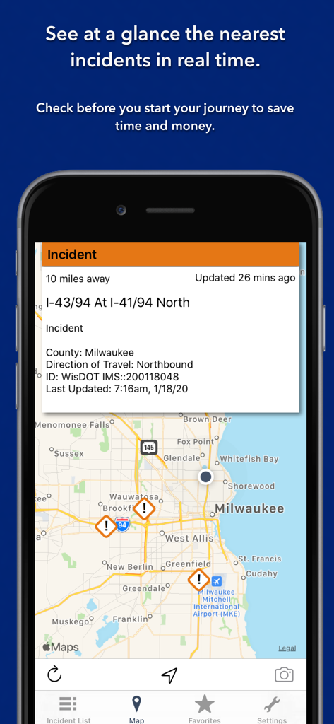
Wisconsin State Roads app displaying real-time traffic incidents on a Milwaukee map.
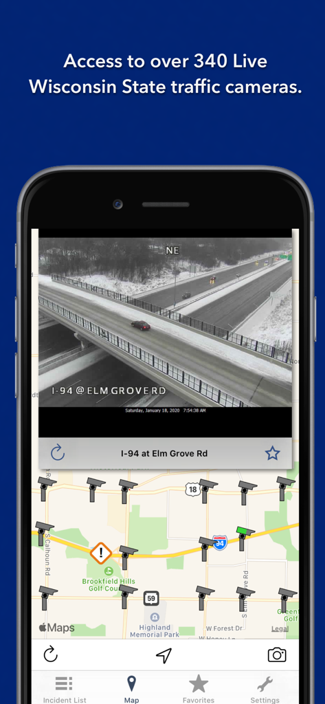
Wisconsin State Roads app displaying a live camera feed of a snowy I-94 highway and a traffic map with camera icons
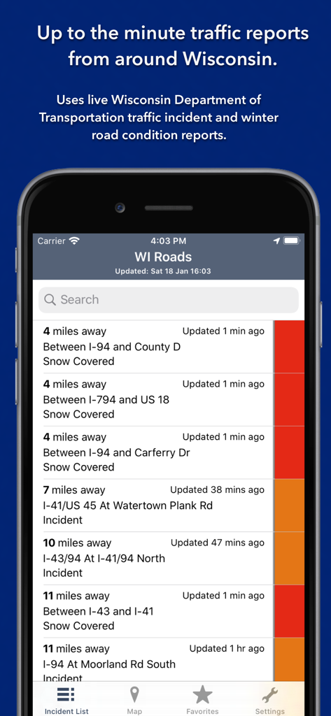
Wisconsin State Roads app displaying a list of real-time traffic incidents and snow-covered road conditions.
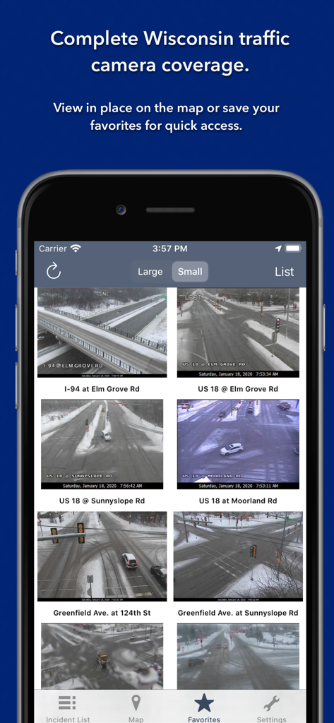
Screenshot of the Wisconsin State Roads app showing a grid of live traffic camera feeds with winter road conditions in the favorites view.
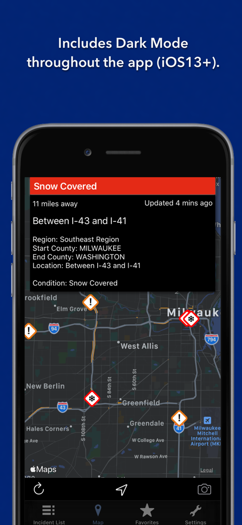
Wisconsin State Roads app interface in dark mode showing a traffic map with snow-covered road alerts in Milwaukee.
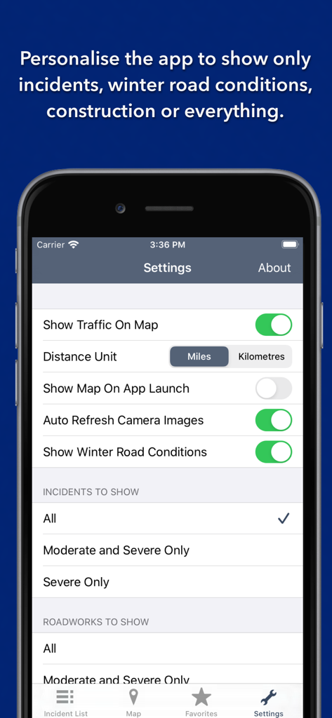
Settings screen of the Wisconsin State Roads app showing personalization options for traffic incidents and winter road conditions
Description
Download
More Like This
Top-ranked apps in the same category

Uber - Request a ride
Uber Technologies, Inc.

铁路12306
ACADEMY OF RAILWAY SCIENCES CO., ltd.

Airbnb
Airbnb, Inc.

Grab: Taxi Ride, Food Delivery
GRABTAXI HOLDINGS PTE. LTD.

Booking.com: Hotels & Travel
Booking.com B.V.

DiDi China: Ride Hailing
Didi Chuxing (Beijing) Network Platform Technology Co., Ltd

Bolt: Request a Ride
BOLT TECHNOLOGY OU

携程旅行-订酒店机票火车票
Shanghai Ctrip Commerce Co.,Ltd

Trip.com: Book Flights, Hotels
Trip.com Travel Singapore Pte. Ltd.
This page is not an official page of the app or its developer, but an independent editorial publication created for informational and commentary purposes. Unless expressly stated otherwise, neither the app nor its developer is affiliated with, endorsed by, sponsored by, authorized by, or otherwise officially connected with MWM, Apple, Google Play, the app publisher, or the app's developer, and nothing on this page implies that the app was developed using MWM's services. Any trademarks, logos, screenshots, and other content remain the property of their respective owners.