Diese Seite ist keine offizielle Seite der App oder ihres Entwicklers, sondern eine unabhängige redaktionelle Veröffentlichung, die zu Informations- und Kommentarzwecken erstellt wurde. Sofern nicht ausdrücklich anders angegeben, sind weder die App noch ihr Entwickler mit MWM, Apple, Google Play, dem App-Herausgeber oder dem Entwickler der App verbunden, von ihnen unterstützt, gesponsert, autorisiert oder anderweitig offiziell verbunden, und nichts auf dieser Seite impliziert, dass die App unter Verwendung der Dienste von MWM entwickelt wurde. Alle Marken, Logos, Screenshots und andere Inhalte bleiben Eigentum ihrer jeweiligen Inhaber.

Tactical NAV
Im Einsatz von einem Veteranen entwickelt, für die anspruchsvollen Anforderungen des Feldes. Erhalten Sie 1-mm-Genauigkeit, MGRS-Koordinaten und vollständige Offline-Karten, um in jeder Umgebung sicher zu operieren.
Downloads
229K+Bewertung
Bewertungen gesamt
600Herausgeber
Kategorie
NavigationSprachen
1Neueste Version
5.0.10Größe
49.3 MBErstveröffentlichung
14. Feb. 2011Für die Mission gebaut, im Kampf erprobt
Stärkt Soldaten und Ersthelfer mit einer robusten, hochpräzisen Navigationsplattform, die für den Einsatz in den unwirtlichsten Umgebungen der Welt entwickelt wurde.
Präzision auf dem Schlachtfeld
Erreichen Sie eine Genauigkeit von 1 mm mit MGRS-, UTM- und BNG-Koordinatensystemen, die der Leistung offizieller DoD-Hardware wie dem AN/PSN-13 DAGR entspricht.
Vollständige Offline-Fähigkeit
Operieren Sie ohne zellulare Emissionen. Laden Sie Karten herunter und planen Sie Missionen in völlig getrennten oder umkämpften Umgebungen mit vollständiger taktischer Zeichenunterstützung.
Die folgenden Screenshots und die Beschreibung stammen direkt aus dem offiziellen Store-Eintrag der App und sind Eigentum des Entwicklers.
App Store
Screenshots
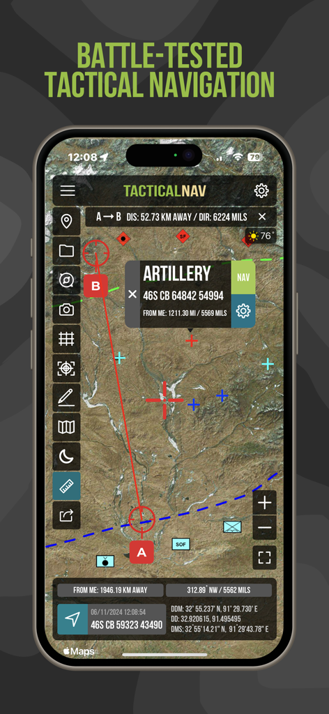
Tactical NAV App-Oberfläche, die eine Satellitenkarte mit MGRS-Koordinaten und einem Artillerie-Wegpunkt anzeigt
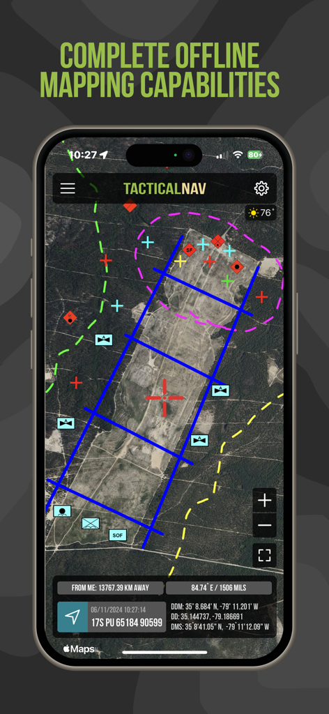
Tactical NAV App-Oberfläche, die Offline-Satellitenkarten mit militärischen Gitterkoordinaten und taktischen Überlagerungen anzeigt
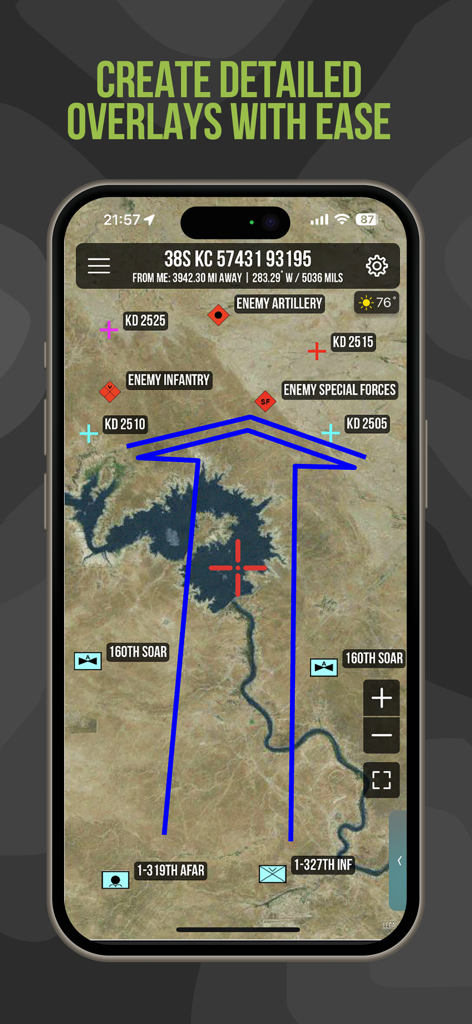
Tactical NAV App, die detaillierte militärische Überlagerungen und Einheitenpositionen auf einer Satellitenkarte anzeigt
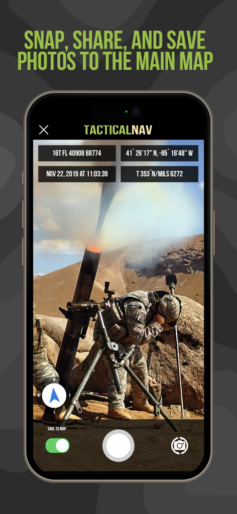
Tactical NAV App-Oberfläche, die ein Foto von militärischen Operationen mit MGRS-Koordinaten und Standortdaten-Overlays anzeigt
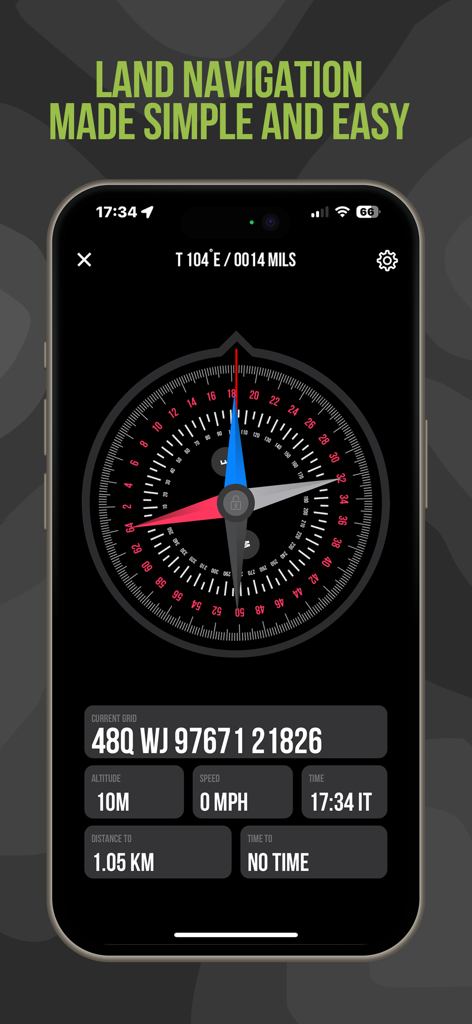
Tactical NAV Landnavigationsbildschirm mit MGRS-Koordinaten und digitalem Kompass
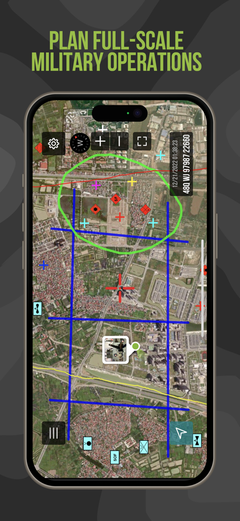
Tactical NAV App-Oberfläche mit Missionsplanungs-Tools und taktischen Karten-Overlays
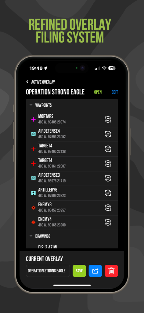
Tactical NAV App-Oberfläche, die Wegpunktverwaltung und MGRS-Koordinaten für die Missionsplanung anzeigt
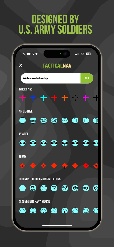
Tactical NAV App-Bildschirm, der verschiedene militärische Symbole und Icons für die taktische Missionsplanung anzeigt

Tactical NAV App-Bildschirm, der den gefallenen Helden der US-Armee und Veteranen-Wohltätigkeitsorganisationen gewidmet ist

Über-Seite der Tactical NAV App mit einer persönlichen Nachricht ihres Veteranen-Erstellers
Beschreibung
Download
Ähnliche Apps
Apps mit ähnlichen Funktionen und Nutzererfahrung

MilGPS
Cascode Labs Pty Ltd

SEAiq Pilot VPP
Sakhalin, LLC

Cartograph Maps 3
Harald Meyer

新知卫星地图-路线规划,高清地图导航
Chongqing Xinzhi Space Technology Co., Ltd.

Coordinates – GPS Converter
Mapnitude Company Limited

Mgrs & Utm Map
Vahid Cataltas

DeepStateMap
Heorhii Karpenko

Map Plus
Miocool Inc.

Compass 55. Map & GPS kit.
Kalimex-Consulting s.r.o.
Diese Seite ist keine offizielle Seite der App oder ihres Entwicklers, sondern eine unabhängige redaktionelle Veröffentlichung, die zu Informations- und Kommentarzwecken erstellt wurde. Sofern nicht ausdrücklich anders angegeben, sind weder die App noch ihr Entwickler mit MWM, Apple, Google Play, dem App-Herausgeber oder dem Entwickler der App verbunden, von ihnen unterstützt, gesponsert, autorisiert oder anderweitig offiziell verbunden, und nichts auf dieser Seite impliziert, dass die App unter Verwendung der Dienste von MWM entwickelt wurde. Alle Marken, Logos, Screenshots und andere Inhalte bleiben Eigentum ihrer jeweiligen Inhaber.