Diese Seite ist keine offizielle Seite der App oder ihres Entwicklers, sondern eine unabhängige redaktionelle Veröffentlichung, die zu Informations- und Kommentarzwecken erstellt wurde. Sofern nicht ausdrücklich anders angegeben, sind weder die App noch ihr Entwickler mit MWM, Apple, Google Play, dem App-Herausgeber oder dem Entwickler der App verbunden, von ihnen unterstützt, gesponsert, autorisiert oder anderweitig offiziell verbunden, und nichts auf dieser Seite impliziert, dass die App unter Verwendung der Dienste von MWM entwickelt wurde. Alle Marken, Logos, Screenshots und andere Inhalte bleiben Eigentum ihrer jeweiligen Inhaber.

Theodolite
Millionen von Fachleuten vertrauen seit 2009 darauf. Konsolidieren Sie Ihren Kompass, Neigungsmesser, Entfernungsmesser und GPS in einem erprobten Werkzeug zur Erfassung von Geo-Overlay-Daten in den anspruchsvollsten Umgebungen.
Downloads
289K+Bewertung
Bewertungen gesamt
3K+Herausgeber
Kategorie
NavigationSprachen
1Neueste Version
9.1Größe
29.6 MBErstveröffentlichung
30. Nov. 2009Professionelle Navigation für Feldexperten
Theodolit konsolidiert einen Kompass, Neigungsmesser, Entfernungsmesser und GPS in einem einzigen AR-Sucher, der für Vermesser, Ingenieure und Outdoor-Profis entwickelt wurde.
Dokumentation mit Daten-Overlay
Erfassen Sie Fotos und Videos mit Standort-, Winkel- und Projektnotizen, die direkt in das Bild und die Metadaten eingebettet sind, für sofortige Feldaufzeichnungen.
Präzisions-Ingenieurswerkzeuge
Greifen Sie auf professionelle Instrumente zu, darunter mil-basierte Absehen, optische Entfernungsmesser und Koordinatensysteme in verschiedenen Formaten wie MGRS und US State Plane.
Die folgenden Screenshots und die Beschreibung stammen direkt aus dem offiziellen Store-Eintrag der App und sind Eigentum des Entwicklers.
App Store
Screenshots
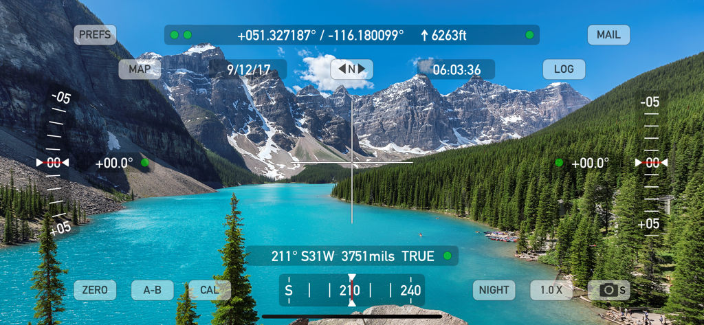
Theodolit-App-Oberfläche mit Echtzeit-GPS-Koordinaten, Höhen- und Neigungsmesserdaten, überlagert auf einer malerischen Bergseeslandschaft
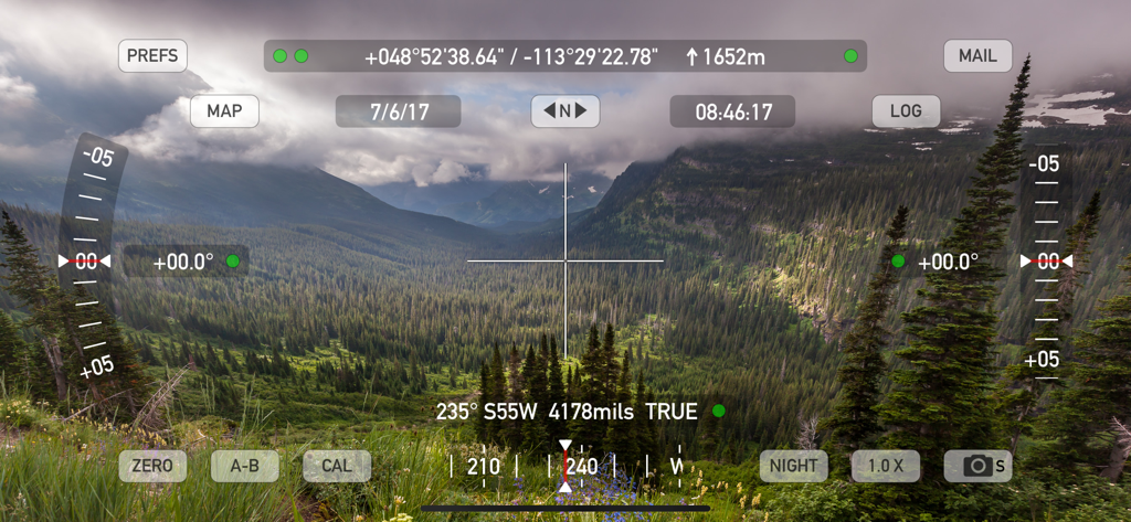
Theodolit-App AR-Sucher mit GPS- und Höhen-Datenüberlagerung auf einer Berglandschaft
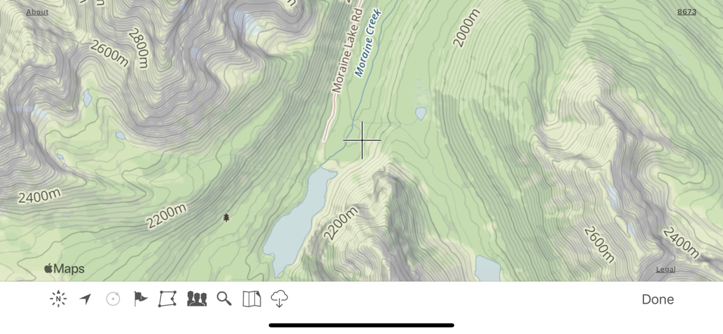
Topografische Kartenoberfläche in der Theodolit-App, die Höhenlinien und Geländemerkmale anzeigt
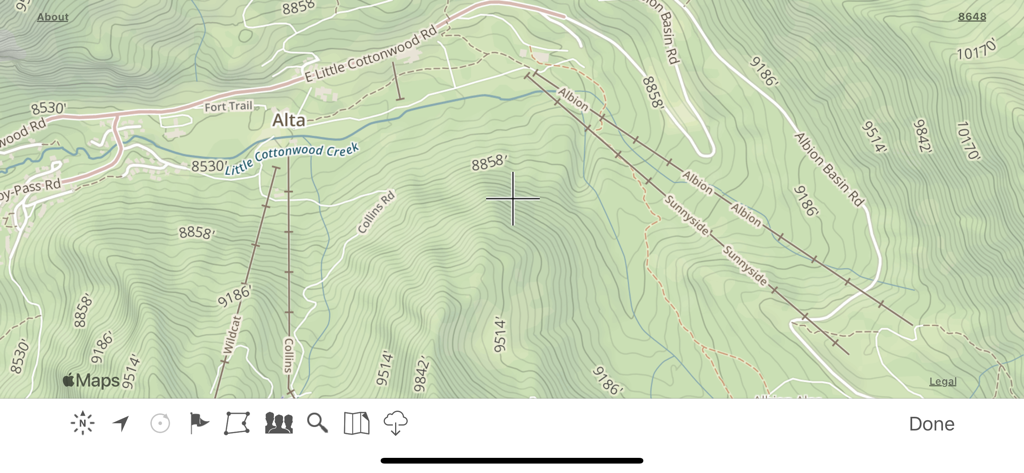
Topografische Kartenanzeige in der Theodolit-App mit Höhenlinien und Wegbeschriftungen
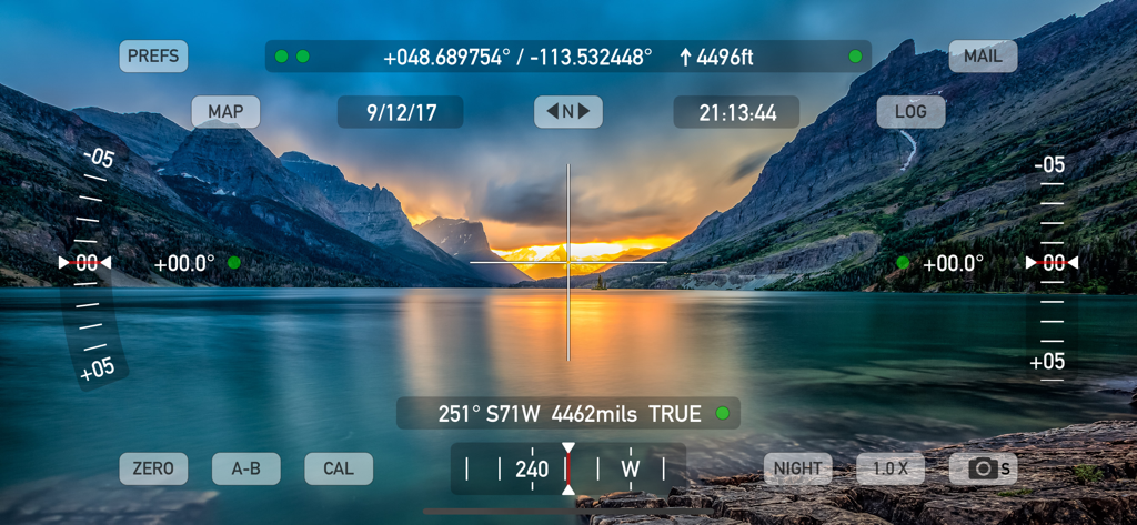
Theodolit-App AR-Sucher, der GPS-Koordinaten und professionelle Navigationsdaten über einem Bergsee anzeigt.
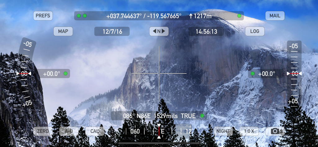
Theodolit-App Augmented-Reality-Sucher mit GPS-Koordinaten und Höhen-Daten über einer Berglandschaft
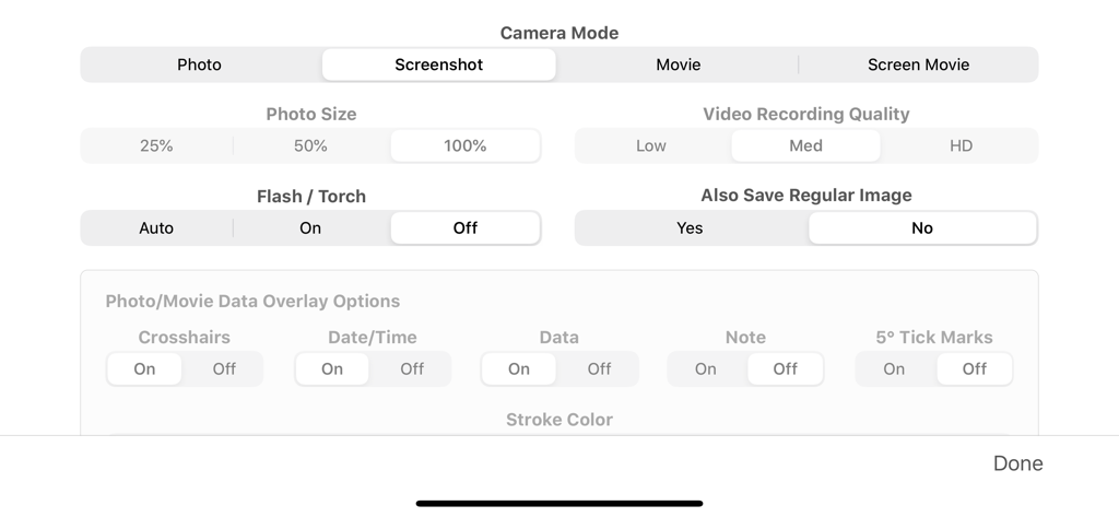
Kameramodus und Einstellungen für die Datenüberlagerung im Einstellungsmenü der Theodolit-App

Einstellungsbildschirm der Theodolit-App für Metadaten von Fotos und Optionen zur Benennung von Dateien.
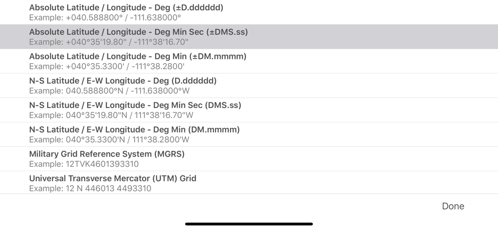
Ein Menü in der Theodolit-App, das verschiedene GPS-Koordinatenformate wie MGRS und UTM anzeigt
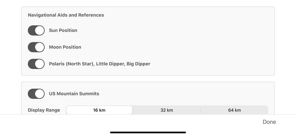
Einstellungen der Theodolit-App für Himmelsnavigationshilfen und die Anzeige von US-Gipfeln in Reichweite

Liste der geografischen Koordinatensystemoptionen in der Theodolit-App, einschließlich MGRS und UTM
Beschreibung
Download
Ähnliche Apps
Apps mit ähnlichen Funktionen und Nutzererfahrung

MilGPS
Cascode Labs Pty Ltd

SEAiq Pilot VPP
Sakhalin, LLC

Cartograph Maps 3
Harald Meyer

新知卫星地图-路线规划,高清地图导航
Chongqing Xinzhi Space Technology Co., Ltd.

Coordinates – GPS Converter
Mapnitude Company Limited

Mgrs & Utm Map
Vahid Cataltas

DeepStateMap
Heorhii Karpenko

Map Plus
Miocool Inc.

Compass 55. Map & GPS kit.
Kalimex-Consulting s.r.o.
Diese Seite ist keine offizielle Seite der App oder ihres Entwicklers, sondern eine unabhängige redaktionelle Veröffentlichung, die zu Informations- und Kommentarzwecken erstellt wurde. Sofern nicht ausdrücklich anders angegeben, sind weder die App noch ihr Entwickler mit MWM, Apple, Google Play, dem App-Herausgeber oder dem Entwickler der App verbunden, von ihnen unterstützt, gesponsert, autorisiert oder anderweitig offiziell verbunden, und nichts auf dieser Seite impliziert, dass die App unter Verwendung der Dienste von MWM entwickelt wurde. Alle Marken, Logos, Screenshots und andere Inhalte bleiben Eigentum ihrer jeweiligen Inhaber.