このページはアプリまたはその開発者の公式ページではなく、情報提供および論評を目的として作成された独立した編集出版物です。明示的に別段の記載がない限り、アプリおよびその開発者は、MWM、Apple、Google Play、アプリのパブリッシャー、またはアプリの開発者と提携、承認、後援、認可、またはその他の公式的な関係はなく、このページのいかなる内容も、アプリがMWMのサービスを使用して開発されたことを意味するものではありません。すべての商標、ロゴ、スクリーンショット、その他のコンテンツはそれぞれの所有者の財産です。

精图地球-高清,卫星,街景,全球,3D,探索
複数ソースの高精度画像、過去の映像、3D地形レンダリングを統合。KML/GeoJSONデータ描画、プロフェッショナルGPS軌跡記録、緯度経度ウォーターマークカメラをサポートし、没入型の地理情報プロフェッショナルソリューションを提供します。
ダウンロード
41K+ユーザー評価
評価数
200開発元
カテゴリ
Navigation対応言語
1最新バージョン
5.0.14サイズ
136.5 MBリリース日
2023年9月12日プロフェッショナルマッピングとグローバルビジュアライゼーション
高精度の3D地形、過去の衛星画像、エンタープライズグレードのGISツールで、中国語圏のプロフェッショナルや探検家を支援します。
プロフェッショナルGISと測量ツール
KMLまたはGeoJSONデータを簡単に描画、測定、エクスポートできます。不動産、建設、フィールド測量に最適で、検証済みの記録のためのGPSウォーターマークカメラが内蔵されています。
高解像度3D地形
グローバルな景観や都市景観の超リアルな3Dレンダリングを体験してください。地形の誇張や過去の画像を使用して、時間の経過に伴う地形の変化を分析できます。
以下のスクリーンショットと説明は、アプリの公式ストアリスティングから直接取得されたものであり、アプリ開発者の所有物です。
アプリストア
スクリーンショット
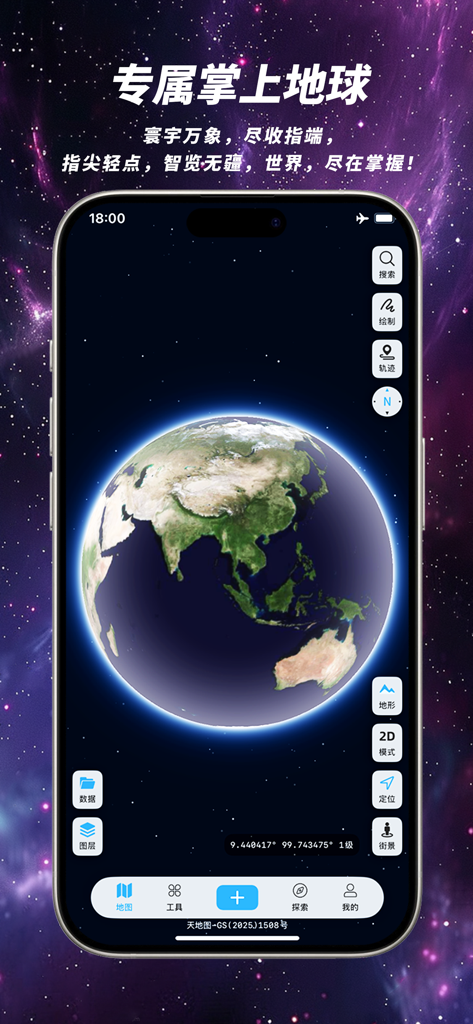
Kingtop Earthアプリのインターフェースに、星空を背景にした高解像度の3Dグローブが表示されているスマートフォンの画面。
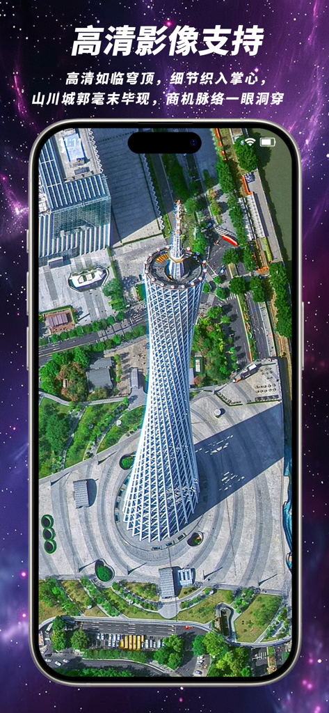
Kingtop Earthモバイルアプリのインターフェース内に表示された、広州の広州タワーの高解像度衛星画像。
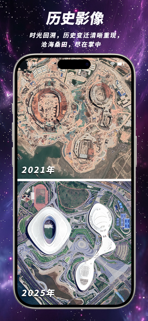
Kingtop Earthアプリで、スタジアムの建設と完成を示す2021年と2025年の衛星画像の比較。
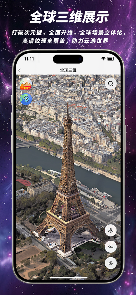
Kingtop Earthアプリのインターフェースに表示された、パリのエッフェル塔の高解像度3D衛星ビュー。
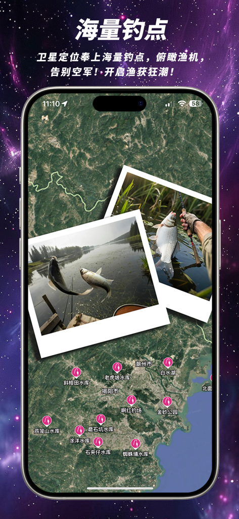
Kingtop Earth内の衛星地図ビュー。さまざまな釣りスポットのマーカーと、釣果の写真が表示されています。
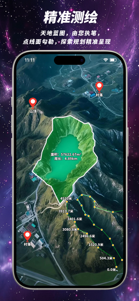
Kingtop Earthアプリのインターフェース。面積測定および距離追跡ツールを備えた3D衛星地図が表示されています。
説明
Download
類似アプリ
同じカテゴリのトップランクアプリ

Google Maps
Google LLC

Waze Navigation & Live Traffic
waze

AMap Global
AutoNavi Information Technology Co. Ltd.

百度地图-路线规划,出行必备
Beijing Baidu Netcom Science & Technology Co.,Ltd

Moovit: Bus & Transit Tracker
Moovit App Global LTD

Transit • Subway & Bus Times
9280-0366 Quebec inc.

ParkMobile: Park. Pay. Go.
Parkmobile USA, Inc

腾讯地图-路线规划,导航地铁打车出行
Shenzhen Tencent Computer Systems Company Limited

Île-de-France Mobilités
Ile de France Mobilites
このページはアプリまたはその開発者の公式ページではなく、情報提供および論評を目的として作成された独立した編集出版物です。明示的に別段の記載がない限り、アプリおよびその開発者は、MWM、Apple、Google Play、アプリのパブリッシャー、またはアプリの開発者と提携、承認、後援、認可、またはその他の公式的な関係はなく、このページのいかなる内容も、アプリがMWMのサービスを使用して開発されたことを意味するものではありません。すべての商標、ロゴ、スクリーンショット、その他のコンテンツはそれぞれの所有者の財産です。