このページはアプリまたはその開発者の公式ページではなく、情報提供および論評を目的として作成された独立した編集出版物です。明示的に別段の記載がない限り、アプリおよびその開発者は、MWM、Apple、Google Play、アプリのパブリッシャー、またはアプリの開発者と提携、承認、後援、認可、またはその他の公式的な関係はなく、このページのいかなる内容も、アプリがMWMのサービスを使用して開発されたことを意味するものではありません。すべての商標、ロゴ、スクリーンショット、その他のコンテンツはそれぞれの所有者の財産です。

ダウンロード
933K+ユーザー評価
評価数
9K+開発元
カテゴリ
Navigation対応言語
11最新バージョン
4.60.0サイズ
140.2 MBリリース日
2016年3月10日スカイラインの秘密を解き明かす
世界最先端のAR山岳ガイドを体験してください。カジュアルなハイキングから本格的な登山まで、世界中にある100万以上の山頂に関するデータを無料で瞬時に入手できます。
瞬時の山頂認識
デバイスを向けるだけで、見事なARパノラマビューですべての山頂の名前、標高、距離を表示します。
3D地形インテリジェンス
半透明の3Dオーバーレイで地平線と完璧にマッチさせたり、傾けて衛星スタイルの鳥瞰図を表示したりできます。
よくある質問
について知っておくべきこと AR AlpineGuide
AR AlpineGuideとは何ですか?
AR AlpineGuideは、デバイスのカメラを山にかざすことで、山の名前、標高、距離を特定するiOSアプリです。360度のパノラマ拡張現実ビューで峰を表示します。
AR AlpineGuideは無料で使用できますか?
はい、AR AlpineGuideは無料で使用できます。すべての機能は無料で利用できます。
AR AlpineGuideにはいくつの山の峰が含まれていますか?
AR AlpineGuideには、世界中の約100万の峰のデータが含まれています。この広範なデータベースにより、広範囲の山の識別が可能です。
AR AlpineGuideは360度ビューで山を識別できますか?
はい、AR AlpineGuideは360度のパノラマ拡張現実(AR)ビューですべての山の峰の名前を識別します。
iOSデバイスのカメラが傾いていてもAR AlpineGuideは機能しますか?
はい、AR AlpineGuideは3次元座標とジャイロスコープを使用して、iOSデバイスのカメラが傾いていても峰の名前を正確に表示します。
ユーザーはAR AlpineGuideを使用して、既存の写真に峰の名前を追加できますか?
はい、AR AlpineGuideでは、他のアプリで撮影した写真をインポートして、峰の名前を追加することができます。
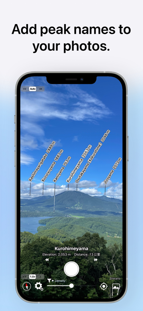
AR AlpineGuideはオフラインで使用できますか?
はい、AR AlpineGuideはオフラインで使用できます。この機能により、インターネット接続なしで山の識別が可能です。
AR AlpineGuideは誤った方向表示をどのように処理しますか?
AR AlpineGuideが誤った方向を表示した場合、iOSデバイスのカバーを取り外してください。カバーの金属や磁石がセンサーに干渉し、誤動作を引き起こす可能性があります。
AR AlpineGuideで峰の名前の表示位置を調整できますか?
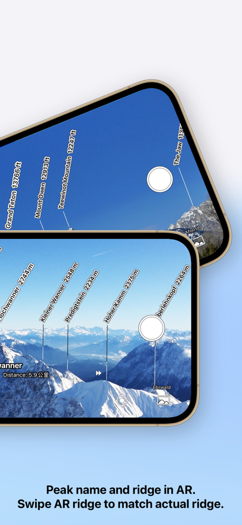
はい、AR AlpineGuideでは、ARディスプレイをスワイプすることで峰の名前の表示位置を調整できます。この調整は、写真を撮った後でも可能です。
AR AlpineGuideは3D地形を表示しますか?
はい、AR AlpineGuideは3次元地形を半透明で表示します。この機能により、実際の山の形状と比較して峰の位置を確認するのに役立ちます。
AR AlpineGuideは指定された地図上の場所からの風景を表示できますか?
はい、AR AlpineGuideでは、地図上の任意の指定された場所から見える地形や山の名前を確認できます。
以下のスクリーンショットと説明は、アプリの公式ストアリスティングから直接取得されたものであり、アプリ開発者の所有物です。
アプリストア
スクリーンショット
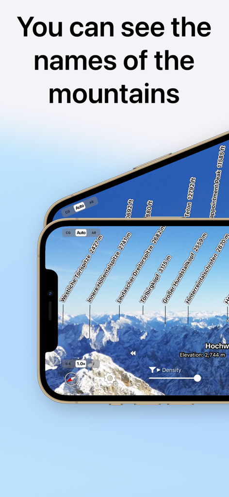
スマートフォンの画面に拡張現実の山頂名と標高を表示するAR AlpineGuideアプリ
拡張現実カメラビューを通じて山頂と標高を特定するAR AlpineGuideアプリ
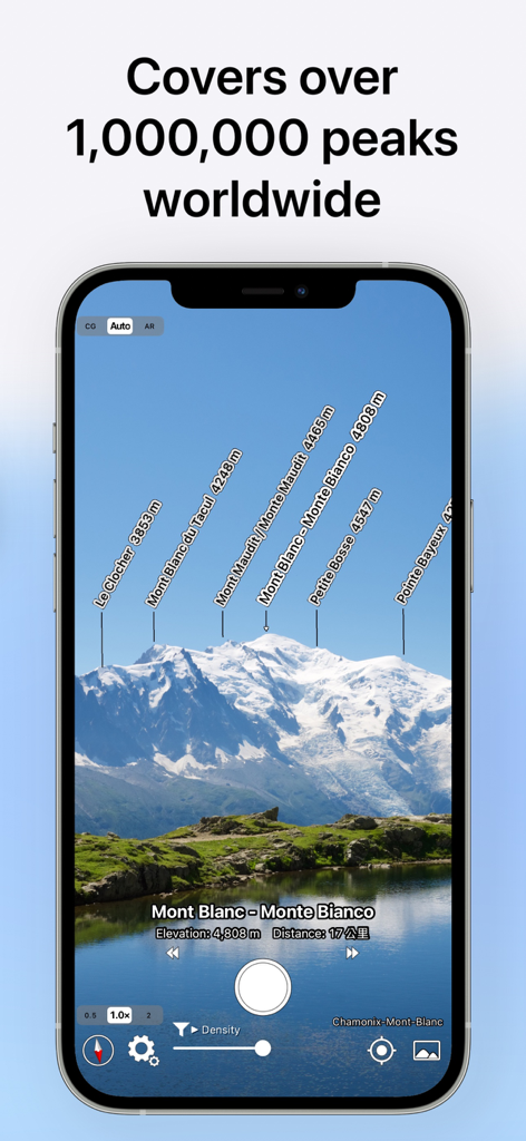
モンブラン山脈の上に拡張現実の山頂ラベルを表示するAR AlpineGuideアプリの画面
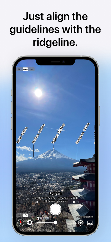
富士山の山頂名と標高の拡張現実ラベルを表示するAR AlpineGuideアプリのインターフェース
写真上の山頂を名前と標高で特定するAR AlpineGuideアプリ
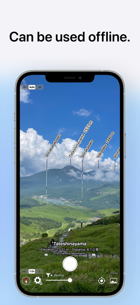
オフラインモードのキャプション付き拡張現実ビューで、名前と標高がラベル付けされた山頂を表示するAR AlpineGuideアプリのインターフェース
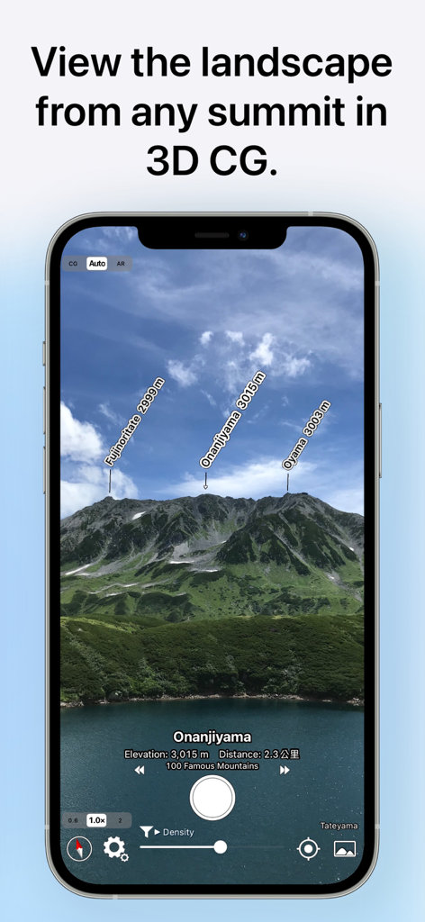
3Dビューで名前と標高がラベル付けされた山頂を表示するAR AlpineGuideアプリのスクリーンショット
説明
Download


このページはアプリまたはその開発者の公式ページではなく、情報提供および論評を目的として作成された独立した編集出版物です。明示的に別段の記載がない限り、アプリおよびその開発者は、MWM、Apple、Google Play、アプリのパブリッシャー、またはアプリの開発者と提携、承認、後援、認可、またはその他の公式的な関係はなく、このページのいかなる内容も、アプリがMWMのサービスを使用して開発されたことを意味するものではありません。すべての商標、ロゴ、スクリーンショット、その他のコンテンツはそれぞれの所有者の財産です。