このページはアプリまたはその開発者の公式ページではなく、情報提供および論評を目的として作成された独立した編集出版物です。明示的に別段の記載がない限り、アプリおよびその開発者は、MWM、Apple、Google Play、アプリのパブリッシャー、またはアプリの開発者と提携、承認、後援、認可、またはその他の公式的な関係はなく、このページのいかなる内容も、アプリがMWMのサービスを使用して開発されたことを意味するものではありません。すべての商標、ロゴ、スクリーンショット、その他のコンテンツはそれぞれの所有者の財産です。

Bruce Trail App
公式オフラインマップとリアルタイムアップデートで、ナイアガラ断崖を自信を持ってナビゲートしましょう。ルートを計画し、進捗を追跡し、旅のすべてのステップでトレイル保全を支援しましょう。
ダウンロード
13K+ユーザー評価
評価数
200開発元
カテゴリ
Lifestyle対応言語
1最新バージョン
2.5サイズ
28.5 MBリリース日
2021年11月1日すべてのマイルを自信を持ってナビゲート
リアルタイムアップデートと専門家が設計したツールを備えた、カナダで最も象徴的な遊歩道の公式ガイド。旅のすべてのステップに対応。
公式オフラインマップ
携帯サービスがなくても、専門家がキュレーションした42のマップにアクセスできます。コンサバンシーからのライブルートアップデートを直接受け取り、安心感を得ましょう。
正確な旅行計画
駐車場、キャンプ場、トレイルヘッドを簡単に検索できます。ルート測定ツールを使用して、毎日の走行距離とロジスティクスを簡単に計画しましょう。
以下のスクリーンショットと説明は、アプリの公式ストアリスティングから直接取得されたものであり、アプリ開発者の所有物です。
アプリストア
スクリーンショット
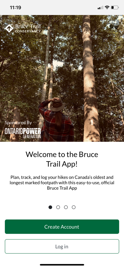
ブルーストレイルアプリのウェルカムスクリーン。高い木々に囲まれた森の中をハイキングするハイカーが表示されています。
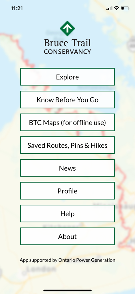
ブルーストレイルアプリのメインメニュー。トレイルマップの背景に、探索、BTCマップ、保存されたルート、ニュースのオプションが表示されています。
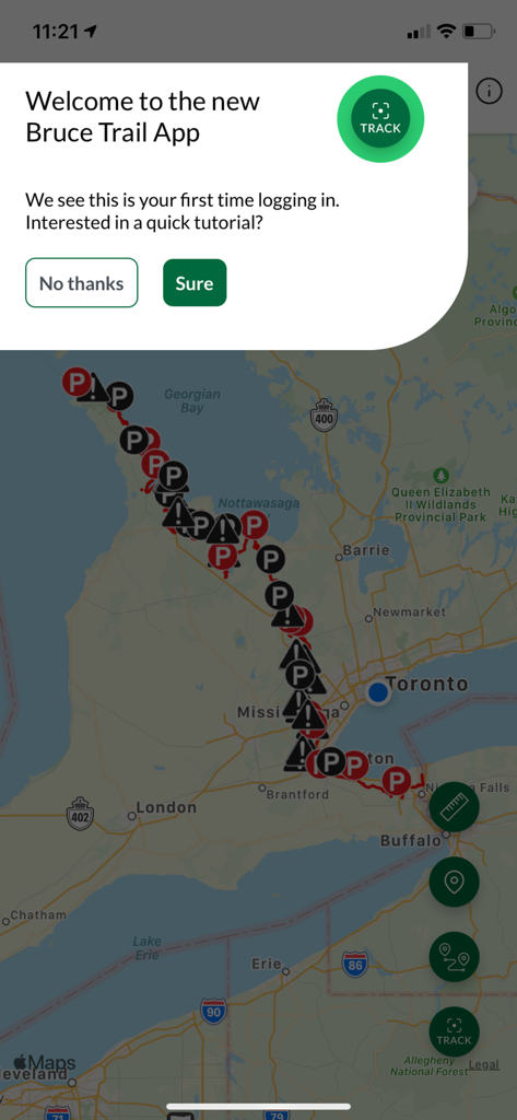
ブルーストレイルアプリのマップビューに表示されたウェルカムチュートポップアップ。
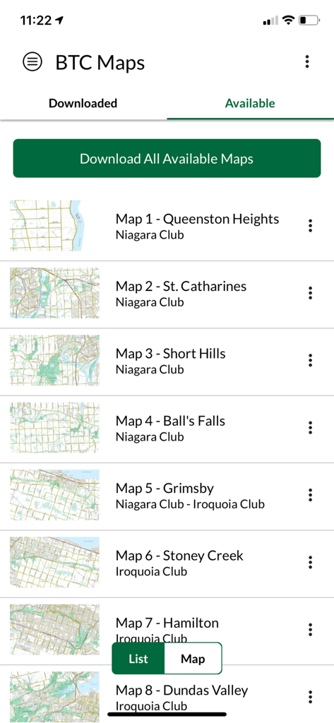
ブルーストレイルアプリでダウンロード可能なマップのリスト。
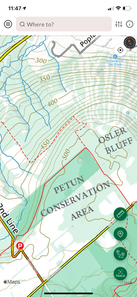
ブルーストレイルアプリのインターフェースにあるペタン保護区の地形図。
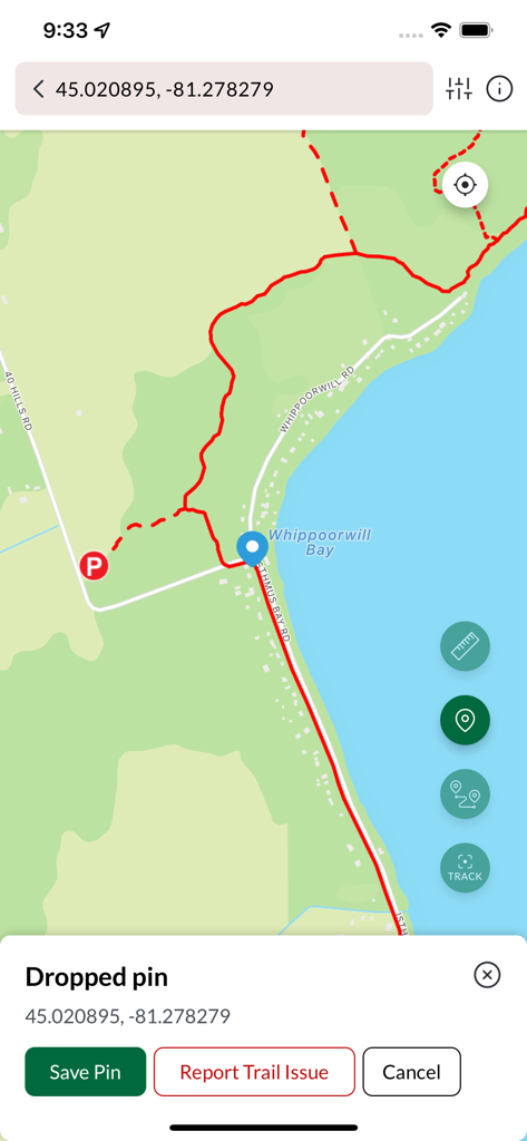
ブルーストレイルアプリのマップインターフェース。ウィップーウィルベイ近くのハイキングルートにドロップされたピンが表示されています。
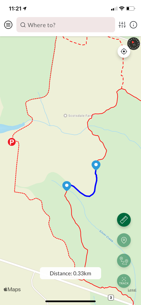
ブルーストレイルアプリのマップインターフェース。距離測定が0.33キロメートルの計画されたハイキングルートが表示されています。
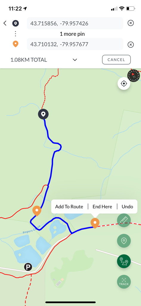
1.08 kmのハイキングルート、GPS座標、カスタムピンが表示されたモバイルマップビュー。
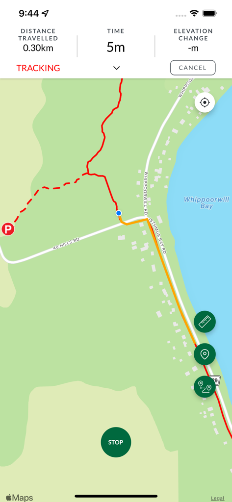
ブルーストレイルアプリの追跡画面。赤いトレイルラインと距離統計が表示されたマップが表示されています。
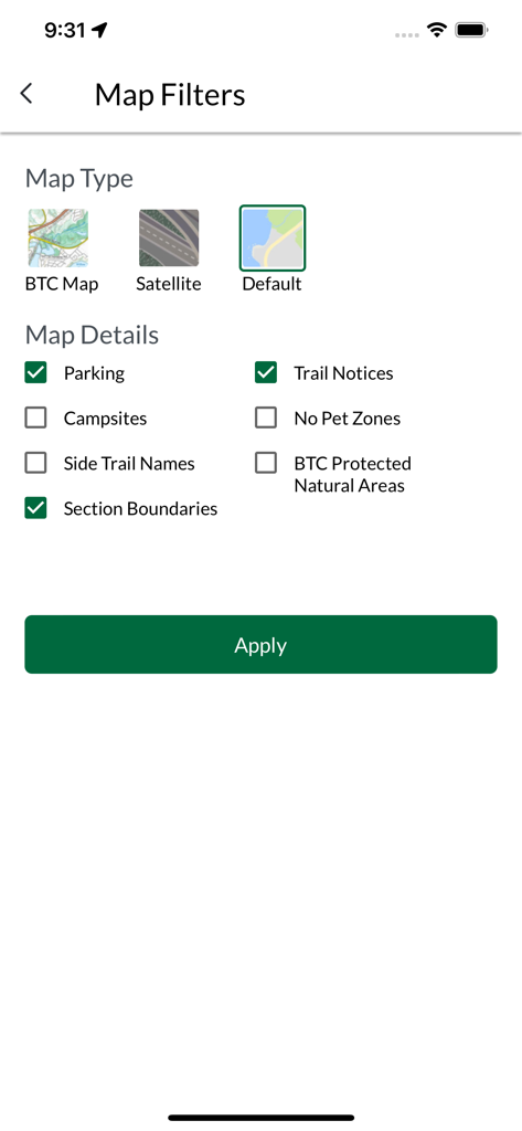
ブルーストレイルアプリのマップフィルター画面。マップタイプ、駐車場や通知などのトレイル詳細のオプションが表示されています。
説明
Download


このページはアプリまたはその開発者の公式ページではなく、情報提供および論評を目的として作成された独立した編集出版物です。明示的に別段の記載がない限り、アプリおよびその開発者は、MWM、Apple、Google Play、アプリのパブリッシャー、またはアプリの開発者と提携、承認、後援、認可、またはその他の公式的な関係はなく、このページのいかなる内容も、アプリがMWMのサービスを使用して開発されたことを意味するものではありません。すべての商標、ロゴ、スクリーンショット、その他のコンテンツはそれぞれの所有者の財産です。