このページはアプリまたはその開発者の公式ページではなく、情報提供および論評を目的として作成された独立した編集出版物です。明示的に別段の記載がない限り、アプリおよびその開発者は、MWM、Apple、Google Play、アプリのパブリッシャー、またはアプリの開発者と提携、承認、後援、認可、またはその他の公式的な関係はなく、このページのいかなる内容も、アプリがMWMのサービスを使用して開発されたことを意味するものではありません。すべての商標、ロゴ、スクリーンショット、その他のコンテンツはそれぞれの所有者の財産です。

TrailSmart: Great Trails
詳細なオフラインマップ、標高プロファイル、厳選された宿泊施設ガイドを使用して、正確に計画し、自信を持ってナビゲートします。インターネット不要、広告なし—あなたと旅だけ。
ダウンロード
1K+ユーザー評価
評価数
0開発元
カテゴリ
Travel対応言語
4最新バージョン
3.70サイズ
82.4 MBリリース日
2017年3月10日次の大冒険をナビゲート
TrailSmartは、世界で最も象徴的な長距離トレッキングのための究極のデジタルコンパニオンであり、専門家が厳選した洞察と、細部にこだわる旅行者のための完全なオフライン独立性を提供します。
完全なオフライン独立性
遠隔地のデッドゾーンでも自信を持ってナビゲートできます。すべてのマップ、ガイド、トレイルデータに100%オフラインでアクセスし、ローミング料金を回避し、信号なしで安全に過ごせます。
インテリジェントなウェイファインディング
黄色い矢印に従ってください。スマートコンパスは、現在地と選択したルートに基づいて動的に更新され、ライブ標高プロファイルは、1日のペースを完璧に調整するのに役立ちます。
以下のスクリーンショットと説明は、アプリの公式ストアリスティングから直接取得されたものであり、アプリ開発者の所有物です。
アプリストア
スクリーンショット
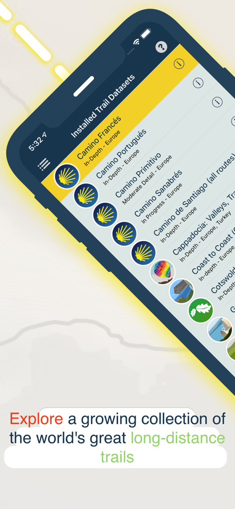
TrailSmartアプリ画面には、カミーノ・デ・サンティアゴを含むインストール済みの長距離トレイルデータセットのリストが表示されています。
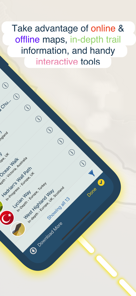
TrailSmartのモバイルアプリインターフェイスには、世界中のハイキングトレイルのリストとオフラインマップ機能が表示されています。
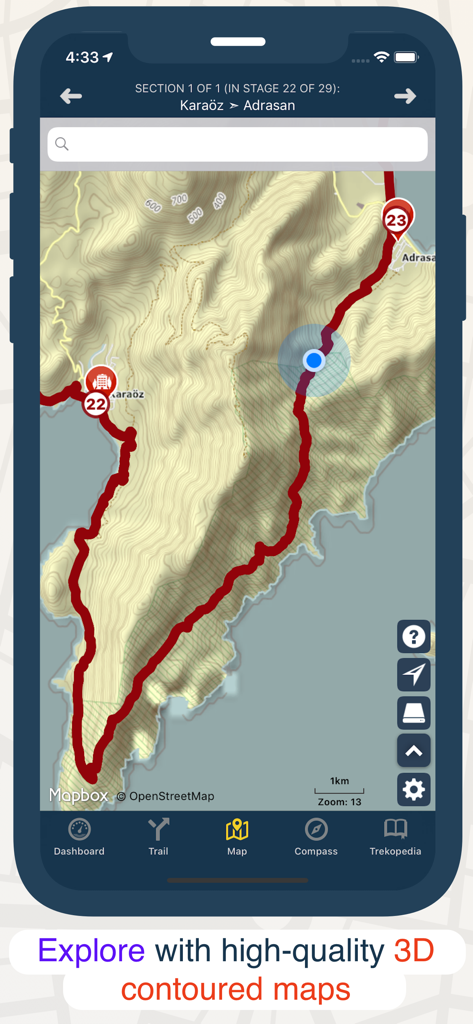
トレイルルートと3D等高線ハイキングマップを備えたTrailSmartアプリを示すスマートフォンスクリーン。
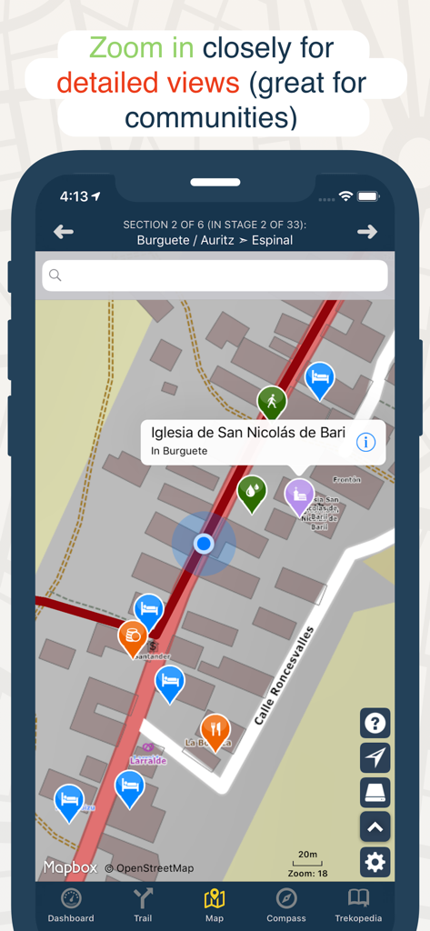
TrailSmartアプリのズームインマップビューには、ハイキングトレイル沿いの宿泊施設、ダイニング、ランドマークのアイコンが表示されています。
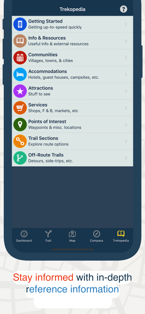
TrailSmartアプリのトレコペディア画面には、宿泊施設や見どころなどのハイキングトレイルの参照カテゴリが表示されています。
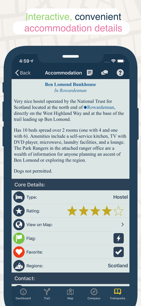
長距離ハイキングトレイルのホステルの詳細情報(評価やアメニティを含む)を表示するスマートフォン画面。
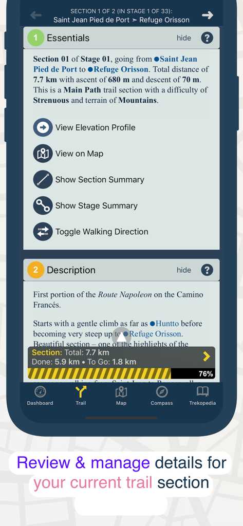
距離、標高、説明を示すTrailSmartアプリのトレイルセクションの詳細ビュー。
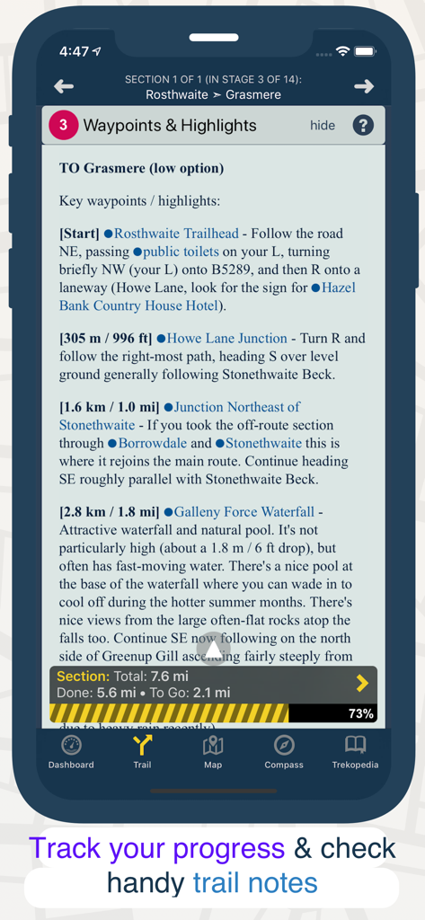
ハイキングのウェイポイントとセクションの進捗状況トラッカーの詳細を表示するTrailSmartアプリインターフェイス。
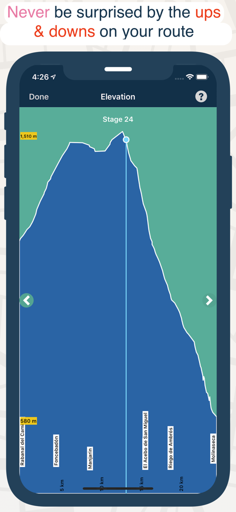
標高と距離のマーカーを備えたハイキングトレイルのステージの詳細な標高プロファイルチャートを示すモバイルアプリのスクリーンショット。
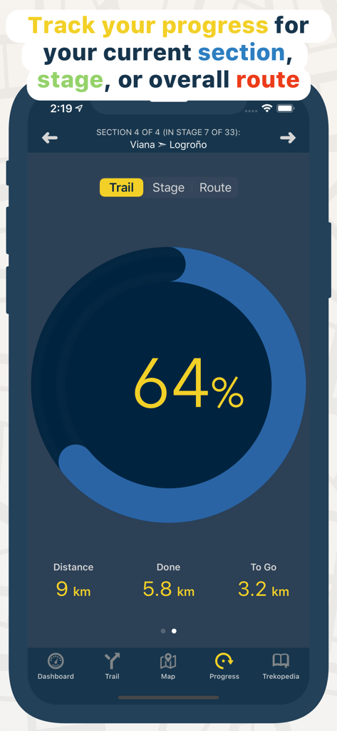
ハイキングトレイルセクションの完了距離とパーセンテージを示すTrailSmartアプリの進捗状況トラックスクリーン。
説明
Download


このページはアプリまたはその開発者の公式ページではなく、情報提供および論評を目的として作成された独立した編集出版物です。明示的に別段の記載がない限り、アプリおよびその開発者は、MWM、Apple、Google Play、アプリのパブリッシャー、またはアプリの開発者と提携、承認、後援、認可、またはその他の公式的な関係はなく、このページのいかなる内容も、アプリがMWMのサービスを使用して開発されたことを意味するものではありません。すべての商標、ロゴ、スクリーンショット、その他のコンテンツはそれぞれの所有者の財産です。