このページはアプリまたはその開発者の公式ページではなく、情報提供および論評を目的として作成された独立した編集出版物です。明示的に別段の記載がない限り、アプリおよびその開発者は、MWM、Apple、Google Play、アプリのパブリッシャー、またはアプリの開発者と提携、承認、後援、認可、またはその他の公式的な関係はなく、このページのいかなる内容も、アプリがMWMのサービスを使用して開発されたことを意味するものではありません。すべての商標、ロゴ、スクリーンショット、その他のコンテンツはそれぞれの所有者の財産です。

Directional Drilling
石油技術者と現場掘削作業員に、プロフェッショナルグレードの計算、3D坑井経路の視覚化、およびシームレスなCSVデータ統合を提供。リグ現場に最適化されています。
ダウンロード
3K+ユーザー評価
評価数
0開発元
カテゴリ
Education対応言語
1最新バージョン
4.2サイズ
21.1 MBリリース日
2015年3月4日現場向けの精密工学ツール
方向性掘削作業員とエンジニアに、プロフェッショナルグレードの坑井計画、業界標準の計算、高忠実度の視覚化を1つのポータブルパッケージで提供します。
高度な計算エンジン
最小曲率および曲率半径を含む5つの業界標準の方法を利用して、測量データを検証し、坑井経路の精度を確保します。
高忠実度3Dプロット
断面図、平面図、およびXYZ 3Dプロットを使用して複雑な坑井経路を視覚化し、生産層内に留まり、多国間レイアウトを管理します。
以下のスクリーンショットと説明は、アプリの公式ストアリスティングから直接取得されたものであり、アプリ開発者の所有物です。
アプリストア
スクリーンショット
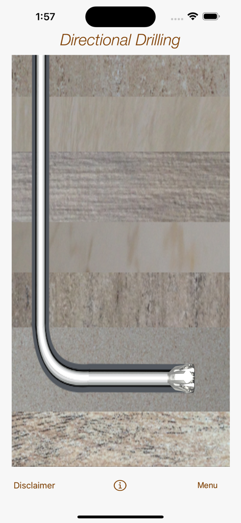
水平坑井経路と掘削ビットの断面図が地層を貫通している様子
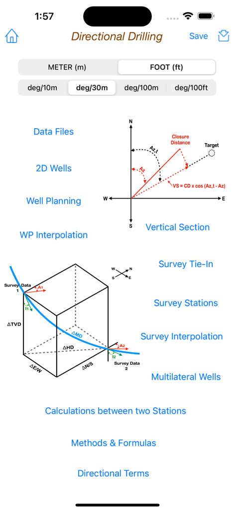
Directional Drillingアプリのメインメニュー。技術図と石油工学計算ツールが表示されています。
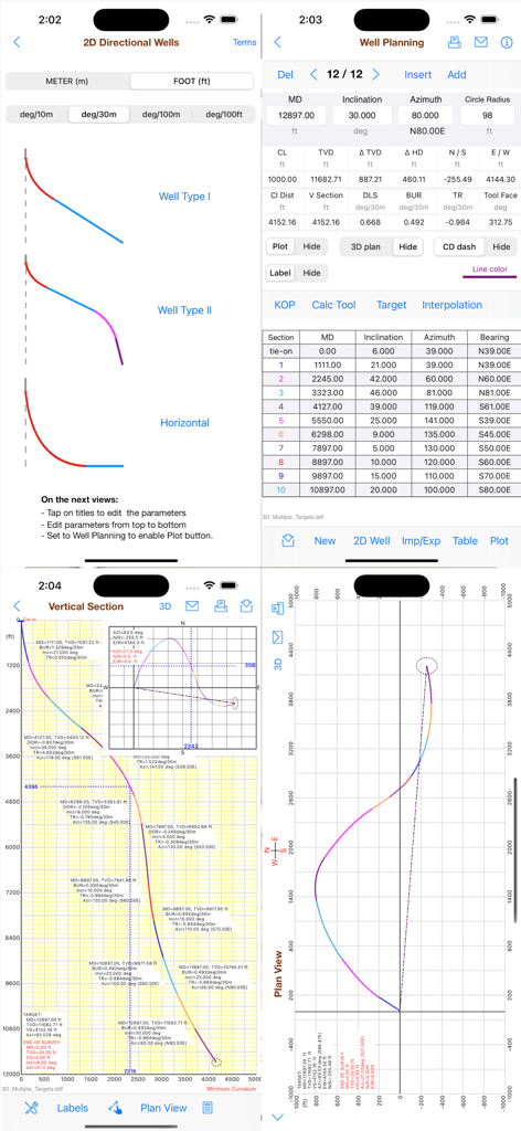
Directional Drillingアプリのインターフェース。坑井計画データテーブルと軌道プロットが表示されています。
モバイルアプリのインターフェースに、深度と座標軸が表示された方向性坑井経路の3D視覚化。
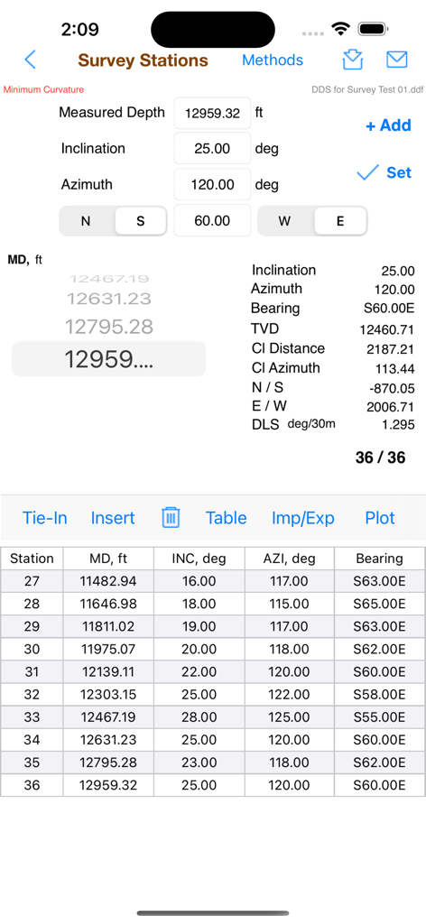
Directional Drillingアプリのインターフェース。測量ステーションデータ、技術計算、および詳細なステーションテーブルが表示されています。
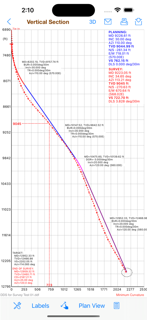
計画されたデータと測量データポイントを示す、方向性坑井経路の断面図グラフ。
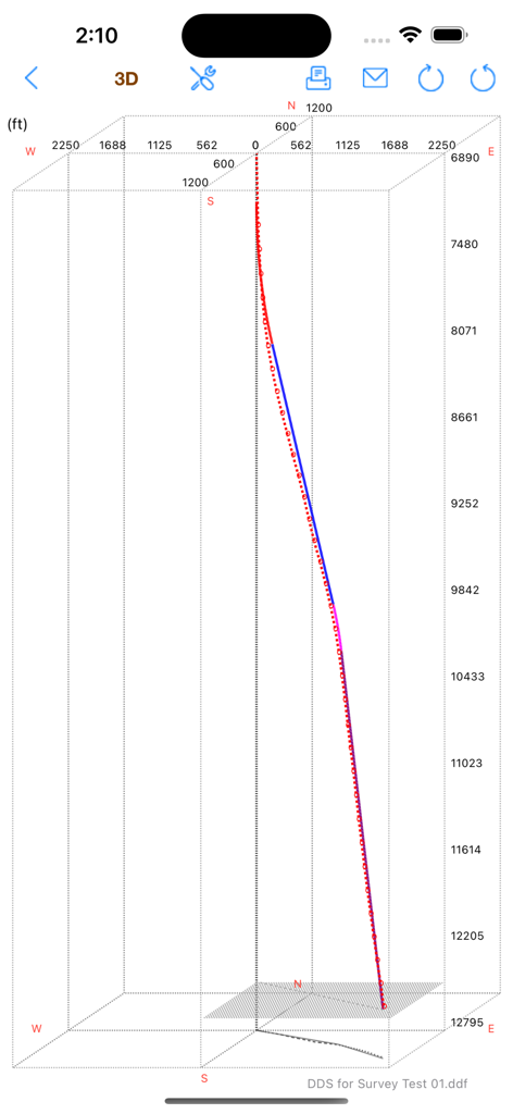
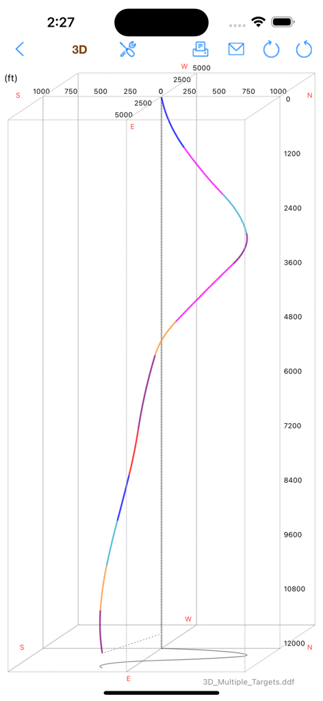
深度と座標を示す方向性掘削坑井経路の3Dプロット。
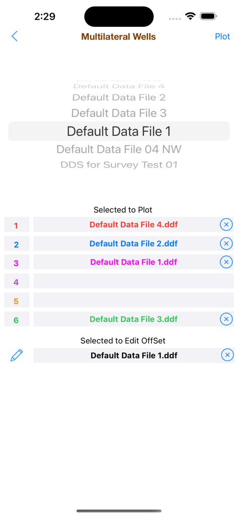
Directional Drillingアプリの多国間坑井選択画面のスクリーンショット。プロットとオフセット編集のために選択されたさまざまなデータファイルが表示されています。
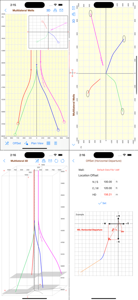
Directional Drillingアプリのスクリーンショット。3D坑井経路プロット、多国間坑井ビュー、および水平方向オフセット計算が表示されています。
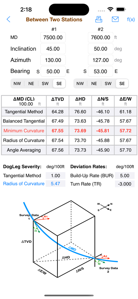
Directional Drillingアプリ。2点間の測量データ計算と3D坑井図が表示されています。
説明
Download
類似アプリ
同じカテゴリのトップランクアプリ

Duolingo - Language Lessons
Duolingo, Inc

Speak & Learn English: Learna
DEEP FLOW SOFTWARE SERVICES - FZCO

驾考宝典-科一科四驾驶证考试驾考通
Wuhan Jiakaobaodian Information Service Co., Ltd.

Toca Boca World
Toca Boca AB

Google Classroom
Google LLC

作业帮-中小学家长作业检查和辅导工具
Guangzhou Polar Future Culture Technology Co., Ltd

Gauth: AI Study Companion
GAUTHTECH PTE. LTD.

学信网
Student Information Consultation Service Co., Ltd.

ArtWorkout: Learn How to Draw
Aleksandr Ulitin
このページはアプリまたはその開発者の公式ページではなく、情報提供および論評を目的として作成された独立した編集出版物です。明示的に別段の記載がない限り、アプリおよびその開発者は、MWM、Apple、Google Play、アプリのパブリッシャー、またはアプリの開発者と提携、承認、後援、認可、またはその他の公式的な関係はなく、このページのいかなる内容も、アプリがMWMのサービスを使用して開発されたことを意味するものではありません。すべての商標、ロゴ、スクリーンショット、その他のコンテンツはそれぞれの所有者の財産です。