このページはアプリまたはその開発者の公式ページではなく、情報提供および論評を目的として作成された独立した編集出版物です。明示的に別段の記載がない限り、アプリおよびその開発者は、MWM、Apple、Google Play、アプリのパブリッシャー、またはアプリの開発者と提携、承認、後援、認可、またはその他の公式的な関係はなく、このページのいかなる内容も、アプリがMWMのサービスを使用して開発されたことを意味するものではありません。すべての商標、ロゴ、スクリーンショット、その他のコンテンツはそれぞれの所有者の財産です。

Earthquake Alerts Map for USGS
USGSとEMSCの信頼できるデータを使用して、世界の振動を正確に監視します。即時の通知、インタラクティブマップ、高度なフィルターで、家族を保護し、地震イベントに先んじて備えましょう。
ダウンロード
14K+ユーザー評価
評価数
100開発元
カテゴリ
Weather対応言語
23最新バージョン
2.3.0サイズ
29.7 MBリリース日
2025年3月4日比類なき地震認識
公式USGSデータを利用して、リアルタイムの世界地震監視と精密マッピングで自宅と家族を保護しましょう。
検証済みの機関データ
USGSおよびEMSCからのリアルタイム地震レポートに直接アクセスできます。世界で最も信頼されている地質学当局に基づいた安全対策を確実にしましょう。
インタラクティブな近接マッピング
ダイナミックマップ上で震源地を即座に視覚化します。振動と自宅または愛する人との距離を迅速に評価し、即時のリスクを判断します。
以下のスクリーンショットと説明は、アプリの公式ストアリスティングから直接取得されたものであり、アプリ開発者の所有物です。
アプリストア
スクリーンショット
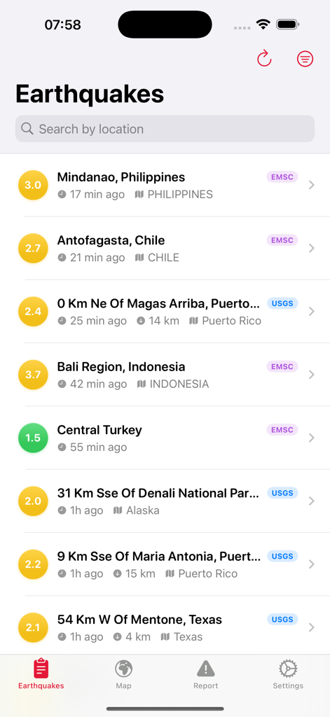
USGSとEMSCのデータを使用して、マグニチュード、場所、イベントからの経過時間を示す最近の世界の地震のリスト。
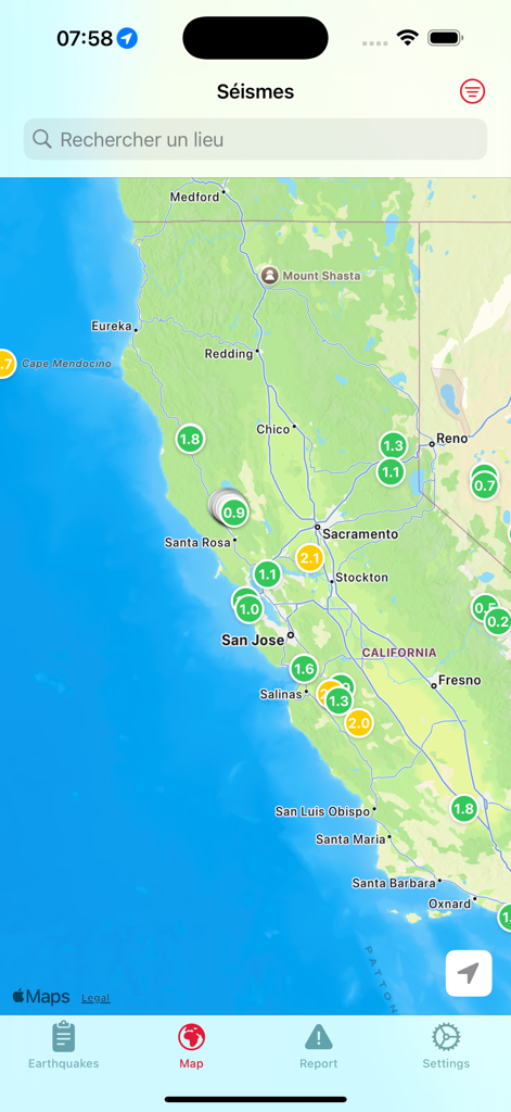
カリフォルニアの地震活動とマグニチュードを示すインタラクティブな地震マップ。
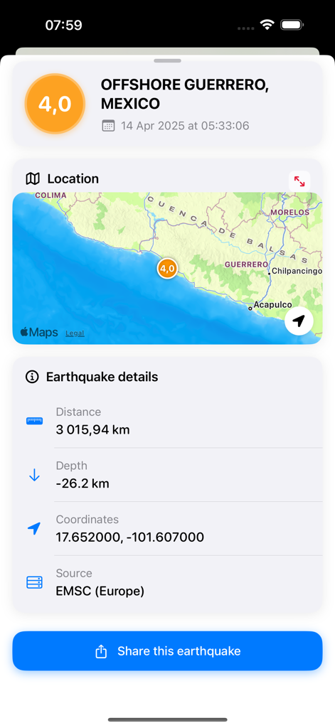
地理的なマップと深度データを含むマグニチュード4.0の地震の地震活動の詳細
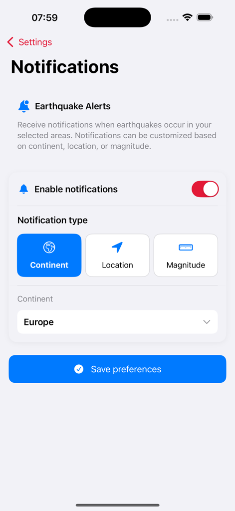
場所とマグニチュードのカスタマイズ可能なフィルターを備えた地震アラートの通知設定インターフェイス
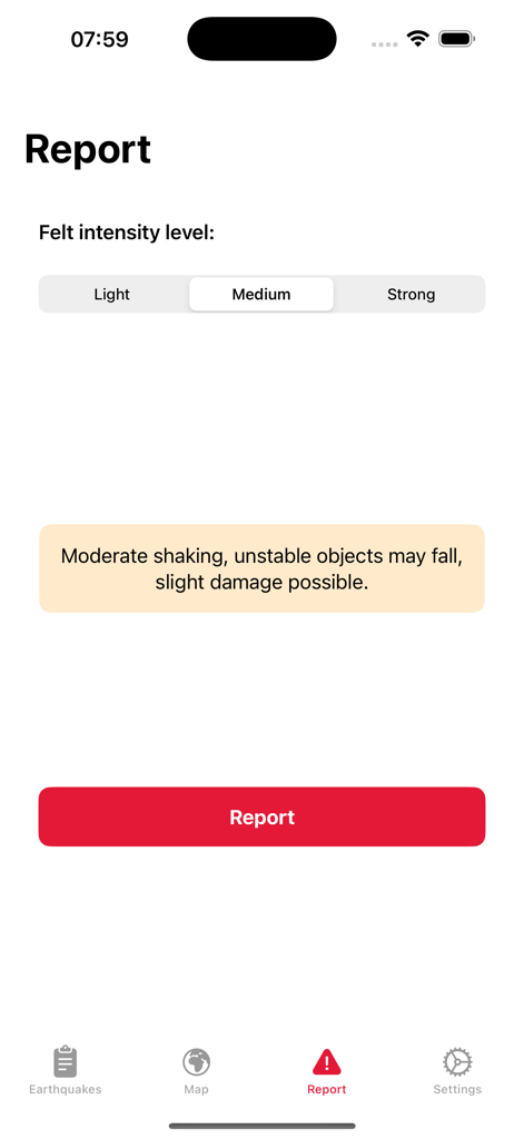
軽度、中程度、強度のレベルなど、地震の強度を報告するためのインターフェイス
説明
Download
類似アプリ
似た機能とユーザー体験を持つアプリ

Alerta Sísmica México - SASSLA
Diego Ramirez

QuakeFeed Earthquake Alerts
Artisan Global LLC

My Earthquake Alerts Pro
JRustonApps B.V.

My Earthquake Alerts & Feed
JRustonApps B.V.

Earthquake - alerts and map
Nico Tranquilli

Earthquake+ Alerts, Map & Info
Slava Barouline

LastQuake
Ctre Sismologique Euro Mediterraneen

Earthquake Alert - Seismic
婷 张

Volcanoes: Map, Alerts & Ash
Slava Barouline
このページはアプリまたはその開発者の公式ページではなく、情報提供および論評を目的として作成された独立した編集出版物です。明示的に別段の記載がない限り、アプリおよびその開発者は、MWM、Apple、Google Play、アプリのパブリッシャー、またはアプリの開発者と提携、承認、後援、認可、またはその他の公式的な関係はなく、このページのいかなる内容も、アプリがMWMのサービスを使用して開発されたことを意味するものではありません。すべての商標、ロゴ、スクリーンショット、その他のコンテンツはそれぞれの所有者の財産です。