このページはアプリまたはその開発者の公式ページではなく、情報提供および論評を目的として作成された独立した編集出版物です。明示的に別段の記載がない限り、アプリおよびその開発者は、MWM、Apple、Google Play、アプリのパブリッシャー、またはアプリの開発者と提携、承認、後援、認可、またはその他の公式的な関係はなく、このページのいかなる内容も、アプリがMWMのサービスを使用して開発されたことを意味するものではありません。すべての商標、ロゴ、スクリーンショット、その他のコンテンツはそれぞれの所有者の財産です。

Field Area Measure on GPS Map
専門家レベルの精度で面積を計算し、境界線を追跡し、土地プロジェクトを管理します。農家、不動産業者、測量士があらゆる区画を測定し、レポートを即座にエクスポートするための必須のオフラインツールです。
ダウンロード
600ユーザー評価
評価数
0開発元
カテゴリ
Utilities対応言語
1最新バージョン
1.5サイズ
97.6 MBリリース日
2025年7月15日専門的な精度で土地を測定
面積、距離、周囲長を数秒で計算します。現場でもオフィスでも、農業、不動産、建設に必要な正確なデータを取得できます。
GPS境界追跡
携帯電話を持って境界線を歩くだけで、フィールドのサイズと周囲長を計算できます。大規模な農場や物件管理に最適です。
信頼性の高いオフラインアクセス
人里離れた農村部でも自信を持って作業できます。携帯電話の信号がなくても物件を地図に表示し、測定できるため、データは常に利用可能です。
以下のスクリーンショットと説明は、アプリの公式ストアリスティングから直接取得されたものであり、アプリ開発者の所有物です。
アプリストア
スクリーンショット
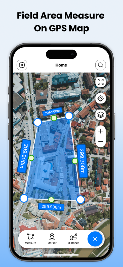
Field Area Measure on GPS Mapアプリのインターフェースで、衛星地図上に土地面積測定のポリゴンが表示されている
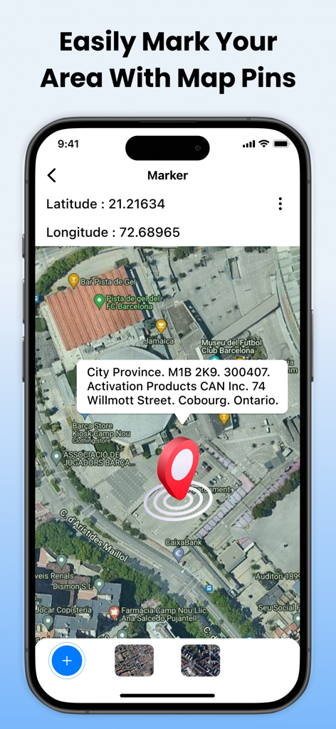
Field Area Measureアプリのスクリーンショットで、衛星地図上に赤いピンマーカーが表示され、GPS座標と住所の詳細が表示されている
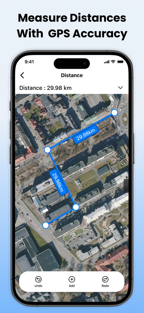
衛星地図ビューと青いマーカーと線が表示されたスマートフォンで、合計距離29.98 kmを測定している
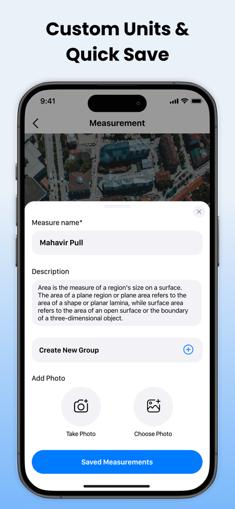
モバイルアプリのインターフェースで、GPS土地測定に名前を付け、説明し、写真を追加するオプションが表示されている
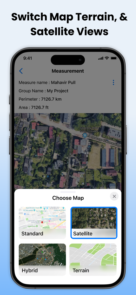
標準、衛星、ハイブリッド、地形の地図ビューを切り替えるオプションが表示されているインターフェース
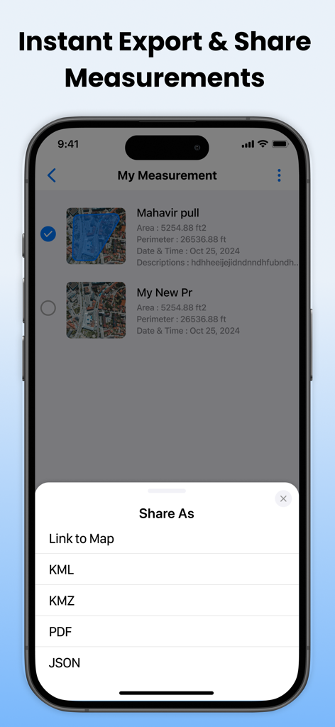
モバイルアプリの画面で、KMLおよびPDF形式を含む土地測定のエクスポートオプションが表示されている
説明
Download
類似アプリ
同じカテゴリのトップランクアプリ

Google LLC

Google Chrome
Google LLC

中国移动(手机营业厅)
China Mobile Online Services Co., Ltd.

Google Authenticator
Google LLC

CNH do Brasil
Servicos e Informacoes do Brasil

Cleanup: Phone Storage Cleaner
DEEP FLOW SOFTWARE SERVICES - FZCO

gov.br
Servicos e Informacoes do Brasil

中国电信-全国统一官方服务平台
CHINA TELECOM Corporation Ltd.

Microsoft Edge: AI Browser
Microsoft Corporation
このページはアプリまたはその開発者の公式ページではなく、情報提供および論評を目的として作成された独立した編集出版物です。明示的に別段の記載がない限り、アプリおよびその開発者は、MWM、Apple、Google Play、アプリのパブリッシャー、またはアプリの開発者と提携、承認、後援、認可、またはその他の公式的な関係はなく、このページのいかなる内容も、アプリがMWMのサービスを使用して開発されたことを意味するものではありません。すべての商標、ロゴ、スクリーンショット、その他のコンテンツはそれぞれの所有者の財産です。