このページはアプリまたはその開発者の公式ページではなく、情報提供および論評を目的として作成された独立した編集出版物です。明示的に別段の記載がない限り、アプリおよびその開発者は、MWM、Apple、Google Play、アプリのパブリッシャー、またはアプリの開発者と提携、承認、後援、認可、またはその他の公式的な関係はなく、このページのいかなる内容も、アプリがMWMのサービスを使用して開発されたことを意味するものではありません。すべての商標、ロゴ、スクリーンショット、その他のコンテンツはそれぞれの所有者の財産です。

GeoBallistics
テクニカルシューターのためのオールインワンエコシステム。プロフェッショナル3 DOFソルバー、衛星マッピングされたレンジカード、シームレスなハードウェア統合を組み合わせて、推測を排除し、あらゆる射撃をマスターしましょう。
ダウンロード
8K+ユーザー評価
評価数
200開発元
カテゴリ
Utilities対応言語
1最新バージョン
7.2.9(373)サイズ
76.5 MBリリース日
2015年8月25日現代のマークスマンのための精密工学
ハードウェア、気象データ、衛星画像を統合するプログレードの弾道エコシステムで、推測を排除し、一発必中の精度を実現しましょう。
高度な3 DOFソルバー
極端な距離でコリオリ効果、スピンドリフト、空気抵抗によるジャンプを考慮して、超精密なソリューションを計算します。
シームレスなハードウェア同期
Vortex Razor HD、Kestrel、WeatherFlowデバイスと直接接続し、リアルタイムの気象データと即時レンジアップデートを取得します。
以下のスクリーンショットと説明は、アプリの公式ストアリスティングから直接取得されたものであり、アプリ開発者の所有物です。
アプリストア
スクリーンショット
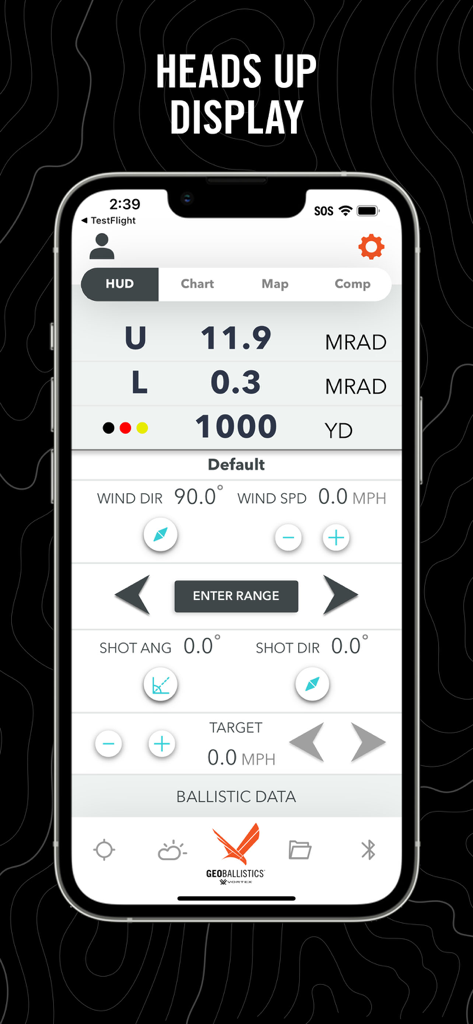
GeoBallisticsアプリのヘッドアップディスプレイ。弾道計算とターゲットまでの距離を表示しています。
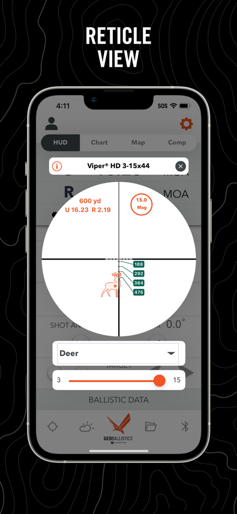
GeoBallisticsアプリのレティクルビュー。鹿のターゲットに対する弾道計算を表示しています。
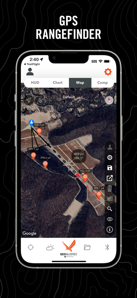
GeoBallisticsアプリのGPS距離計インターフェース。距離ピンとターゲットマーカーが表示された衛星画像を表示しています。
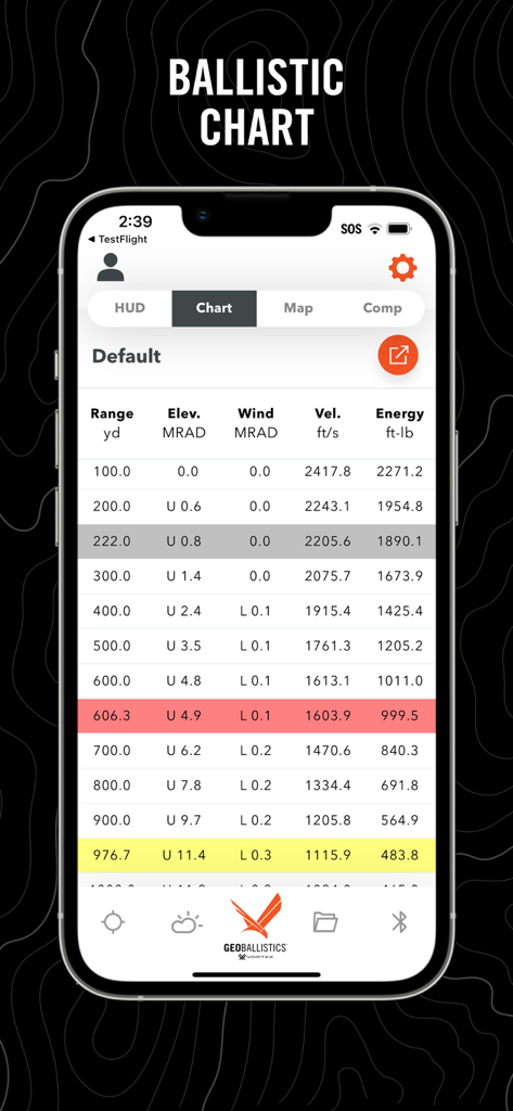
GeoBallisticsアプリのスクリーンショット。距離、仰角、風上、速度、エネルギーデータを含む詳細な弾道チャートを表示しています。
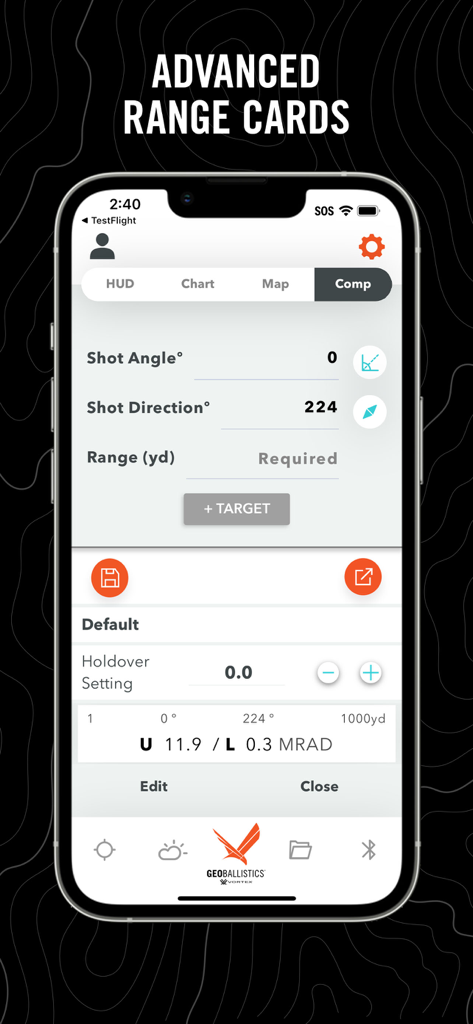
GeoBallisticsアプリのインターフェース。精密射撃のためのコンプモードでの高度なレンジカードと射撃パラメータを表示しています。
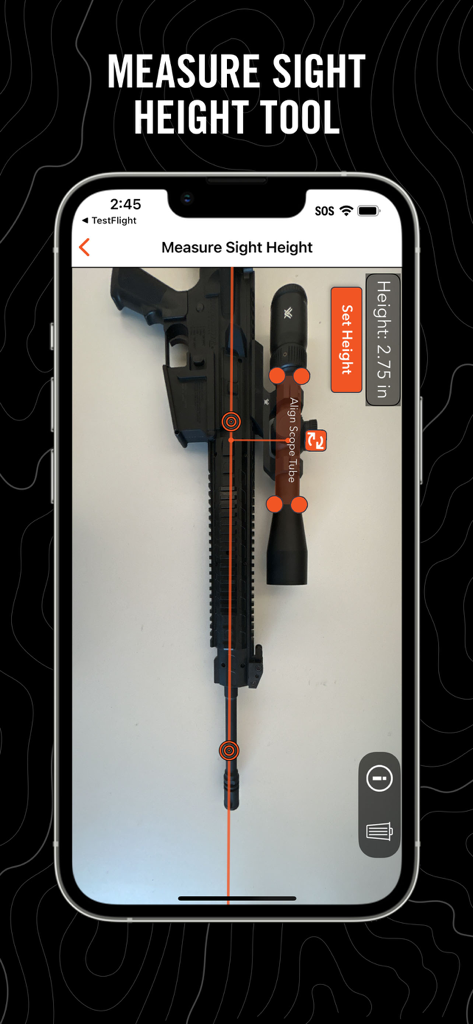
GeoBallisticsアプリ。スコープ付きライフルに使用される照準器高さ測定ツールを表示しています。
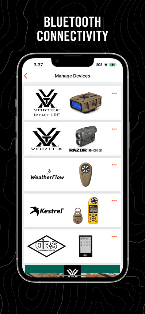
GeoBallisticsアプリのデバイス管理画面。VortexおよびKestrelハードウェアとのBluetooth接続を表示しています。
説明
Download
類似アプリ
同じカテゴリのトップランクアプリ

Google LLC

Google Chrome
Google LLC

中国移动(手机营业厅)
China Mobile Online Services Co., Ltd.

Google Authenticator
Google LLC

CNH do Brasil
Servicos e Informacoes do Brasil

Cleanup: Phone Storage Cleaner
DEEP FLOW SOFTWARE SERVICES - FZCO

gov.br
Servicos e Informacoes do Brasil

中国电信-全国统一官方服务平台
CHINA TELECOM Corporation Ltd.

Microsoft Edge: AI Browser
Microsoft Corporation
このページはアプリまたはその開発者の公式ページではなく、情報提供および論評を目的として作成された独立した編集出版物です。明示的に別段の記載がない限り、アプリおよびその開発者は、MWM、Apple、Google Play、アプリのパブリッシャー、またはアプリの開発者と提携、承認、後援、認可、またはその他の公式的な関係はなく、このページのいかなる内容も、アプリがMWMのサービスを使用して開発されたことを意味するものではありません。すべての商標、ロゴ、スクリーンショット、その他のコンテンツはそれぞれの所有者の財産です。