このページはアプリまたはその開発者の公式ページではなく、情報提供および論評を目的として作成された独立した編集出版物です。明示的に別段の記載がない限り、アプリおよびその開発者は、MWM、Apple、Google Play、アプリのパブリッシャー、またはアプリの開発者と提携、承認、後援、認可、またはその他の公式的な関係はなく、このページのいかなる内容も、アプリがMWMのサービスを使用して開発されたことを意味するものではありません。すべての商標、ロゴ、スクリーンショット、その他のコンテンツはそれぞれの所有者の財産です。

Global Mapper Mobile
高精度GNSSサポート、オフライン地形表示、エンジニアや測量士向けのシームレスなワークフロー統合により、オフィスと現場のギャップを埋めます。
ダウンロード
205K+ユーザー評価
評価数
0開発元
カテゴリ
Navigation対応言語
2最新バージョン
3.1.8サイズ
126.3 MBリリース日
2016年6月15日フィールドGISワークフローを最適化
高精度なマッピング、データ収集、空間解析をあらゆる遠隔地に持ち込み、オフィスと現場をシームレスにつなぐプロフェッショナルの選択肢。
スマートなデータ収集
カスタム属性フォームとジオタグ付き写真を使用して、ポイント、ライン、ポリゴンを記録し、現場から直接高品質なデータの整合性を確保します。
信頼性の高いオフラインマッピング
携帯電話の電波が届かない最果ての地でも、ベクター、ラスター、地形レイヤーにアクセスし、どこにいても完全な状況把握を可能にします。
以下のスクリーンショットと説明は、アプリの公式ストアリスティングから直接取得されたものであり、アプリ開発者の所有物です。
アプリストア
スクリーンショット
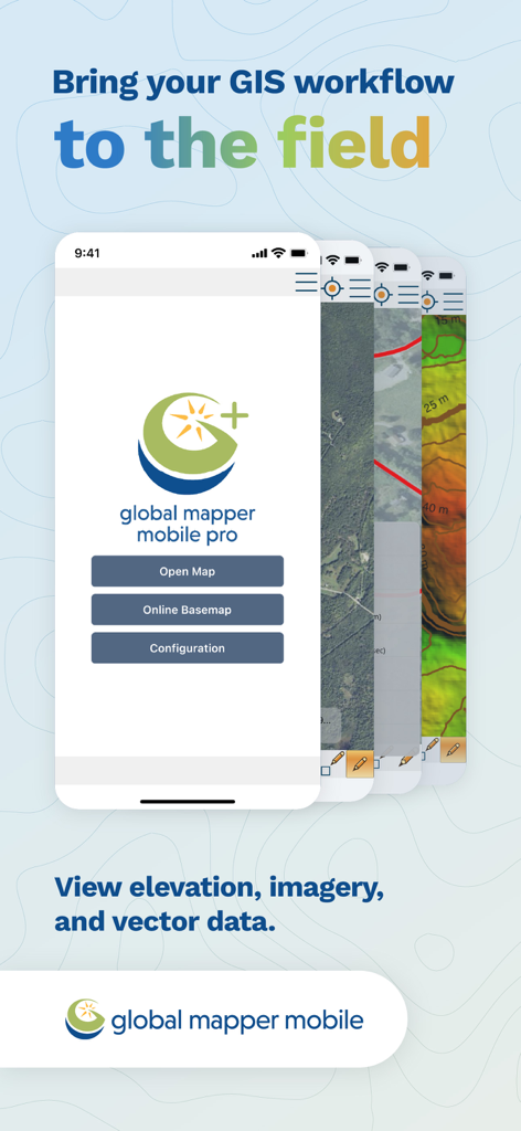
フィールドマッピングとデータ収集のためのGISワークフロー機能を表示するGlobal Mapper Mobileアプリの画面
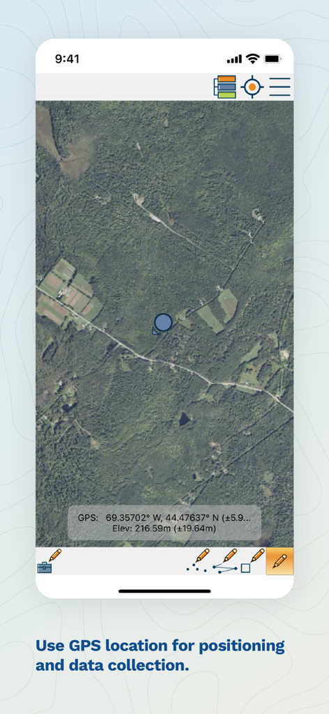
GPS座標、標高、およびフィールドデータ収集ツールを表示するGlobal Mapper Mobileの衛星マップビュー
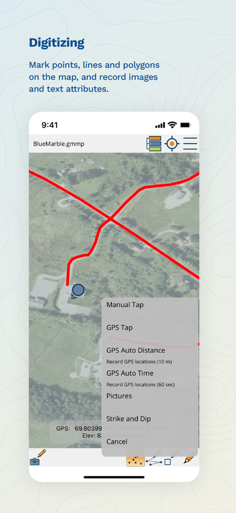
地図上にポイント、ライン、ポリゴンをマークするためのGISデジタイズツールを表示するGlobal Mapper Mobileの画面
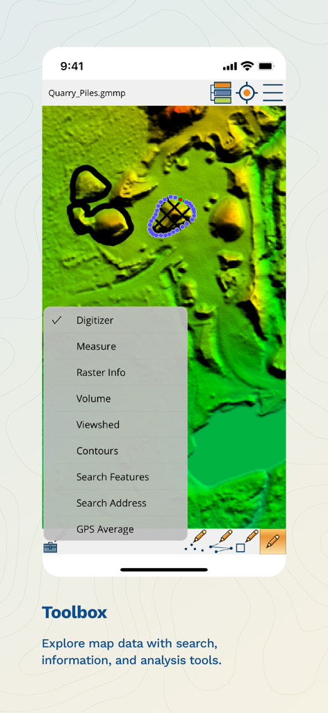
地形マップ上に体積、可視領域、等高線などの解析機能を表示するツールボックスメニューを備えたGlobal Mapper Mobileアプリ
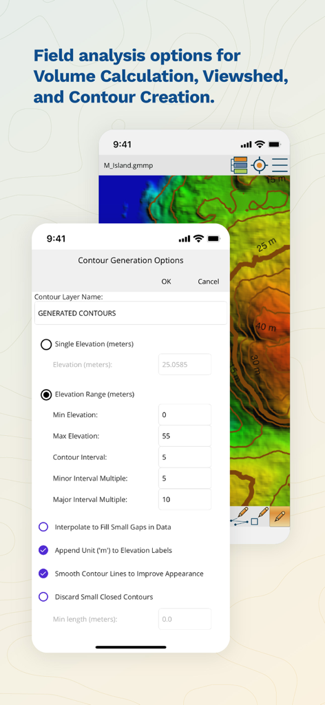
フィールド解析用の等高線生成オプションを表示するGlobal Mapper Mobileのインターフェース
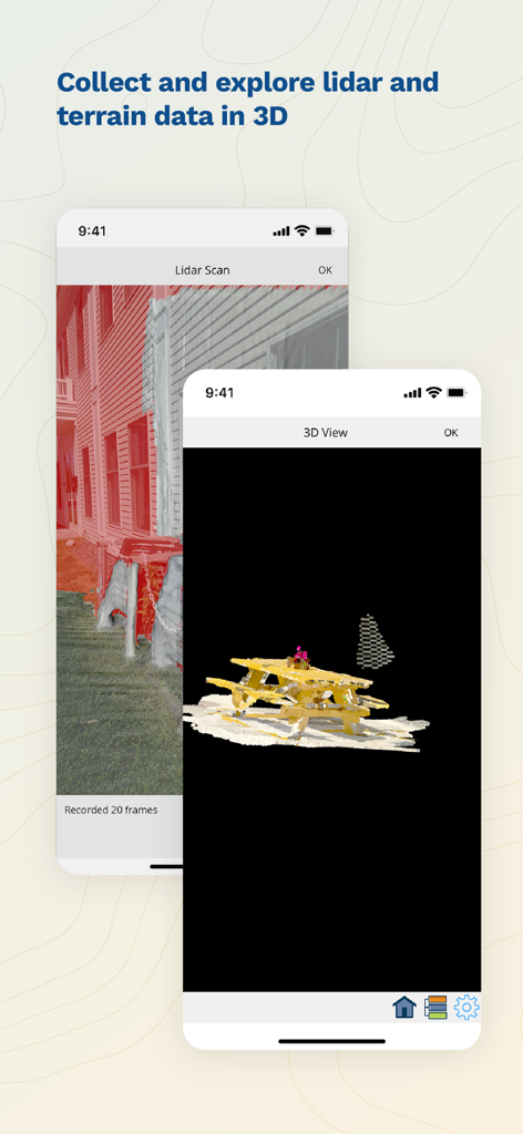
スマートフォン上でのLiDARスキャンと3D地形可視化を表示するGlobal Mapper Mobileアプリのインターフェース
説明
Download
類似アプリ
似た機能とユーザー体験を持つアプリ

MilGPS
Cascode Labs Pty Ltd

SEAiq Pilot VPP
Sakhalin, LLC

Cartograph Maps 3
Harald Meyer

新知卫星地图-路线规划,高清地图导航
Chongqing Xinzhi Space Technology Co., Ltd.

Coordinates – GPS Converter
Mapnitude Company Limited

Mgrs & Utm Map
Vahid Cataltas

DeepStateMap
Heorhii Karpenko

Map Plus
Miocool Inc.

Compass 55. Map & GPS kit.
Kalimex-Consulting s.r.o.
このページはアプリまたはその開発者の公式ページではなく、情報提供および論評を目的として作成された独立した編集出版物です。明示的に別段の記載がない限り、アプリおよびその開発者は、MWM、Apple、Google Play、アプリのパブリッシャー、またはアプリの開発者と提携、承認、後援、認可、またはその他の公式的な関係はなく、このページのいかなる内容も、アプリがMWMのサービスを使用して開発されたことを意味するものではありません。すべての商標、ロゴ、スクリーンショット、その他のコンテンツはそれぞれの所有者の財産です。