このページはアプリまたはその開発者の公式ページではなく、情報提供および論評を目的として作成された独立した編集出版物です。明示的に別段の記載がない限り、アプリおよびその開発者は、MWM、Apple、Google Play、アプリのパブリッシャー、またはアプリの開発者と提携、承認、後援、認可、またはその他の公式的な関係はなく、このページのいかなる内容も、アプリがMWMのサービスを使用して開発されたことを意味するものではありません。すべての商標、ロゴ、スクリーンショット、その他のコンテンツはそれぞれの所有者の財産です。

GlobeViewer Moon PRO
NASAデータで強化されたプロレベルの地形学で月面を探検しましょう。リアルな望遠鏡シミュレーションからクレーター分析のためのカスタマイズ可能な照明まで、最も詳細な3Dマップで月面観測をマスターしましょう。
ダウンロード
100ユーザー評価
評価数
0開発元
カテゴリ
Education対応言語
18最新バージョン
0.8.4サイズ
158.9 MBリリース日
2022年8月14日月のあらゆる詳細を発見する
高解像度のNASAデータを利用して、GlobeViewer Moon PROは愛好家、教育者、望遠鏡ユーザーにとってプロレベルの3D環境を提供します。
精密望遠鏡シミュレーション
実際の望遠鏡の視界に合わせた月の満ち欠けと秤動のリアルなシミュレーションで、観測セッションを計画しましょう。
NASA搭載3D地形
絶対的な精度を期すため、高解像度の月周回衛星(LRO)データからレンダリングされたクレーター、溝、山脈を探検しましょう。
以下のスクリーンショットと説明は、アプリの公式ストアリスティングから直接取得されたものであり、アプリ開発者の所有物です。
アプリストア
スクリーンショット
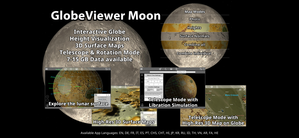
GlobeViewer Moon PROアプリ機能の概要。3D表面マップと望遠鏡モードを含む
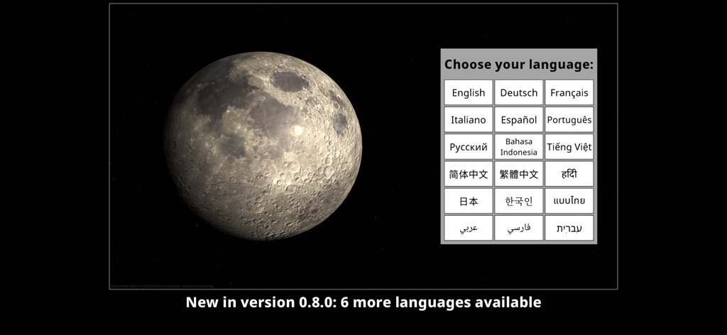
3D月面モデルを備えたGlobeViewer Moon PROの言語選択画面。
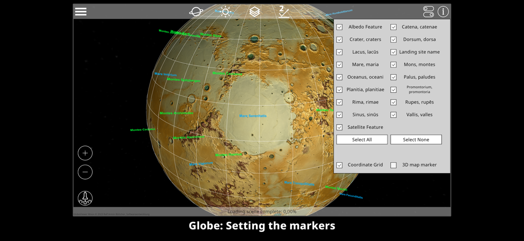
3Dグローブ上の月面特徴マーカーの設定を示すGlobeViewer Moon PROのインターフェース。
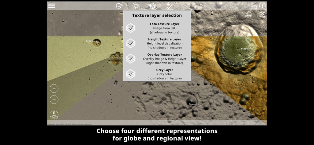
月面の写真高度とオーバーレイマップモードを示すGlobeViewer Moon PROのテクスチャレイヤー選択メニュー
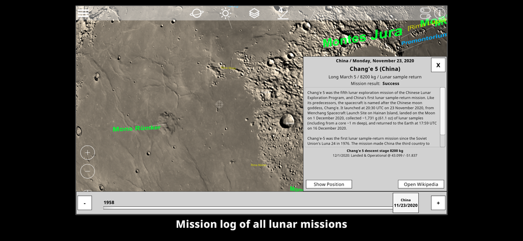
中国の嫦娥5号着陸地点の位置とミッションの詳細を示す3D月面マップ
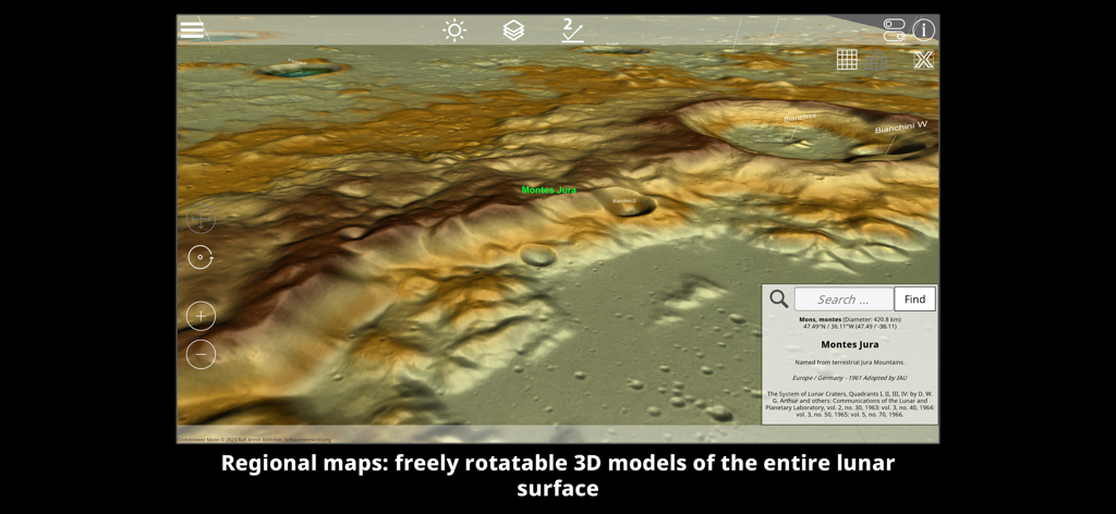
モンテス・ジュラ山脈とクレーターを強調する詳細な3D地形図の月面
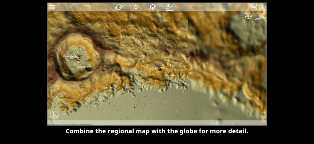
詳細な月面地形とビアンキーニクレーターを示す高解像度3D地域マップ。
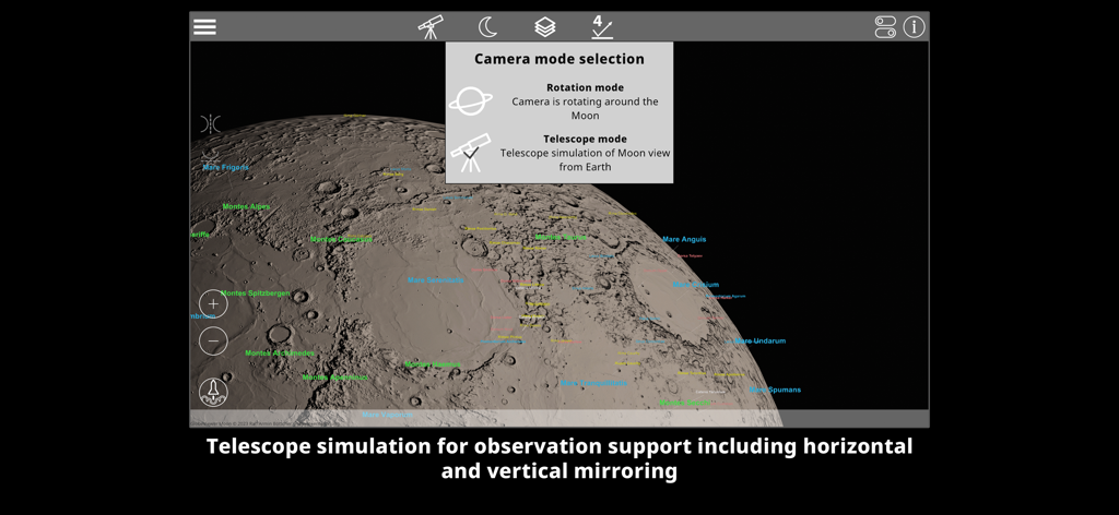
クレーターラベル付きの3D月面上の望遠鏡シミュレーション用のカメラモード選択を示すGlobeViewer Moon PROのインターフェース。
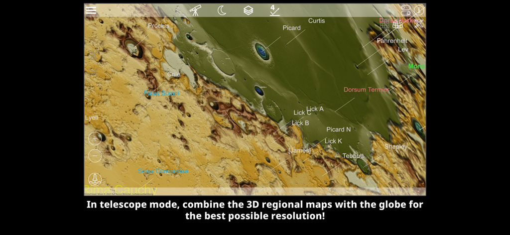
ラベル付きのクレーターと地形の詳細な高解像度3D地域マップ
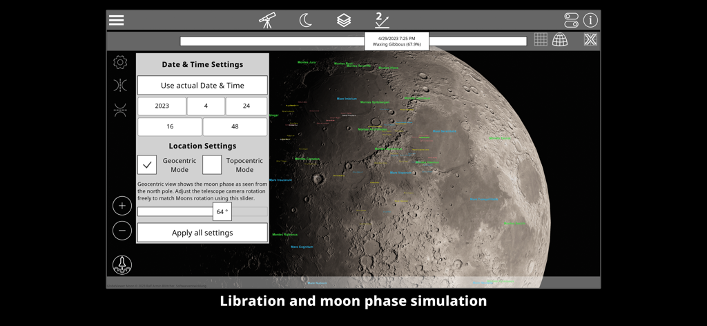
秤動と月の満ち欠けシミュレーション設定を示すGlobeViewer Moon PROインターフェース
説明
Download
類似アプリ
同じカテゴリのトップランクアプリ

Duolingo - Language Lessons
Duolingo, Inc

Speak & Learn English: Learna
DEEP FLOW SOFTWARE SERVICES - FZCO

驾考宝典-科一科四驾驶证考试驾考通
Wuhan Jiakaobaodian Information Service Co., Ltd.

Toca Boca World
Toca Boca AB

Google Classroom
Google LLC

作业帮-中小学家长作业检查和辅导工具
Guangzhou Polar Future Culture Technology Co., Ltd

学信网
Student Information Consultation Service Co., Ltd.

Gauth: AI Study Companion
GAUTHTECH PTE. LTD.

ArtWorkout: Learn How to Draw
Aleksandr Ulitin
このページはアプリまたはその開発者の公式ページではなく、情報提供および論評を目的として作成された独立した編集出版物です。明示的に別段の記載がない限り、アプリおよびその開発者は、MWM、Apple、Google Play、アプリのパブリッシャー、またはアプリの開発者と提携、承認、後援、認可、またはその他の公式的な関係はなく、このページのいかなる内容も、アプリがMWMのサービスを使用して開発されたことを意味するものではありません。すべての商標、ロゴ、スクリーンショット、その他のコンテンツはそれぞれの所有者の財産です。