このページはアプリまたはその開発者の公式ページではなく、情報提供および論評を目的として作成された独立した編集出版物です。明示的に別段の記載がない限り、アプリおよびその開発者は、MWM、Apple、Google Play、アプリのパブリッシャー、またはアプリの開発者と提携、承認、後援、認可、またはその他の公式的な関係はなく、このページのいかなる内容も、アプリがMWMのサービスを使用して開発されたことを意味するものではありません。すべての商標、ロゴ、スクリーンショット、その他のコンテンツはそれぞれの所有者の財産です。

GPS Area Measure Map
精度高く面積を計算し、距離を追跡し、境界線をマークします。農家、請負業者、不動産の専門家が、あらゆる地形を自信を持ってマッピングするための、必須のオールインワンツールキットです。
ダウンロード
100ユーザー評価
評価数
0開発元
カテゴリ
Utilities対応言語
13最新バージョン
4.0サイズ
71.7 MBリリース日
2025年6月4日あらゆるプロジェクトのための精度ツール
iPhoneをプロ仕様の測量ツールキットに変えます。工事現場の見積もり、農場のマッピング、境界線のマークなど、数秒で正確なデータを取得できます。
即時の面積と周囲長統計
マップをタップするか、境界線を歩くだけで、面積、平方フィート、またはフェンスの長さを計算できます。迅速な現場見積もりに最適です。
スマートな位置マーキング
カスタムマーカーを使用して、敷地の角、水源、またはユーティリティラインなどの重要なランドマークを正確に特定して保存し、フィールドノートを整理します。
以下のスクリーンショットと説明は、アプリの公式ストアリスティングから直接取得されたものであり、アプリ開発者の所有物です。
アプリストア
スクリーンショット
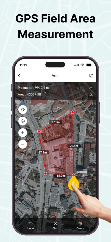
建物の面積を測定するために使用される赤いポリゴンが表示された衛星マップを表示するiPhone
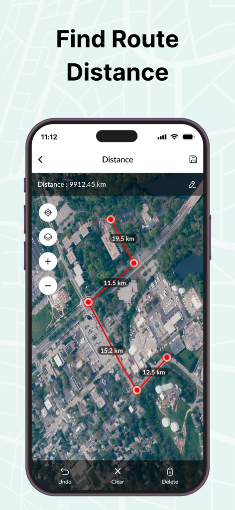
衛星マップ上のルート距離測定を示すGPSアプリインターフェイス
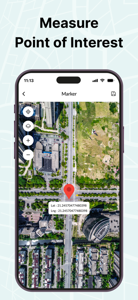
特定の地点の緯度と経度座標、および赤いマーカーピンが表示された衛星マップを表示するスマートフォン画面
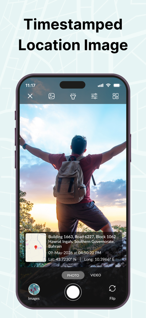
GPS座標とミニマップを含むタイムスタンプ付きの場所オーバーレイが表示された写真を示すスマートフォンの画面
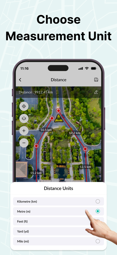
衛星マップを表示するGPSエリア測定マップアプリインターフェイスで距離測定単位を選択
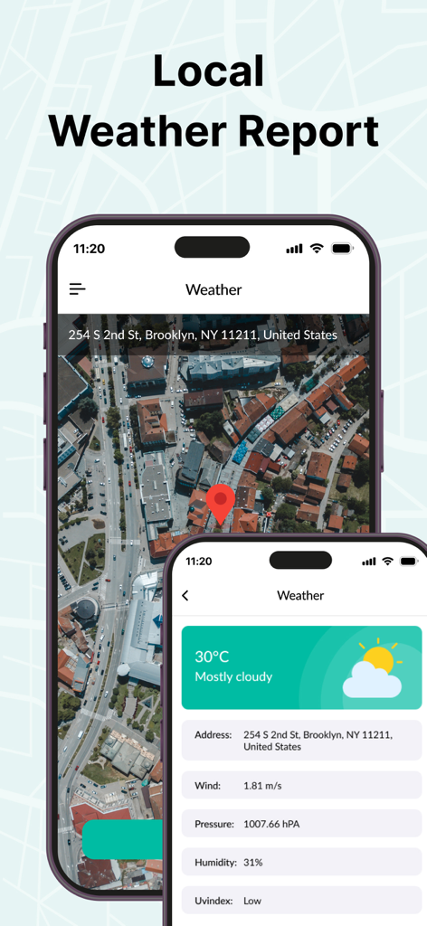
気温や風速などの環境データと衛星マップビューが表示された地域の天気予報を示すスマートフォンの画面
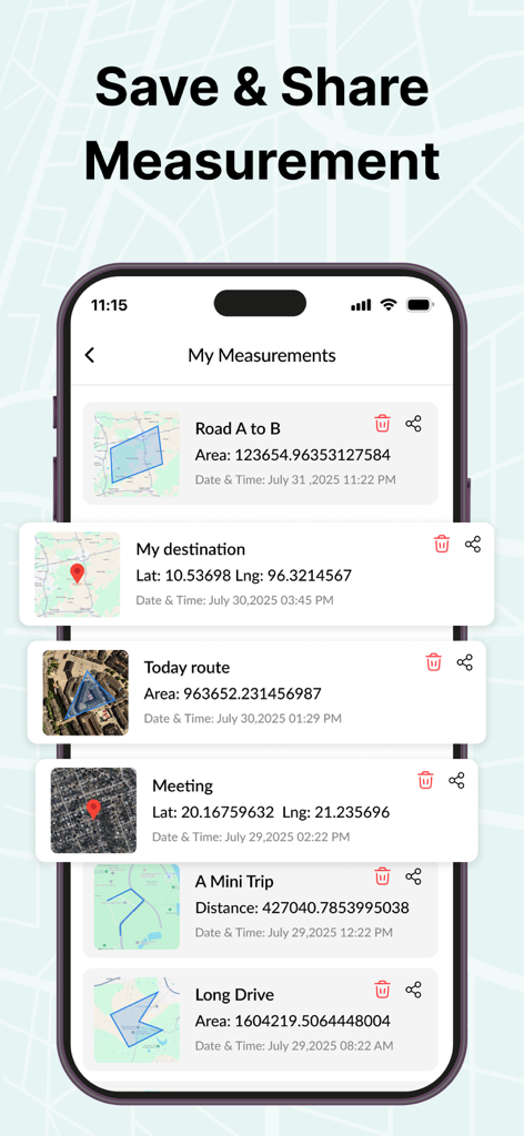
保存および共有オプションが表示されたさまざまな土地面積とルートを示すGPSエリア測定マップアプリで保存された測定値のリスト
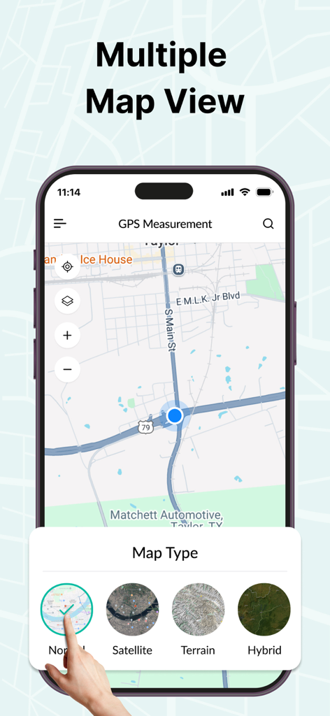
衛星および地形モードを示すGPSエリア測定アプリの複数のマップビューオプション
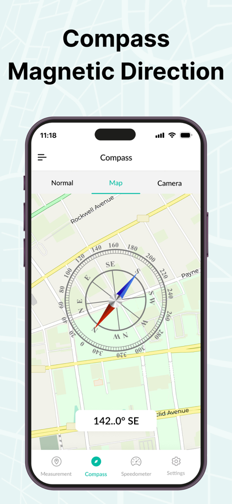
通りの地図ビュー上に磁気コンパスの方向を示すGPSエリア測定マップアプリ
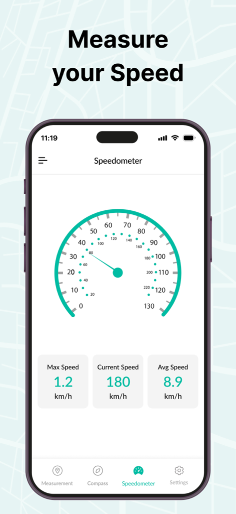
リアルタイム速度追跡データが表示されたGPSエリア測定マップアプリのスピードメーター機能を示すスマートフォン
説明
Download
類似アプリ
同じカテゴリのトップランクアプリ

Google LLC

Google Chrome
Google LLC

中国移动(手机营业厅)
China Mobile Online Services Co., Ltd.

Google Authenticator
Google LLC

CNH do Brasil
Servicos e Informacoes do Brasil

Cleanup: Phone Storage Cleaner
DEEP FLOW SOFTWARE SERVICES - FZCO

gov.br
Servicos e Informacoes do Brasil

Super VPN Fly 2026
YUNFAN TECHNOLOGY CO., LIMITED

Microsoft Edge: AI Browser
Microsoft Corporation
このページはアプリまたはその開発者の公式ページではなく、情報提供および論評を目的として作成された独立した編集出版物です。明示的に別段の記載がない限り、アプリおよびその開発者は、MWM、Apple、Google Play、アプリのパブリッシャー、またはアプリの開発者と提携、承認、後援、認可、またはその他の公式的な関係はなく、このページのいかなる内容も、アプリがMWMのサービスを使用して開発されたことを意味するものではありません。すべての商標、ロゴ、スクリーンショット、その他のコンテンツはそれぞれの所有者の財産です。