このページはアプリまたはその開発者の公式ページではなく、情報提供および論評を目的として作成された独立した編集出版物です。明示的に別段の記載がない限り、アプリおよびその開発者は、MWM、Apple、Google Play、アプリのパブリッシャー、またはアプリの開発者と提携、承認、後援、認可、またはその他の公式的な関係はなく、このページのいかなる内容も、アプリがMWMのサービスを使用して開発されたことを意味するものではありません。すべての商標、ロゴ、スクリーンショット、その他のコンテンツはそれぞれの所有者の財産です。

GPS Emulator - Location Track
世界中へのリアルな旅行をシミュレートし、プロフェッショナルな記録のためにジオタグ付き写真をキャプチャし、iOS向け究極の位置情報管理ツールで任意の地域を探索しましょう。
ダウンロード
1K+ユーザー評価
評価数
0開発元
カテゴリ
Navigation対応言語
1最新バージョン
1.0サイズ
15.1 MBリリース日
2025年12月30日仮想プレゼンスをマスターする
テスト、ドキュメント、仮想探索のために設計された精密に作られたiOSエクスペリエンスで、座標を完全にコントロールしましょう。
リアルな移動シミュレーション
カスタム速度制御により、歩行、運転、飛行モードをシミュレートしてソファから世界中を移動できます。位置情報ベースのゲームや開発者に最適です。
検証済み写真メタデータ
ライブGPS座標、タイムスタンプ、地図データを写真に直接埋め込み、現場訪問を正確にキャプチャし、プロレベルのドキュメントを作成します。
以下のスクリーンショットと説明は、アプリの公式ストアリスティングから直接取得されたものであり、アプリ開発者の所有物です。
アプリストア
スクリーンショット
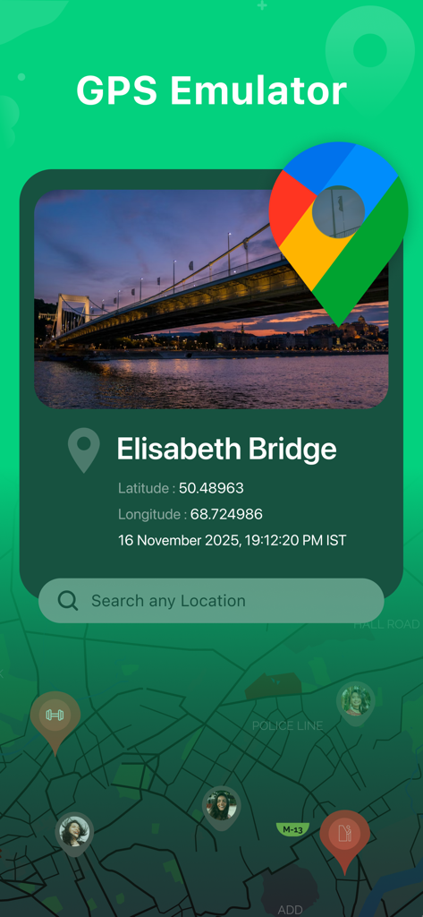
GPSエミュレーターアプリのインターフェースには、エリザベス橋の地理座標と検索バーが表示されています
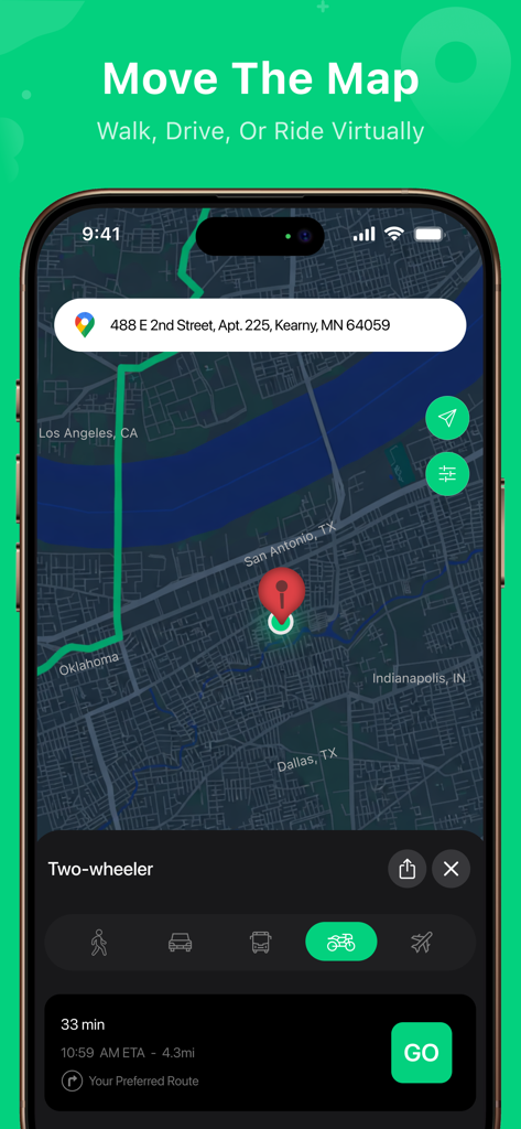
GPSエミュレーターアプリには、二輪車での仮想旅行シミュレーションが表示されています

複数のユーザープロファイルピンと、座標や住所などの詳細な場所メタデータが表示された地図を示すモバイルインターフェース。
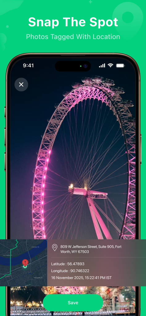
GPS位置座標と住所が埋め込まれた観覧車の写真を示すスマートフォンの画面。
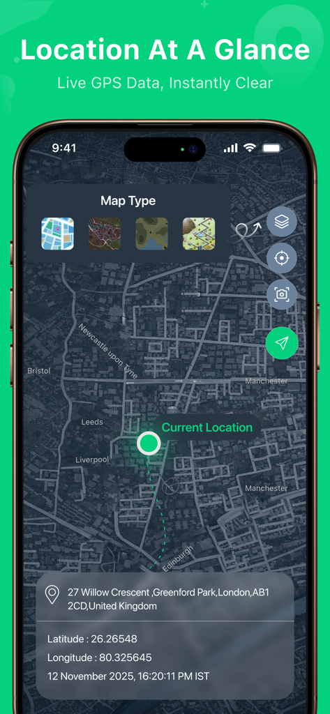
地図上に緯度、経度、住所などのライブ位置情報が表示されたGPSエミュレーターアプリを示すスマートフォンの画面
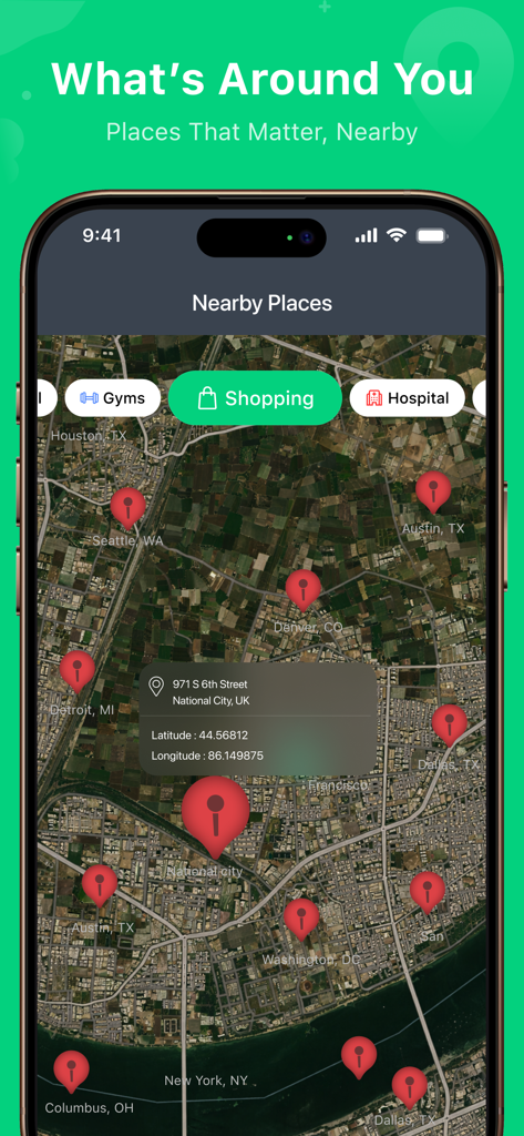
GPSエミュレーターアプリのインターフェースには、衛星地図ビューで近くのショッピングやジムの場所が表示されています
説明
Download
類似アプリ
同じカテゴリのトップランクアプリ

Google Maps
Google LLC

Waze Navigation & Live Traffic
waze

AMap Global
AutoNavi Information Technology Co. Ltd.

百度地图-路线规划,出行必备
Beijing Baidu Netcom Science & Technology Co.,Ltd

Moovit: Bus & Transit Tracker
Moovit App Global LTD

Transit • Subway & Bus Times
9280-0366 Quebec inc.

ParkMobile: Park. Pay. Go.
Parkmobile USA, Inc

腾讯地图-路线规划,导航地铁打车出行
Shenzhen Tencent Computer Systems Company Limited

Île-de-France Mobilités
Ile de France Mobilites
このページはアプリまたはその開発者の公式ページではなく、情報提供および論評を目的として作成された独立した編集出版物です。明示的に別段の記載がない限り、アプリおよびその開発者は、MWM、Apple、Google Play、アプリのパブリッシャー、またはアプリの開発者と提携、承認、後援、認可、またはその他の公式的な関係はなく、このページのいかなる内容も、アプリがMWMのサービスを使用して開発されたことを意味するものではありません。すべての商標、ロゴ、スクリーンショット、その他のコンテンツはそれぞれの所有者の財産です。