このページはアプリまたはその開発者の公式ページではなく、情報提供および論評を目的として作成された独立した編集出版物です。明示的に別段の記載がない限り、アプリおよびその開発者は、MWM、Apple、Google Play、アプリのパブリッシャー、またはアプリの開発者と提携、承認、後援、認可、またはその他の公式的な関係はなく、このページのいかなる内容も、アプリがMWMのサービスを使用して開発されたことを意味するものではありません。すべての商標、ロゴ、スクリーンショット、その他のコンテンツはそれぞれの所有者の財産です。

GPS Fields Area Measure on Map
農家、不動産業者、屋外プロフェッショナル向けの究極のGPSツール。境界線を正確に測定し、土地の面積を計算し、高精度な衛星画像で物件データを管理します。
ダウンロード
1K+ユーザー評価
評価数
200開発元
カテゴリ
Utilities対応言語
1最新バージョン
1.0.19サイズ
45.8 MBリリース日
2023年7月25日プロフェッショナルグレードの高精度で土地をマスターしましょう
作付け計画のための面積計算から物件境界線の定義まで、当社のGPS搭載ツールは、プロフェッショナルと物件所有者の両方に即時かつ正確な測定値を提供します。
ピンポイントな面積計算
高解像度の衛星マップ上に直接境界線をマークすることで、あらゆる区画、農場、または畑の正確なサイズを即座に計算します。
正確な境界マッピング
プロのGPS精度で周囲長とランドマーク間の距離を測定します。フェンシング、造園、灌漑計画に最適です。
以下のスクリーンショットと説明は、アプリの公式ストアリスティングから直接取得されたものであり、アプリ開発者の所有物です。
アプリストア
スクリーンショット
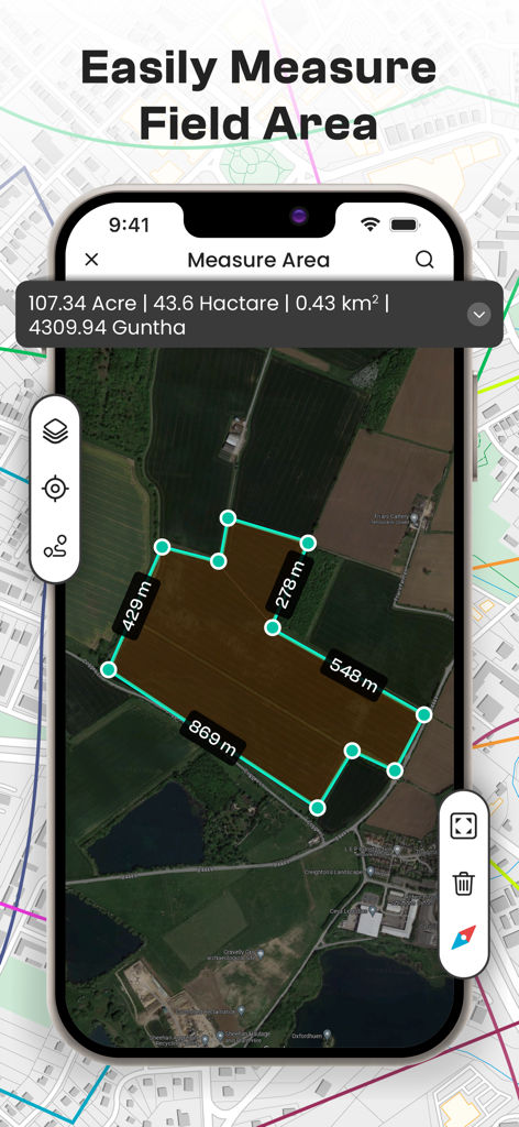
衛星マップビュー、農地の面積をエーカーとヘクタールで表示
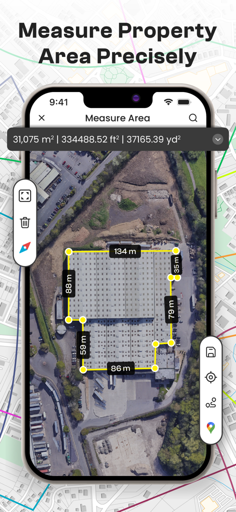
建物の正確な面積と周囲長を測定する衛星マップインターフェイスを示すスマートフォン
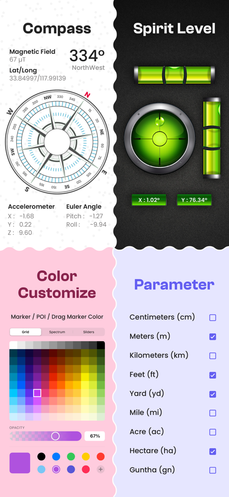
コンパス、水準器、色のカスタマイズ、測定単位のオプションを備えたモバイルアプリ画面
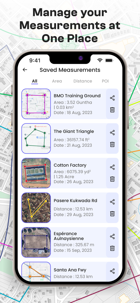
GPS Fieldsアプリに保存された土地面積と距離測定値のリスト

都市マップ上の複数のピン間の測定距離を表示するモバイルアプリインターフェイス
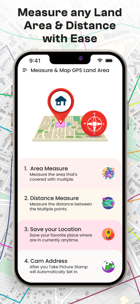
場所の保存やカメラ写真スタンプの機能を持つGPS土地面積および距離測定用のモバイルアプリ画面
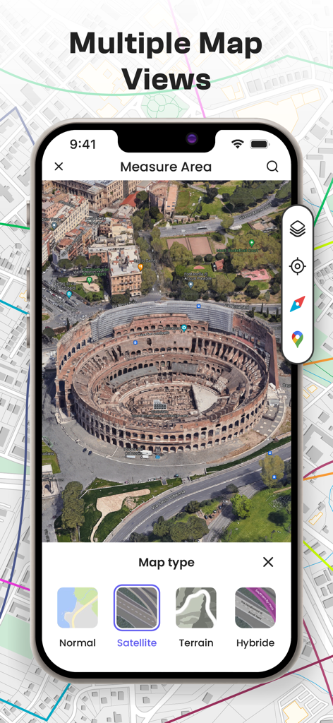
GPS Fields Area Measureアプリ内の通常、衛星、地形を含む複数のマップタイプオプションと衛星マップビューを示すスマートフォンスクリーン
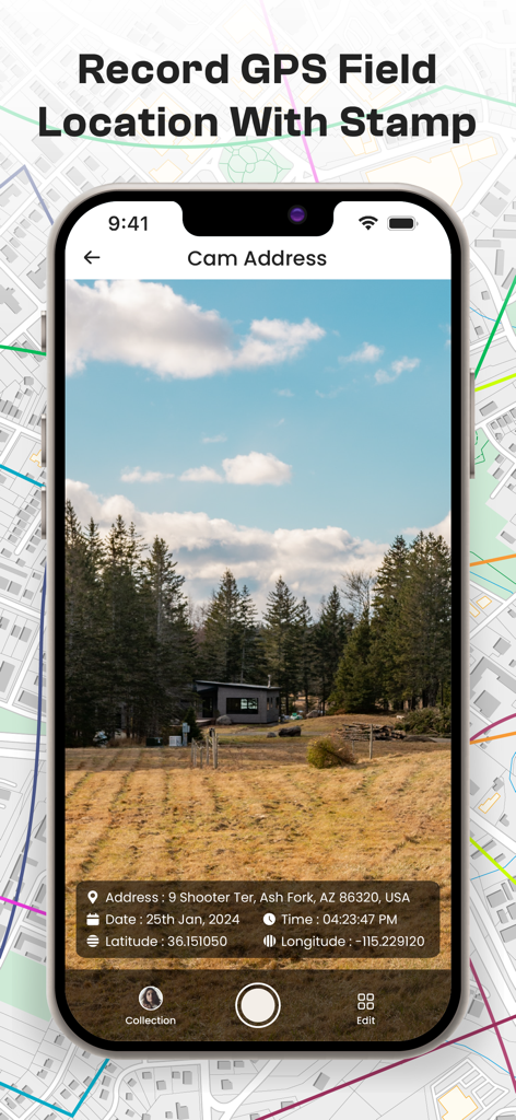
場所と座標データスタンプを備えたアプリ内のフィールド写真
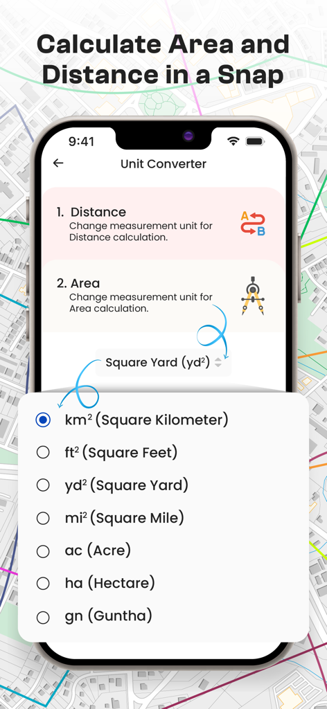
GPS Fields Area Measureアプリのインターフェイス、平方フィートやエーカーを含む面積測定単位のリストを表示
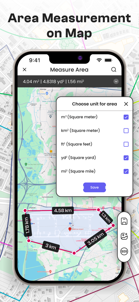
土地計算のために単位選択を表示するGPSマップ面積測定ツール
説明
Download
類似アプリ
同じカテゴリのトップランクアプリ

Google LLC

Google Chrome
Google LLC

中国移动(手机营业厅)
China Mobile Online Services Co., Ltd.

Google Authenticator
Google LLC

CNH do Brasil
Servicos e Informacoes do Brasil

Cleanup: Phone Storage Cleaner
DEEP FLOW SOFTWARE SERVICES - FZCO

gov.br
Servicos e Informacoes do Brasil

Microsoft Edge: AI Browser
Microsoft Corporation

Super VPN Fly 2026
YUNFAN TECHNOLOGY CO., LIMITED
このページはアプリまたはその開発者の公式ページではなく、情報提供および論評を目的として作成された独立した編集出版物です。明示的に別段の記載がない限り、アプリおよびその開発者は、MWM、Apple、Google Play、アプリのパブリッシャー、またはアプリの開発者と提携、承認、後援、認可、またはその他の公式的な関係はなく、このページのいかなる内容も、アプリがMWMのサービスを使用して開発されたことを意味するものではありません。すべての商標、ロゴ、スクリーンショット、その他のコンテンツはそれぞれの所有者の財産です。