このページはアプリまたはその開発者の公式ページではなく、情報提供および論評を目的として作成された独立した編集出版物です。明示的に別段の記載がない限り、アプリおよびその開発者は、MWM、Apple、Google Play、アプリのパブリッシャー、またはアプリの開発者と提携、承認、後援、認可、またはその他の公式的な関係はなく、このページのいかなる内容も、アプリがMWMのサービスを使用して開発されたことを意味するものではありません。すべての商標、ロゴ、スクリーンショット、その他のコンテンツはそれぞれの所有者の財産です。

Light Pollution Map - Dark Sky
最も暗い空を見つけ、ライブオーロラを追跡し、夜を極めましょう。星空観察者、写真家、アウトドア探検家のためのオールインワン精密ツールです。
ダウンロード
611K+ユーザー評価
評価数
1K+開発元
カテゴリ
Weather対応言語
1最新バージョン
5.5.0サイズ
95.6 MBリリース日
2017年2月17日夜を極めるために必要なすべて
最も暗いキャンプ地を特定することから、オーロラの追跡まで、究極の星空観察体験に必要な精密データを提供します。
インタラクティブなダークスカイマップ
次の休暇に合わせた高解像度の光害データで、写真撮影や観察に最適な、最も澄んで暗い空を見つけましょう。
即時イベント通知
流星群、スーパームーン、地元のオーロラ活動に関するリアルタイムプッシュアラートで、珍しい天体イベントを見逃すことはありません。
よくある質問
について知っておくべきこと Light Pollution Map - Dark Sky
Light Pollution Map - Dark Sky アプリの主な目的は何ですか?
Light Pollution Map - Dark Sky アプリは、ユーザーが星空観賞、夜空の写真撮影、天体イベントの観測に適した、光害の影響を受けない暗い空の場所を見つけるのに役立ちます。
Light Pollution Map - Dark Sky はオーロラ追跡機能を提供していますか?
はい、Light Pollution Map - Dark Sky アプリは、KP値、地磁気データ、および両半球のライブ可視性マップを含む、オーロラのライブ情報を提供します。
Light Pollution Map - Dark Sky Pro バージョンの料金はいくらですか?
Light Pollution Map - Dark Sky Pro バージョンは、年間サブスクリプションで 9.99 米ドルです。この価格は毎年更新されます。
Light Pollution Map - Dark Sky で国際宇宙ステーション (ISS) を追跡できますか?
はい、Light Pollution Map - Dark Sky には ISS トラッカーが含まれており、国際宇宙ステーションの場所、可視性、速度、高度に関するライブアップデートを提供します。
Light Pollution Map - Dark Sky アプリは月の満ち欠け情報も表示しますか?
はい、Light Pollution Map - Dark Sky アプリは、月の満ち欠け、日の出と日の入り時刻、次回の満月と新月の期日など、包括的な月の情報を提供します。
Light Pollution Map - Dark Sky アプリは、どのようにして晴れた空を見つけるのに役立ちますか?
Light Pollution Map - Dark Sky アプリは、ローカルの雲量インジケーターとメインマップ上の雲量オーバーレイを提供し、ユーザーが晴れた空の場所を見つけるのを支援します。
Light Pollution Map - Dark Sky は天体イベントのアラートを提供していますか?
はい、Light Pollution Map - Dark Sky は、ローカルおよびグローバルのオーロラ活動、流星群、スーパームーン、月食に関するアラートとプッシュ通知を提供します。
Light Pollution Map - Dark Sky でお気に入りの暗い空の場所を保存できますか?
はい、Light Pollution Map - Dark Sky では、ユーザーがお気に入りの暗い空の場所を保存して読み込み、Apple Maps アプリを使用してそれらに移動できます。
Light Pollution Map - Dark Sky アプリを使用するにはインターネット接続が必要ですか?
はい、Light Pollution Map - Dark Sky アプリは、データをロードするためにアクティブなインターネット接続または Wi-Fi が必要です。
Light Pollution Map - Dark Sky 内のナイトイベントカレンダーには、どのような種類の天体イベントが記載されていますか?
Light Pollution Map - Dark Sky のナイトイベントカレンダーには、ペルセウス座流星群などの流星群、スーパームーン、月食などのイベントの期日が記載されています。
以下のスクリーンショットと説明は、アプリの公式ストアリスティングから直接取得されたものであり、アプリ開発者の所有物です。
アプリストア
スクリーンショット
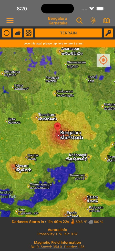
地形と暗闇のデータを示すインタラクティブな光害マップで星空観察に役立つ
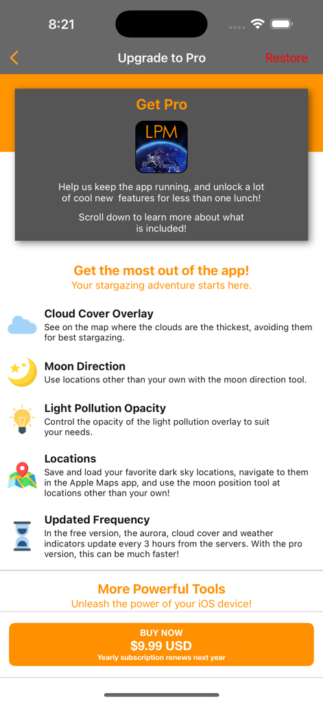
光害マップPro版アップグレード画面のスクリーンショット。プレミアム機能と購読価格が記載されている
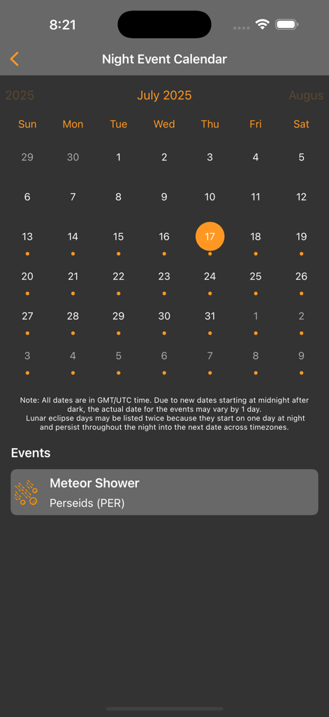
ペルセウス座流星群の通知が表示された夜間イベントカレンダーのモバイル画面。
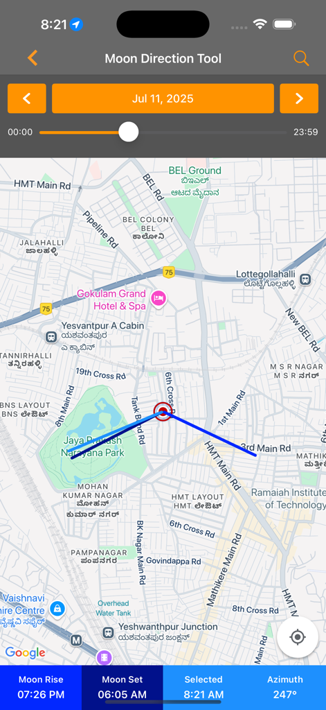
星空観察計画のために地図上に位置を示す月の方角ツールインターフェース
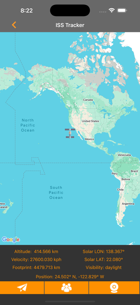
高度と速度データ付きの国際宇宙ステーションリアルタイム追跡マップ
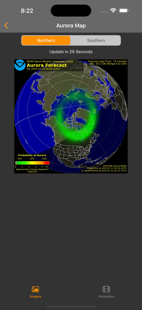
光害マップアプリのオーロラマップ画面のスクリーンショット。北半球の地図上にオーロラの予報が表示されている。
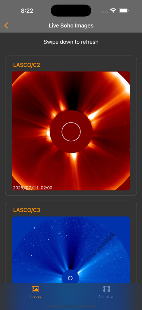
SOHOミッションによる太陽コロナグラフを示すライブ太陽画像
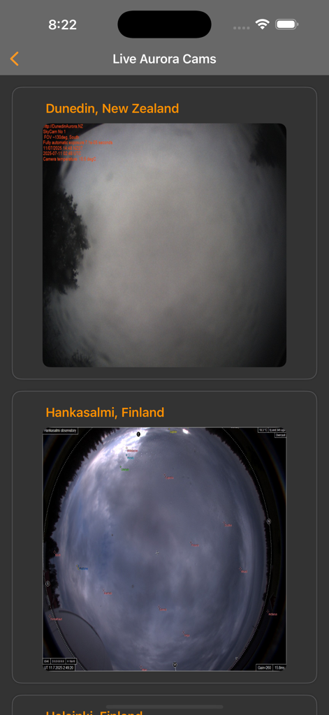
ニュージーランドとフィンランドからのライブオーロラカメラフィードを表示するモバイルインターフェース
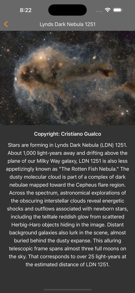
アプリ内でLynds暗黒星雲1251を示す今日の天体写真
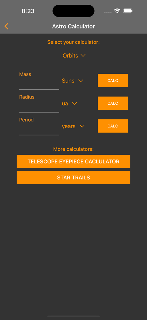
軌道計算、望遠鏡接眼レンズツール、星の軌跡設定を示すアストロ計算機画面
説明
Download
類似アプリ
似た機能とユーザー体験を持つアプリ

Moon Phases and Lunar Calendar
Business City s.r.o.

My Moon Phase - Lunar Calendar
JRustonApps B.V.

The Moon: Calendar Moon Phases
Vitalii Gryniuk

Moonlitt: Moon Phase Tracker
Flipping Hues Srls

Sunrise Sunset Times
Fascinating Projects Pty Ltd

PhotoPills
PhotoPills S.L.

AuroraReach
HuskyCodes Oy

Sun Seeker - Sunlight Tracker
Ajnaware Pty Ltd

Sun Tracker AR
Zuzana Eskinasi
このページはアプリまたはその開発者の公式ページではなく、情報提供および論評を目的として作成された独立した編集出版物です。明示的に別段の記載がない限り、アプリおよびその開発者は、MWM、Apple、Google Play、アプリのパブリッシャー、またはアプリの開発者と提携、承認、後援、認可、またはその他の公式的な関係はなく、このページのいかなる内容も、アプリがMWMのサービスを使用して開発されたことを意味するものではありません。すべての商標、ロゴ、スクリーンショット、その他のコンテンツはそれぞれの所有者の財産です。