このページはアプリまたはその開発者の公式ページではなく、情報提供および論評を目的として作成された独立した編集出版物です。明示的に別段の記載がない限り、アプリおよびその開発者は、MWM、Apple、Google Play、アプリのパブリッシャー、またはアプリの開発者と提携、承認、後援、認可、またはその他の公式的な関係はなく、このページのいかなる内容も、アプリがMWMのサービスを使用して開発されたことを意味するものではありません。すべての商標、ロゴ、スクリーンショット、その他のコンテンツはそれぞれの所有者の財産です。

ダウンロード
144K+ユーザー評価
評価数
0開発元
カテゴリ
Navigation対応言語
1最新バージョン
12.1.0サイズ
25.8 MBリリース日
2019年3月28日プロ仕様の海事インテリジェンス
数学的精度と100%オフライン信頼性を要求するプロの船乗りや熱心なオフショアセーラーのために設計された、25以上の専門ツールの包括的なスイート。
高度な幾何学的ルーティング
ルンブライン、大圏航路、WGS84アルゴリズムを使用して複雑なナビゲーション問題を解決し、長距離航路計画を最適化します。
完全な天測航法スイート
海事暦、ABC表、および視線縮小ツールを統合して、かさばるマニュアルを置き換え、プロの天体測位を行います。
以下のスクリーンショットと説明は、アプリの公式ストアリスティングから直接取得されたものであり、アプリ開発者の所有物です。
アプリストア
スクリーンショット
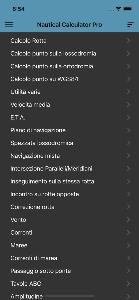
Nautical Calculator Proアプリのメインメニューインターフェース。ナビゲーションツールと計算が表示されています
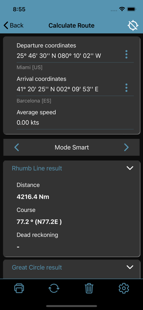
Nautical Calculator Proインターフェース。マイアミからバルセロナへの航路計算が表示され、ルンブラインの距離とコースの詳細が含まれています
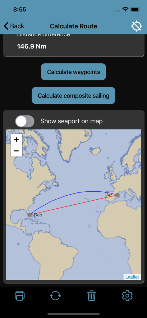
Nautical Calculator Proの航路計算。世界地図上にルンブラインと大圏航路が表示されています
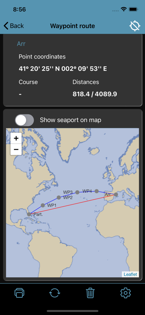
ウェイポイントルートマップ。座標データと、Nautical Calculator Proでの大西洋横断ナビゲーションパスが表示されています
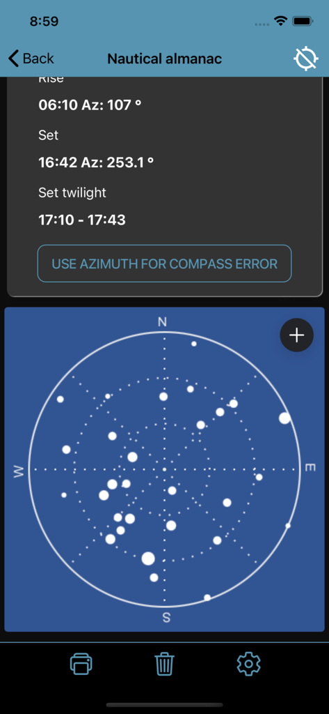
Nautical almanac画面。日の出と日の入りのデータ、および円形の天体星図が表示されています
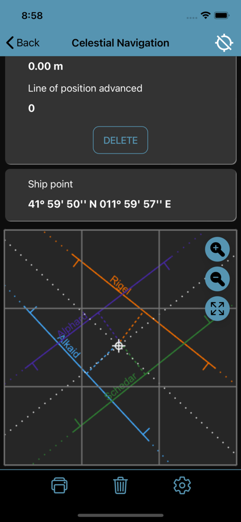
Nautical Calculator Pro Celestial Navigationインターフェース。さまざまな恒星の位置線が表示されています
説明
Download
類似アプリ
似た機能とユーザー体験を持つアプリ


このページはアプリまたはその開発者の公式ページではなく、情報提供および論評を目的として作成された独立した編集出版物です。明示的に別段の記載がない限り、アプリおよびその開発者は、MWM、Apple、Google Play、アプリのパブリッシャー、またはアプリの開発者と提携、承認、後援、認可、またはその他の公式的な関係はなく、このページのいかなる内容も、アプリがMWMのサービスを使用して開発されたことを意味するものではありません。すべての商標、ロゴ、スクリーンショット、その他のコンテンツはそれぞれの所有者の財産です。