The world's most popular free-flight app!
The most comprehensive source for site info, forecasts, webcams, photos & more!
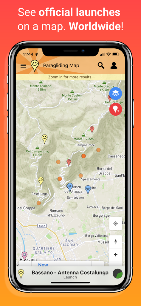
See where you can fly right now. Worldwide!
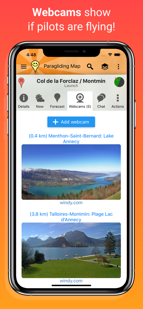
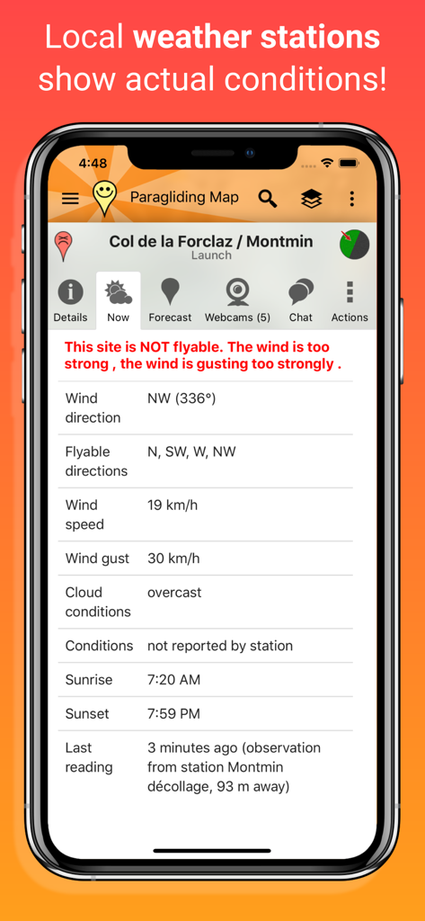
▪ Explore over 15,000 launch sites, 7,500 landings, 30,000 weather stations and 39,000 webcams.
▪ Official data from the DHV, Flyland, FFVL, Paragliding Earth and more.
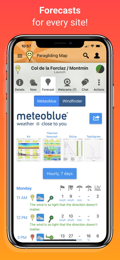
▪ Forecasts from Meteoblue, Windy and WindFinder.
▪ Live webcams.
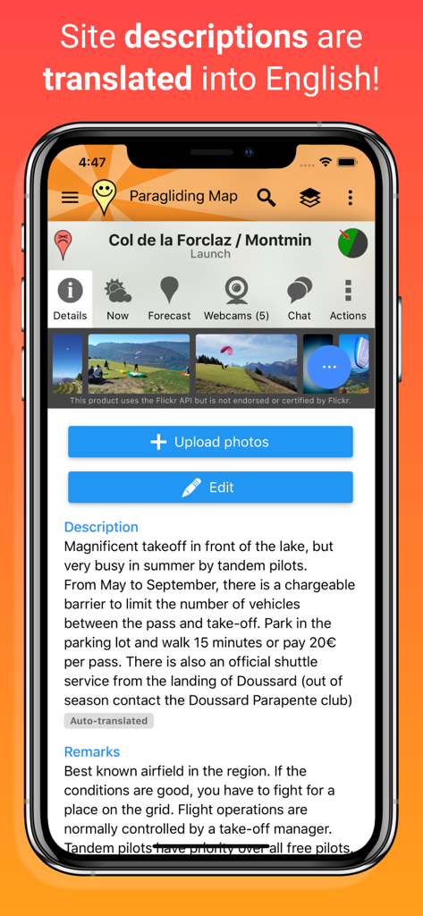
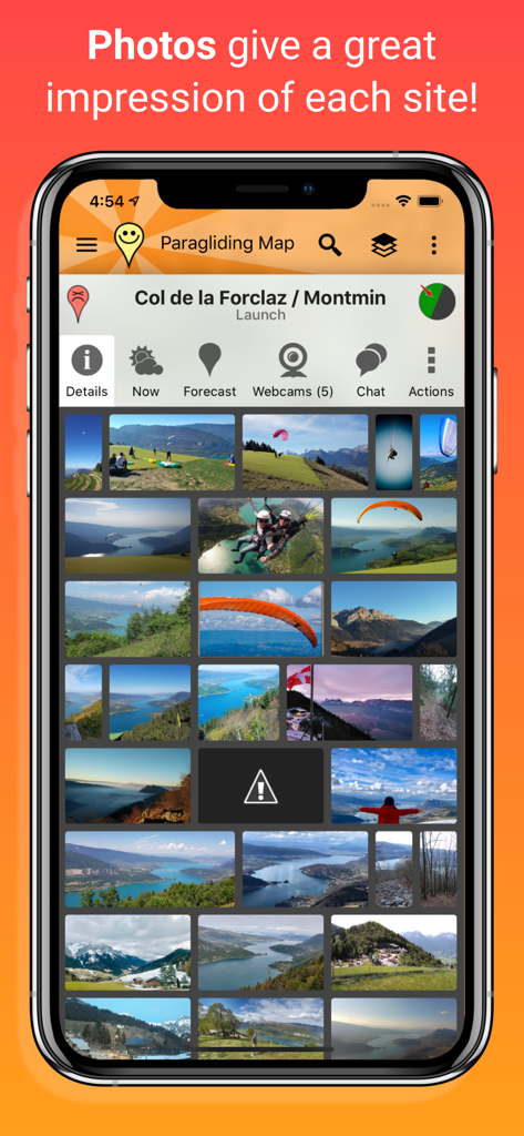
▪ Photos give you a great impression of each spot.
▪ Valley winds - Arrows show valley wind directions in the European Alps.
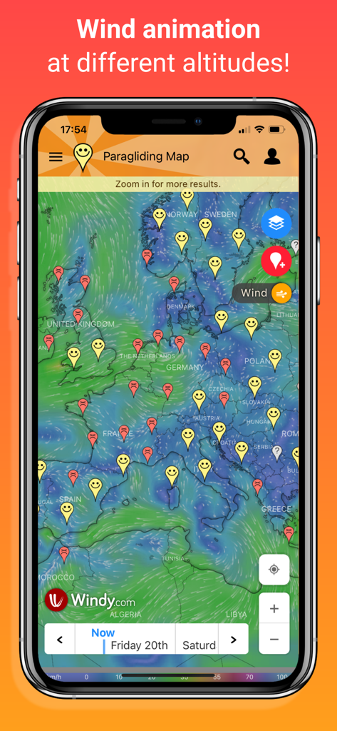
▪ Wind animation - View clouds, thunderstorms, rain and wind at different altitudes.
▪ Airspace - View airspace and NOTAMs (short notice, daily airspace restrictions) on the map.
▪ Official NOTAMs - View Notices to Airmen (NOTAMs) on the map from international aviation authorities. A vital safety feature for every flight!
▪ Automatic NOTAM warnings - A prominent warning is displayed when an active NOTAM impacts your launch or landing.
▪ Filter the map to show only launches for paragliding, hang gliding, speed flying, thermalling, soaring, hike & fly, public transport, wind speed and much more!
▪ See soaring index, cloud cover, weather warnings and much more!
▪ Many forecast providers: UK MetOffice, German Weather Service, Meteo France, meteoblue, ECMWF, NOAA and others!
▪ Real-time weather station data from Pioupiou, Holfuy, MADIS and FFVL show you actual weather conditions.
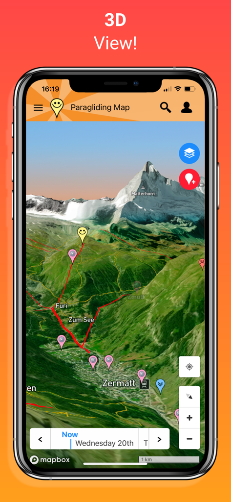
▪ 3D view.
▪ "Hike & fly" trails.
▪ Ski lifts, cable cars and gondolas.
▪ Automatic translation of site descriptions into English.
▪ See future flying conditions on the map by using the Time Travel Slider.
▪ Directions to each spot using navigation.
▪ Favourites can be saved for easy access later.
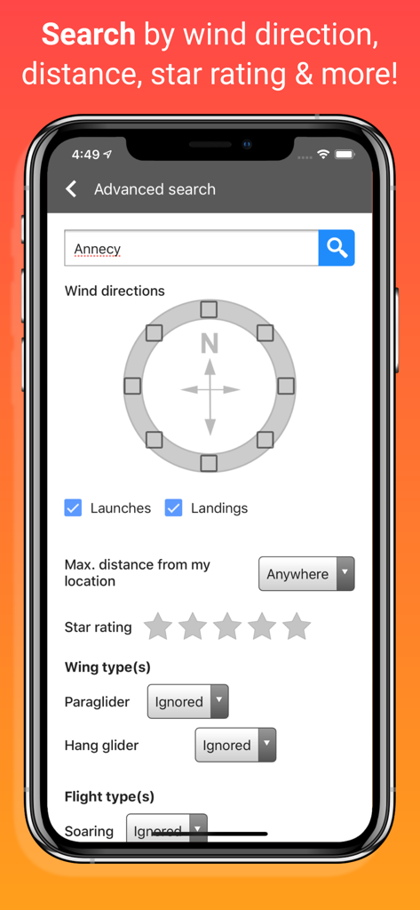
▪ Advanced search.
▪ Send “SOS!” and “I need a ride” messages to friends, including your GPS coordinates.
▪ Links to original info from the DHV, Flyland, FFVL und Paragliding Earth.
▪ No advertising.
▪ Full support included.
Your feedback is always welcome. Help us to make the best paragliding app in the world!
Many feature of Paragliding Map are free but supported by advertising. If you choose to make any in-app purchase, advertising will automatically turn off and your purchase will be enabled (webcams, forecasts, etc).
Information about subscriptions:
Payment will be charged to your iTunes Account at confirmation of purchase. Subscriptions will auto-renew unless turned off at least 24 hours before the end of the current period, and will renew for the same price as the original subscription. You can cancel your subscription after purchasing by clicking the "manage subscriptions" button within the app or by opening Account Settings on your device. No cancellation of the current subscription is allowed during the active subscription period. Any unused portion of the free trial period will be forfeited when purchasing the subscription.
Paragliding Map is a fully supported product. If you have any problems, please let me know and I will help you personally.
Privacy policy and terms and conditions can be found at https://www.paraglidingmap.com/TermsAndConditions.aspx