このページはアプリまたはその開発者の公式ページではなく、情報提供および論評を目的として作成された独立した編集出版物です。明示的に別段の記載がない限り、アプリおよびその開発者は、MWM、Apple、Google Play、アプリのパブリッシャー、またはアプリの開発者と提携、承認、後援、認可、またはその他の公式的な関係はなく、このページのいかなる内容も、アプリがMWMのサービスを使用して開発されたことを意味するものではありません。すべての商標、ロゴ、スクリーンショット、その他のコンテンツはそれぞれの所有者の財産です。

Peakbagger
Peakbagger.comとListsOfJohn.comと登山記録を同期し、オフライン地形図でナビゲートし、データに基づいた精度で公式ピークリストの進捗を追跡しましょう。
ダウンロード
400ユーザー評価
評価数
0開発元
カテゴリ
Health & Fitness対応言語
11最新バージョン
1.63.2サイズ
140.6 MBリリース日
2015年10月17日リストを制覇し、山をマスターしよう
リアルタイムGPS追跡から世界のピークデータベースまで、真剣な登山家やリスト達成者のために構築されたプロフェッショナルツールの数々にアクセスできます。
統合ピークデータベース
Peakbagger.comとListsOfJohnと即座に同期し、公式ピークリストの進捗を管理し、すべての成功した登頂を記録しましょう。
信頼性の高いオフグリッドナビゲーション
ダウンロード可能な地形図、標高プロファイル、オフラインGPS追跡を利用して、遠隔地のバックカントリー向けに設計された、自信を持ってより深く冒険しましょう。
以下のスクリーンショットと説明は、アプリの公式ストアリスティングから直接取得されたものであり、アプリ開発者の所有物です。
アプリストア
スクリーンショット
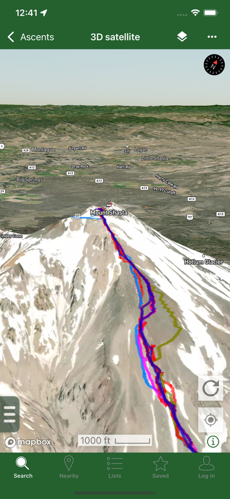
Peakbaggerアプリに表示されたシャスタ山の3D衛星地図ビュー。複数のカラフルなGPSトラックが山頂への登山経路を示している。
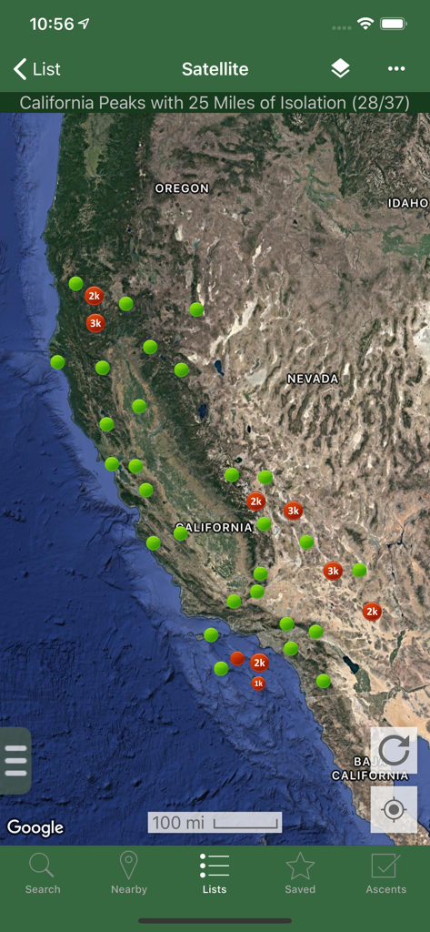
Peakbaggerアプリのカリフォルニアのピークを示す衛星地図。孤立度マーカーが表示されている。
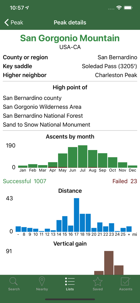
Peakbaggerアプリに表示されたサン・ゴルゴニオ山の詳細な技術データと登頂統計。
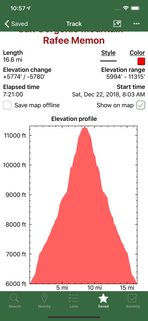
Peakbaggerアプリのスクリーンショット。記録された登山トラックの詳細な標高プロファイルグラフとハイキング統計が表示されている。
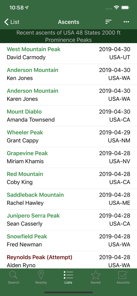
Peakbaggerアプリのスクリーンショット。登山者名と場所を含む、最近の登頂記録の時系列リストが表示されている。
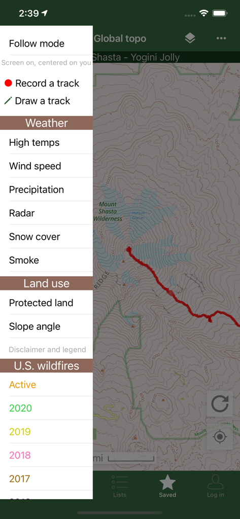
Peakbaggerアプリのインターフェース。地形図と、天気および山火事データオーバーレイ用のサイドバーメニューが表示されている。
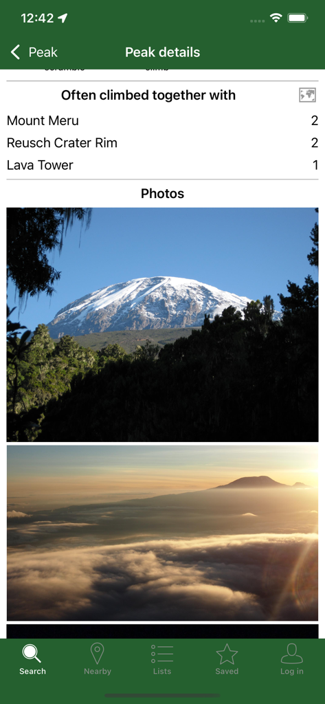
Peakbaggerアプリに、ピークの詳細写真と、よく一緒に登られる山頂のリストが表示されている。
説明
Download
類似アプリ
同じカテゴリのトップランクアプリ

Strava: Run, Bike, Walk
Strava Inc.

Flo Cycle & Period Tracker
FLO HEALTH UK LIMITED

AI Calorie Tracker by Yazio
YAZIO GmbH

Mi Fitness (Xiaomi Wear Lite)
Beijing Xiaomi Co., Ltd

MyFitnessPal: Calorie Counter
MyFitnessPal, Inc.

Cal AI - Calorie Tracker
Viral Development LLC

美柚 - 经期·备孕·怀孕·育儿&亲友版
Xiamen Meet You Co., Ltd.

Yuka - Food & Cosmetic Scanner
Yuca

Period Tracker Period Calendar
ABISHKKING LIMITED.
このページはアプリまたはその開発者の公式ページではなく、情報提供および論評を目的として作成された独立した編集出版物です。明示的に別段の記載がない限り、アプリおよびその開発者は、MWM、Apple、Google Play、アプリのパブリッシャー、またはアプリの開発者と提携、承認、後援、認可、またはその他の公式的な関係はなく、このページのいかなる内容も、アプリがMWMのサービスを使用して開発されたことを意味するものではありません。すべての商標、ロゴ、スクリーンショット、その他のコンテンツはそれぞれの所有者の財産です。