このページはアプリまたはその開発者の公式ページではなく、情報提供および論評を目的として作成された独立した編集出版物です。明示的に別段の記載がない限り、アプリおよびその開発者は、MWM、Apple、Google Play、アプリのパブリッシャー、またはアプリの開発者と提携、承認、後援、認可、またはその他の公式的な関係はなく、このページのいかなる内容も、アプリがMWMのサービスを使用して開発されたことを意味するものではありません。すべての商標、ロゴ、スクリーンショット、その他のコンテンツはそれぞれの所有者の財産です。

Radius on Map + : draw circle
サービスエリア、不動産、フィールドオペレーションに不可欠なツール。UTM/MGRSをサポートする複数の半径を定義し、KMLファイルをエクスポートし、URL経由で結果を共有できます。すべて一度購入するだけで、サブスクリプションは不要です。
ダウンロード
15K+ユーザー評価
評価数
0開発元
カテゴリ
Utilities対応言語
36最新バージョン
2.9サイズ
5.0 MBリリース日
2015年5月31日精密な半径マッピングのためのプログレードツール
基本的な地図以上のものを求めるプロフェッショナルのために設計された高精度のツールキットで、境界を定義し、サービスエリアを計算し、空間データをエクスポートします。
技術的な精度と座標
UTMやMGRSなどのプロフェッショナルな座標フォーマットを使用し、KML/KMZファイルを使用してモバイルデバイスとGoogle Earth間のギャップを埋めます。
即時共有可能なインサイト
ユニークなURLを生成したり、カスタムポリゴンをエクスポートして、クライアントやチームにサービスエリアやプロジェクトの境界がどこにあるかを正確に示します。
以下のスクリーンショットと説明は、アプリの公式ストアリスティングから直接取得されたものであり、アプリ開発者の所有物です。
アプリストア
スクリーンショット
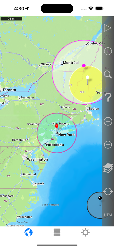
北東米国地図上に複数の円形の距離ゾーンを表示するRadius on Mapアプリのインターフェース。
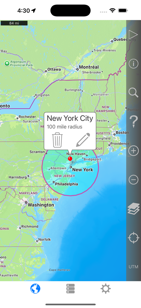
Radius on Mapアプリのインターフェースで、ニューヨーク市を中心に100マイルの円が表示された地図
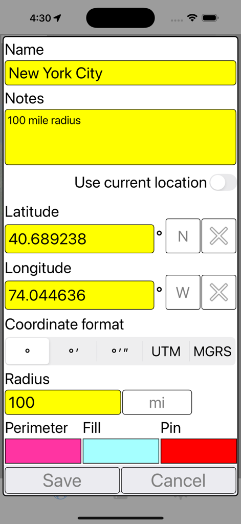
座標を使用してニューヨーク市を中心に100マイルの半径を定義するためのRadius on Mapアプリの設定画面
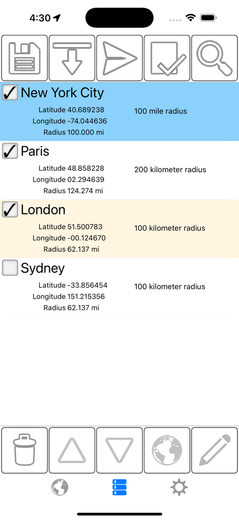
ニューヨークやパリなどの都市の保存された地理的半径のリスト。座標と距離測定が表示されています。
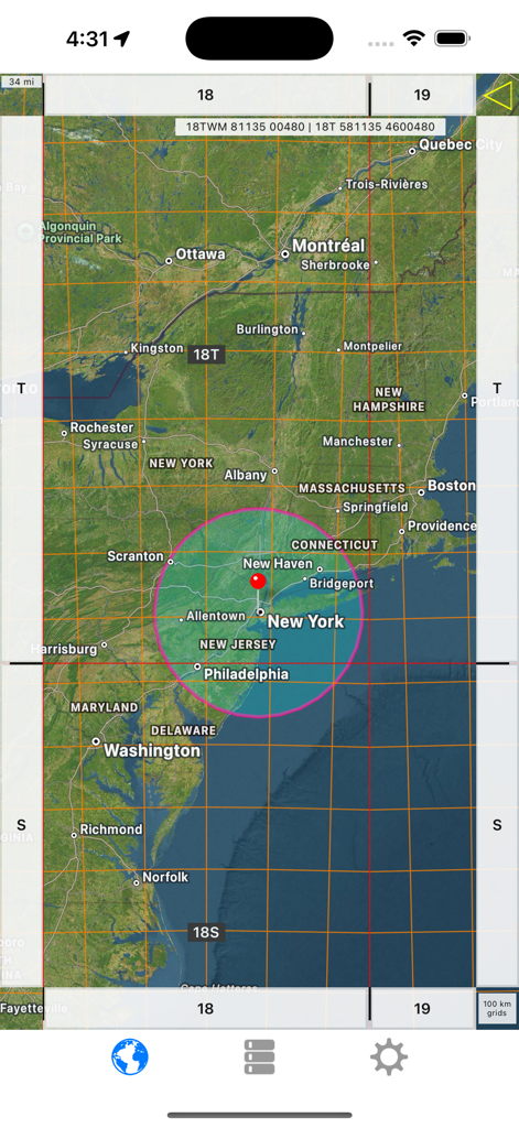
ニューヨーク上にピンクの円と技術的なグリッド線が表示されているRadius on Mapアプリのスクリーンショット
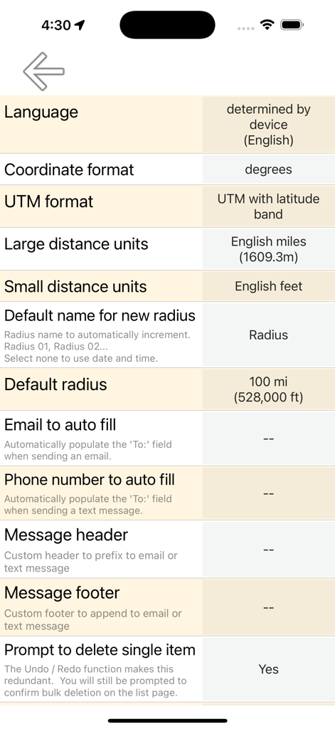
座標フォーマットと距離単位オプションが表示されているRadius on Mapアプリの設定画面
説明
Download
類似アプリ
同じカテゴリのトップランクアプリ

Google LLC

Google Chrome
Google LLC

中国移动(手机营业厅)
China Mobile Online Services Co., Ltd.

Google Authenticator
Google LLC

CNH do Brasil
Servicos e Informacoes do Brasil

Cleanup: Phone Storage Cleaner
DEEP FLOW SOFTWARE SERVICES - FZCO

gov.br
Servicos e Informacoes do Brasil

中国电信-全国统一官方服务平台
CHINA TELECOM Corporation Ltd.

Microsoft Edge: AI Browser
Microsoft Corporation
このページはアプリまたはその開発者の公式ページではなく、情報提供および論評を目的として作成された独立した編集出版物です。明示的に別段の記載がない限り、アプリおよびその開発者は、MWM、Apple、Google Play、アプリのパブリッシャー、またはアプリの開発者と提携、承認、後援、認可、またはその他の公式的な関係はなく、このページのいかなる内容も、アプリがMWMのサービスを使用して開発されたことを意味するものではありません。すべての商標、ロゴ、スクリーンショット、その他のコンテンツはそれぞれの所有者の財産です。