このページはアプリまたはその開発者の公式ページではなく、情報提供および論評を目的として作成された独立した編集出版物です。明示的に別段の記載がない限り、アプリおよびその開発者は、MWM、Apple、Google Play、アプリのパブリッシャー、またはアプリの開発者と提携、承認、後援、認可、またはその他の公式的な関係はなく、このページのいかなる内容も、アプリがMWMのサービスを使用して開発されたことを意味するものではありません。すべての商標、ロゴ、スクリーンショット、その他のコンテンツはそれぞれの所有者の財産です。

ダウンロード
482K+ユーザー評価
評価数
1K+開発元
カテゴリ
Photo & Video対応言語
21最新バージョン
2.9.1サイズ
66.1 MBリリース日
2012年5月11日あらゆる光条件をマスターする
ゴールデンアワーの撮影からソーラーパネルの設置まで、高精度ARとインタラクティブデータを利用して、いつでもどこでも太陽と月の軌道を視覚化できます。
ライブAR投影
カメラを通して太陽と月の軌道を直接視覚化し、完璧なショットやソーラーサイトを正確に配置します。
ビジュアルタイムマシン
時間をスクラブして、将来の任意の日付の影の長さ、ゴールデンアワーのタイミング、天体の位置をプレビューします。
以下のスクリーンショットと説明は、アプリの公式ストアリスティングから直接取得されたものであり、アプリ開発者の所有物です。
アプリストア
スクリーンショット
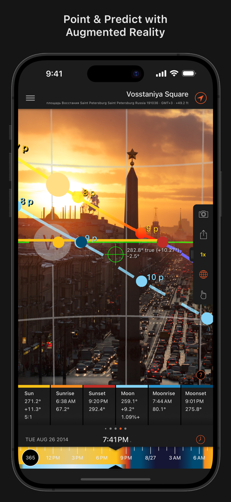
街並みの上に太陽と月の軌道を示す拡張現実ビュー
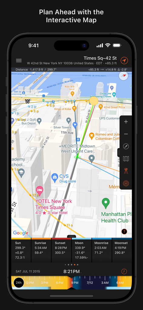
ニューヨークの太陽と月の軌道を示すSun Surveyorアプリのインタラクティブマップ
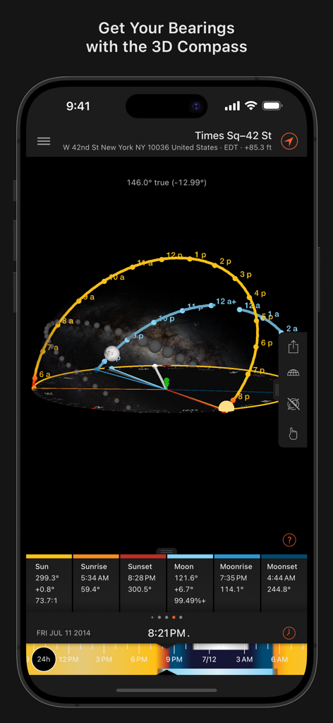
ニューヨーク市の上空の太陽と月の軌道を示すSun Surveyorアプリの3Dコンパスインターフェース
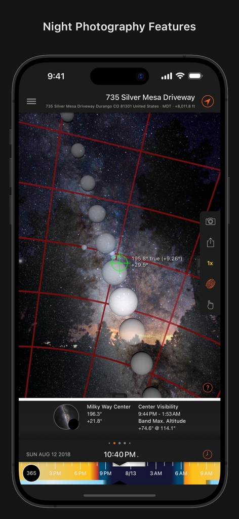
可視性データと天体オーバーレイを使用して天の川のショットを計画するための夜間撮影機能を示すSun Surveyorアプリのスクリーンショット
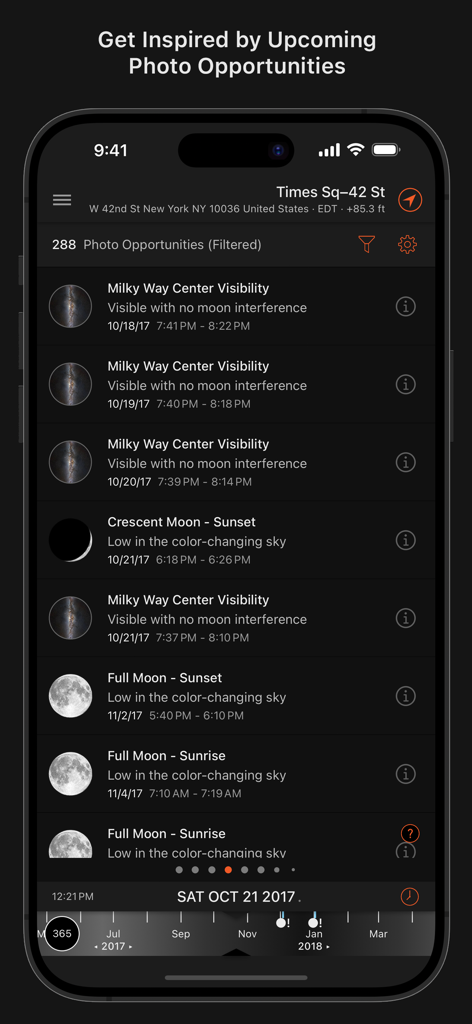
天の川の可視性や月の満ち欠けなどの今後の天体写真の機会をリストするアプリ画面
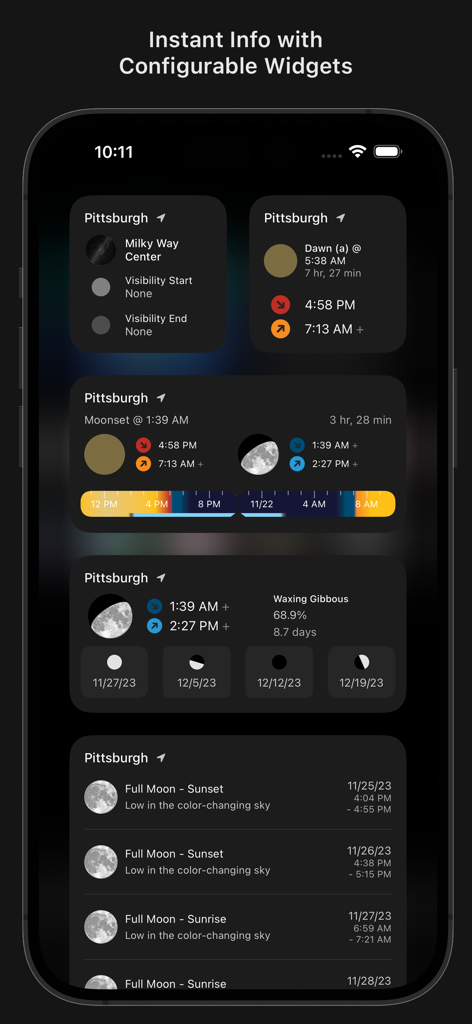
iPhoneで太陽、月、天の川の可視性データを表示するSun Surveyorアプリのウィジェット
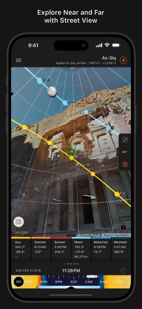
プロの写真撮影計画のために、史跡のストリートビューに太陽と月の軌道オーバーレイを表示するSun Surveyorアプリ
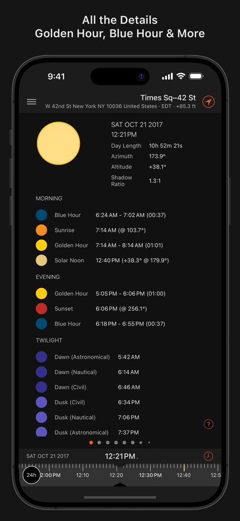
ニューヨーク市の詳細な朝、夕方、夕暮れ時のタイミングを表示するSun Surveyorアプリのインターフェース
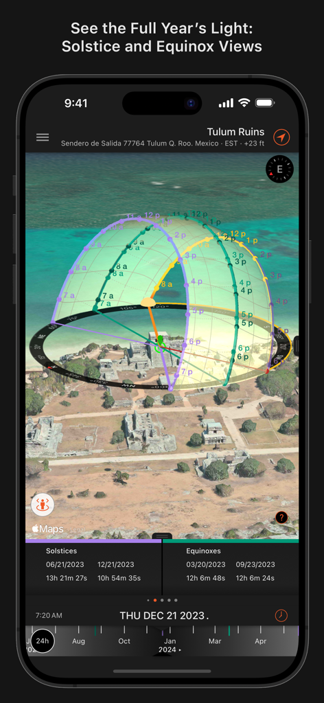
3D航空写真マップに夏至と冬至の太陽軌道投影を表示するSun Surveyorアプリのインターフェース
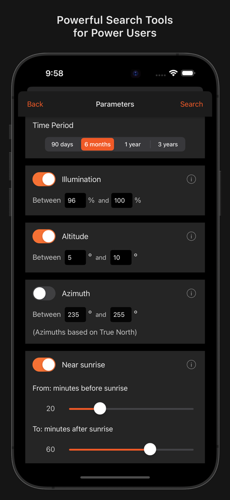
照明、高度、方位角の設定を示すSun Surveyorの高度な検索パラメータインターフェース
説明
Download
類似アプリ
似た機能とユーザー体験を持つアプリ

Moon Phases and Lunar Calendar
Business City s.r.o.

My Moon Phase - Lunar Calendar
JRustonApps B.V.

The Moon: Calendar Moon Phases
Vitalii Gryniuk

Moonlitt: Moon Phase Tracker
Flipping Hues Srls

Sunrise Sunset Times
Fascinating Projects Pty Ltd

PhotoPills
PhotoPills S.L.

AuroraReach
HuskyCodes Oy

Sun Seeker - Sunlight Tracker
Ajnaware Pty Ltd

Sun Tracker AR
Zuzana Eskinasi
このページはアプリまたはその開発者の公式ページではなく、情報提供および論評を目的として作成された独立した編集出版物です。明示的に別段の記載がない限り、アプリおよびその開発者は、MWM、Apple、Google Play、アプリのパブリッシャー、またはアプリの開発者と提携、承認、後援、認可、またはその他の公式的な関係はなく、このページのいかなる内容も、アプリがMWMのサービスを使用して開発されたことを意味するものではありません。すべての商標、ロゴ、スクリーンショット、その他のコンテンツはそれぞれの所有者の財産です。