このページはアプリまたはその開発者の公式ページではなく、情報提供および論評を目的として作成された独立した編集出版物です。明示的に別段の記載がない限り、アプリおよびその開発者は、MWM、Apple、Google Play、アプリのパブリッシャー、またはアプリの開発者と提携、承認、後援、認可、またはその他の公式的な関係はなく、このページのいかなる内容も、アプリがMWMのサービスを使用して開発されたことを意味するものではありません。すべての商標、ロゴ、スクリーンショット、その他のコンテンツはそれぞれの所有者の財産です。

Tactical NAV
現場での過酷な要求に応えるため、現役兵士が戦闘で開発。1mmの精度、MGRS座標、完全なオフラインマッピングで、あらゆる環境で自信を持って運用できます。
ダウンロード
229K+ユーザー評価
評価数
600開発元
カテゴリ
Navigation対応言語
1最新バージョン
5.0.10サイズ
49.3 MBリリース日
2011年2月14日ミッションのために構築され、戦闘で実証された
世界で最も過酷な環境で運用できるように設計された、堅牢で高精度のナビゲーションプラットフォームで、軍人や初動対応者に力を与えます。
戦場の精度
公式のDoDハードウェア(AN/PSN-13 DAGRなど)と同等のパフォーマンスを発揮する、MGRS、UTM、BNG座標システムで1mmの精度を実現します。
完全なオフライン機能
セルラー通信なしで運用できます。マップをダウンロードし、完全な戦術描画サポートにより、完全に切断された、または争われている環境でミッションを計画できます。
以下のスクリーンショットと説明は、アプリの公式ストアリスティングから直接取得されたものであり、アプリ開発者の所有物です。
アプリストア
スクリーンショット
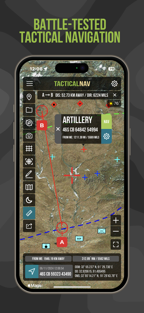
MGRS座標と砲兵ウェイポイントを示す衛星マップを表示するTactical NAVアプリインターフェース
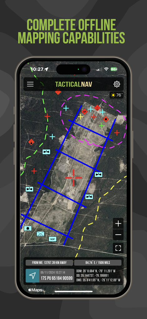
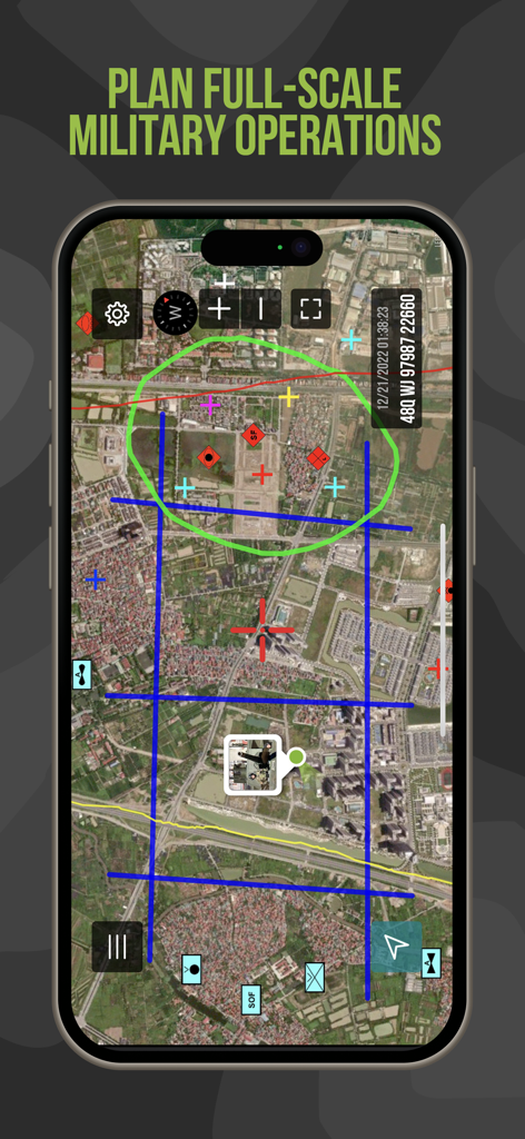
軍事グリッド座標と戦術オーバーレイを表示するオフライン衛星マッピングを表示するTactical NAVアプリインターフェース
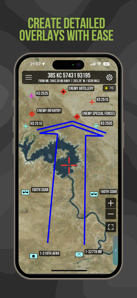
衛星マップ上に詳細な軍事オーバーレイと部隊位置を表示するTactical NAVアプリ
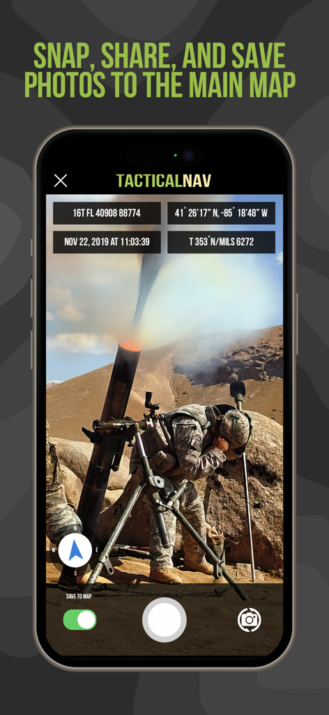
MGRS座標と位置データオーバーレイを備えた軍事作戦の写真を表示するTactical NAVアプリインターフェース
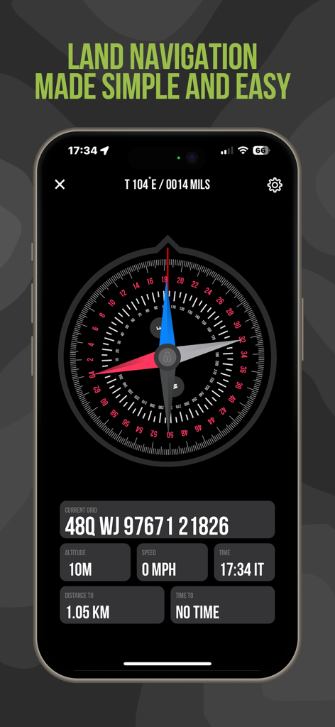
MGRS座標とデジタルコンパスを備えたTactical NAV陸上ナビゲーション画面
ミッション計画ツールと戦術マップオーバーレイを特徴とするTactical NAVアプリインターフェース
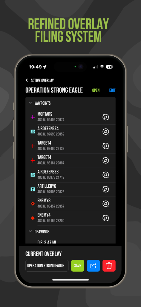
ミッション計画のためのウェイポイント管理とMGRS座標を表示するTactical NAVアプリインターフェース
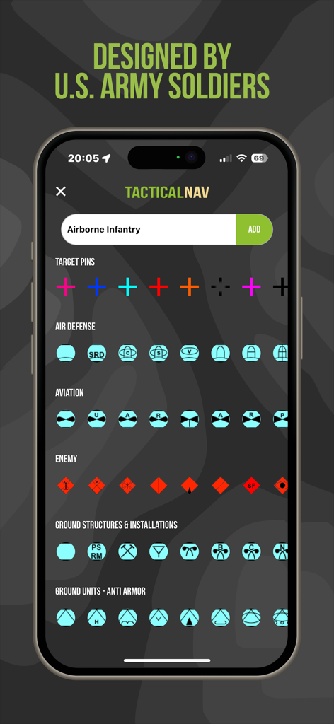
戦術ミッション計画のためのさまざまな軍事シンボルとアイコンを表示するTactical NAVアプリ画面

米陸軍の戦没者と退役軍人慈善団体に捧げられたTactical NAVアプリ画面

退役軍人の作成者からの個人的なメッセージを表示するTactical NAVアプリの「アプリについて」ページ
説明
Download
類似アプリ
似た機能とユーザー体験を持つアプリ

MilGPS
Cascode Labs Pty Ltd

SEAiq Pilot VPP
Sakhalin, LLC

Cartograph Maps 3
Harald Meyer

新知卫星地图-路线规划,高清地图导航
Chongqing Xinzhi Space Technology Co., Ltd.

Coordinates – GPS Converter
Mapnitude Company Limited

Mgrs & Utm Map
Vahid Cataltas

DeepStateMap
Heorhii Karpenko

Map Plus
Miocool Inc.

Compass 55. Map & GPS kit.
Kalimex-Consulting s.r.o.
このページはアプリまたはその開発者の公式ページではなく、情報提供および論評を目的として作成された独立した編集出版物です。明示的に別段の記載がない限り、アプリおよびその開発者は、MWM、Apple、Google Play、アプリのパブリッシャー、またはアプリの開発者と提携、承認、後援、認可、またはその他の公式的な関係はなく、このページのいかなる内容も、アプリがMWMのサービスを使用して開発されたことを意味するものではありません。すべての商標、ロゴ、スクリーンショット、その他のコンテンツはそれぞれの所有者の財産です。