このページはアプリまたはその開発者の公式ページではなく、情報提供および論評を目的として作成された独立した編集出版物です。明示的に別段の記載がない限り、アプリおよびその開発者は、MWM、Apple、Google Play、アプリのパブリッシャー、またはアプリの開発者と提携、承認、後援、認可、またはその他の公式的な関係はなく、このページのいかなる内容も、アプリがMWMのサービスを使用して開発されたことを意味するものではありません。すべての商標、ロゴ、スクリーンショット、その他のコンテンツはそれぞれの所有者の財産です。

The Photographer's Ephemeris
風景写真家やアウトドア写真家向けの業界標準の計画ツール。3Dマップオーバーレイ、ARスカウティング、高度な視線分析を使用して、太陽、月、天の川を視覚化し、常に完璧なショットを撮影します。
ダウンロード
419K+ユーザー評価
評価数
4K+開発元
カテゴリ
Photo & Video対応言語
4最新バージョン
4.15.1サイズ
95.2 MBリリース日
2010年4月17日完璧な光を計画する
地球上のどこでも自然光と天体の配置をマスターするための、精度重視の写真家向けの業界標準ツールキット。
地形認識型計画
山岳地帯でピンポイントの精度で、正確に太陽または月が地元の地形の背後から昇る時間を決定します。
オンロケーションARビジュアライゼーション
拡張現実を使用してリアルタイムで天体の経路を視覚化し、完璧な瞬間の数時間前に構図を確定します。
以下のスクリーンショットと説明は、アプリの公式ストアリスティングから直接取得されたものであり、アプリ開発者の所有物です。
アプリストア
スクリーンショット
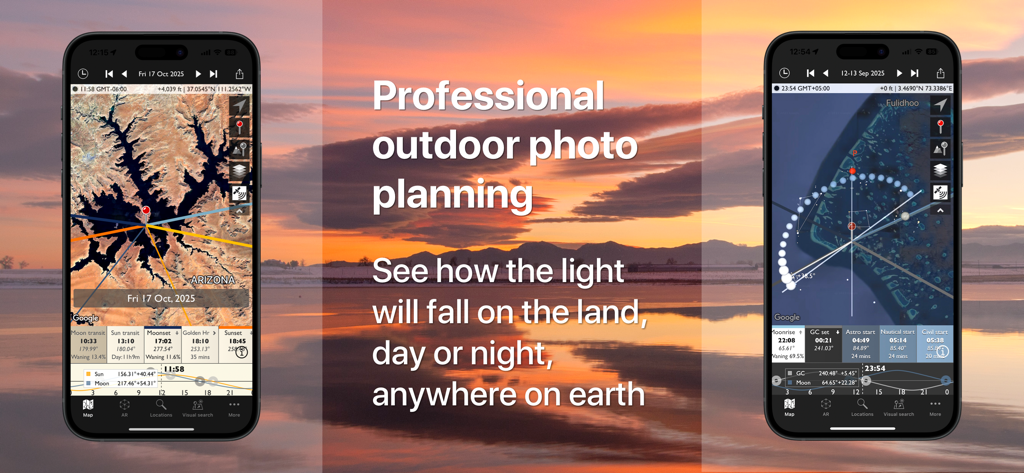
アウトドア写真計画のための地図上の太陽と月の経路を示すPhotographers Ephemerisモバイルアプリのインターフェース
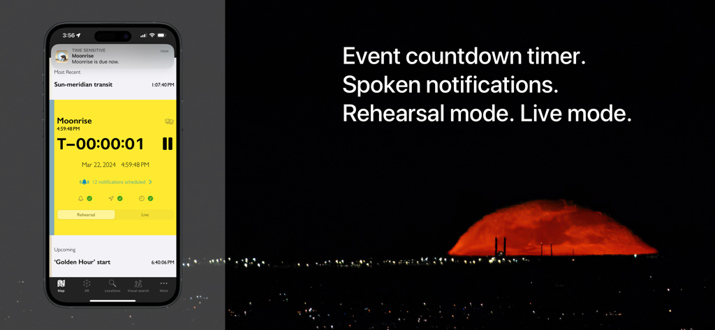
月の出のカウントダウンタイマーとイベント通知設定を示すPhotographer's Ephemerisアプリのインターフェース。
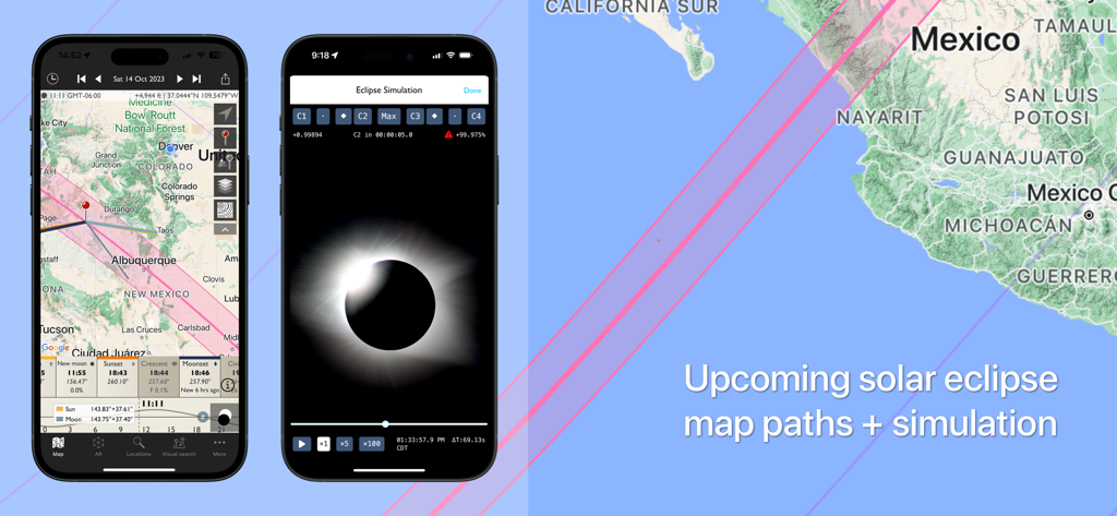
Photographer's Ephemerisモバイルアプリでの日食マップ経路と視覚シミュレーション。
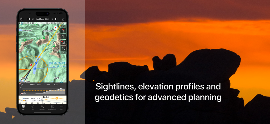
日没時の写真計画のための視線と標高プロファイルを示すPhotographers Ephemerisアプリのインターフェース
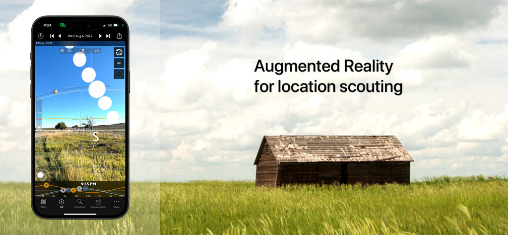
場所の偵察のためにPhotographer's Ephemerisアプリの拡張現実機能を表示するスマートフォン。木造小屋のある野原の上。
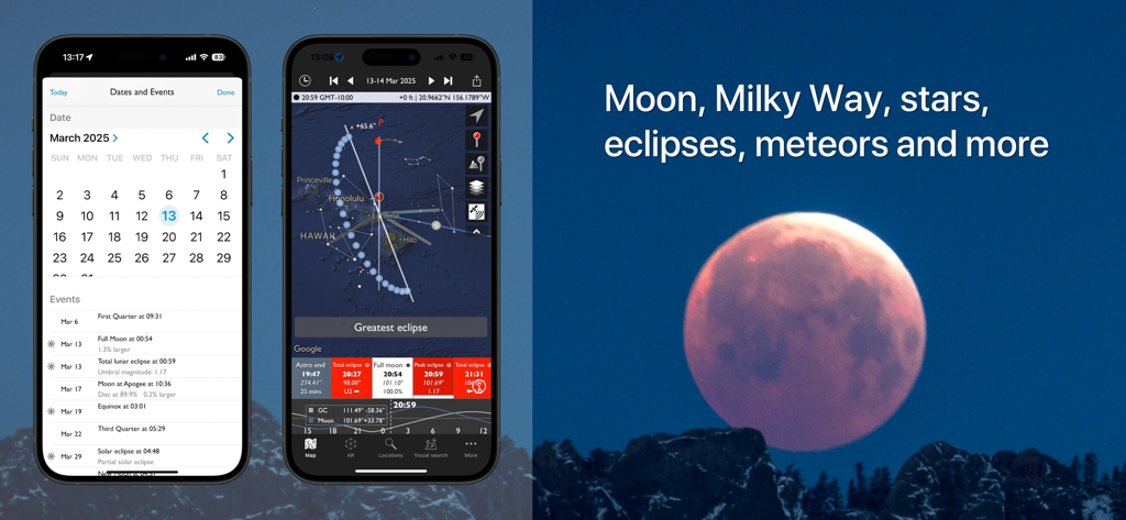
星団イベントカレンダーと月食マッピング機能を示すPhotographers Ephemerisアプリのスクリーンショット。
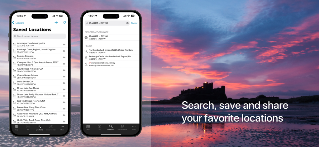
日没の風景の上に保存された場所と検索機能を表示するPhotographer's Ephemerisアプリのモバイル画面
説明
Download
類似アプリ
似た機能とユーザー体験を持つアプリ

Moon Phases and Lunar Calendar
Business City s.r.o.

My Moon Phase - Lunar Calendar
JRustonApps B.V.

The Moon: Calendar Moon Phases
Vitalii Gryniuk

Moonlitt: Moon Phase Tracker
Flipping Hues Srls

Sunrise Sunset Times
Fascinating Projects Pty Ltd

PhotoPills
PhotoPills S.L.

AuroraReach
HuskyCodes Oy

Sun Seeker - Sunlight Tracker
Ajnaware Pty Ltd

Sun Tracker AR
Zuzana Eskinasi
このページはアプリまたはその開発者の公式ページではなく、情報提供および論評を目的として作成された独立した編集出版物です。明示的に別段の記載がない限り、アプリおよびその開発者は、MWM、Apple、Google Play、アプリのパブリッシャー、またはアプリの開発者と提携、承認、後援、認可、またはその他の公式的な関係はなく、このページのいかなる内容も、アプリがMWMのサービスを使用して開発されたことを意味するものではありません。すべての商標、ロゴ、スクリーンショット、その他のコンテンツはそれぞれの所有者の財産です。