このページはアプリまたはその開発者の公式ページではなく、情報提供および論評を目的として作成された独立した編集出版物です。明示的に別段の記載がない限り、アプリおよびその開発者は、MWM、Apple、Google Play、アプリのパブリッシャー、またはアプリの開発者と提携、承認、後援、認可、またはその他の公式的な関係はなく、このページのいかなる内容も、アプリがMWMのサービスを使用して開発されたことを意味するものではありません。すべての商標、ロゴ、スクリーンショット、その他のコンテンツはそれぞれの所有者の財産です。

ダウンロード
175K+ユーザー評価
評価数
100開発元
カテゴリ
Education対応言語
11最新バージョン
9.5.5サイズ
123.4 MBリリース日
2016年7月15日世界の地理とグローバルデータをマスター
正確なグローバルインサイトを求める好奇心旺盛な人々、学生、旅行者のために設計された総合的なデジタル年鑑。
深い統計的インサイト
260以上の国と地域の人間開発指数(HDI)、人口増加率、経済統計などの包括的なデータにアクセス。
インタラクティブなトリビアチャレンジ
学生や生涯学習者向けに設計されたゲーム形式のクイズを通じて、国旗、首都、国境をマスターしましょう。
以下のスクリーンショットと説明は、アプリの公式ストアリスティングから直接取得されたものであり、アプリ開発者の所有物です。
アプリストア
スクリーンショット
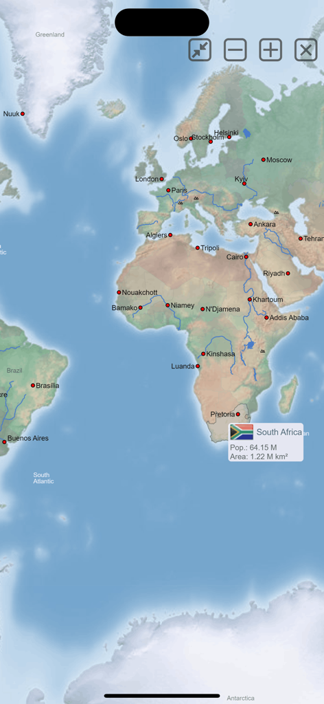
南アフリカの統計を表示するMxGeo世界地図帳アプリの地図インターフェース
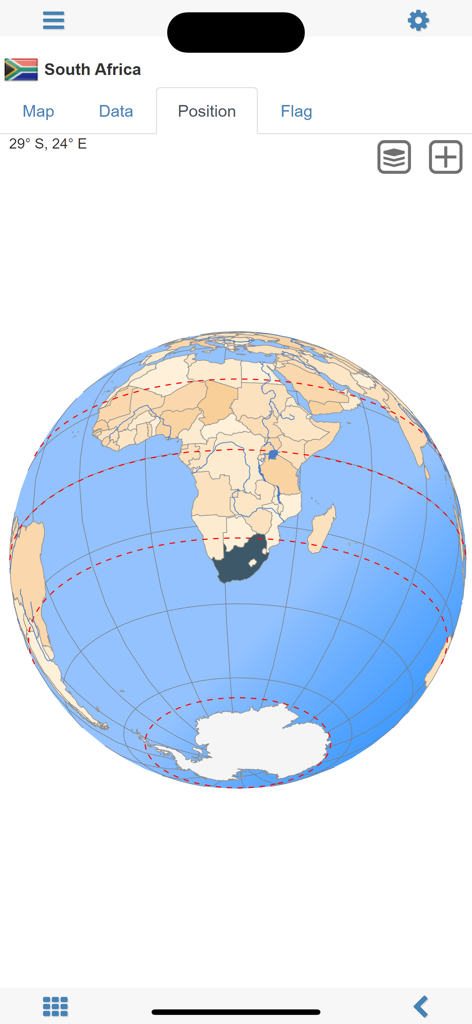
3D地球儀上で南アフリカの位置を表示する世界地図帳MxGeoアプリのスクリーンショット
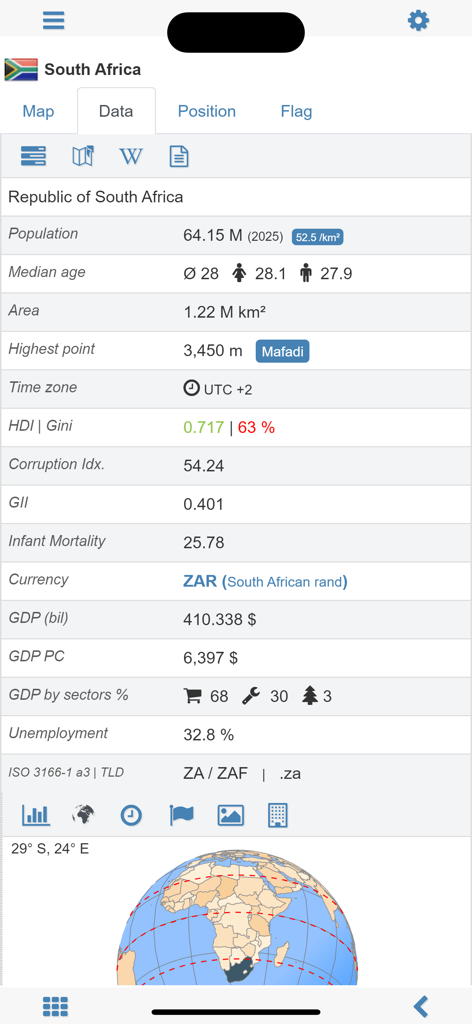
MxGeoアプリにおける南アフリカの詳細な人口統計および経済統計
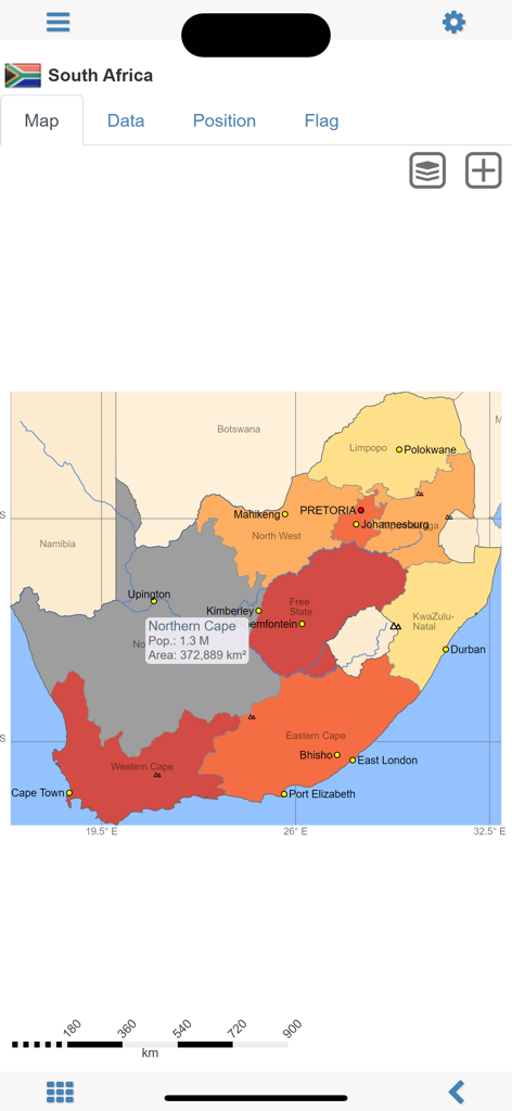
世界地図帳MxGeoアプリにおける、地域の人口と面積データを表示する南アフリカの詳細な政治地図。
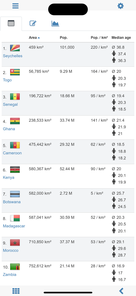
アフリカ諸国の面積、人口、年齢中央値などの統計データを表示する、世界地図帳MxGeoアプリの比較表。
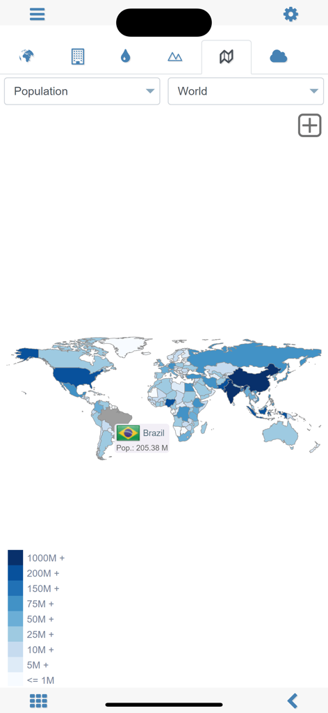
MxGeoアプリでブラジルが選択された状態の、人口統計を表示する世界地図
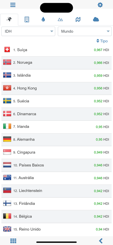
世界地図帳アプリにおける人間開発指数(HDI)の上位国のランキング
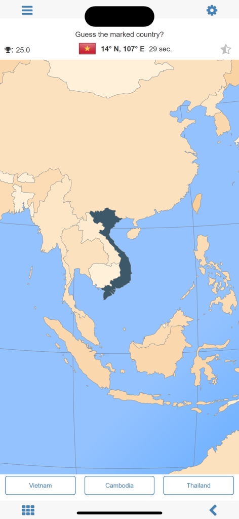
ベトナムがハイライトされた東南アジアの地図を表示するMxGeo地理クイズ画面。
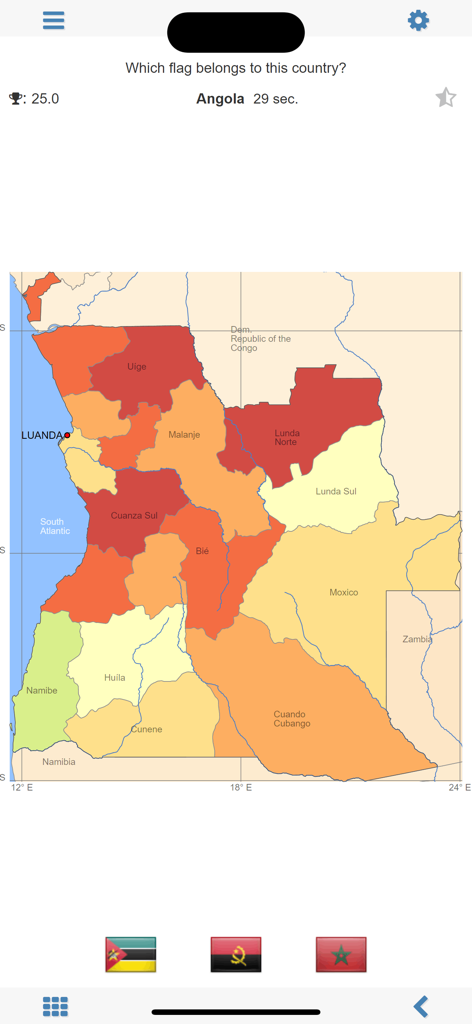
州を表示する地図とともにアンゴラの国旗を特定するよう求めるMxGeoアプリの地理クイズ画面
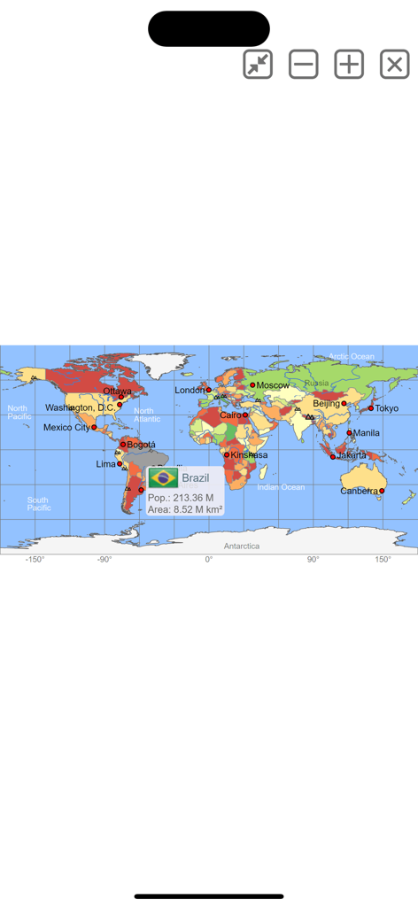
ブラジルの人口と面積データを表示するインタラクティブな世界地図
説明
Download
類似アプリ
同じカテゴリのトップランクアプリ

Duolingo - Language Lessons
Duolingo, Inc

Speak & Learn English: Learna
DEEP FLOW SOFTWARE SERVICES - FZCO

驾考宝典-科一科四驾驶证考试驾考通
Wuhan Jiakaobaodian Information Service Co., Ltd.

Toca Boca World
Toca Boca AB

Google Classroom
Google LLC

作业帮-中小学家长作业检查和辅导工具
Guangzhou Polar Future Culture Technology Co., Ltd

学信网
Student Information Consultation Service Co., Ltd.

Gauth: AI Study Companion
GAUTHTECH PTE. LTD.

ArtWorkout: Learn How to Draw
Aleksandr Ulitin
このページはアプリまたはその開発者の公式ページではなく、情報提供および論評を目的として作成された独立した編集出版物です。明示的に別段の記載がない限り、アプリおよびその開発者は、MWM、Apple、Google Play、アプリのパブリッシャー、またはアプリの開発者と提携、承認、後援、認可、またはその他の公式的な関係はなく、このページのいかなる内容も、アプリがMWMのサービスを使用して開発されたことを意味するものではありません。すべての商標、ロゴ、スクリーンショット、その他のコンテンツはそれぞれの所有者の財産です。