이 페이지는 앱이나 개발자의 공식 페이지가 아니며, 정보 제공 및 논평을 목적으로 작성된 독립 편집 간행물입니다. 명시적으로 달리 언급되지 않는 한, 해당 앱이나 개발자는 MWM, Apple, Google Play, 앱 퍼블리셔 또는 앱 개발자와 제휴, 보증, 후원, 승인 또는 공식적으로 연결되어 있지 않으며, 이 페이지의 어떤 내용도 해당 앱이 MWM의 서비스를 사용하여 개발되었음을 의미하지 않습니다. 모든 상표, 로고, 스크린샷 및 기타 콘텐츠는 해당 소유자의 자산입니다.

3D Mappa - GIS & Topo Analysis
iPhone 또는 iPad를 강력한 지리공간 워크스테이션으로 전환하세요. 등고선, 경사 및 흐름 패턴을 실시간으로 시각화하고 현장에서 바로 AutoCAD 및 GIS 소프트웨어로 정밀 데이터를 내보냅니다.
다운로드
7K+사용자 평점
총 평가 수
0개발사
카테고리
Navigation지원 언어
1최신 버전
1.5.0크기
232.3 MB출시일
2024년 4월 11일현장 준비 GIS 분석
사무실을 기다리지 마세요. iPhone 또는 iPad에서 직접 지형을 분석하고, 흐름 패턴을 시뮬레이션하고, 전문가 수준의 데이터를 내보냅니다.
현장 데스크톱 성능
경사, 방위, 흐름 분석을 현장에서 직접 수행하여 비용이 많이 드는 재방문을 줄이고 현장 효율성을 높입니다.
원활한 CAD 통합
DXF, SHP 및 CSV와 같은 업계 표준 형식으로 결과를 내보내 현장 데이터를 AutoCAD 또는 ArcGIS 프로젝트로 바로 이동하세요.
다음 스크린샷과 설명은 앱의 공식 스토어 목록에서 직접 가져온 것이며 앱 개발자의 자산입니다.
앱 스토어
스크린샷
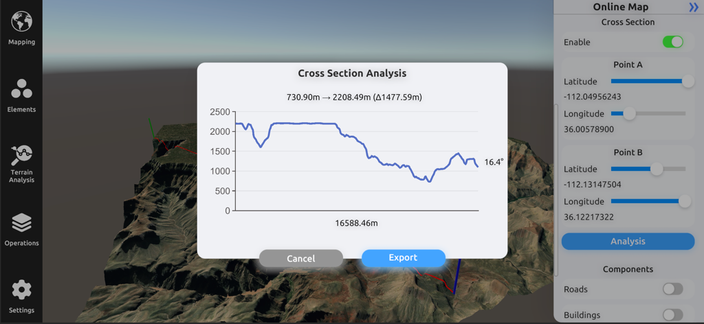
3D 지형 모델 위에 고도 프로필이 있는 단면 분석 그래프를 보여주는 3D Mappa 인터페이스
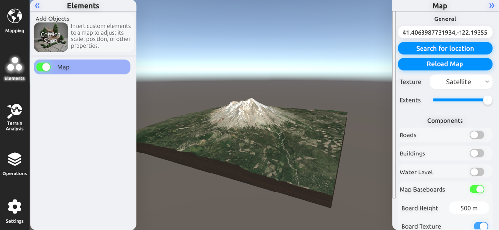
3D Mappa GIS 앱에서 위성 이미지와 맵 구성 설정이 있는 산의 3D 지형 모델.
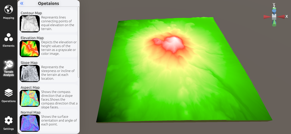
3D Mappa 앱의 3D 고도 모델 및 지형 분석 사이드바
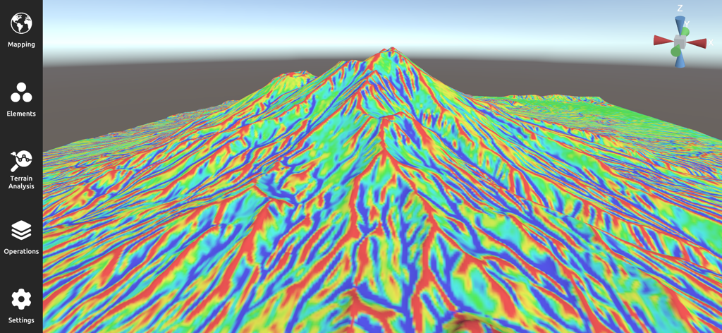
3D Mappa 앱의 산악 풍경에 여러 색상의 경사 맵을 보여주는 3D 지형 시각화
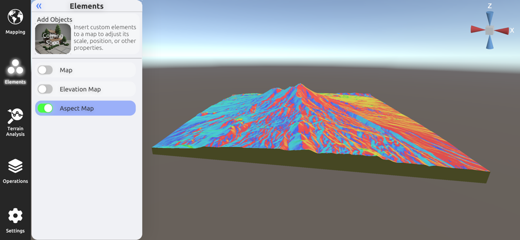
지형 분석을 위한 상세한 다채로운 3D 방위 맵을 표시하는 3D Mappa 모바일 인터페이스.
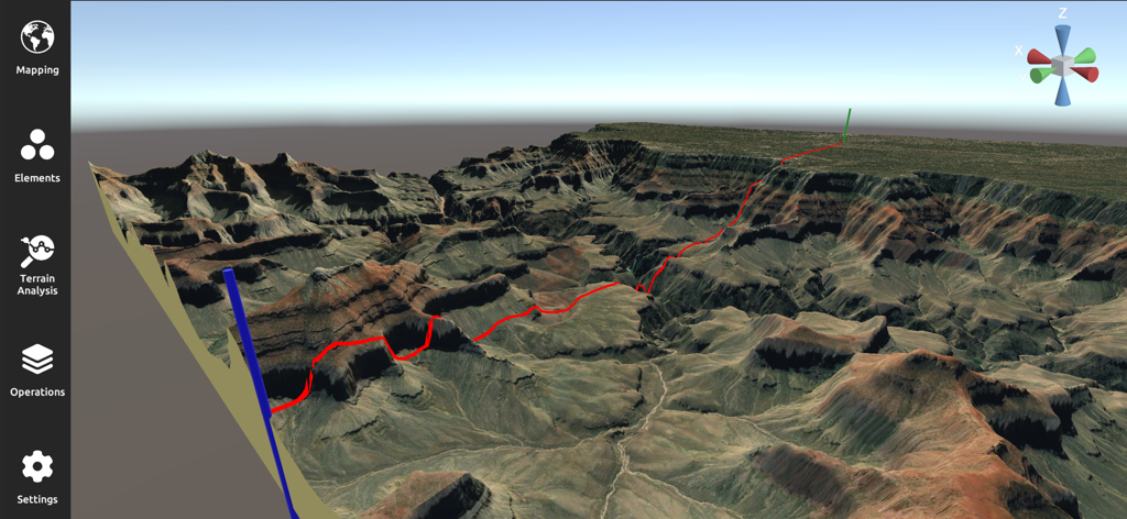
붉은색 경로가 있는 험준한 협곡 풍경을 보여주는 전문적인 3D 지형 분석 및 매핑 인터페이스
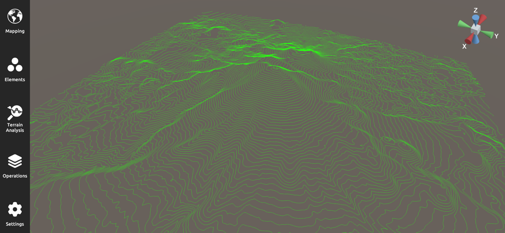
GIS 지형 분석을 위한 녹색 등고선이 있는 3D 지형도
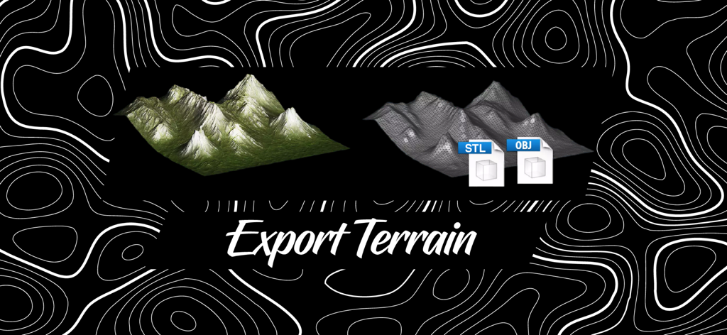
3D Mappa를 사용하여 STL 및 OBJ 형식으로 3D 지형 모델 내보내기.
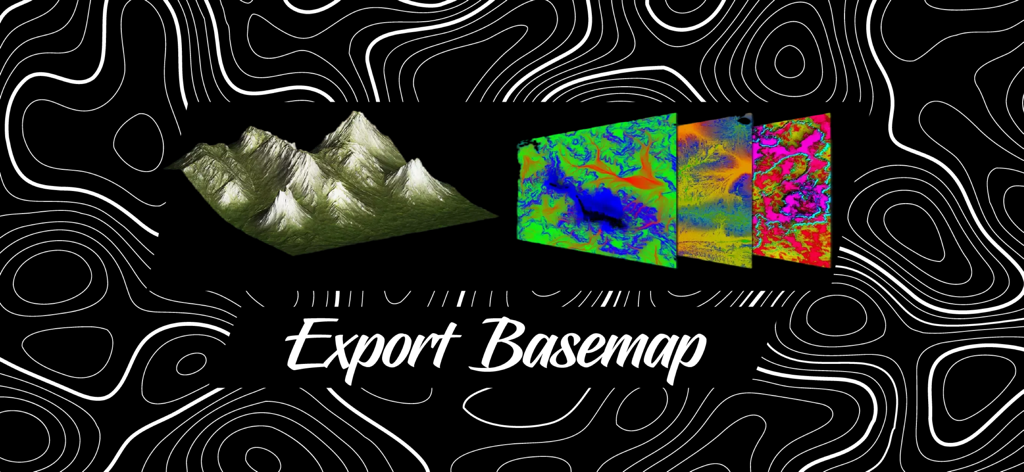
내보내기 기본 맵이라는 텍스트가 있는 3D 지형 모델 및 색상 지형 기본 맵 레이어
설명
Download
비슷한 앱
같은 카테고리의 상위 앱

Google Maps
Google LLC

Waze Navigation & Live Traffic
waze

AMap Global
AutoNavi Information Technology Co. Ltd.

百度地图-路线规划,出行必备
Beijing Baidu Netcom Science & Technology Co.,Ltd

Moovit: Bus & Transit Tracker
Moovit App Global LTD

Transit • Subway & Bus Times
9280-0366 Quebec inc.

ParkMobile: Park. Pay. Go.
Parkmobile USA, Inc

腾讯地图-路线规划,导航地铁打车出行
Shenzhen Tencent Computer Systems Company Limited

Île-de-France Mobilités
Ile de France Mobilites
이 페이지는 앱이나 개발자의 공식 페이지가 아니며, 정보 제공 및 논평을 목적으로 작성된 독립 편집 간행물입니다. 명시적으로 달리 언급되지 않는 한, 해당 앱이나 개발자는 MWM, Apple, Google Play, 앱 퍼블리셔 또는 앱 개발자와 제휴, 보증, 후원, 승인 또는 공식적으로 연결되어 있지 않으며, 이 페이지의 어떤 내용도 해당 앱이 MWM의 서비스를 사용하여 개발되었음을 의미하지 않습니다. 모든 상표, 로고, 스크린샷 및 기타 콘텐츠는 해당 소유자의 자산입니다.