이 페이지는 앱이나 개발자의 공식 페이지가 아니며, 정보 제공 및 논평을 목적으로 작성된 독립 편집 간행물입니다. 명시적으로 달리 언급되지 않는 한, 해당 앱이나 개발자는 MWM, Apple, Google Play, 앱 퍼블리셔 또는 앱 개발자와 제휴, 보증, 후원, 승인 또는 공식적으로 연결되어 있지 않으며, 이 페이지의 어떤 내용도 해당 앱이 MWM의 서비스를 사용하여 개발되었음을 의미하지 않습니다. 모든 상표, 로고, 스크린샷 및 기타 콘텐츠는 해당 소유자의 자산입니다.

aSmart HUD 3D +SpeedCams
전면 유리를 미래 지향적인 3D 대시보드로 변환하세요. 실시간 과속 카메라 경고, 고급 주행 기록, 통합 음악 제어 기능을 모두 현대 운전자를 위해 설계된 전문 HUD 하나로 경험하세요.
다운로드
155K+사용자 평점
총 평가 수
600개발사
카테고리
Navigation지원 언어
1최신 버전
8.1크기
8.4 MB출시일
2009년 9월 24일전문 3D 대시보드로 주행 경험을 혁신하세요
현대 운전자를 위해 설계된 실시간 HUD 프로젝션, 고급 과속 카메라 경고, 포괄적인 주행 데이터로 프리미엄 조종석 인터페이스를 경험하세요.
미래 지향적인 HUD 프로젝션
안전한 야간 주행과 눈을 떼지 않고도 하이테크 조종석 경험을 위해 대시보드를 전면 유리에 직접 투사하세요.
스마트 과속 카메라 방어
수정 가능한 글로벌 속도 위반 및 신호 위반 카메라 데이터베이스와 사전 예방적인 다단계 속도 제한 경고를 결합하여 비싼 벌금을 피하세요.
다음 스크린샷과 설명은 앱의 공식 스토어 목록에서 직접 가져온 것이며 앱 개발자의 자산입니다.
앱 스토어
스크린샷
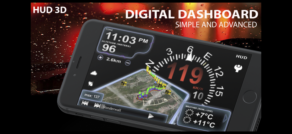
aSmart HUD 3D 디지털 대시보드 앱 인터페이스, 속도 및 내비게이션 표시
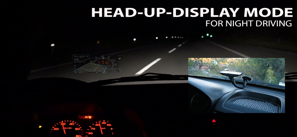
aSmart HUD 3D 앱 인터페이스가 야간 주행 중 헤드업 디스플레이 모드로 자동차 전면 유리에 반사되는 모습
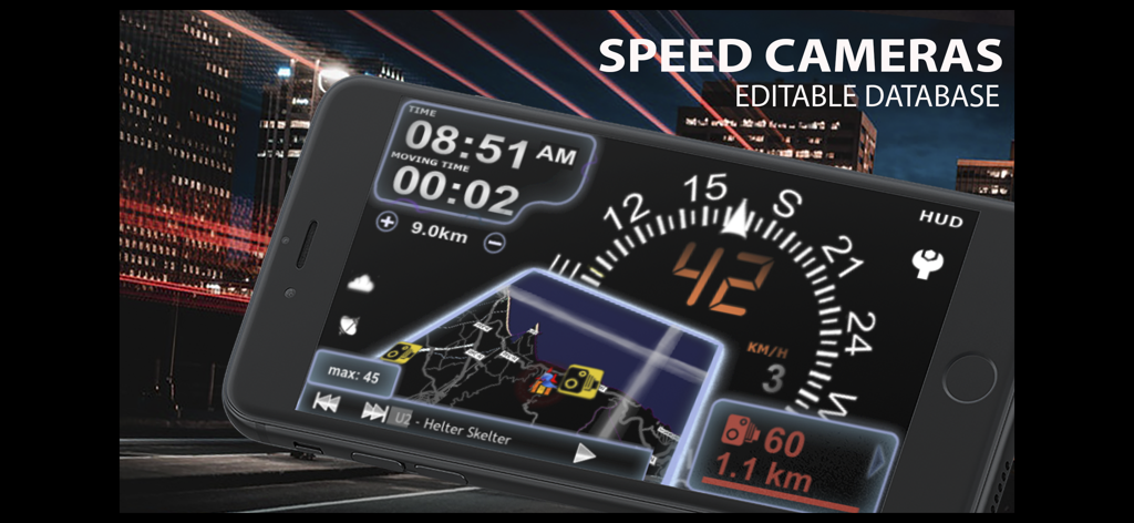
aSmart HUD 3D 앱, 과속 카메라 경고 및 내비게이션 인터페이스가 있는 디지털 자동차 대시보드 표시
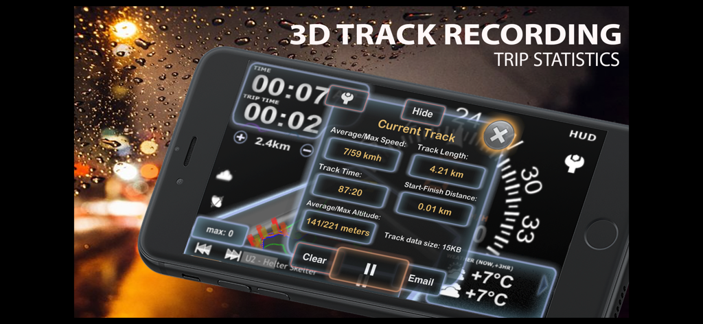
aSmart HUD 3D 앱에서 3D 트랙 기록 및 상세 주행 통계를 보여주는 인터페이스
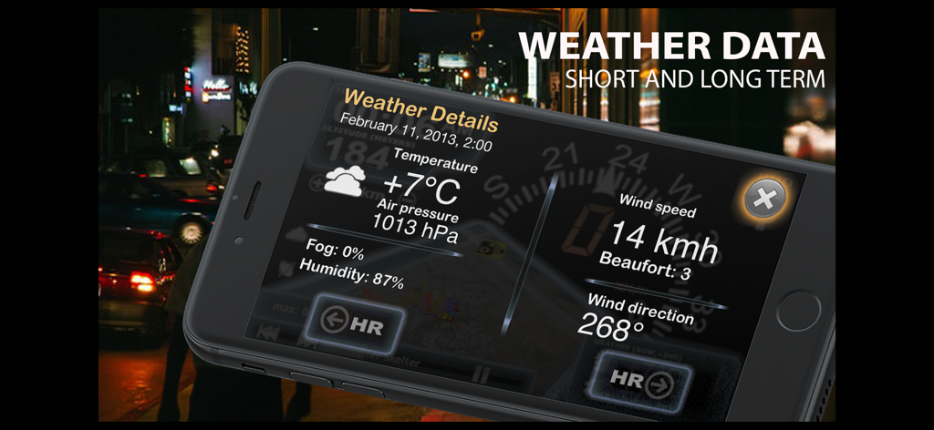
aSmart HUD 3D 앱에서 온도, 압력, 풍속을 포함한 날씨 세부 정보를 표시하는 스마트폰
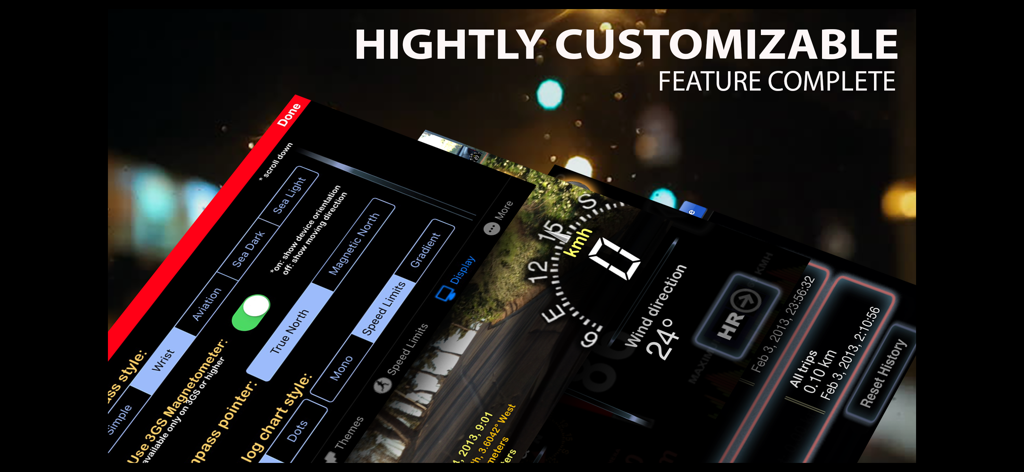
aSmart HUD 3D 앱 화면 몽타주, 사용자 지정 가능한 대시보드 설정 및 실시간 주행 데이터 표시
설명
Download
비슷한 앱
같은 카테고리의 상위 앱

Google Maps
Google LLC

Waze Navigation & Live Traffic
waze

AMap Global
AutoNavi Information Technology Co. Ltd.

百度地图-路线规划,出行必备
Beijing Baidu Netcom Science & Technology Co.,Ltd

Moovit: Bus & Transit Tracker
Moovit App Global LTD

Transit • Subway & Bus Times
9280-0366 Quebec inc.

ParkMobile: Park. Pay. Go.
Parkmobile USA, Inc

腾讯地图-路线规划,导航地铁打车出行
Shenzhen Tencent Computer Systems Company Limited

Île-de-France Mobilités
Ile de France Mobilites
이 페이지는 앱이나 개발자의 공식 페이지가 아니며, 정보 제공 및 논평을 목적으로 작성된 독립 편집 간행물입니다. 명시적으로 달리 언급되지 않는 한, 해당 앱이나 개발자는 MWM, Apple, Google Play, 앱 퍼블리셔 또는 앱 개발자와 제휴, 보증, 후원, 승인 또는 공식적으로 연결되어 있지 않으며, 이 페이지의 어떤 내용도 해당 앱이 MWM의 서비스를 사용하여 개발되었음을 의미하지 않습니다. 모든 상표, 로고, 스크린샷 및 기타 콘텐츠는 해당 소유자의 자산입니다.