이 페이지는 앱이나 개발자의 공식 페이지가 아니며, 정보 제공 및 논평을 목적으로 작성된 독립 편집 간행물입니다. 명시적으로 달리 언급되지 않는 한, 해당 앱이나 개발자는 MWM, Apple, Google Play, 앱 퍼블리셔 또는 앱 개발자와 제휴, 보증, 후원, 승인 또는 공식적으로 연결되어 있지 않으며, 이 페이지의 어떤 내용도 해당 앱이 MWM의 서비스를 사용하여 개발되었음을 의미하지 않습니다. 모든 상표, 로고, 스크린샷 및 기타 콘텐츠는 해당 소유자의 자산입니다.

Bristol Maps
계절별 저조위 위성 이미지로 변화하는 모래톱을 항해하고, 비용이 많이 드는 경계 위반 벌금을 피하고, 통합된 디지털 로그와 사설 그룹 조정을 통해 ROI를 극대화하세요.
다운로드
300사용자 평점
총 평가 수
0개발사
카테고리
Navigation지원 언어
-최신 버전
3.13.1크기
413.0 MB출시일
2023년 5월 7일다음 스크린샷과 설명은 앱의 공식 스토어 목록에서 직접 가져온 것이며 앱 개발자의 자산입니다.
앱 스토어
스크린샷
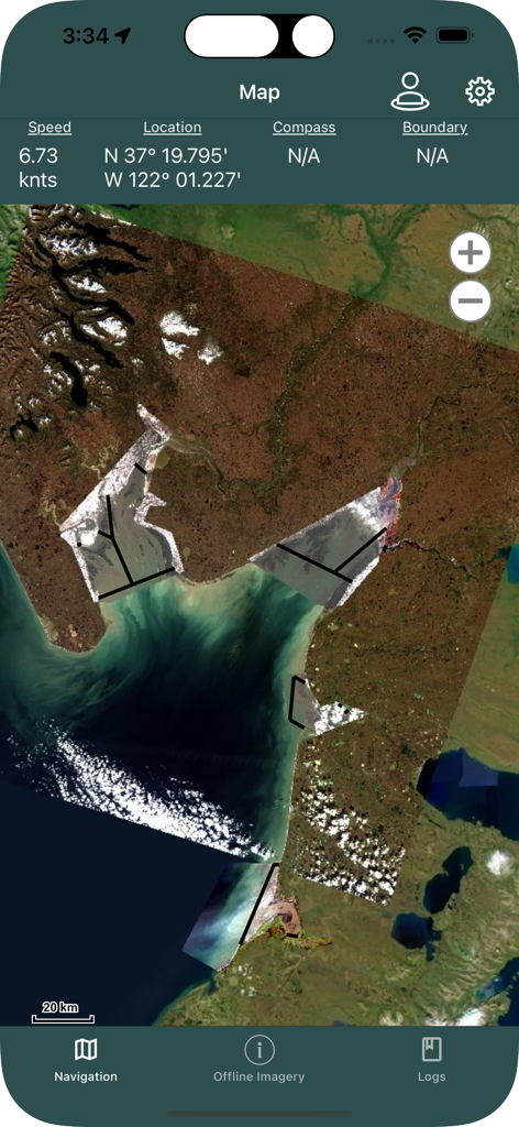
브리스톨 지도 앱 내비게이션 인터페이스, 어업 구역의 고해상도 위성 이미지 및 실시간 선박 좌표 표시
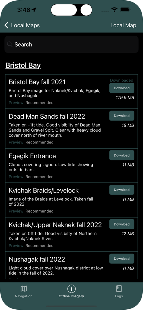
브리스톨 지도 앱, 알래스카 어업 구역용 다운로드 가능한 위성 이미지 목록 표시
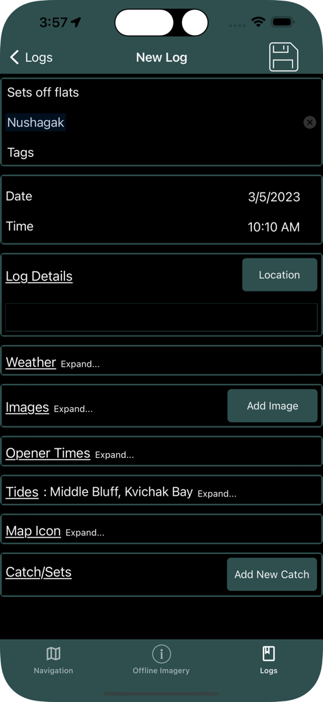
브리스톨 지도 앱 인터페이스, 위치, 조석, 어획량 세부 정보 기록을 위한 새 로그 항목 화면 표시
설명
Download
비슷한 앱
같은 카테고리의 상위 앱

Google Maps
Google LLC

AMap Global
AutoNavi Information Technology Co. Ltd.

Waze Navigation & Live Traffic
waze

百度地图-路线规划,出行必备
Beijing Baidu Netcom Science & Technology Co.,Ltd

Moovit: Bus & Transit Tracker
Moovit App Global LTD

Transit • Subway & Bus Times
9280-0366 Quebec inc.

ParkMobile: Park. Pay. Go.
Parkmobile USA, Inc

腾讯地图-路线规划,导航地铁打车出行
Shenzhen Tencent Computer Systems Company Limited

MapXplorer: Map Radar Navigate
GOLDLAB APPLICATIONS YAZILIM VE BILISIM ANONIM SIRKETI
이 페이지는 앱이나 개발자의 공식 페이지가 아니며, 정보 제공 및 논평을 목적으로 작성된 독립 편집 간행물입니다. 명시적으로 달리 언급되지 않는 한, 해당 앱이나 개발자는 MWM, Apple, Google Play, 앱 퍼블리셔 또는 앱 개발자와 제휴, 보증, 후원, 승인 또는 공식적으로 연결되어 있지 않으며, 이 페이지의 어떤 내용도 해당 앱이 MWM의 서비스를 사용하여 개발되었음을 의미하지 않습니다. 모든 상표, 로고, 스크린샷 및 기타 콘텐츠는 해당 소유자의 자산입니다.