이 페이지는 앱이나 개발자의 공식 페이지가 아니며, 정보 제공 및 논평을 목적으로 작성된 독립 편집 간행물입니다. 명시적으로 달리 언급되지 않는 한, 해당 앱이나 개발자는 MWM, Apple, Google Play, 앱 퍼블리셔 또는 앱 개발자와 제휴, 보증, 후원, 승인 또는 공식적으로 연결되어 있지 않으며, 이 페이지의 어떤 내용도 해당 앱이 MWM의 서비스를 사용하여 개발되었음을 의미하지 않습니다. 모든 상표, 로고, 스크린샷 및 기타 콘텐츠는 해당 소유자의 자산입니다.

Bruce Trail App
공식 오프라인 지도와 실시간 업데이트를 사용하여 나이아가라 절벽을 자신 있게 탐색하세요. 경로를 계획하고, 진행 상황을 추적하고, 여정의 모든 단계에서 트레일 보존을 지원하세요.
다운로드
13K+사용자 평점
총 평가 수
200개발사
카테고리
Lifestyle지원 언어
1최신 버전
2.5크기
28.5 MB출시일
2021년 11월 1일모든 마일을 자신 있게 탐색하세요
실시간 업데이트와 전문가 도구가 포함된 캐나다에서 가장 상징적인 도보 경로의 공식 가이드로, 여정의 모든 단계를 위해 설계되었습니다.
공식 오프라인 지도
휴대폰 서비스 없이도 전문가가 큐레이션한 42개의 지도를 이용하세요. 완벽한 마음의 평화를 위해 보존 협회로부터 직접 실시간 경로 업데이트를 받으세요.
정밀한 여행 계획
주차 공간, 캠핑장, 트레일헤드를 손쉽게 찾으세요. 경로 측정 도구를 사용하여 일일 마일리지와 물류를 쉽게 계획하세요.
다음 스크린샷과 설명은 앱의 공식 스토어 목록에서 직접 가져온 것이며 앱 개발자의 자산입니다.
앱 스토어
스크린샷
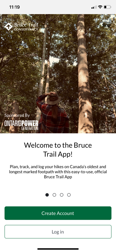
브루스 트레일 앱의 환영 화면. 키 큰 나무가 있는 숲속의 하이커 모습이 보입니다.
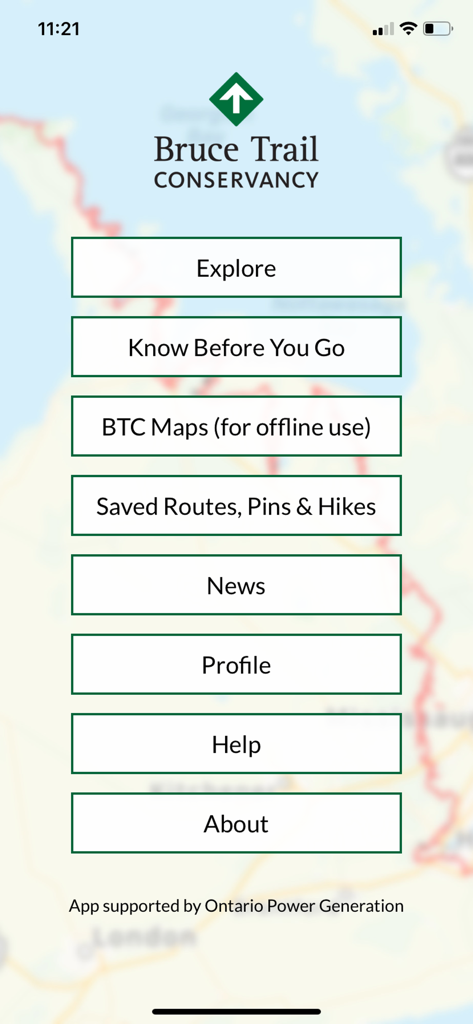
브루스 트레일 앱의 메인 메뉴. 탐색, BTC 지도, 저장된 경로, 뉴스 옵션이 트레일 지도 배경 위에 보입니다.
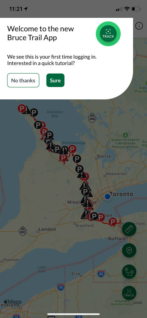
브루스 트레일 앱의 지도 보기 위에 표시되는 환영 튜토리얼 팝업.
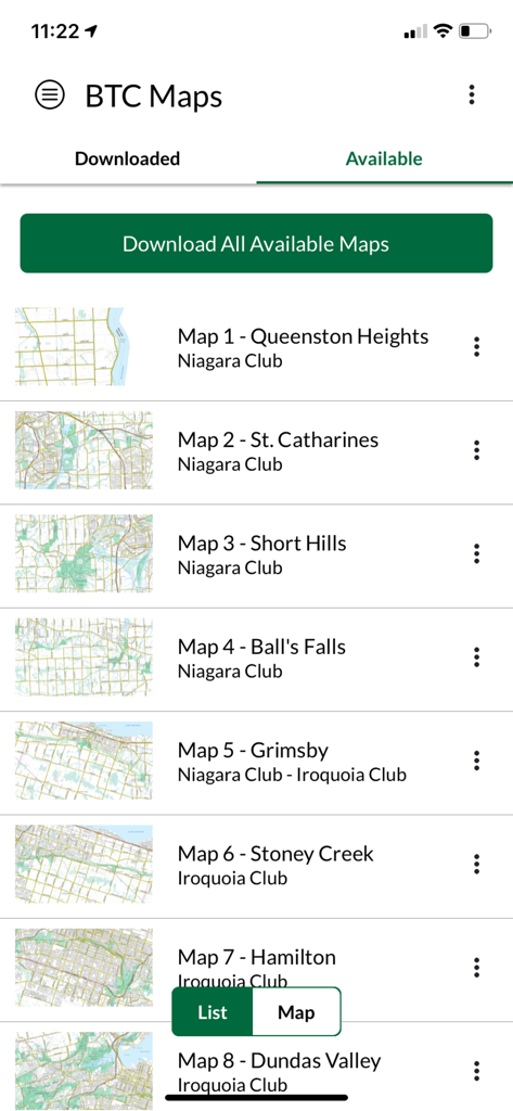
브루스 트레일 앱에서 다운로드 가능한 지도 목록
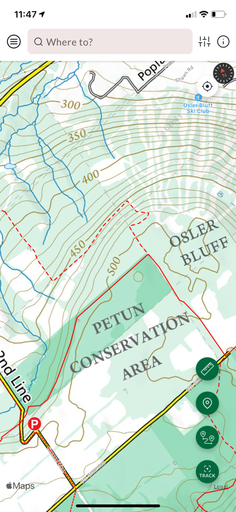
브루스 트레일 앱 인터페이스의 페툰 보존 지역 지형도
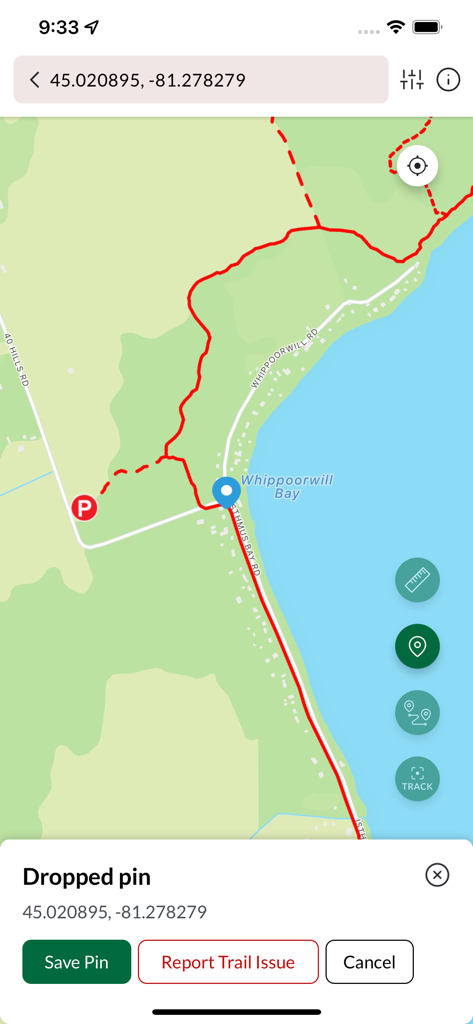
브루스 트레일 앱 지도 인터페이스. Whippoorwill Bay 근처 하이킹 경로에 핀이 표시됩니다.
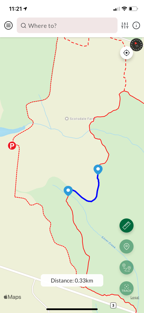
브루스 트레일 앱의 지도 인터페이스. 0.33km 거리 측정값과 함께 계획된 하이킹 경로가 표시됩니다.
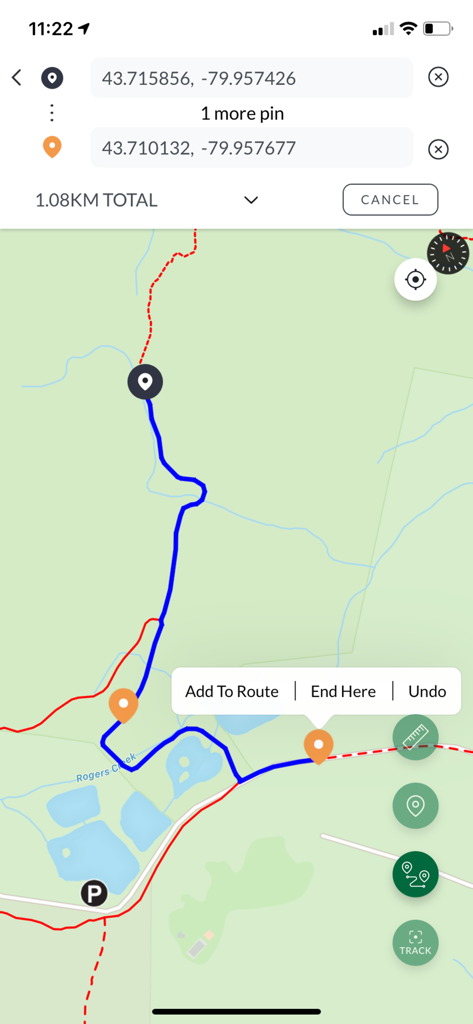
GPS 좌표와 사용자 정의 핀이 있는 1.08km 하이킹 경로를 보여주는 모바일 지도 보기
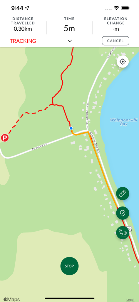
브루스 트레일 앱 추적 화면. 빨간색 트레일 선과 거리 통계가 표시된 지도가 보입니다.
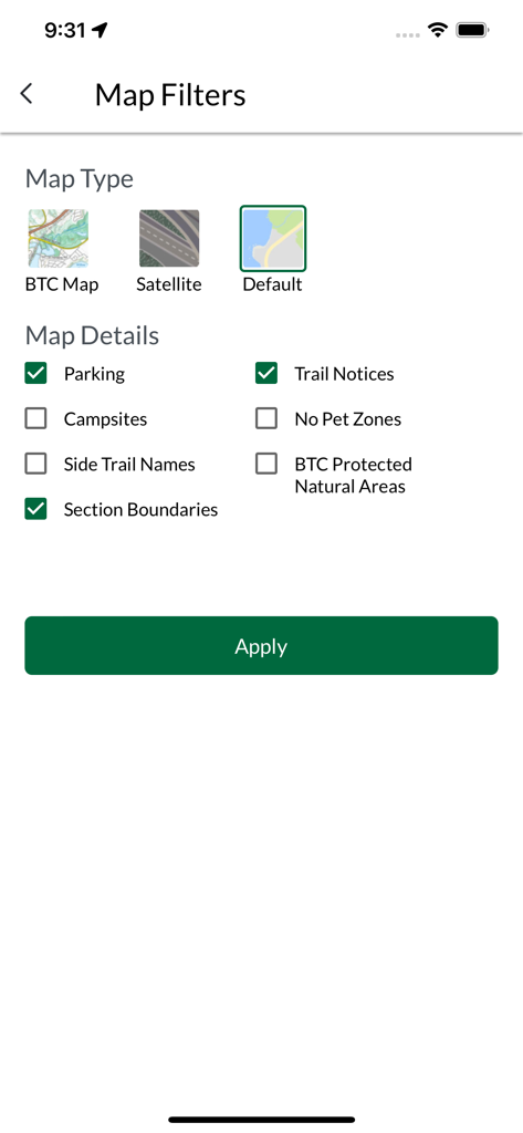
브루스 트레일 앱의 지도 필터 화면. 지도 유형 및 주차 및 공지 사항과 같은 트레일 세부 정보 옵션이 표시됩니다.
설명
Download


이 페이지는 앱이나 개발자의 공식 페이지가 아니며, 정보 제공 및 논평을 목적으로 작성된 독립 편집 간행물입니다. 명시적으로 달리 언급되지 않는 한, 해당 앱이나 개발자는 MWM, Apple, Google Play, 앱 퍼블리셔 또는 앱 개발자와 제휴, 보증, 후원, 승인 또는 공식적으로 연결되어 있지 않으며, 이 페이지의 어떤 내용도 해당 앱이 MWM의 서비스를 사용하여 개발되었음을 의미하지 않습니다. 모든 상표, 로고, 스크린샷 및 기타 콘텐츠는 해당 소유자의 자산입니다.