이 페이지는 앱이나 개발자의 공식 페이지가 아니며, 정보 제공 및 논평을 목적으로 작성된 독립 편집 간행물입니다. 명시적으로 달리 언급되지 않는 한, 해당 앱이나 개발자는 MWM, Apple, Google Play, 앱 퍼블리셔 또는 앱 개발자와 제휴, 보증, 후원, 승인 또는 공식적으로 연결되어 있지 않으며, 이 페이지의 어떤 내용도 해당 앱이 MWM의 서비스를 사용하여 개발되었음을 의미하지 않습니다. 모든 상표, 로고, 스크린샷 및 기타 콘텐츠는 해당 소유자의 자산입니다.

TrailSmart: Great Trails
상세한 오프라인 지도, 고도 프로필 및 엄선된 숙박 시설 가이드를 사용하여 정밀하게 계획하고 자신감 있게 탐색하세요. 인터넷이 필요 없으며 광고도 없습니다. 오직 당신과 여정만이 있습니다.
다운로드
1K+사용자 평점
총 평가 수
0개발사
카테고리
Travel지원 언어
4최신 버전
3.70크기
82.4 MB출시일
2017년 3월 10일다음 위대한 모험을 탐색하세요
TrailSmart는 세계에서 가장 상징적인 장거리 트레킹을 위한 최고의 디지털 동반자로서, 세심한 여행객을 위한 전문가가 선별한 통찰력과 완전한 오프라인 독립성을 제공합니다.
완벽한 오프라인 독립성
외딴 지역의 통신 불능 지역에서도 자신 있게 탐색하세요. 모든 지도, 가이드 및 트레일 데이터에 100% 오프라인으로 액세스하여 로밍 요금을 피하고 신호 없이 안전하게 머무르세요.
지능형 경로 안내
노란색 화살표를 따라가세요. 스마트 나침반은 현재 위치와 선택한 경로에 따라 동적으로 업데이트되며, 실시간 고도 프로필은 하루의 페이스를 완벽하게 조절하는 데 도움이 됩니다.
다음 스크린샷과 설명은 앱의 공식 스토어 목록에서 직접 가져온 것이며 앱 개발자의 자산입니다.
앱 스토어
스크린샷
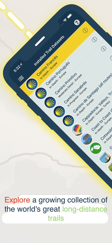
TrailSmart 앱 화면에 카미노 데 산티아고를 포함한 설치된 장거리 트레일 데이터 세트 목록이 표시됩니다.
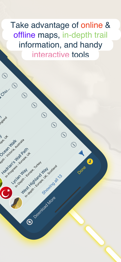
TrailSmart의 모바일 앱 인터페이스에 전 세계 하이킹 트레일 목록과 오프라인 지도 기능이 표시됩니다.
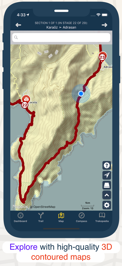
스마트폰 화면에 TrailSmart 앱이 3D 등고선 하이킹 지도와 트레일 경로가 표시됩니다.
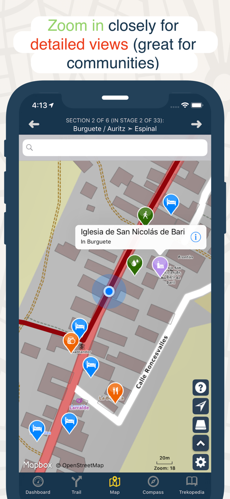
TrailSmart 앱의 확대된 지도 보기에 하이킹 트레일을 따라 숙박 시설, 식당 및 랜드마크 아이콘이 표시됩니다.
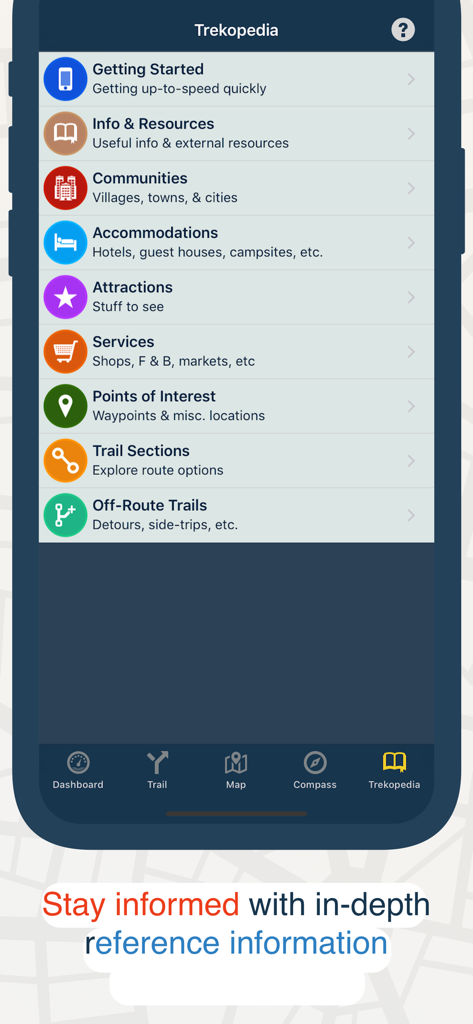
TrailSmart 앱 Trekopedia 화면에 숙박 시설 및 관심 지점을 포함한 하이킹 트레일에 대한 참조 카테고리가 표시됩니다.
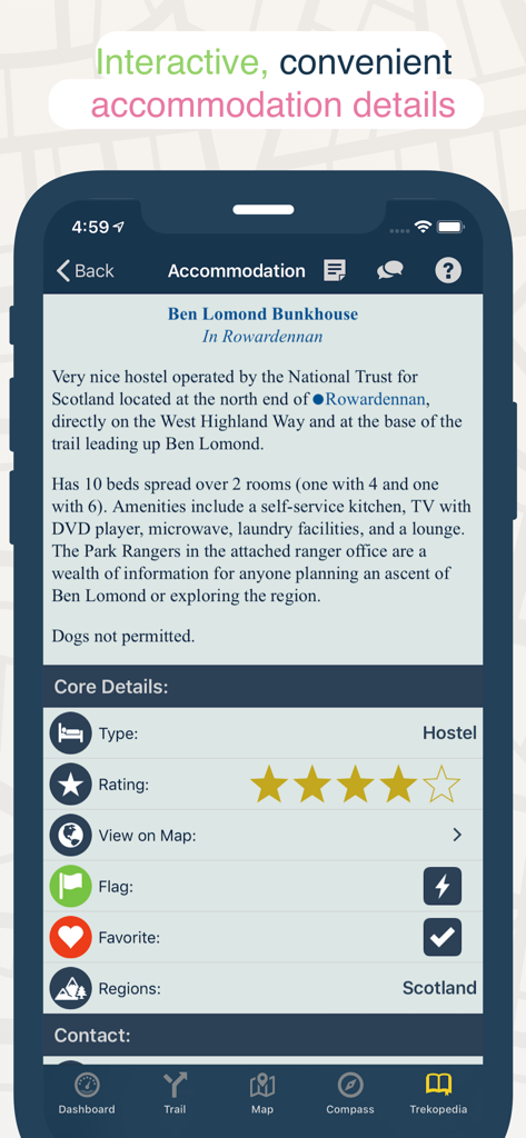
스마트폰 화면에 평점 및 편의 시설을 포함하여 장거리 하이킹 트레일의 호스텔에 대한 상세 정보가 표시됩니다.
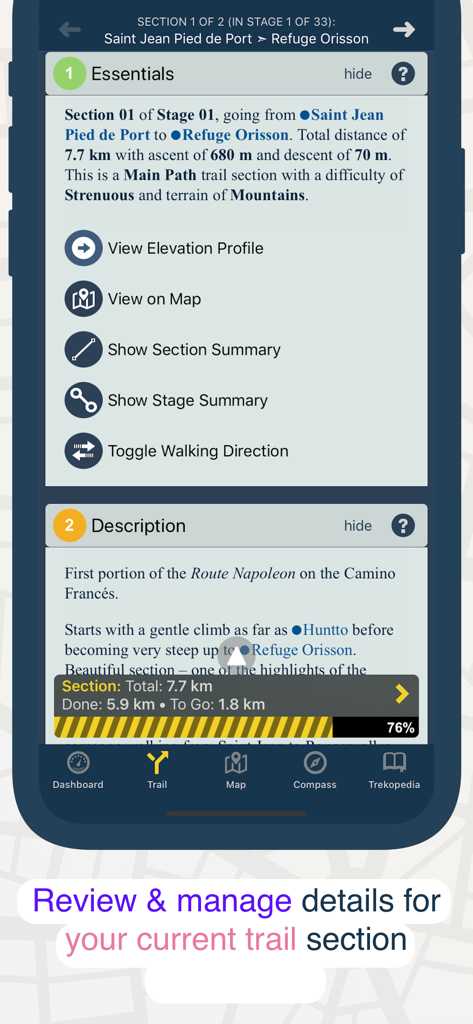
TrailSmart 앱의 트레일 구간 상세 보기에는 거리, 고도 및 설명이 표시됩니다.
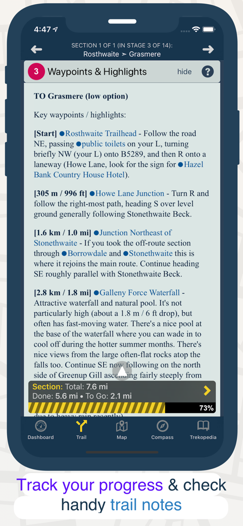
TrailSmart 앱 인터페이스에 상세한 하이킹 경유지와 구간 진행률 추적기가 표시됩니다.
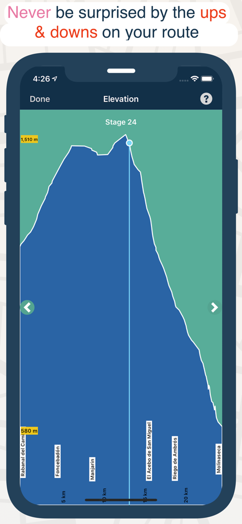
모바일 앱 스크린샷에 고도 및 거리 표시가 있는 하이킹 트레일 구간의 상세 고도 프로필 차트가 표시됩니다.
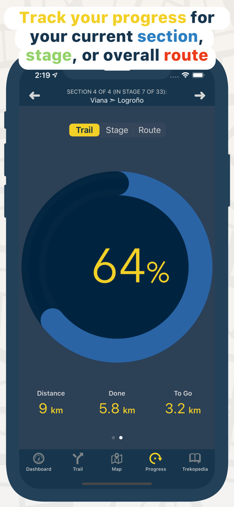
TrailSmart 앱의 진행률 추적 화면에 완료된 거리와 하이킹 트레일 구간의 백분율이 표시됩니다.
설명
Download


이 페이지는 앱이나 개발자의 공식 페이지가 아니며, 정보 제공 및 논평을 목적으로 작성된 독립 편집 간행물입니다. 명시적으로 달리 언급되지 않는 한, 해당 앱이나 개발자는 MWM, Apple, Google Play, 앱 퍼블리셔 또는 앱 개발자와 제휴, 보증, 후원, 승인 또는 공식적으로 연결되어 있지 않으며, 이 페이지의 어떤 내용도 해당 앱이 MWM의 서비스를 사용하여 개발되었음을 의미하지 않습니다. 모든 상표, 로고, 스크린샷 및 기타 콘텐츠는 해당 소유자의 자산입니다.