이 페이지는 앱이나 개발자의 공식 페이지가 아니며, 정보 제공 및 논평을 목적으로 작성된 독립 편집 간행물입니다. 명시적으로 달리 언급되지 않는 한, 해당 앱이나 개발자는 MWM, Apple, Google Play, 앱 퍼블리셔 또는 앱 개발자와 제휴, 보증, 후원, 승인 또는 공식적으로 연결되어 있지 않으며, 이 페이지의 어떤 내용도 해당 앱이 MWM의 서비스를 사용하여 개발되었음을 의미하지 않습니다. 모든 상표, 로고, 스크린샷 및 기타 콘텐츠는 해당 소유자의 자산입니다.

Coastal Explorer
정교한 크루즈 계획, 원활한 하드웨어 통합 및 NOAA 차트의 정확성으로 모든 항해를 마스터하십시오. 해상에서나 육상에서나 신뢰성을 위해 진지한 항해자들에게 신뢰받고 있습니다.
다운로드
2K+사용자 평점
총 평가 수
0개발사
카테고리
Navigation지원 언어
1최신 버전
1.3크기
54.3 MB출시일
2021년 1월 26일진지한 항해자를 위한 정밀 도구
소파에서 계획하는 것부터 연안 항해까지, Coastal Explorer는 안전하고 원활한 항해에 필요한 전문가급 데이터와 하드웨어 통합을 제공합니다.
고급 크루즈 계획
iPad에서 상세한 경로와 웨이포인트를 생성하고 클라우드를 통해 모든 기기에서 즉시 동기화하십시오.
원활한 해상 통합
AIS, 수심 측정기, 자동 조종 장치 및 NMEA 센서와 연동하여 태블릿을 기본 차트 플로터로 바꾸십시오.
다음 스크린샷과 설명은 앱의 공식 스토어 목록에서 직접 가져온 것이며 앱 개발자의 자산입니다.
앱 스토어
스크린샷
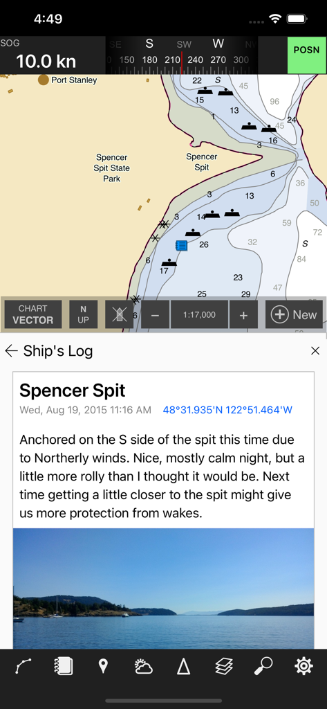
Coastal Explorer 앱에 항해 차트와 선박 로그 항목이 표시됨
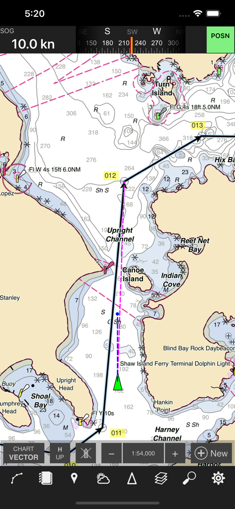
Coastal Explorer 앱 인터페이스에 계획된 경로와 항해 표시가 있는 상세한 항해 차트가 표시됨
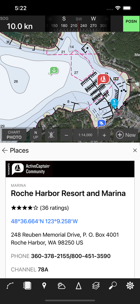
Coastal Explorer 앱에 로슈 하버의 상세한 마리나 정보가 있는 항해 차트가 표시됨
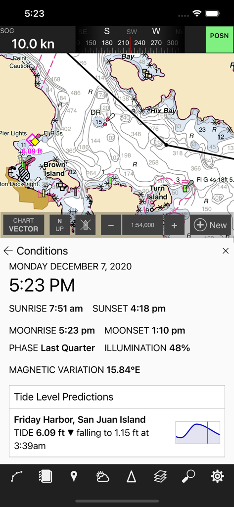
샌후안 섬의 상세한 차트와 실시간 조석 및 달 위상 데이터를 보여주는 항해 내비게이션 앱.
설명
Download
비슷한 앱
같은 카테고리의 상위 앱

Google Maps
Google LLC

Waze Navigation & Live Traffic
waze

AMap Global
AutoNavi Information Technology Co. Ltd.

百度地图-路线规划,出行必备
Beijing Baidu Netcom Science & Technology Co.,Ltd

Moovit: Bus & Transit Tracker
Moovit App Global LTD

Transit • Subway & Bus Times
9280-0366 Quebec inc.

ParkMobile: Park. Pay. Go.
Parkmobile USA, Inc

腾讯地图-路线规划,导航地铁打车出行
Shenzhen Tencent Computer Systems Company Limited

Île-de-France Mobilités
Ile de France Mobilites
이 페이지는 앱이나 개발자의 공식 페이지가 아니며, 정보 제공 및 논평을 목적으로 작성된 독립 편집 간행물입니다. 명시적으로 달리 언급되지 않는 한, 해당 앱이나 개발자는 MWM, Apple, Google Play, 앱 퍼블리셔 또는 앱 개발자와 제휴, 보증, 후원, 승인 또는 공식적으로 연결되어 있지 않으며, 이 페이지의 어떤 내용도 해당 앱이 MWM의 서비스를 사용하여 개발되었음을 의미하지 않습니다. 모든 상표, 로고, 스크린샷 및 기타 콘텐츠는 해당 소유자의 자산입니다.