이 페이지는 앱이나 개발자의 공식 페이지가 아니며, 정보 제공 및 논평을 목적으로 작성된 독립 편집 간행물입니다. 명시적으로 달리 언급되지 않는 한, 해당 앱이나 개발자는 MWM, Apple, Google Play, 앱 퍼블리셔 또는 앱 개발자와 제휴, 보증, 후원, 승인 또는 공식적으로 연결되어 있지 않으며, 이 페이지의 어떤 내용도 해당 앱이 MWM의 서비스를 사용하여 개발되었음을 의미하지 않습니다. 모든 상표, 로고, 스크린샷 및 기타 콘텐츠는 해당 소유자의 자산입니다.

Compass: GPS & Altimeter
등산객, 탐험가 및 전문가를 위한 올인원 아웃도어 도구. 신호 없이도 고도를 추적하고 3D 지형을 모니터링하며 전문 등급의 지리 데이터를 사용하여 여정을 기록하세요.
다운로드
12K+사용자 평점
총 평가 수
100개발사
카테고리
Travel지원 언어
33최신 버전
2.1.4크기
31.4 MB출시일
2025년 5월 14일모든 트레일과 지형을 마스터하세요
산봉우리부터 외딴 사막까지, 완전히 오프라인 상태에서도 전문 등급 내비게이션과 실시간 환경 데이터를 받아보세요.
정밀 프로 내비게이션
깊은 야생에서 방향 착오를 방지하기 위해 3D 지형 보기 및 자기장 모니터링으로 경로를 유지하세요.
실시간 고도 및 날씨
기압, 풍속 및 고도 추세를 추적하여 급격한 산악 날씨 변화에 앞서 나가세요.
다음 스크린샷과 설명은 앱의 공식 스토어 목록에서 직접 가져온 것이며 앱 개발자의 자산입니다.
앱 스토어
스크린샷
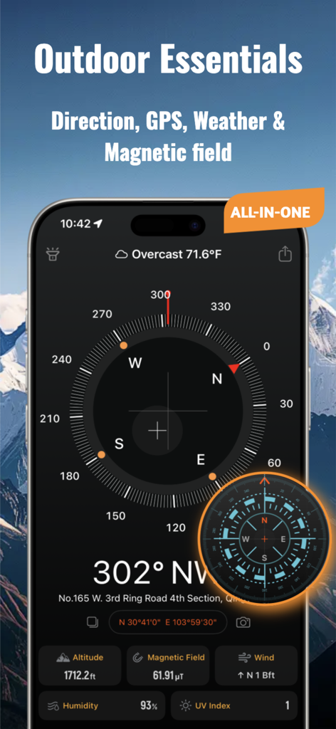
나침반 GPS 및 고도계 앱 인터페이스가 야외 탐색을 위한 방향, 날씨 및 고도 정보를 보여줍니다.
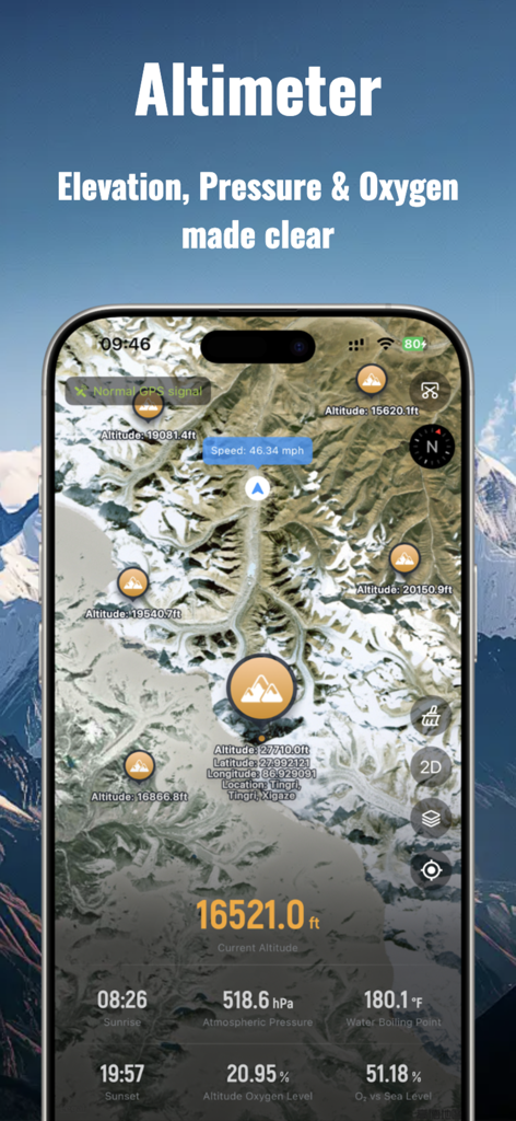
위성 지도에서 고도, 대기압 및 산소 수준을 표시하는 고도계 화면.
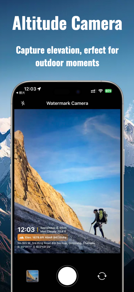
산악 하이킹 사진에 GPS 위치 및 고도 데이터가 표시되는 고도 카메라 인터페이스.
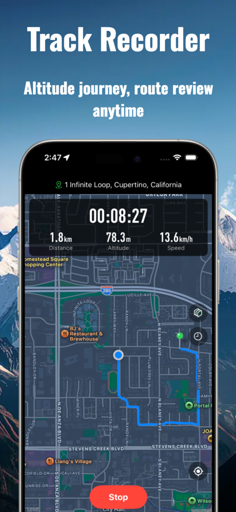
스마트폰 화면에 지도 경로와 실시간 거리, 고도 및 속도 데이터가 있는 트랙 기록기 기능이 표시됩니다.

모바일 앱 인터페이스에서 다양한 나침반 및 고도계 디자인 테마 그리드.
설명
Download
비슷한 앱
유사한 기능과 사용자 경험을 가진 앱

Realtime Altimeter
Zhenlai Xia

Travel Camera & Compass
Ha Nguyen

compass-latitude and longitude
美霞 熊

Compass ×
DOUBLE U s.r.o.

GPS Altitude-海拔表
祥琦 孔

Compass - GPS positioning
嘉 罗

Compass360X-GPS Speedometer
卫豪 吴

指南针-GPS经纬度海拔定位
Chongqing Xinzhi Space Technology Co., Ltd.

Travel Altimeter & Elevation
BranchenKing Ltd.
이 페이지는 앱이나 개발자의 공식 페이지가 아니며, 정보 제공 및 논평을 목적으로 작성된 독립 편집 간행물입니다. 명시적으로 달리 언급되지 않는 한, 해당 앱이나 개발자는 MWM, Apple, Google Play, 앱 퍼블리셔 또는 앱 개발자와 제휴, 보증, 후원, 승인 또는 공식적으로 연결되어 있지 않으며, 이 페이지의 어떤 내용도 해당 앱이 MWM의 서비스를 사용하여 개발되었음을 의미하지 않습니다. 모든 상표, 로고, 스크린샷 및 기타 콘텐츠는 해당 소유자의 자산입니다.