이 페이지는 앱이나 개발자의 공식 페이지가 아니며, 정보 제공 및 논평을 목적으로 작성된 독립 편집 간행물입니다. 명시적으로 달리 언급되지 않는 한, 해당 앱이나 개발자는 MWM, Apple, Google Play, 앱 퍼블리셔 또는 앱 개발자와 제휴, 보증, 후원, 승인 또는 공식적으로 연결되어 있지 않으며, 이 페이지의 어떤 내용도 해당 앱이 MWM의 서비스를 사용하여 개발되었음을 의미하지 않습니다. 모든 상표, 로고, 스크린샷 및 기타 콘텐츠는 해당 소유자의 자산입니다.

Coordinate Converter - MyGPSC
인터넷 없이 MGRS, UTM, GARS 등으로 즉시 변환하세요. 가장 중요한 순간에 정확한 데이터가 필요한 군인, 구조대원 및 오지 탐험가를 위해 제작된 개인 정보 보호 기능이 있는 광고 없는 도구입니다.
다운로드
1K+사용자 평점
총 평가 수
0개발사
카테고리
Navigation지원 언어
1최신 버전
1.0.4크기
0.8 MB출시일
2025년 7월 11일전술 탐색을 위한 정밀 도구
격자 체계가 끝나는 곳에서 작전을 수행하는 사람들을 위해 설계되었습니다. MyGPSC는 군사, SAR 및 오지 전문가를 위한 고정밀 오프라인 우선 변환 도구를 제공합니다.
100% 오프라인 안정성
셀룰러 신호가 없나요? 문제없습니다. 데이터나 Wi-Fi 없이도 깊은 오지에서 원격 임무 지역까지 어디에서든 좌표를 변환할 수 있습니다.
범용 격자 지원
민간 및 군사 시스템 간의 격차를 해소합니다. MGRS, UTM, GARS 및 모든 표준 위도/경도 형식 간에 즉시 번역할 수 있습니다.
다음 스크린샷과 설명은 앱의 공식 스토어 목록에서 직접 가져온 것이며 앱 개발자의 자산입니다.
앱 스토어
스크린샷
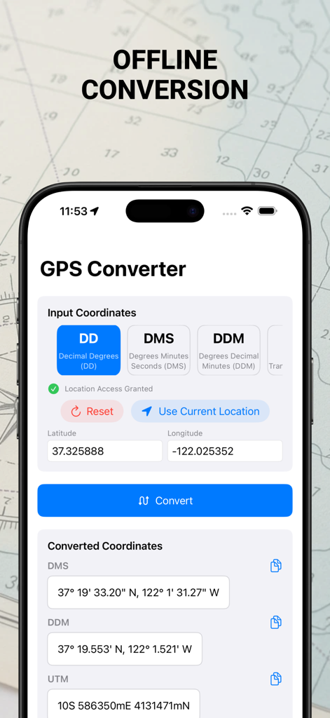
MyGPSC 앱 인터페이스는 DD DMS 및 UTM 형식 간의 오프라인 GPS 좌표 변환을 보여줍니다.
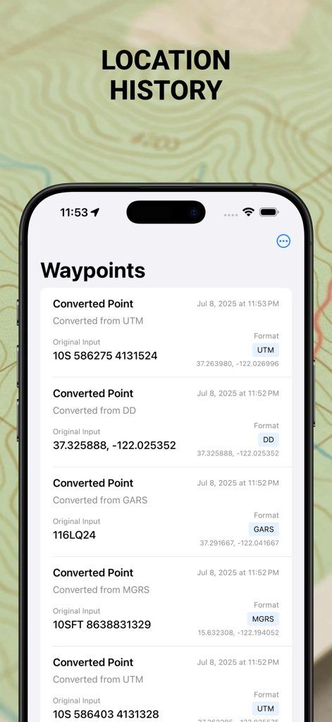
좌표 변환기 앱 스크린샷은 UTM, MGRS 및 GARS와 같은 좌표 형식이 있는 저장된 웨이포인트 및 위치 기록 목록을 보여줍니다.
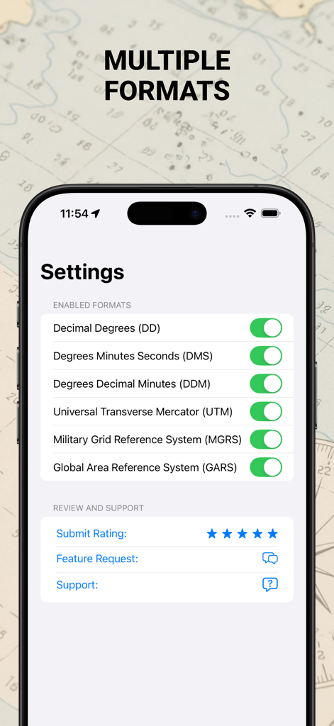
MyGPSC 앱의 설정 화면은 UTM 및 MGRS를 포함한 여러 좌표 형식 토글을 보여줍니다.
설명
Download
비슷한 앱
같은 카테고리의 상위 앱

Google Maps
Google LLC

Waze Navigation & Live Traffic
waze

AMap Global
AutoNavi Information Technology Co. Ltd.

百度地图-路线规划,出行必备
Beijing Baidu Netcom Science & Technology Co.,Ltd

Moovit: Bus & Transit Tracker
Moovit App Global LTD

Transit • Subway & Bus Times
9280-0366 Quebec inc.

ParkMobile: Park. Pay. Go.
Parkmobile USA, Inc

腾讯地图-路线规划,导航地铁打车出行
Shenzhen Tencent Computer Systems Company Limited

Île-de-France Mobilités
Ile de France Mobilites
이 페이지는 앱이나 개발자의 공식 페이지가 아니며, 정보 제공 및 논평을 목적으로 작성된 독립 편집 간행물입니다. 명시적으로 달리 언급되지 않는 한, 해당 앱이나 개발자는 MWM, Apple, Google Play, 앱 퍼블리셔 또는 앱 개발자와 제휴, 보증, 후원, 승인 또는 공식적으로 연결되어 있지 않으며, 이 페이지의 어떤 내용도 해당 앱이 MWM의 서비스를 사용하여 개발되었음을 의미하지 않습니다. 모든 상표, 로고, 스크린샷 및 기타 콘텐츠는 해당 소유자의 자산입니다.