이 페이지는 앱이나 개발자의 공식 페이지가 아니며, 정보 제공 및 논평을 목적으로 작성된 독립 편집 간행물입니다. 명시적으로 달리 언급되지 않는 한, 해당 앱이나 개발자는 MWM, Apple, Google Play, 앱 퍼블리셔 또는 앱 개발자와 제휴, 보증, 후원, 승인 또는 공식적으로 연결되어 있지 않으며, 이 페이지의 어떤 내용도 해당 앱이 MWM의 서비스를 사용하여 개발되었음을 의미하지 않습니다. 모든 상표, 로고, 스크린샷 및 기타 콘텐츠는 해당 소유자의 자산입니다.

Distance & Area Measure On Map
토지, 들판, 건설 현장에 대해 100% 정확한 측정을 얻으세요. KML 파일을 내보내고, 오프라인으로 작업하며, 최고의 미국 매핑 도구로 작업 흐름을 간소화하세요.
다운로드
92K+사용자 평점
총 평가 수
0개발사
카테고리
Navigation지원 언어
1최신 버전
2.0.3크기
2.9 MB출시일
2018년 1월 22일주머니 속 전문 매핑 도구
추측은 그만, 이제 측정하세요. 면적을 관리하든, 현장 자재를 추정하든, 경로를 계획하든, 직관적인 GPS 측정 도구로 100% 정확한 데이터를 얻으세요.
정밀 필드 측정
농장, 정원 또는 건설 현장의 토지 면적을 즉시 계산합니다. 실시간 그리기 또는 핀 드롭 모드를 사용하여 에이커, 평방 피트 또는 마일 단위로 정확한 측정을 얻으세요.
오프라인 신뢰성
휴대폰 서비스 없이도 어디서든 작업하세요. 통신 불통 지역에서도 완벽하게 작동하는 고성능 GPS 추적으로 외딴 시골 부지나 산책로를 매핑하세요.
다음 스크린샷과 설명은 앱의 공식 스토어 목록에서 직접 가져온 것이며 앱 개발자의 자산입니다.
앱 스토어
스크린샷
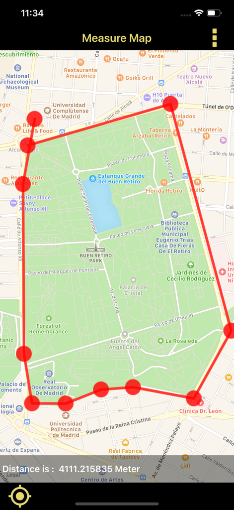
특정 거리를 측정하기 위해 도시 지도에 그려진 빨간색 경계선을 보여주는 모바일 앱 인터페이스
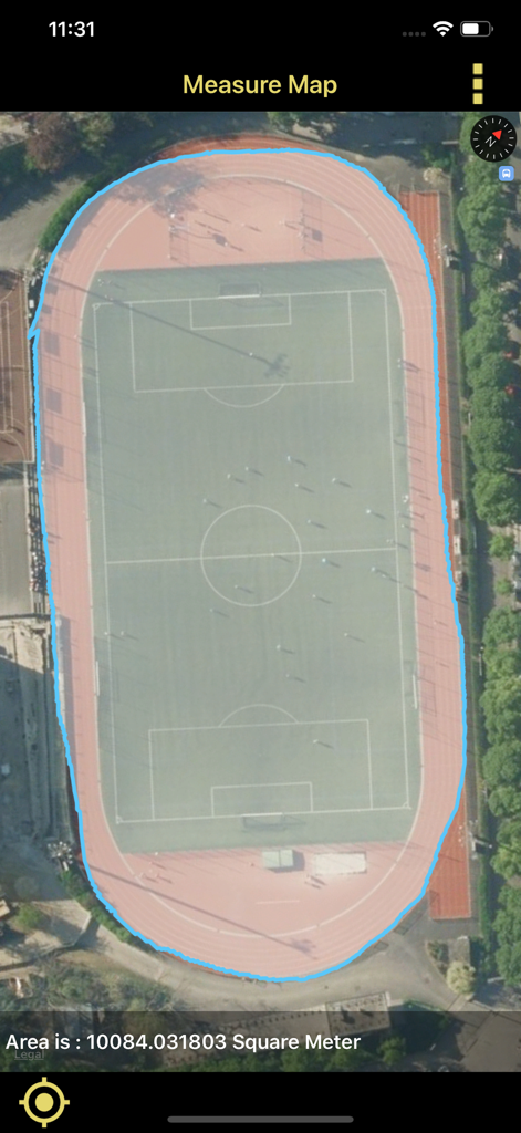
위성 지도에 표시된 스포츠 경기장 면적 측정
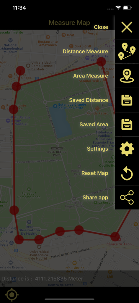
지도에서 거리 및 면적 측정 앱의 인터페이스로, 도시 지도에 측정된 영역과 사이드바 메뉴를 보여줍니다.
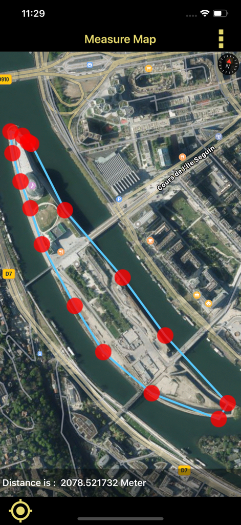
섬 주변에 측정된 경계선과 미터 단위로 계산된 거리를 보여주는 위성 지도 보기
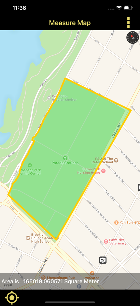
지도에 토지 면적 다각형을 제곱미터로 측정하는 모바일 앱 인터페이스
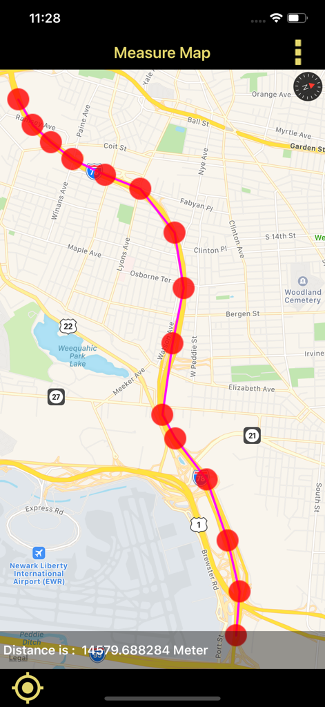
GPS 지도에 측정된 경로와 미터 단위로 계산된 거리를 보여주는 모바일 화면
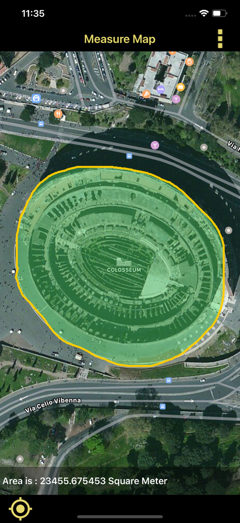
앱을 사용하여 콜로세움의 면적을 제곱미터로 측정한 위성 보기
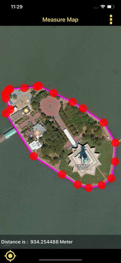
자유의 여신상 섬의 빨간색 핀 경계선과 거리 측정을 위성 지도에 보여주는 모바일 앱 인터페이스
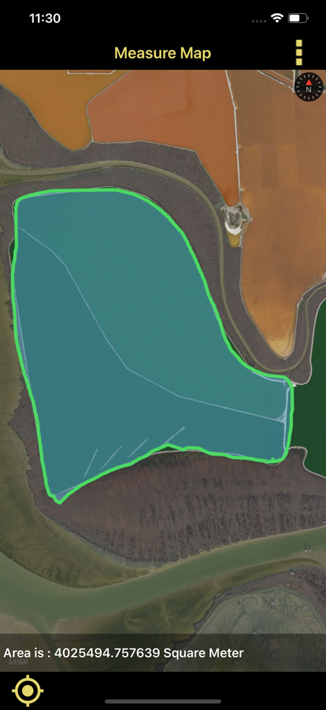
토지 면적을 제곱미터로 측정하는 위성 지도 표시
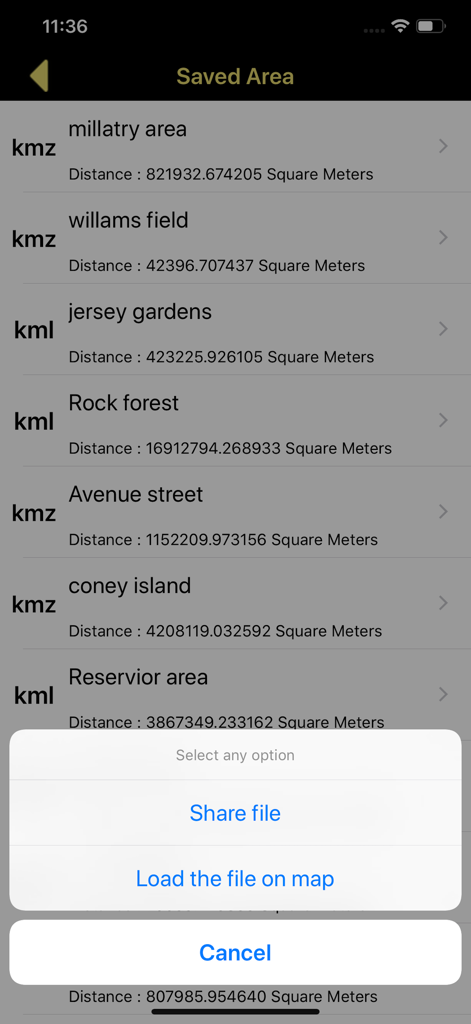
KML 및 KMZ 파일을 공유하거나 불러올 수 있는 옵션이 있는 저장된 지도 면적 측정 목록
설명
Download
비슷한 앱
같은 카테고리의 상위 앱

Google Maps
Google LLC

Waze Navigation & Live Traffic
waze

AMap Global
AutoNavi Information Technology Co. Ltd.

百度地图-路线规划,出行必备
Beijing Baidu Netcom Science & Technology Co.,Ltd

Moovit: Bus & Transit Tracker
Moovit App Global LTD

Transit • Subway & Bus Times
9280-0366 Quebec inc.

ParkMobile: Park. Pay. Go.
Parkmobile USA, Inc

腾讯地图-路线规划,导航地铁打车出行
Shenzhen Tencent Computer Systems Company Limited

Île-de-France Mobilités
Ile de France Mobilites
이 페이지는 앱이나 개발자의 공식 페이지가 아니며, 정보 제공 및 논평을 목적으로 작성된 독립 편집 간행물입니다. 명시적으로 달리 언급되지 않는 한, 해당 앱이나 개발자는 MWM, Apple, Google Play, 앱 퍼블리셔 또는 앱 개발자와 제휴, 보증, 후원, 승인 또는 공식적으로 연결되어 있지 않으며, 이 페이지의 어떤 내용도 해당 앱이 MWM의 서비스를 사용하여 개발되었음을 의미하지 않습니다. 모든 상표, 로고, 스크린샷 및 기타 콘텐츠는 해당 소유자의 자산입니다.