이 페이지는 앱이나 개발자의 공식 페이지가 아니며, 정보 제공 및 논평을 목적으로 작성된 독립 편집 간행물입니다. 명시적으로 달리 언급되지 않는 한, 해당 앱이나 개발자는 MWM, Apple, Google Play, 앱 퍼블리셔 또는 앱 개발자와 제휴, 보증, 후원, 승인 또는 공식적으로 연결되어 있지 않으며, 이 페이지의 어떤 내용도 해당 앱이 MWM의 서비스를 사용하여 개발되었음을 의미하지 않습니다. 모든 상표, 로고, 스크린샷 및 기타 콘텐츠는 해당 소유자의 자산입니다.

DroneDeploy Flight App
DJI 드론 비행을 고해상도 데이터로 변환하세요. 탭 두 번으로 미션을 자동화하고, 부피를 측정하고, 조사 등급의 지도를 건설, 농업, 검사 프로젝트 전반에 걸쳐 공유하세요.
다운로드
370K+사용자 평점
총 평가 수
14K+개발사
카테고리
Photo & Video지원 언어
2최신 버전
5.111.0크기
357.7 MB출시일
2015년 3월 24일모든 비행에서 얻는 엔터프라이즈급 인사이트
데이터 수집을 자동화하고 항공 이미지를 업계별 맞춤 고해상도 지도, 3D 모델 및 실행 가능한 보고서로 변환하세요.
정밀 자동 비행
반복 가능한 미션을 계획하고 탭 두 번으로 복잡한 자율 비행을 실행하여 항상 일관된 고정밀 데이터 캡처를 보장합니다.
조사 등급 측정
부피, 고도 및 표면적을 즉시 계산하여 수동 작업 없이 현장 진행 상황과 자재 비용을 추적합니다.
다음 스크린샷과 설명은 앱의 공식 스토어 목록에서 직접 가져온 것이며 앱 개발자의 자산입니다.
앱 스토어
스크린샷
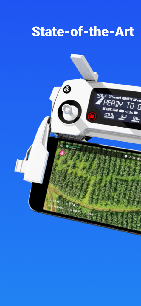
드론 컨트롤러에 부착된 스마트폰에서 항공 필드 맵을 표시하는 DroneDeploy 앱
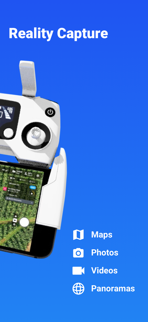
지도, 사진, 동영상을 포함한 현실 캡처 기능을 표시하는 드론 컨트롤러 및 스마트폰
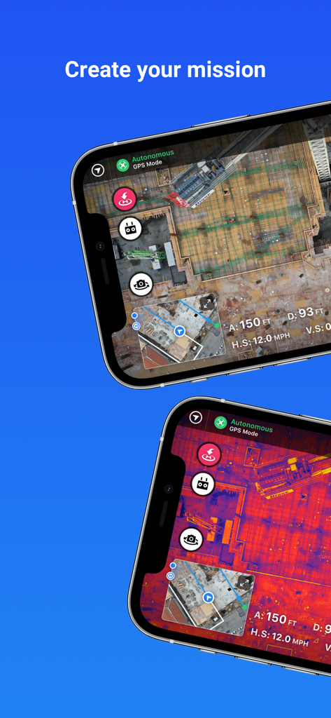
건설 현장 매핑 및 자동 비행 임무를 위한 열 이미징을 보여주는 DroneDeploy 앱 화면
자동 비행 임무 및 열 건설 현장 매핑을 보여주는 DroneDeploy 앱 인터페이스
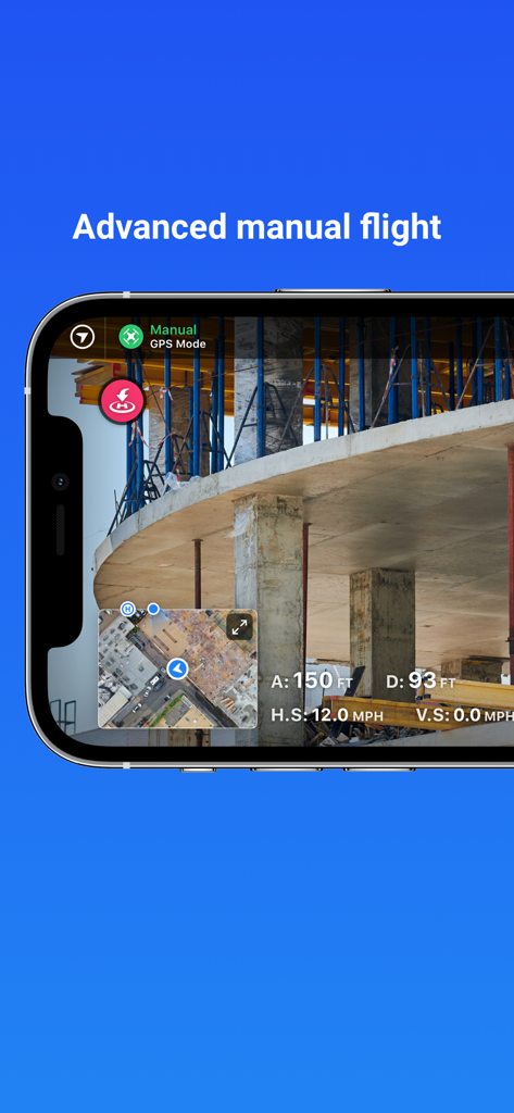
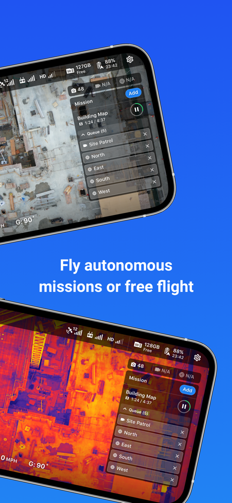
건설 현장의 실시간 보기를 포함한 고급 수동 비행 모드를 보여주는 DroneDeploy 앱 인터페이스
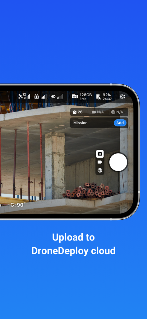
클라우드 업로드 텍스트가 있는 건설 현장의 드론 카메라 보기를 보여주는 DroneDeploy 앱 인터페이스
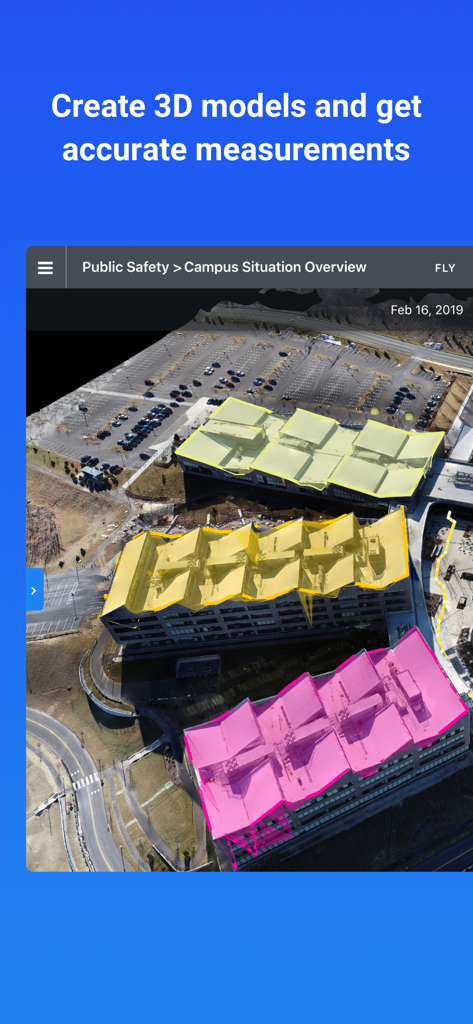
측정을 위해 색상으로 구분된 지붕 세그먼트가 있는 3D 건물 모델을 보여주는 DroneDeploy 인터페이스
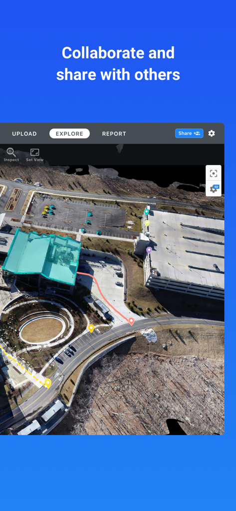
DroneDeploy 앱에서 팀 협업을 위해 건설 현장을 보여주는 주석이 달린 항공 드론 지도
설명
Download
비슷한 앱
같은 카테고리의 상위 앱

CapCut: Photo & Video Editor
BYTEDANCE PTE. LTD.

Instagram, Inc.

YouTube
Google LLC

Canva: AI Photo & Video Editor
Canva Pty Ltd

Snapchat
Snap, Inc.

快手
Beijing Kwai Technology Co., Ltd.

Edits: Video Editor
Instagram, Inc.

Meitu- AI Photo & Video Editor
Xiamen Meitu Technology Co., Ltd.

Google Photos: Backup & Edit
Google LLC
이 페이지는 앱이나 개발자의 공식 페이지가 아니며, 정보 제공 및 논평을 목적으로 작성된 독립 편집 간행물입니다. 명시적으로 달리 언급되지 않는 한, 해당 앱이나 개발자는 MWM, Apple, Google Play, 앱 퍼블리셔 또는 앱 개발자와 제휴, 보증, 후원, 승인 또는 공식적으로 연결되어 있지 않으며, 이 페이지의 어떤 내용도 해당 앱이 MWM의 서비스를 사용하여 개발되었음을 의미하지 않습니다. 모든 상표, 로고, 스크린샷 및 기타 콘텐츠는 해당 소유자의 자산입니다.