이 페이지는 앱이나 개발자의 공식 페이지가 아니며, 정보 제공 및 논평을 목적으로 작성된 독립 편집 간행물입니다. 명시적으로 달리 언급되지 않는 한, 해당 앱이나 개발자는 MWM, Apple, Google Play, 앱 퍼블리셔 또는 앱 개발자와 제휴, 보증, 후원, 승인 또는 공식적으로 연결되어 있지 않으며, 이 페이지의 어떤 내용도 해당 앱이 MWM의 서비스를 사용하여 개발되었음을 의미하지 않습니다. 모든 상표, 로고, 스크린샷 및 기타 콘텐츠는 해당 소유자의 자산입니다.

FireMapper Enterprise
미션 크리티컬한 조정 및 업계 표준 심볼을 통해 팀에 힘을 실어주세요. 소방관이 비상 서비스를 위해 구축했으며, 10분 안에 숙달할 수 있을 만큼 직관적입니다.
다운로드
29K+사용자 평점
총 평가 수
0개발사
카테고리
Navigation지원 언어
1최신 버전
1.365크기
47.3 MB출시일
2019년 1월 8일모든 임무를 위한 전술 정보
FireMapper Enterprise는 현장과 지휘 센터 간의 격차를 해소하여, 고위험 사고 중 학습 곡선이 전혀 필요 없는 견고하고 표준화된 매핑 솔루션을 제공합니다.
실시간 상황 인식
전체 조직에 걸쳐 라이브 지도 데이터를 동기화하여 정보의 단일 출처를 구축하고, 모든 대응 요원이 동일한 전술적 그림을 보고 있도록 보장합니다.
표준화된 전술 심볼
미국 PMS 936 및 All Hazards 세트를 포함한 전문 등급 심볼을 사용하여 정밀하게 소통하고, 기관 간의 오해를 제거합니다.
다음 스크린샷과 설명은 앱의 공식 스토어 목록에서 직접 가져온 것이며 앱 개발자의 자산입니다.
앱 스토어
스크린샷
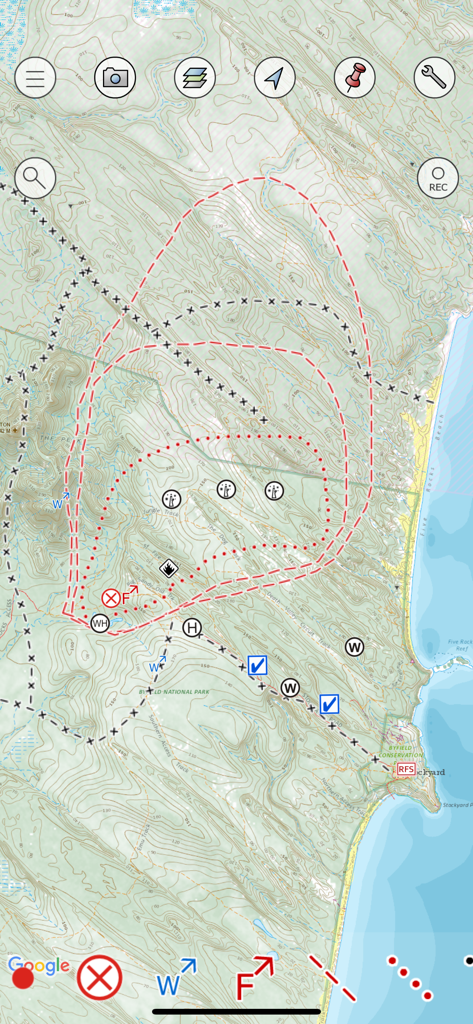
FireMapper Enterprise 앱 인터페이스에 전술적 화재 심볼과 사고 경계선이 표시된 지형도 표시
화재 경계선과 사고 관리 심볼을 표시하는 FireMapper Enterprise 전술 지도
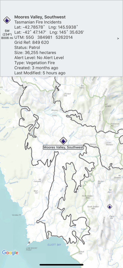
화재 사고 세부 정보와 매핑된 경계선을 보여주는 FireMapper Enterprise 화면
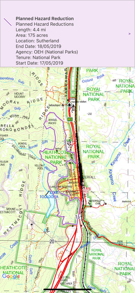
국립공원에서 계획된 위험 감소 구역을 보여주는 FireMapper Enterprise 앱 내 지형 지도
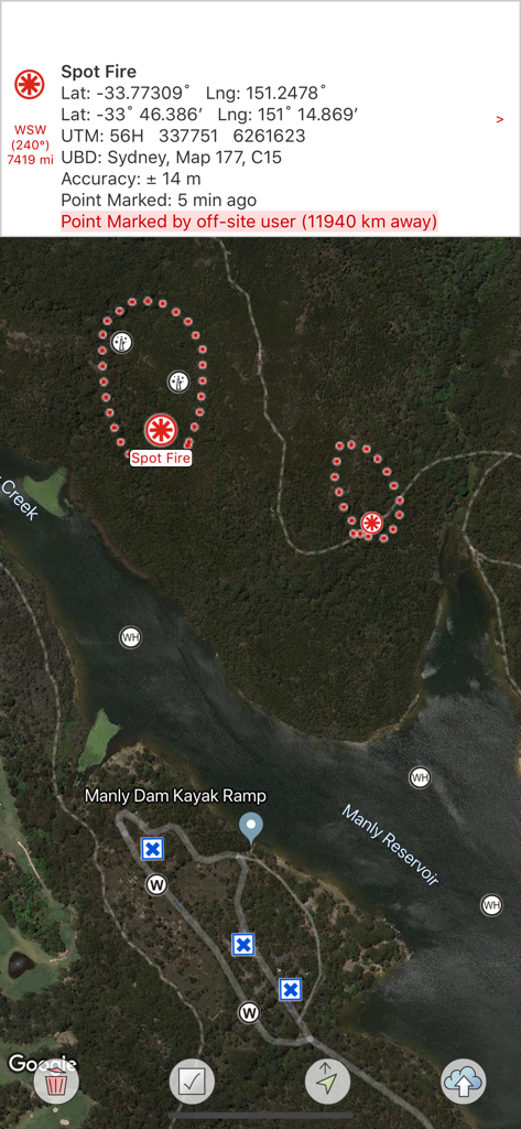
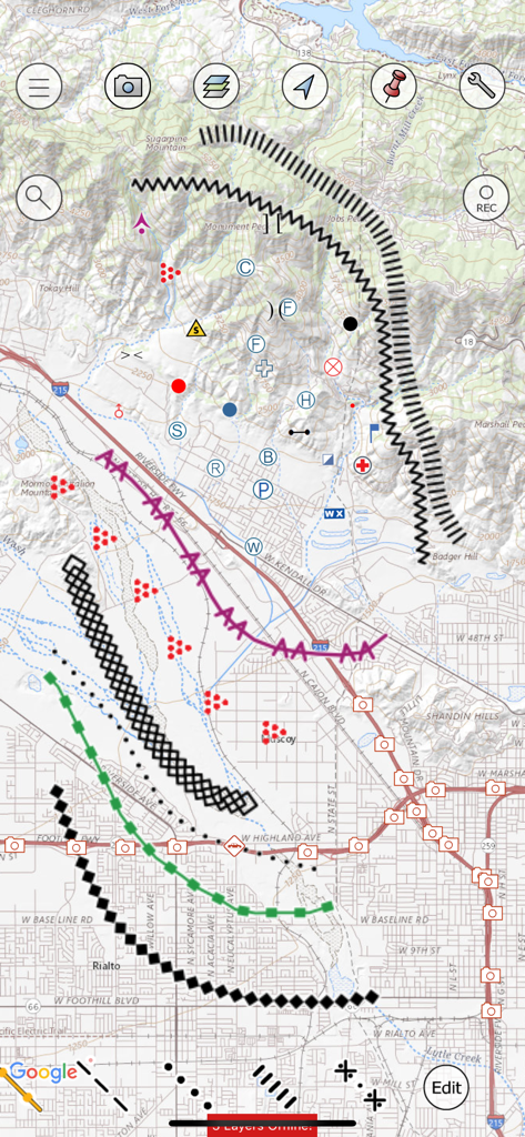
전술적 산불 심볼과 GPS 좌표 데이터가 표시된 FireMapper Enterprise의 위성 지도
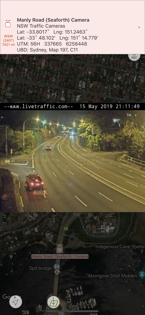
위성 지도 위에 실시간 교통 카메라 피드와 GPS 좌표를 표시하는 FireMapper Enterprise 앱
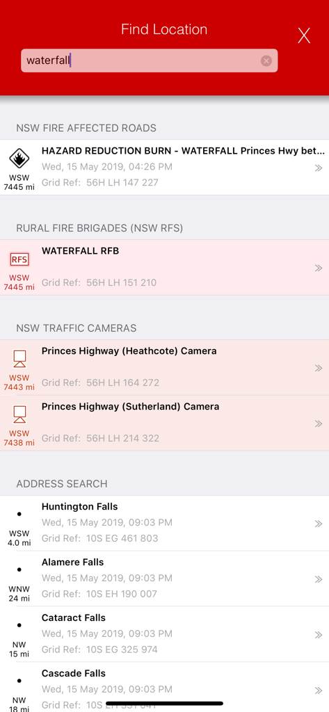
화재 영향을 받은 도로와 소방대 본부를 보여주는 FireMapper Enterprise 위치 검색 인터페이스
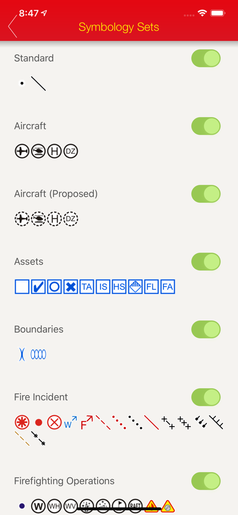
비상 사고 매핑을 위한 다양한 전술 심볼 세트 선택 및 토글 인터페이스
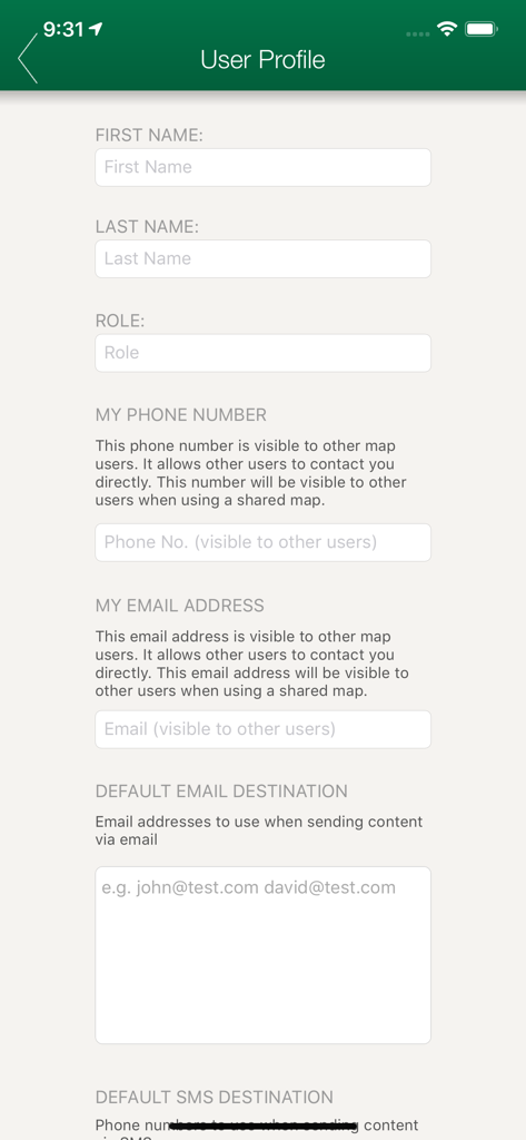
이름, 역할, 전화번호, 이메일 필드를 보여주는 FireMapper Enterprise 앱의 사용자 프로필 설정 화면
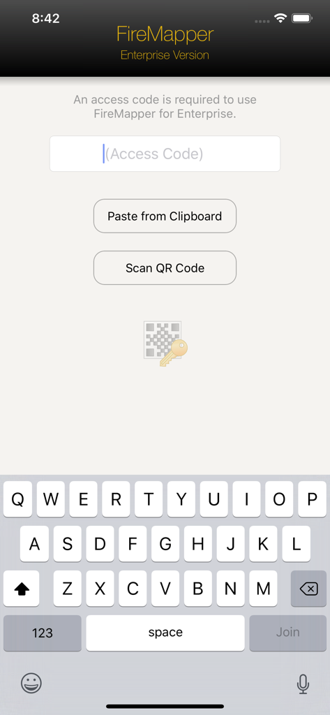
QR 코드를 붙여넣거나 스캔하는 옵션이 있는 FireMapper Enterprise 액세스 코드 입력 화면
설명
Download
비슷한 앱
같은 카테고리의 상위 앱

Google Maps
Google LLC

Waze Navigation & Live Traffic
waze

AMap Global
AutoNavi Information Technology Co. Ltd.

百度地图-路线规划,出行必备
Beijing Baidu Netcom Science & Technology Co.,Ltd

Moovit: Bus & Transit Tracker
Moovit App Global LTD

Transit • Subway & Bus Times
9280-0366 Quebec inc.

ParkMobile: Park. Pay. Go.
Parkmobile USA, Inc

腾讯地图-路线规划,导航地铁打车出行
Shenzhen Tencent Computer Systems Company Limited

Île-de-France Mobilités
Ile de France Mobilites
이 페이지는 앱이나 개발자의 공식 페이지가 아니며, 정보 제공 및 논평을 목적으로 작성된 독립 편집 간행물입니다. 명시적으로 달리 언급되지 않는 한, 해당 앱이나 개발자는 MWM, Apple, Google Play, 앱 퍼블리셔 또는 앱 개발자와 제휴, 보증, 후원, 승인 또는 공식적으로 연결되어 있지 않으며, 이 페이지의 어떤 내용도 해당 앱이 MWM의 서비스를 사용하여 개발되었음을 의미하지 않습니다. 모든 상표, 로고, 스크린샷 및 기타 콘텐츠는 해당 소유자의 자산입니다.