이 페이지는 앱이나 개발자의 공식 페이지가 아니며, 정보 제공 및 논평을 목적으로 작성된 독립 편집 간행물입니다. 명시적으로 달리 언급되지 않는 한, 해당 앱이나 개발자는 MWM, Apple, Google Play, 앱 퍼블리셔 또는 앱 개발자와 제휴, 보증, 후원, 승인 또는 공식적으로 연결되어 있지 않으며, 이 페이지의 어떤 내용도 해당 앱이 MWM의 서비스를 사용하여 개발되었음을 의미하지 않습니다. 모든 상표, 로고, 스크린샷 및 기타 콘텐츠는 해당 소유자의 자산입니다.

GPS Area Measure Map
정확하게 에이커를 계산하고, 거리를 추적하고, 경계를 표시합니다. 농부, 계약자, 부동산 전문가가 자신 있게 모든 지형을 매핑할 수 있는 필수 올인원 툴킷입니다.
다운로드
100사용자 평점
총 평가 수
0개발사
카테고리
Utilities지원 언어
13최신 버전
4.0크기
71.7 MB출시일
2025년 6월 4일모든 프로젝트를 위한 정밀 도구
iPhone을 전문가 수준의 측량 툴킷으로 바꿔보세요. 작업 현장을 추정하든, 농장을 매핑하든, 재산 경계를 표시하든, 몇 초 안에 정확한 데이터를 얻을 수 있습니다.
즉각적인 면적 및 둘레 통계
지도를 탭하거나 경계를 따라 걷기만 하면 에이커, 제곱피트 또는 울타리 길이를 계산할 수 있습니다. 현장에서의 신속한 견적에 완벽합니다.
스마트 위치 표시
필드 노트를 정리하기 위해 사용자 지정 마커로 재산 모서리, 수원 또는 유틸리티 라인과 같은 중요한 랜드마크를 정확히 찾아 저장합니다.
다음 스크린샷과 설명은 앱의 공식 스토어 목록에서 직접 가져온 것이며 앱 개발자의 자산입니다.
앱 스토어
스크린샷
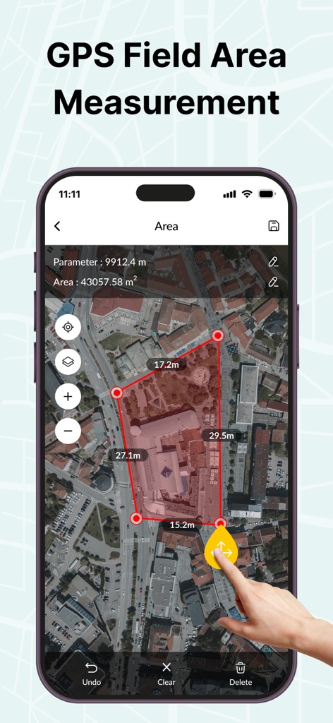
여러 건물 면적을 측정하는 데 사용되는 빨간색 다각형이 있는 위성 지도를 표시하는 iPhone
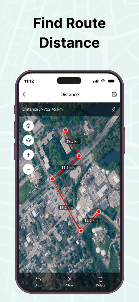
위성 지도에서 경로 거리 측정을 보여주는 GPS 앱 인터페이스
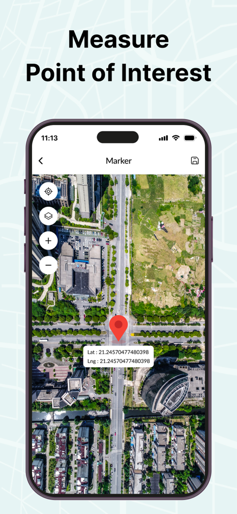
특정 관심 지점에 대한 빨간색 마커 핀과 위도 및 경도 좌표가 있는 위성 지도를 표시하는 스마트폰 화면
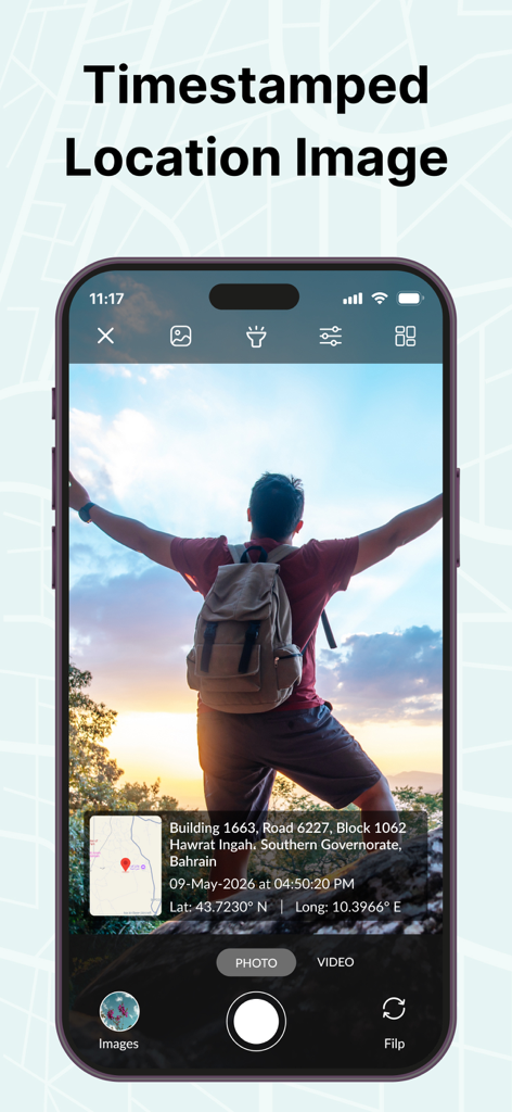
타임스탬프가 찍힌 위치 오버레이와 GPS 좌표 및 미니 지도가 포함된 GPS 사진을 보여주는 스마트폰 화면
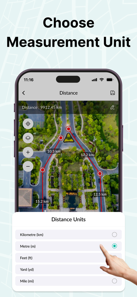
위성 지도를 보여주는 GPS 면적 측정 앱 인터페이스에서 거리 측정 단위를 선택하는 모습
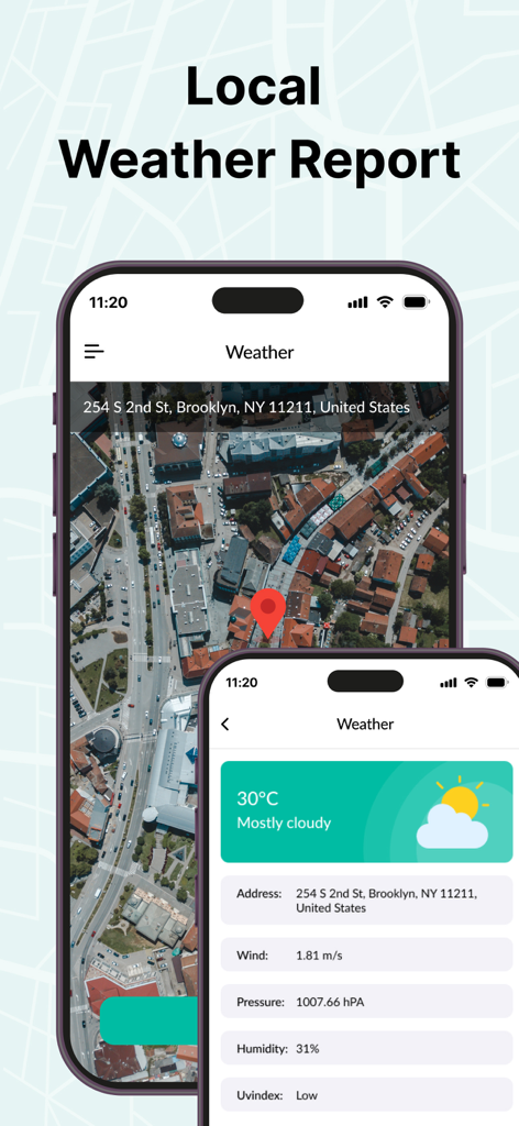
온도 및 풍속을 포함한 환경 데이터와 함께 위성 지도 보기 및 지역 일기 예보를 보여주는 스마트폰 화면
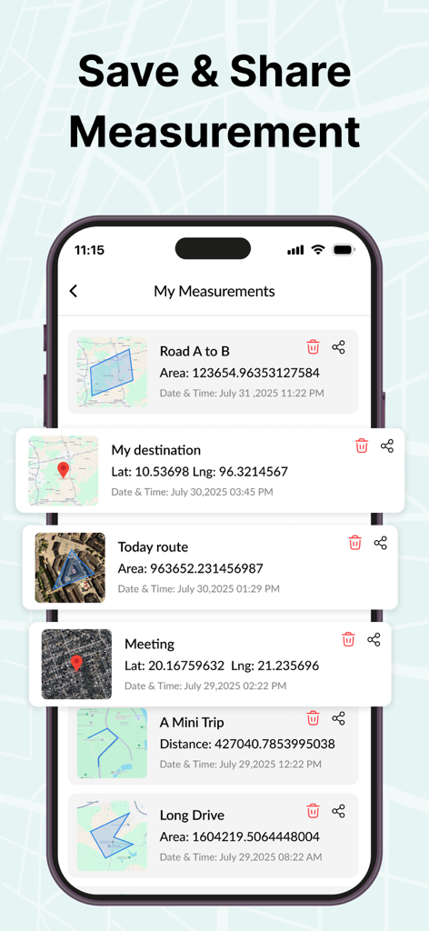
저장 및 공유 옵션이 있는 다양한 토지 면적 및 경로를 보여주는 GPS 면적 측정 앱의 저장된 측정값 목록
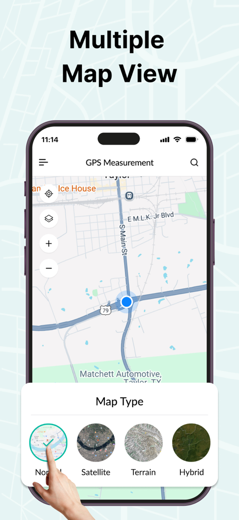
위성 및 지형 모드를 보여주는 GPS 면적 측정 앱의 여러 지도 보기 옵션
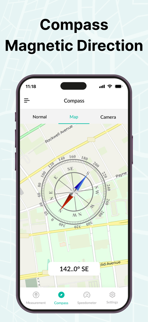
거리 지도 보기 위에 자기 나침반 방향을 보여주는 GPS 면적 측정 지도 앱
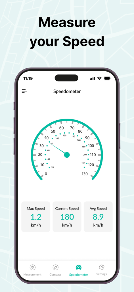
실시간 속도 추적 데이터가 있는 GPS 면적 측정 앱의 속도계 기능을 보여주는 스마트폰
설명
Download
비슷한 앱
같은 카테고리의 상위 앱

Google LLC

Google Chrome
Google LLC

中国移动(手机营业厅)
China Mobile Online Services Co., Ltd.

Google Authenticator
Google LLC

CNH do Brasil
Servicos e Informacoes do Brasil

Cleanup: Phone Storage Cleaner
DEEP FLOW SOFTWARE SERVICES - FZCO

gov.br
Servicos e Informacoes do Brasil

Super VPN Fly 2026
YUNFAN TECHNOLOGY CO., LIMITED

Microsoft Edge: AI Browser
Microsoft Corporation
이 페이지는 앱이나 개발자의 공식 페이지가 아니며, 정보 제공 및 논평을 목적으로 작성된 독립 편집 간행물입니다. 명시적으로 달리 언급되지 않는 한, 해당 앱이나 개발자는 MWM, Apple, Google Play, 앱 퍼블리셔 또는 앱 개발자와 제휴, 보증, 후원, 승인 또는 공식적으로 연결되어 있지 않으며, 이 페이지의 어떤 내용도 해당 앱이 MWM의 서비스를 사용하여 개발되었음을 의미하지 않습니다. 모든 상표, 로고, 스크린샷 및 기타 콘텐츠는 해당 소유자의 자산입니다.