이 페이지는 앱이나 개발자의 공식 페이지가 아니며, 정보 제공 및 논평을 목적으로 작성된 독립 편집 간행물입니다. 명시적으로 달리 언급되지 않는 한, 해당 앱이나 개발자는 MWM, Apple, Google Play, 앱 퍼블리셔 또는 앱 개발자와 제휴, 보증, 후원, 승인 또는 공식적으로 연결되어 있지 않으며, 이 페이지의 어떤 내용도 해당 앱이 MWM의 서비스를 사용하여 개발되었음을 의미하지 않습니다. 모든 상표, 로고, 스크린샷 및 기타 콘텐츠는 해당 소유자의 자산입니다.

GPS Fields Area Measure App
토지 소유주, 계약자, 야외 활동가를 위해 설계된 전문가 수준의 도구로 정확하게 면적을 측정하고, 다중 경유지 경로를 계획하며, 안전하게 길을 찾으세요.
다운로드
14K+사용자 평점
총 평가 수
0개발사
카테고리
Navigation지원 언어
16최신 버전
1.0크기
149.8 MB출시일
2024년 12월 10일토지와 도로를 위한 최고의 디지털 도구 상자
조경 프로젝트를 위한 면적 계산부터 첨단 HUD를 이용한 농촌 경로 탐색까지, 하나의 강력한 앱에서 필요한 모든 전문 도구를 제공합니다.
정밀한 토지 및 면적 계산
지도에서 지점을 표시하여 평방피트, 에이커 또는 둘레를 쉽게 측정하세요. 울타리 설치, 농업, 재산 관리에 이상적입니다.
지오태그 GPS 카메라
전문적인 기록 관리를 위해 위도, 경도, 타임스탬프가 자동으로 포함된 사진으로 작업을 문서화하세요.
다음 스크린샷과 설명은 앱의 공식 스토어 목록에서 직접 가져온 것이며 앱 개발자의 자산입니다.
앱 스토어
스크린샷
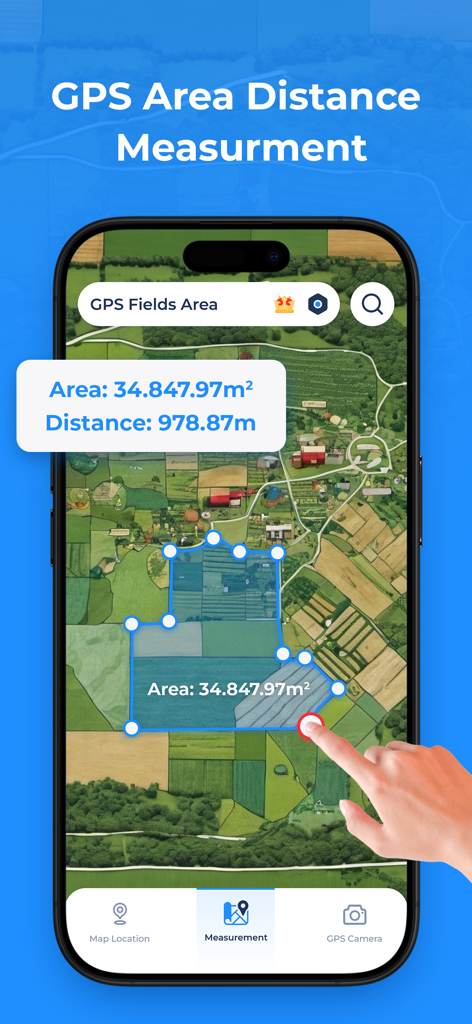
측정된 필지 면적과 거리 계산이 표시된 위성 지도를 보여주는 스마트폰 앱.
위성 지도 보기와 토지 측정 도구를 보여주는 GPS 필지 면적 측정 앱
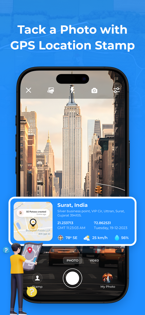
사진 위에 위치 좌표와 지도가 오버레이된 GPS 카메라 기능이 표시된 스마트폰 화면.
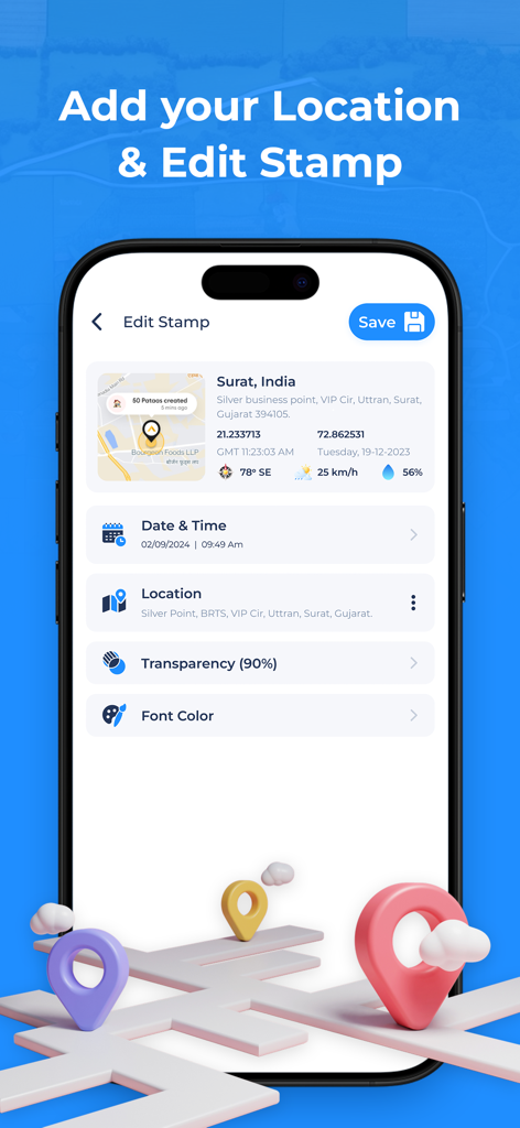
날짜, 시간, 좌표를 포함한 GPS 위치 스탬프 편집 옵션을 보여주는 모바일 화면
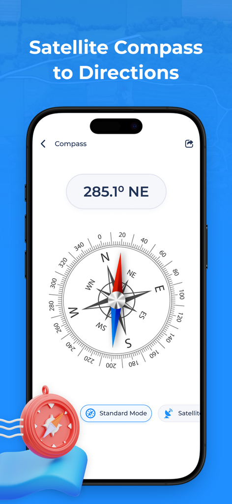
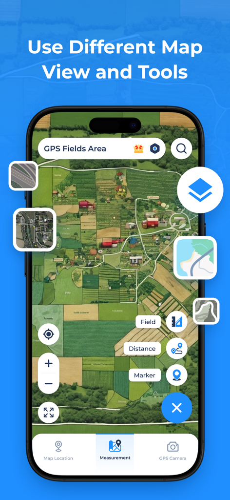
방위 각도 및 위성 모드가 표시된 디지털 나침반을 보여주는 GPS 필지 면적 측정 앱
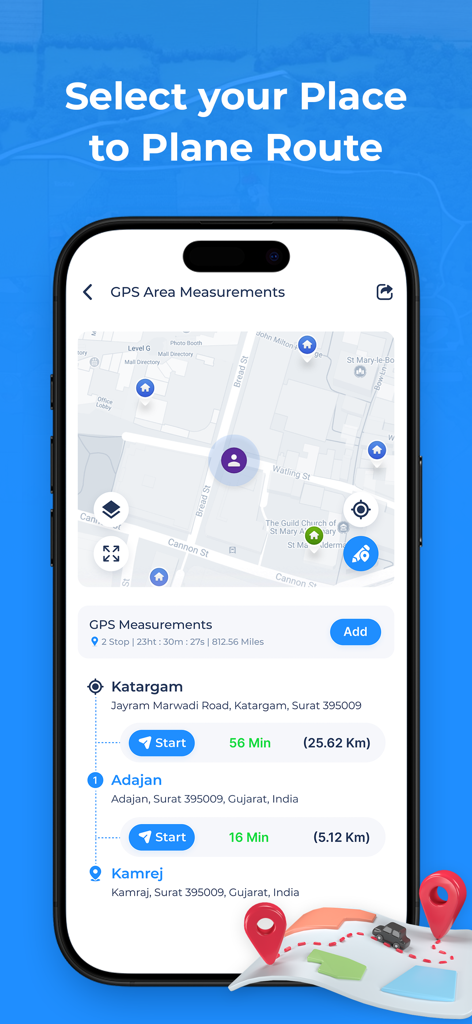
출발지 및 목적지 입력, 검색 기록이 있는 다중 경유지 경로 플래너를 보여주는 GPS 필지 면적 측정 앱
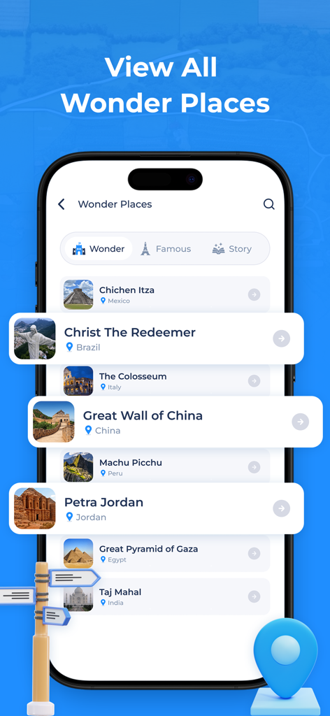
GPS 내비게이션 앱의 만리장성, 페트라와 같은 세계 유명 랜드마크 목록
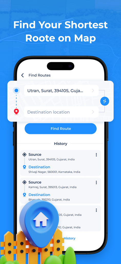
출발지 및 목적지 입력, 검색 기록이 있는 경로 찾기 기능을 보여주는 GPS 필지 면적 측정 앱의 인터페이스
설명
Download
비슷한 앱
같은 카테고리의 상위 앱

Google Maps
Google LLC

Waze Navigation & Live Traffic
waze

AMap Global
AutoNavi Information Technology Co. Ltd.

百度地图-路线规划,出行必备
Beijing Baidu Netcom Science & Technology Co.,Ltd

Moovit: Bus & Transit Tracker
Moovit App Global LTD

Transit • Subway & Bus Times
9280-0366 Quebec inc.

ParkMobile: Park. Pay. Go.
Parkmobile USA, Inc

腾讯地图-路线规划,导航地铁打车出行
Shenzhen Tencent Computer Systems Company Limited

Île-de-France Mobilités
Ile de France Mobilites
이 페이지는 앱이나 개발자의 공식 페이지가 아니며, 정보 제공 및 논평을 목적으로 작성된 독립 편집 간행물입니다. 명시적으로 달리 언급되지 않는 한, 해당 앱이나 개발자는 MWM, Apple, Google Play, 앱 퍼블리셔 또는 앱 개발자와 제휴, 보증, 후원, 승인 또는 공식적으로 연결되어 있지 않으며, 이 페이지의 어떤 내용도 해당 앱이 MWM의 서비스를 사용하여 개발되었음을 의미하지 않습니다. 모든 상표, 로고, 스크린샷 및 기타 콘텐츠는 해당 소유자의 자산입니다.