이 페이지는 앱이나 개발자의 공식 페이지가 아니며, 정보 제공 및 논평을 목적으로 작성된 독립 편집 간행물입니다. 명시적으로 달리 언급되지 않는 한, 해당 앱이나 개발자는 MWM, Apple, Google Play, 앱 퍼블리셔 또는 앱 개발자와 제휴, 보증, 후원, 승인 또는 공식적으로 연결되어 있지 않으며, 이 페이지의 어떤 내용도 해당 앱이 MWM의 서비스를 사용하여 개발되었음을 의미하지 않습니다. 모든 상표, 로고, 스크린샷 및 기타 콘텐츠는 해당 소유자의 자산입니다.

GPS Land Area Measure Live
농부 및 부동산 전문가를 위한 필수 GPS 도구. iPhone에서 바로 전문적인 정확도로 경계를 측정하고, 에이커를 계산하며, 단위를 즉시 변환하세요.
다운로드
25K+사용자 평점
총 평가 수
0개발사
카테고리
Navigation지원 언어
1최신 버전
1.0.3크기
51.0 MB출시일
2025년 1월 9일전문적인 정밀도로 토지를 마스터하세요
농부, 부동산 중개인 및 부동산 소유자가 경계를 측정하고 에이커를 즉시 계산할 수 있는 최고의 GPS 도구 세트입니다.
실시간 경계 추적
고정밀 GPS 추적으로 실시간으로 영역을 매핑하려면 재산 경계를 걸어주세요. 울타리 및 필지 매핑에 완벽합니다.
스마트 수동 매핑
대화형 지도에 정밀 핀을 떨어뜨려 장치에서 직접 매물 또는 개발 프로젝트의 토지 크기를 계산하세요.
다음 스크린샷과 설명은 앱의 공식 스토어 목록에서 직접 가져온 것이며 앱 개발자의 자산입니다.
앱 스토어
스크린샷
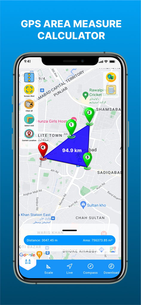
GPS 토지 면적 측정 라이브 앱 인터페이스, 지도에 측정된 다각형 영역과 거리 및 평방 미터 결과 표시
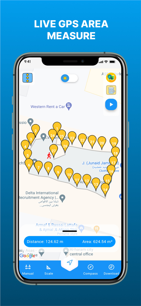
GPS 토지 면적 측정 라이브 앱 스크린샷, 토지 면적 및 거리를 계산하는 핀이 표시된 지도
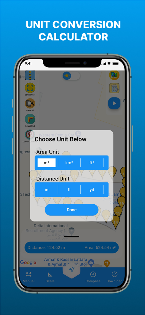
GPS 토지 면적 측정 앱, 지도에서 면적 및 거리 단위 변환 옵션 표시
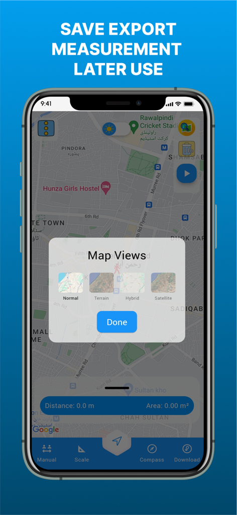
GPS 토지 면적 측정 라이브 앱 인터페이스, 위성 및 지형과 같은 다양한 지도 보기 설정 표시
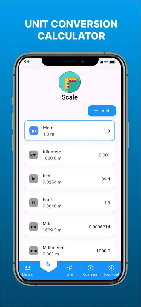
GPS 토지 면적 측정 앱 내 단위 변환 도구, 미터, 킬로미터, 인치, 피트, 마일 단위의 길이 측정 표시
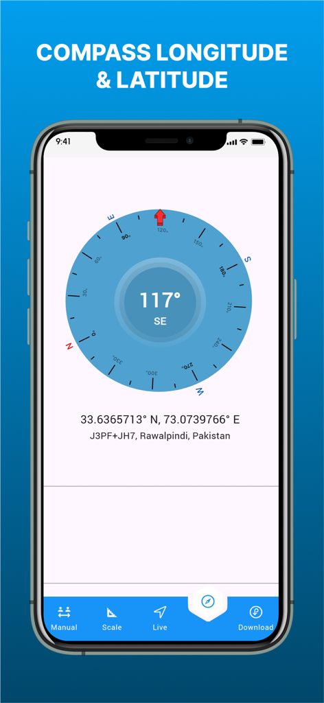
GPS 토지 면적 측정 앱의 경도 및 위도 좌표를 보여주는 디지털 나침반
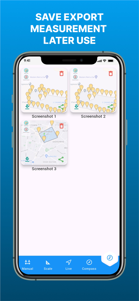
GPS 토지 면적 측정 앱의 저장된 지도 측정 및 내보내기 인터페이스
설명
Download
비슷한 앱
같은 카테고리의 상위 앱

Google Maps
Google LLC

AMap Global
AutoNavi Information Technology Co. Ltd.

Waze Navigation & Live Traffic
waze

百度地图-路线规划,出行必备
Beijing Baidu Netcom Science & Technology Co.,Ltd

Moovit: Bus & Transit Tracker
Moovit App Global LTD

Transit • Subway & Bus Times
9280-0366 Quebec inc.

ParkMobile: Park. Pay. Go.
Parkmobile USA, Inc

腾讯地图-路线规划,导航地铁打车出行
Shenzhen Tencent Computer Systems Company Limited

MapXplorer: Map Radar Navigate
GOLDLAB APPLICATIONS YAZILIM VE BILISIM ANONIM SIRKETI
이 페이지는 앱이나 개발자의 공식 페이지가 아니며, 정보 제공 및 논평을 목적으로 작성된 독립 편집 간행물입니다. 명시적으로 달리 언급되지 않는 한, 해당 앱이나 개발자는 MWM, Apple, Google Play, 앱 퍼블리셔 또는 앱 개발자와 제휴, 보증, 후원, 승인 또는 공식적으로 연결되어 있지 않으며, 이 페이지의 어떤 내용도 해당 앱이 MWM의 서비스를 사용하여 개발되었음을 의미하지 않습니다. 모든 상표, 로고, 스크린샷 및 기타 콘텐츠는 해당 소유자의 자산입니다.