이 페이지는 앱이나 개발자의 공식 페이지가 아니며, 정보 제공 및 논평을 목적으로 작성된 독립 편집 간행물입니다. 명시적으로 달리 언급되지 않는 한, 해당 앱이나 개발자는 MWM, Apple, Google Play, 앱 퍼블리셔 또는 앱 개발자와 제휴, 보증, 후원, 승인 또는 공식적으로 연결되어 있지 않으며, 이 페이지의 어떤 내용도 해당 앱이 MWM의 서비스를 사용하여 개발되었음을 의미하지 않습니다. 모든 상표, 로고, 스크린샷 및 기타 콘텐츠는 해당 소유자의 자산입니다.

GPS海拔高度-海拔高度表,元地球海拔-户外打卡-海拔测量仪
고도, 산소 수준 및 기압에 대한 정밀 추적으로 모든 봉우리를 정복하세요. 등산객과 오버랜더를 위해 설계되었으며, 셀룰러 신호 없이 어디서든 작동합니다.
다운로드
1M+사용자 평점
총 평가 수
63K+개발사
카테고리
Travel지원 언어
1최신 버전
1.2.7크기
46.7 MB출시일
2020년 10월 13일모든 고도를 마스터하세요
가장 야심 찬 오프그리드 모험을 위한 전문가 수준의 고도 추적, 안전 경고 및 환경 데이터.
정밀 오프라인 고도계
셀 서비스에서 수 마일 떨어진 곳에서도 정확한 고도, 좌표 및 기압 데이터를 얻으세요.
실시간 안전 지표
급격한 서부 산악 상승 중 고산병을 앞서 나가기 위해 산소 수준과 대기압을 모니터링하세요.
다음 스크린샷과 설명은 앱의 공식 스토어 목록에서 직접 가져온 것이며 앱 개발자의 자산입니다.
앱 스토어
스크린샷
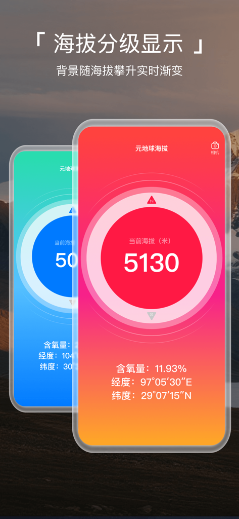
Meta Earth Altimeter 앱이 산소 수준 및 GPS 좌표와 함께 높은 고도 측정을 보여줌
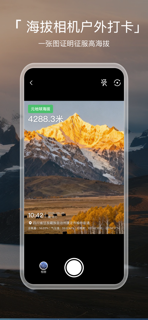
Meta Earth Altimeter 앱 워터마크 카메라가 고도 및 좌표 오버레이가 있는 산봉우리를 표시함
실시간 고도, 산소 수준 및 지리적 좌표를 보여주는 모바일 앱 인터페이스.
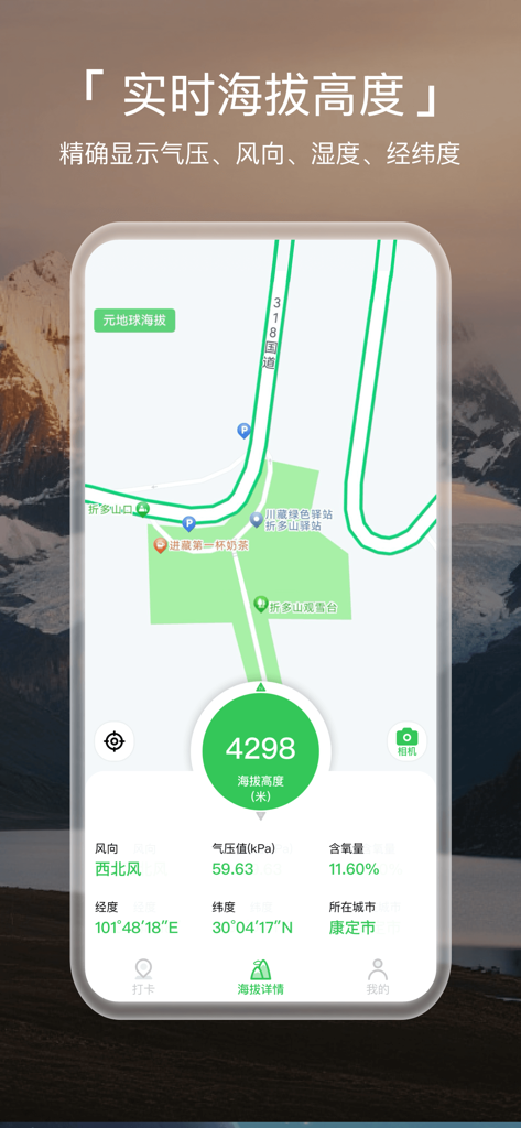
산 배경을 상대로 산소 수준 및 GPS 좌표와 함께 4298미터의 고도를 표시하는 모바일 앱 인터페이스
설명
Download

이 페이지는 앱이나 개발자의 공식 페이지가 아니며, 정보 제공 및 논평을 목적으로 작성된 독립 편집 간행물입니다. 명시적으로 달리 언급되지 않는 한, 해당 앱이나 개발자는 MWM, Apple, Google Play, 앱 퍼블리셔 또는 앱 개발자와 제휴, 보증, 후원, 승인 또는 공식적으로 연결되어 있지 않으며, 이 페이지의 어떤 내용도 해당 앱이 MWM의 서비스를 사용하여 개발되었음을 의미하지 않습니다. 모든 상표, 로고, 스크린샷 및 기타 콘텐츠는 해당 소유자의 자산입니다.