이 페이지는 앱이나 개발자의 공식 페이지가 아니며, 정보 제공 및 논평을 목적으로 작성된 독립 편집 간행물입니다. 명시적으로 달리 언급되지 않는 한, 해당 앱이나 개발자는 MWM, Apple, Google Play, 앱 퍼블리셔 또는 앱 개발자와 제휴, 보증, 후원, 승인 또는 공식적으로 연결되어 있지 않으며, 이 페이지의 어떤 내용도 해당 앱이 MWM의 서비스를 사용하여 개발되었음을 의미하지 않습니다. 모든 상표, 로고, 스크린샷 및 기타 콘텐츠는 해당 소유자의 자산입니다.

GPX Viewer-Converter-Tracking
야외 활동 데이터를 완벽하게 제어하세요. 정밀한 매핑, 웨이포인트 관리 및 원격지 모험을 위한 완벽한 오프라인 지원을 통해 GPS 트랙을 원활하게 가져오고, 변환하고, 기록할 수 있습니다.
다운로드
57K+사용자 평점
총 평가 수
0개발사
카테고리
Navigation지원 언어
1최신 버전
1.7.8크기
13.5 MB출시일
2016년 9월 15일모든 모험을 위한 프로급 GPS 도구
야외 활동 애호가를 위한 실용적인 궁극의 유틸리티입니다. 데이터에 대한 완벽한 제어를 원하는 등산객, 자전거 이용자 및 오프로더를 위해 설계된 강력한 도구로 GPX 파일을 보고, 추적하고, 변환하세요.
정밀 실시간 추적
속도, 시간, 거리에 대한 실시간 지표로 모든 움직임을 기록하세요. 오프그리드 상태에서도 완벽하게 작동하는 고정밀 파란색 선으로 경로를 추적하세요.
원활한 파일 관리
이메일, 웹 링크 또는 iTunes를 통해 .gpx 파일을 가져오고 내보낼 수 있습니다. 독점적인 소셜 생태계나 구독 플랫폼에 얽매이지 않고 데이터 주권을 완벽하게 유지하세요.
다음 스크린샷과 설명은 앱의 공식 스토어 목록에서 직접 가져온 것이며 앱 개발자의 자산입니다.
앱 스토어
스크린샷
파란색 추적 선과 빨간색 웨이포인트 마커를 보여주는 GPX 뷰어 앱의 지도 보기
파란색 경로와 빨간색 웨이포인트 및 여행 통계를 표시하는 GPS 추적 지도
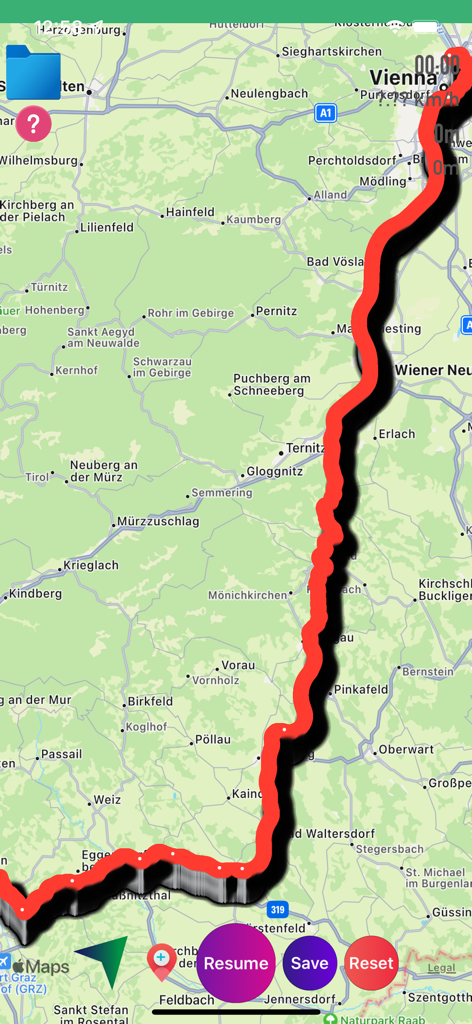
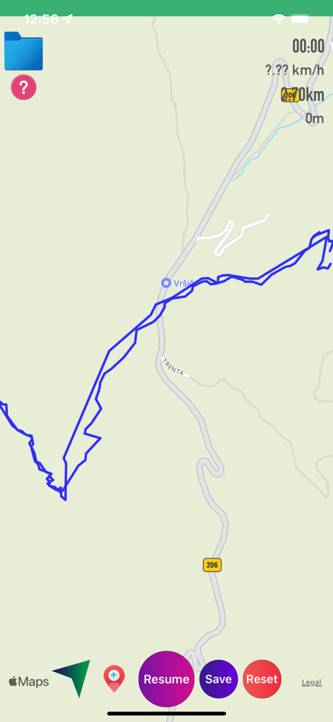
제어 버튼과 함께 지도상에 빨간색으로 추적된 경로를 표시하는 GPX 뷰어 앱의 인터페이스
마커와 통계가 포함된 추적 경로를 표시하는 GPX 뷰어 앱 지도.
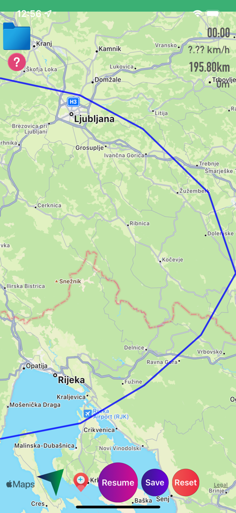
거리 및 속도 통계와 함께 지도상에 파란색 경로 트랙을 보여주는 GPX 뷰어 앱 인터페이스
재개 및 저장 제어 기능과 함께 파란색 GPS 트랙 선을 보여주는 지도 인터페이스
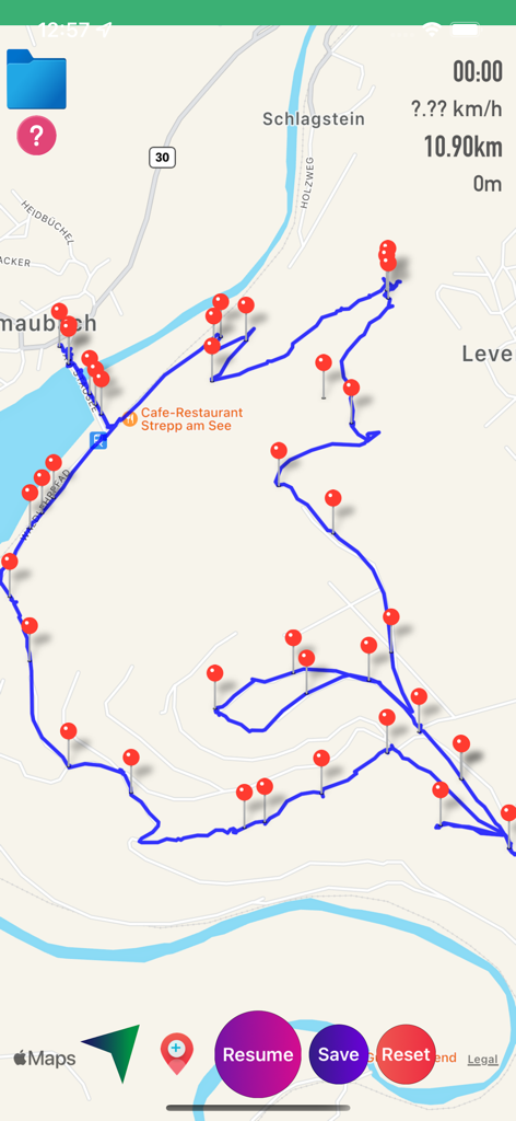
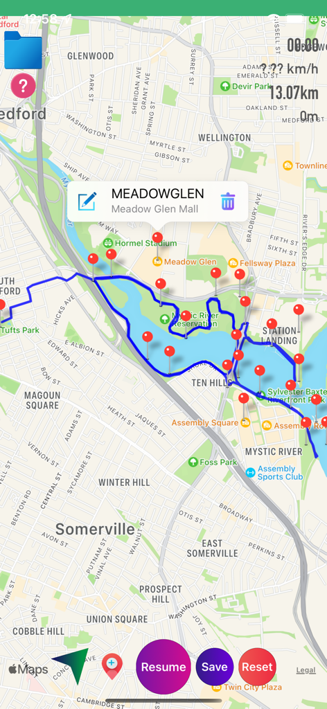
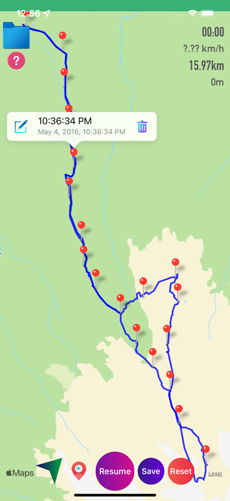
여러 개의 빨간색 핀 마커와 경로 통계와 함께 파란색 GPS 트랙을 표시하는 GPX 뷰어 앱의 지도 화면
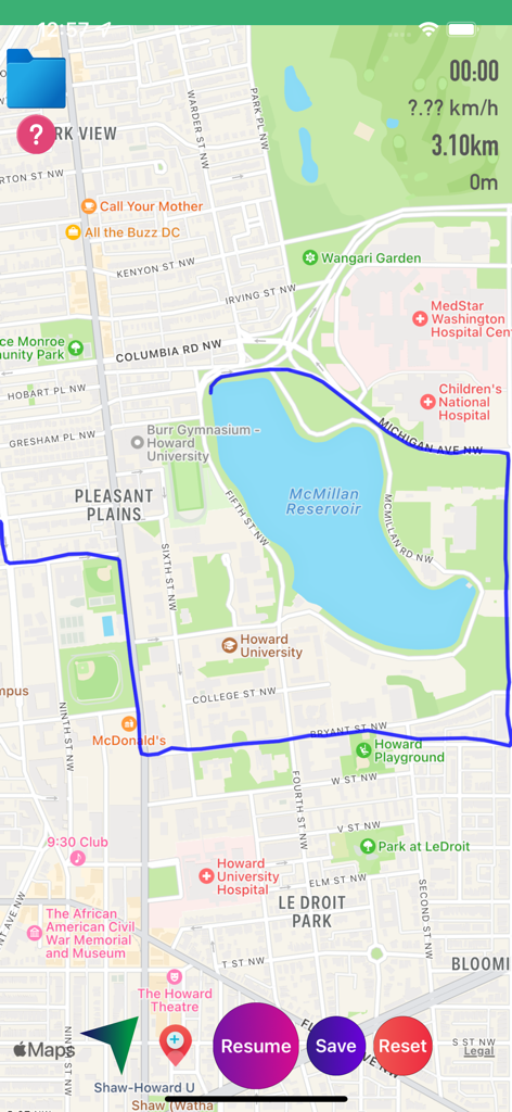
실시간 통계 및 내비게이션 버튼과 함께 맥밀란 저수지 주변의 추적된 경로를 표시하는 GPX 뷰어 앱의 지도 화면
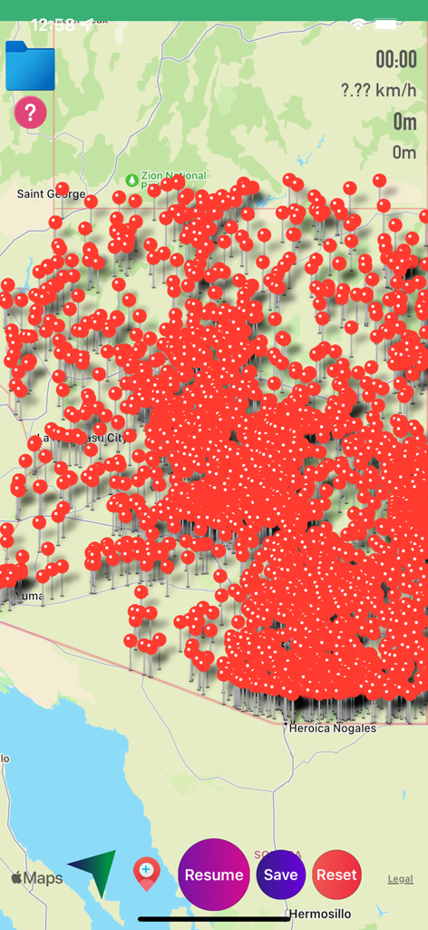
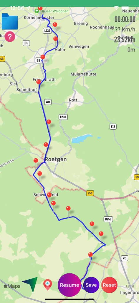
내비게이션 및 경로 추적을 위한 빨간색 핀 웨이포인트로 가득 찬 GPX 뷰어 앱의 지도 인터페이스.
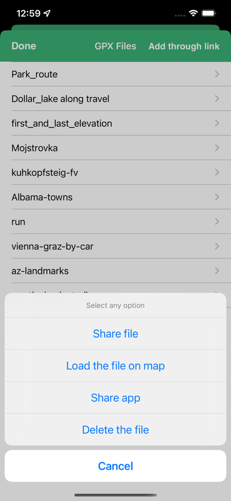
트랙 공유, 로드 또는 삭제를 위한 메뉴가 있는 GPX 파일 관리 화면
설명
Download
비슷한 앱
같은 카테고리의 상위 앱

Google Maps
Google LLC

Waze Navigation & Live Traffic
waze

AMap Global
AutoNavi Information Technology Co. Ltd.

百度地图-路线规划,出行必备
Beijing Baidu Netcom Science & Technology Co.,Ltd

Moovit: Bus & Transit Tracker
Moovit App Global LTD

Transit • Subway & Bus Times
9280-0366 Quebec inc.

ParkMobile: Park. Pay. Go.
Parkmobile USA, Inc

腾讯地图-路线规划,导航地铁打车出行
Shenzhen Tencent Computer Systems Company Limited

Île-de-France Mobilités
Ile de France Mobilites
이 페이지는 앱이나 개발자의 공식 페이지가 아니며, 정보 제공 및 논평을 목적으로 작성된 독립 편집 간행물입니다. 명시적으로 달리 언급되지 않는 한, 해당 앱이나 개발자는 MWM, Apple, Google Play, 앱 퍼블리셔 또는 앱 개발자와 제휴, 보증, 후원, 승인 또는 공식적으로 연결되어 있지 않으며, 이 페이지의 어떤 내용도 해당 앱이 MWM의 서비스를 사용하여 개발되었음을 의미하지 않습니다. 모든 상표, 로고, 스크린샷 및 기타 콘텐츠는 해당 소유자의 자산입니다.