이 페이지는 앱이나 개발자의 공식 페이지가 아니며, 정보 제공 및 논평을 목적으로 작성된 독립 편집 간행물입니다. 명시적으로 달리 언급되지 않는 한, 해당 앱이나 개발자는 MWM, Apple, Google Play, 앱 퍼블리셔 또는 앱 개발자와 제휴, 보증, 후원, 승인 또는 공식적으로 연결되어 있지 않으며, 이 페이지의 어떤 내용도 해당 앱이 MWM의 서비스를 사용하여 개발되었음을 의미하지 않습니다. 모든 상표, 로고, 스크린샷 및 기타 콘텐츠는 해당 소유자의 자산입니다.

Hill Lists
헌신적인 도보 여행자를 위해 제작된 앱으로 Munro, Wainwright 및 20,000개 이상의 봉우리에서 진행 상황을 추적하세요. 다음 해외 모험을 계획하고, 모든 등반을 기록하고, 평생의 등산을 업적의 유산으로 만드세요.
다운로드
68K+사용자 평점
총 평가 수
600개발사
카테고리
Navigation지원 언어
1최신 버전
7.8크기
43.5 MB출시일
2009년 5월 25일정밀하게 모든 봉우리 정복
헌신적인 봉우리 등반가를 위한 궁극의 동반자입니다. 스코틀랜드 고지대부터 레이크 디스트릭트까지, 등산 목표를 기록된 업적의 평생으로 바꾸세요.
20,000개 봉우리, 90개 이상의 공식 목록
영국 및 아일랜드 봉우리들의 결정적인 데이터베이스에 액세스하세요. 영국 및 아일랜드 봉우리 공식 데이터베이스에서 동기화된 데이터를 사용하여 Munro, Wainwright 등을 추적하세요.
전략적인 원정 계획
해외 여행객에게 적합합니다. 해외에서 다음 여행을 계획하고, 현지 MWIS 날씨 예보를 확인하고, 부츠를 챙기기 전에 전문가 경로 가이드에 액세스하세요.
다음 스크린샷과 설명은 앱의 공식 스토어 목록에서 직접 가져온 것이며 앱 개발자의 자산입니다.
앱 스토어
스크린샷
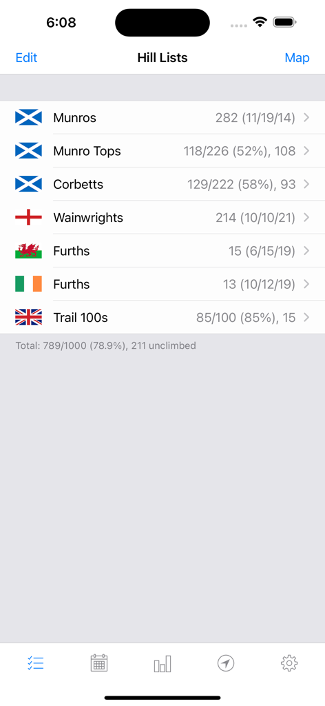
Hill Lists 앱의 대시보드로 Munro, Corbetts, Wainwright 및 기타 영국 봉우리 범주에 대한 완료 통계를 표시합니다.
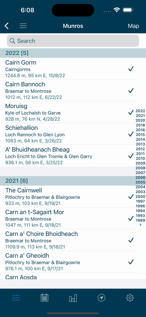
Hill Lists 앱에서 날짜와 체크 표시가 있는 완료된 Munro 봉우리 목록입니다.
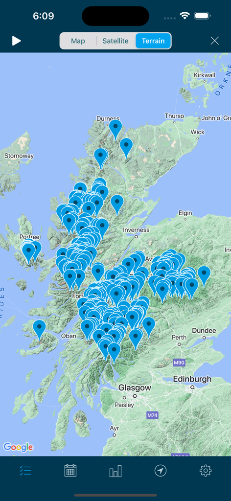
Hill Lists 앱의 스코틀랜드 지형 지도로, 봉우리와 산 위치를 나타내는 수많은 파란색 핀이 표시되어 있습니다.
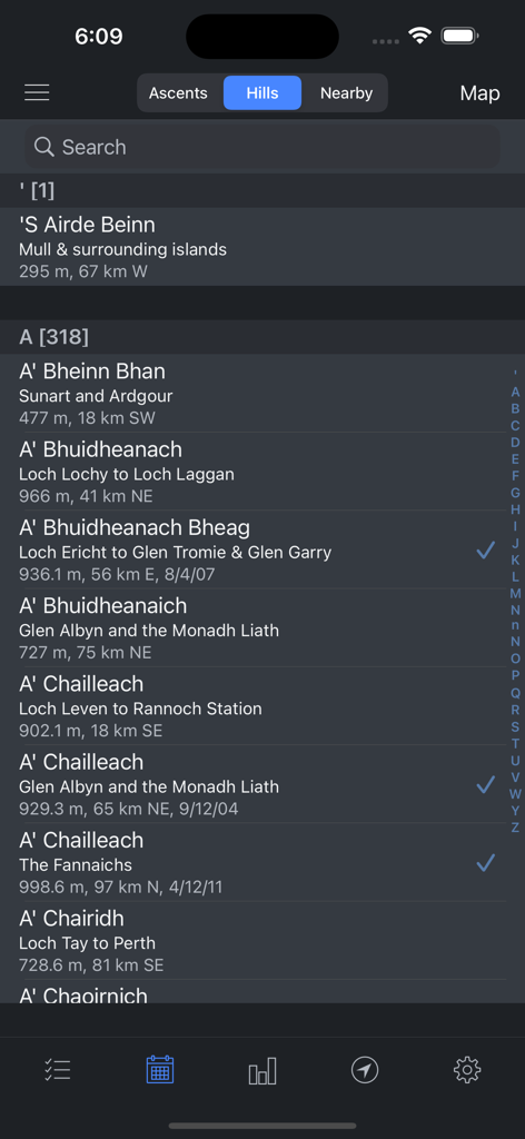
완결 체크 표시와 높이가 있는 스코틀랜드 봉우리 검색 가능한 데이터베이스를 보여주는 모바일 앱 인터페이스입니다.
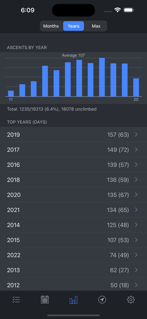
연도별 등반 횟수를 보여주는 막대 차트와 목록이 있는 Hill Lists 앱의 통계 화면입니다.
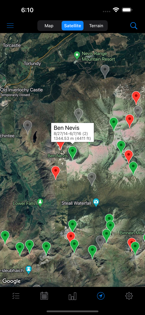
Ben Nevis에 대한 다양한 산 핀과 세부 정보가 표시된 Hill Lists 앱의 위성 지도 보기입니다.
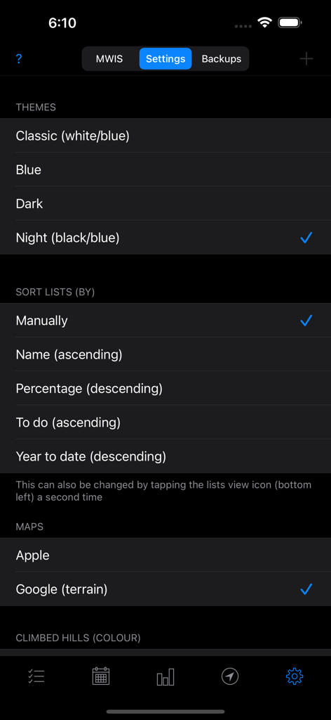
테마, 목록 정렬 및 지도 공급자 선택 옵션을 보여주는 Hill Lists 앱의 설정 화면입니다.
설명
Download
비슷한 앱
같은 카테고리의 상위 앱

Google Maps
Google LLC

Waze Navigation & Live Traffic
waze

AMap Global
AutoNavi Information Technology Co. Ltd.

百度地图-路线规划,出行必备
Beijing Baidu Netcom Science & Technology Co.,Ltd

Moovit: Bus & Transit Tracker
Moovit App Global LTD

Transit • Subway & Bus Times
9280-0366 Quebec inc.

ParkMobile: Park. Pay. Go.
Parkmobile USA, Inc

腾讯地图-路线规划,导航地铁打车出行
Shenzhen Tencent Computer Systems Company Limited

Île-de-France Mobilités
Ile de France Mobilites
이 페이지는 앱이나 개발자의 공식 페이지가 아니며, 정보 제공 및 논평을 목적으로 작성된 독립 편집 간행물입니다. 명시적으로 달리 언급되지 않는 한, 해당 앱이나 개발자는 MWM, Apple, Google Play, 앱 퍼블리셔 또는 앱 개발자와 제휴, 보증, 후원, 승인 또는 공식적으로 연결되어 있지 않으며, 이 페이지의 어떤 내용도 해당 앱이 MWM의 서비스를 사용하여 개발되었음을 의미하지 않습니다. 모든 상표, 로고, 스크린샷 및 기타 콘텐츠는 해당 소유자의 자산입니다.