이 페이지는 앱이나 개발자의 공식 페이지가 아니며, 정보 제공 및 논평을 목적으로 작성된 독립 편집 간행물입니다. 명시적으로 달리 언급되지 않는 한, 해당 앱이나 개발자는 MWM, Apple, Google Play, 앱 퍼블리셔 또는 앱 개발자와 제휴, 보증, 후원, 승인 또는 공식적으로 연결되어 있지 않으며, 이 페이지의 어떤 내용도 해당 앱이 MWM의 서비스를 사용하여 개발되었음을 의미하지 않습니다. 모든 상표, 로고, 스크린샷 및 기타 콘텐츠는 해당 소유자의 자산입니다.

iSailGPS : NOAA USA RNC Charts
구독료, 광고, 개인 정보 침해 없이 미국 해안 수역을 위한 신뢰할 수 있는 오프라인 항해 차트. Practical Sailor "최고의 선택" 수상 경력에 빛나는 해안 크루징 및 레이싱 앱.
다운로드
206K+사용자 평점
총 평가 수
100개발사
카테고리
Navigation지원 언어
1최신 버전
9.6.6크기
10.4 MB출시일
2011년 4월 29일구독료 없는 전문 해양 내비게이션
공식 NOAA 래스터 항해 차트를 사용하여 장치를 고성능 GPS 수신기로 전환하세요. 신뢰할 수 있고 개인 정보 보호에 중점을 두었으며 자립적인 항해사를 위해 설계되었습니다.
정통 래스터 해도
전통적인 종이 차트의 비교할 수 없는 디테일을 얻으세요. 벡터 지도와 달리 당사의 고해상도 RNC 차트는 베테랑 항해사들이 신뢰하는 전문적인 지도 제작 깊이와 메모를 제공합니다.
100% 오프라인 신뢰성
셀룰러 신호 없이 안전하게 항해하세요. 최대 2,200개의 차트를 장치에 직접 다운로드하고 저장하여 어떤 날씨에서도 해상 여행 또는 비상 상황에 대비할 수 있습니다.
다음 스크린샷과 설명은 앱의 공식 스토어 목록에서 직접 가져온 것이며 앱 개발자의 자산입니다.
앱 스토어
스크린샷
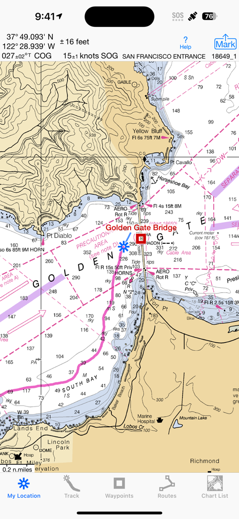
iSailGPS 내비게이션 앱에서 샌프란시스코 입구의 NOAA 래스터 항해 차트를 보여줍니다.
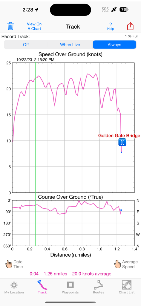
iSailGPS 앱 스크린샷은 금문교 근처에서 지면 속도 및 지면 코스 그래프와 함께 항해 트랙 데이터를 보여줍니다.
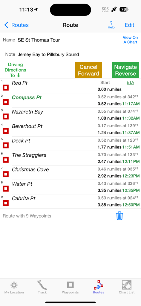
iSailGPS 앱 인터페이스는 거리 및 ETA 데이터와 함께 항해 경로의 내비게이션 웨이포인트 목록을 보여줍니다.
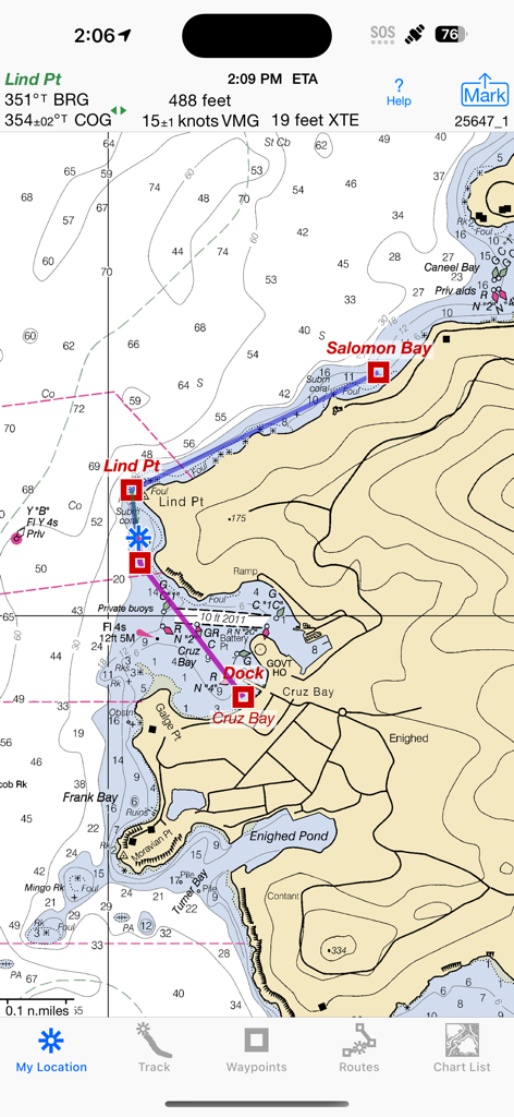
iSailGPS 앱은 내비게이션 측정값 및 경로 웨이포인트와 함께 상세한 NOAA 래스터 항해 차트를 보여줍니다.
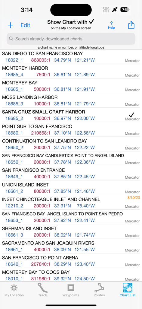
iSailGPS 앱의 캘리포니아용 다운로드된 NOAA 항해 차트 목록입니다.
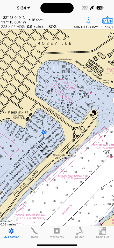
iSailGPS 앱은 샌디에이고 만의 상세한 NOAA 래스터 항해 차트를 보여줍니다.

iSailGPS 앱은 공유 및 웨이포인트 추가 메뉴가 열려 있는 NOAA 래스터 항해 차트를 보여줍니다.
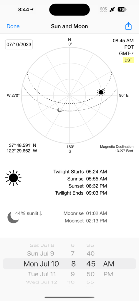
iSailGPS 앱 화면은 천문 항해를 위한 일출, 일몰 및 달 위상 데이터와 함께 태양 및 달 위치를 표시합니다.
설명
Download
비슷한 앱
같은 카테고리의 상위 앱

Google Maps
Google LLC

Waze Navigation & Live Traffic
waze

AMap Global
AutoNavi Information Technology Co. Ltd.

百度地图-路线规划,出行必备
Beijing Baidu Netcom Science & Technology Co.,Ltd

Moovit: Bus & Transit Tracker
Moovit App Global LTD

Transit • Subway & Bus Times
9280-0366 Quebec inc.

ParkMobile: Park. Pay. Go.
Parkmobile USA, Inc

腾讯地图-路线规划,导航地铁打车出行
Shenzhen Tencent Computer Systems Company Limited

Île-de-France Mobilités
Ile de France Mobilites
이 페이지는 앱이나 개발자의 공식 페이지가 아니며, 정보 제공 및 논평을 목적으로 작성된 독립 편집 간행물입니다. 명시적으로 달리 언급되지 않는 한, 해당 앱이나 개발자는 MWM, Apple, Google Play, 앱 퍼블리셔 또는 앱 개발자와 제휴, 보증, 후원, 승인 또는 공식적으로 연결되어 있지 않으며, 이 페이지의 어떤 내용도 해당 앱이 MWM의 서비스를 사용하여 개발되었음을 의미하지 않습니다. 모든 상표, 로고, 스크린샷 및 기타 콘텐츠는 해당 소유자의 자산입니다.