이 페이지는 앱이나 개발자의 공식 페이지가 아니며, 정보 제공 및 논평을 목적으로 작성된 독립 편집 간행물입니다. 명시적으로 달리 언급되지 않는 한, 해당 앱이나 개발자는 MWM, Apple, Google Play, 앱 퍼블리셔 또는 앱 개발자와 제휴, 보증, 후원, 승인 또는 공식적으로 연결되어 있지 않으며, 이 페이지의 어떤 내용도 해당 앱이 MWM의 서비스를 사용하여 개발되었음을 의미하지 않습니다. 모든 상표, 로고, 스크린샷 및 기타 콘텐츠는 해당 소유자의 자산입니다.

Kent Connected
Kent 지역 최고의 여정 플래너. 실시간 대중교통 시간을 확인하고, 고도 정보를 포함한 자전거 경로를 탐색하고, CO2 절감량과 소모 칼로리를 실시간으로 추적하세요.
다운로드
14K+사용자 평점
총 평가 수
0개발사
카테고리
Navigation지원 언어
1최신 버전
2.7.1크기
14.8 MB출시일
2017년 7월 23일더 스마트한 이동 방식
Kent Connected를 통해 건강, 지갑, 환경에 모두 유익한 이동 방식을 선택할 수 있습니다.
실시간 대중교통 추적
실시간 도착 정보를 통해 불확실성을 줄이고 하루 일정을 원활하게 유지하세요.
건강 중심 내비게이션
고도 정보를 포함한 상세한 도보 및 자전거 지도를 사용하여 통근 시간을 운동 시간으로 만드세요.
다음 스크린샷과 설명은 앱의 공식 스토어 목록에서 직접 가져온 것이며 앱 개발자의 자산입니다.
앱 스토어
스크린샷
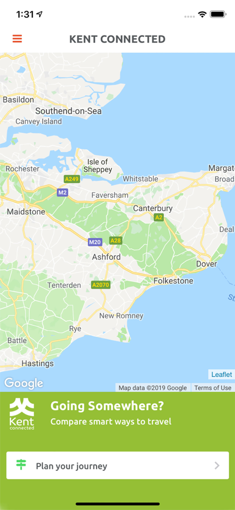
Kent Connected 여정 계획 앱 내의 Kent 지도
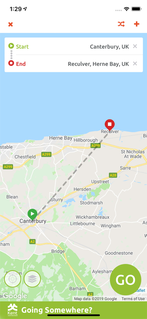
캔터베리에서 레컬버까지의 이동 경로를 보여주는 Kent Connected 앱 인터페이스
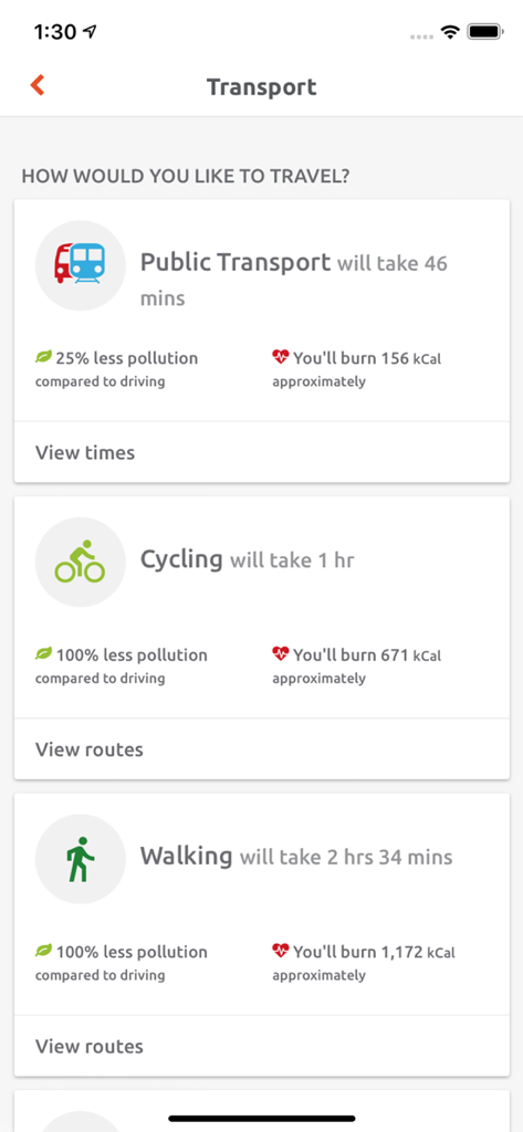
다양한 교통 수단의 이동 시간, 환경 영향 및 칼로리 소모량을 표시하는 Kent Connected 앱 인터페이스
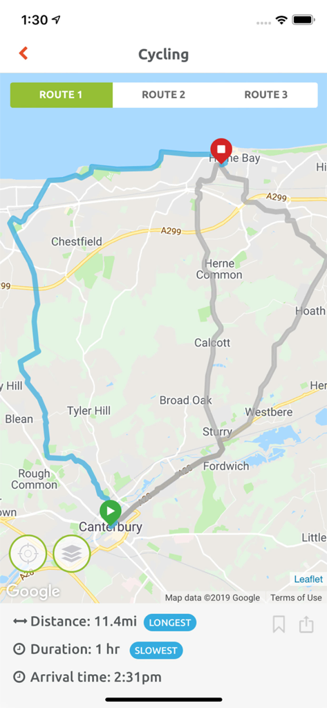
캔터베리에서 헐른 베이까지의 거리 및 시간 정보가 포함된 자전거 경로 지도를 보여주는 Kent Connected 앱 인터페이스
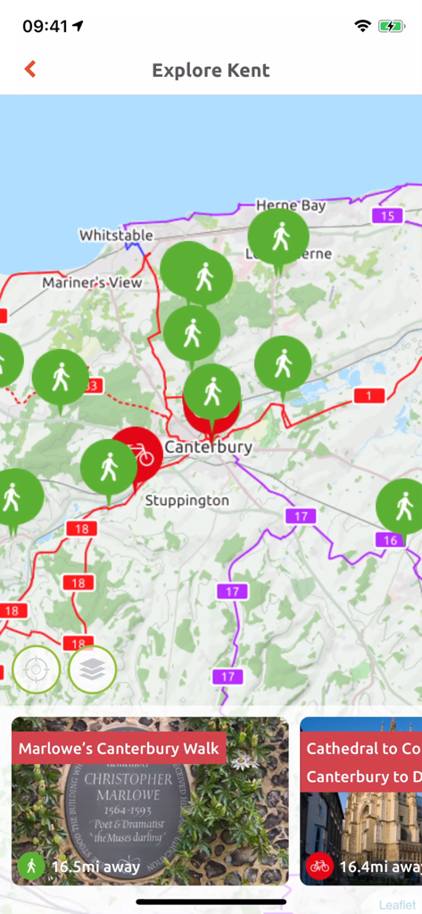
Kent Connected 앱에서 도보 및 자전거 경로를 표시하는 인터랙티브 지도
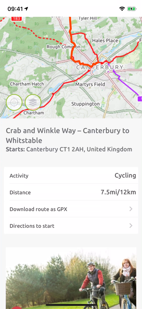
캔터베리에서 위츠테이블까지의 Crab and Winkle Way를 보여주는 Kent Connected 앱의 자전거 경로 지도
설명
Download
비슷한 앱
같은 카테고리의 상위 앱

Google Maps
Google LLC

AMap Global
AutoNavi Information Technology Co. Ltd.

Waze Navigation & Live Traffic
waze

百度地图-路线规划,出行必备
Beijing Baidu Netcom Science & Technology Co.,Ltd

Moovit: Bus & Transit Tracker
Moovit App Global LTD

Transit • Subway & Bus Times
9280-0366 Quebec inc.

ParkMobile: Park. Pay. Go.
Parkmobile USA, Inc

腾讯地图-路线规划,导航地铁打车出行
Shenzhen Tencent Computer Systems Company Limited

MapXplorer: Map Radar Navigate
GOLDLAB APPLICATIONS YAZILIM VE BILISIM ANONIM SIRKETI
이 페이지는 앱이나 개발자의 공식 페이지가 아니며, 정보 제공 및 논평을 목적으로 작성된 독립 편집 간행물입니다. 명시적으로 달리 언급되지 않는 한, 해당 앱이나 개발자는 MWM, Apple, Google Play, 앱 퍼블리셔 또는 앱 개발자와 제휴, 보증, 후원, 승인 또는 공식적으로 연결되어 있지 않으며, 이 페이지의 어떤 내용도 해당 앱이 MWM의 서비스를 사용하여 개발되었음을 의미하지 않습니다. 모든 상표, 로고, 스크린샷 및 기타 콘텐츠는 해당 소유자의 자산입니다.