이 페이지는 앱이나 개발자의 공식 페이지가 아니며, 정보 제공 및 논평을 목적으로 작성된 독립 편집 간행물입니다. 명시적으로 달리 언급되지 않는 한, 해당 앱이나 개발자는 MWM, Apple, Google Play, 앱 퍼블리셔 또는 앱 개발자와 제휴, 보증, 후원, 승인 또는 공식적으로 연결되어 있지 않으며, 이 페이지의 어떤 내용도 해당 앱이 MWM의 서비스를 사용하여 개발되었음을 의미하지 않습니다. 모든 상표, 로고, 스크린샷 및 기타 콘텐츠는 해당 소유자의 자산입니다.

Kml Viewer-Kml Converter app
이동 중에도 KML 파일을 보고, 변환하고, 생성할 수 있는 올인원 도구입니다. 온라인이든 오프라인이든 어디서나 데스크톱 GIS 데이터와 모바일 워크플로우를 원활하게 연결하세요.
다운로드
116K+사용자 평점
총 평가 수
0개발사
카테고리
Navigation지원 언어
1최신 버전
2.0.3크기
2.0 MB출시일
2016년 6월 10일현장에서 공간 데이터를 완벽하게 제어하세요
데스크톱 GIS 소프트웨어와 모바일 작업 사이의 전문적인 가교 역할을 합니다. KML 데이터를 정밀하게 보고, 생성하고, 관리하세요.
원활한 워크플로우 통합
이메일, WhatsApp 또는 iCloud Drive에서 KML 파일을 즉시 엽니다. iTunes 파일 공유를 통해 복잡한 현장 프로젝트를 위한 대규모 데이터 세트를 손쉽게 동기화하세요.
현장 데이터 수집
지리적 지점을 실시간으로 캡처합니다. 길게 눌러 마커를 찍고, 사용자 정의 이름을 추가하고, 사무실로 보낼 새 KML 파일을 생성하세요.
다음 스크린샷과 설명은 앱의 공식 스토어 목록에서 직접 가져온 것이며 앱 개발자의 자산입니다.
앱 스토어
스크린샷
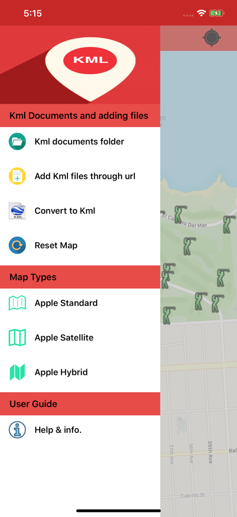
지도 인터페이스 위에 파일 관리 및 지도 유형 옵션이 표시된 KML 뷰어 및 컨버터 앱의 사이드바 메뉴.
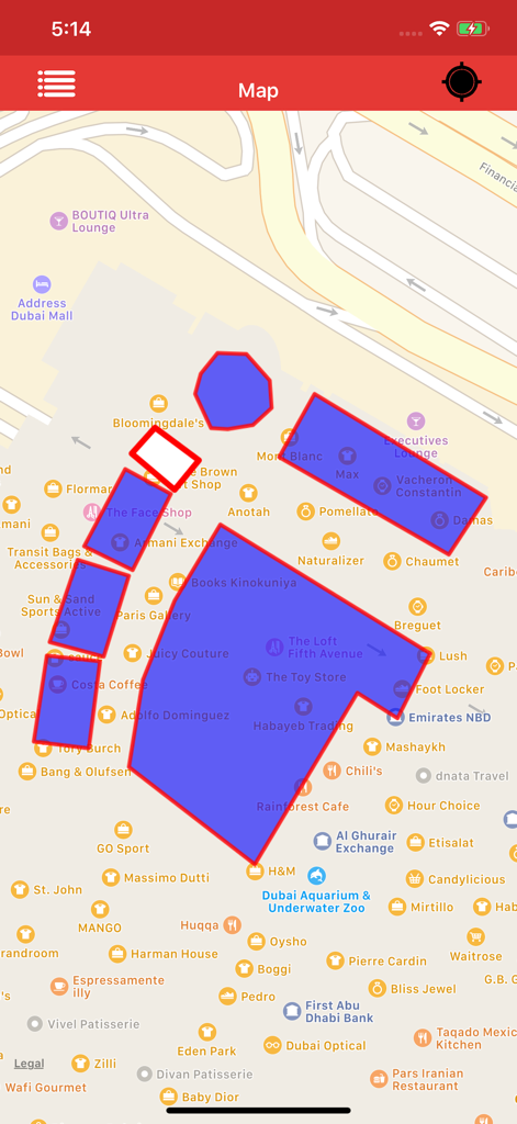
지도에 파란색 폴리곤 오버레이를 표시하는 KML 뷰어 앱 인터페이스
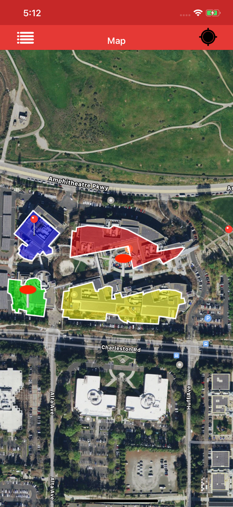
건물 배치도를 나타내는 색상화된 KML 폴리곤과 마커가 있는 위성 지도 보기
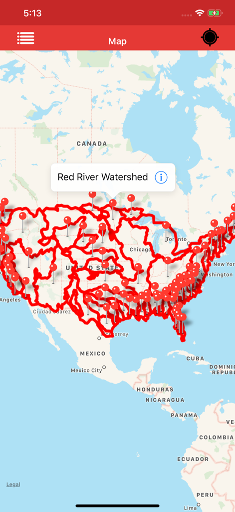
미국 전역의 레드강 유역(Red River Watershed)에 대한 상세한 빨간색 지도 오버레이와 마커를 표시하는 KML 뷰어 앱
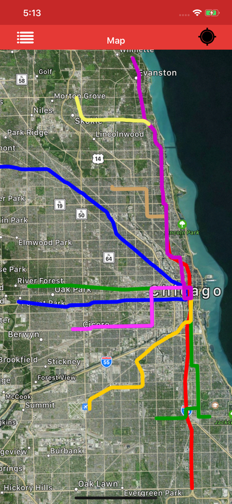
도시 지역의 데이터를 나타내는 여러 색상의 KML 경로 오버레이가 있는 위성 지도 보기
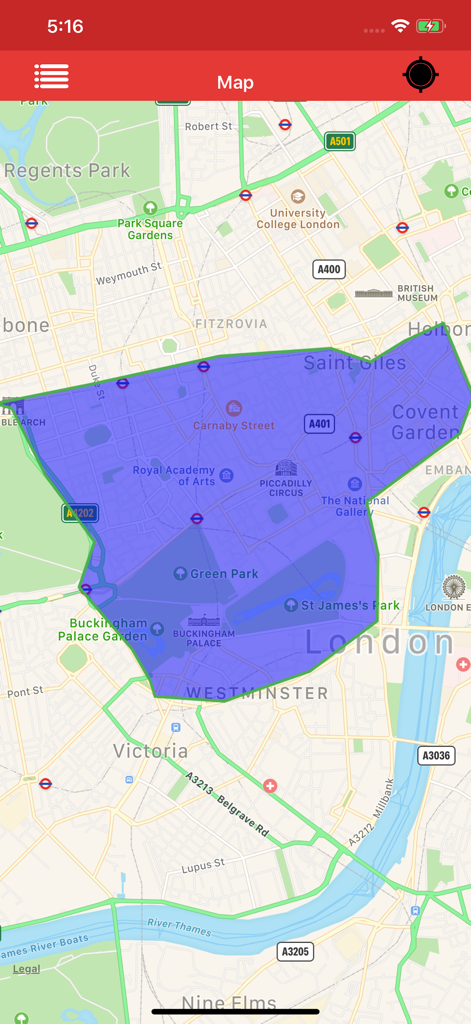
런던 중심부 지도에 대형 파란색 폴리곤 오버레이를 표시하는 KML 뷰어 앱의 스크린샷
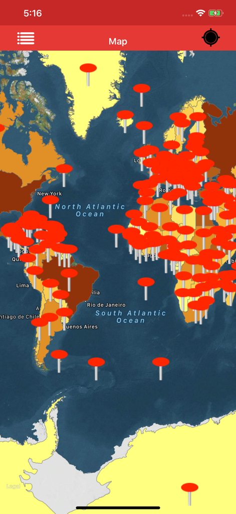
KML 뷰어 앱에서 여러 개의 빨간색 위치 마커를 보여주는 세계 지도 인터페이스
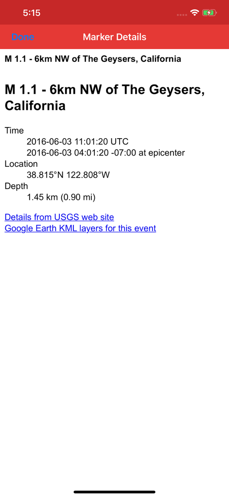
지리 좌표 및 위치 정보를 보여주는 KML 뷰어 앱의 상세 마커 보기
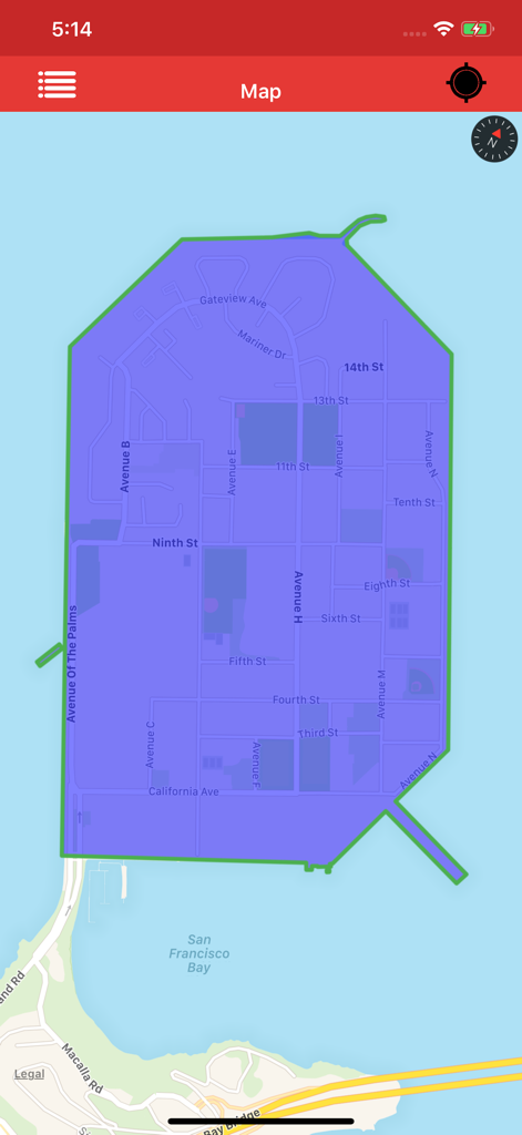
샌프란시스코 트레저 아일랜드 지도에 파란색 폴리곤 오버레이를 표시하는 KML 뷰어 앱
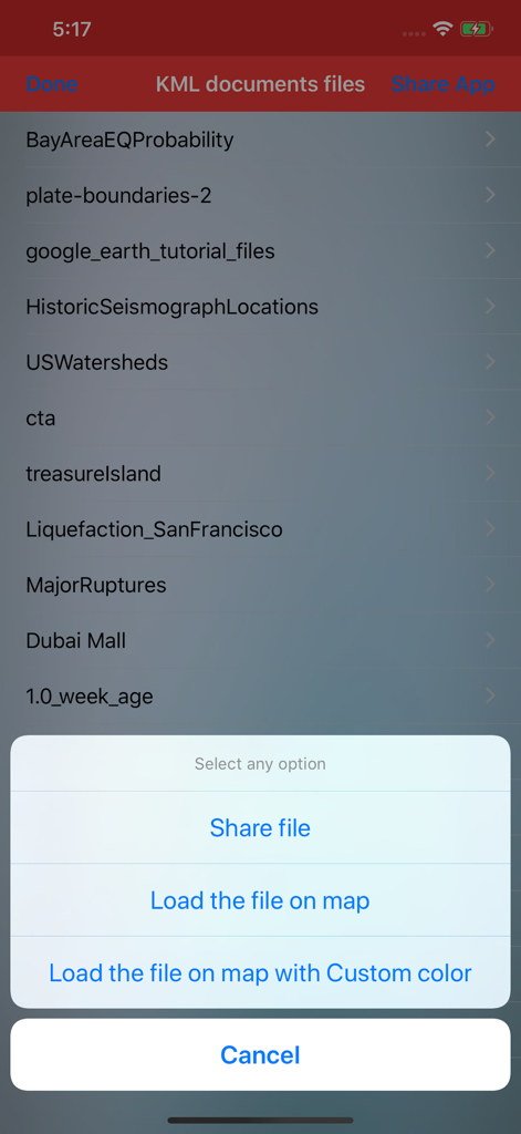
문서 목록과 지도에 파일을 공유하거나 불러오는 옵션이 있는 팝업 메뉴를 보여주는 KML 뷰어 앱 인터페이스.
설명
Download
비슷한 앱
같은 카테고리의 상위 앱

Google Maps
Google LLC

Waze Navigation & Live Traffic
waze

AMap Global
AutoNavi Information Technology Co. Ltd.

百度地图-路线规划,出行必备
Beijing Baidu Netcom Science & Technology Co.,Ltd

Moovit: Bus & Transit Tracker
Moovit App Global LTD

Transit • Subway & Bus Times
9280-0366 Quebec inc.

ParkMobile: Park. Pay. Go.
Parkmobile USA, Inc

腾讯地图-路线规划,导航地铁打车出行
Shenzhen Tencent Computer Systems Company Limited

Île-de-France Mobilités
Ile de France Mobilites
이 페이지는 앱이나 개발자의 공식 페이지가 아니며, 정보 제공 및 논평을 목적으로 작성된 독립 편집 간행물입니다. 명시적으로 달리 언급되지 않는 한, 해당 앱이나 개발자는 MWM, Apple, Google Play, 앱 퍼블리셔 또는 앱 개발자와 제휴, 보증, 후원, 승인 또는 공식적으로 연결되어 있지 않으며, 이 페이지의 어떤 내용도 해당 앱이 MWM의 서비스를 사용하여 개발되었음을 의미하지 않습니다. 모든 상표, 로고, 스크린샷 및 기타 콘텐츠는 해당 소유자의 자산입니다.