이 페이지는 앱이나 개발자의 공식 페이지가 아니며, 정보 제공 및 논평을 목적으로 작성된 독립 편집 간행물입니다. 명시적으로 달리 언급되지 않는 한, 해당 앱이나 개발자는 MWM, Apple, Google Play, 앱 퍼블리셔 또는 앱 개발자와 제휴, 보증, 후원, 승인 또는 공식적으로 연결되어 있지 않으며, 이 페이지의 어떤 내용도 해당 앱이 MWM의 서비스를 사용하여 개발되었음을 의미하지 않습니다. 모든 상표, 로고, 스크린샷 및 기타 콘텐츠는 해당 소유자의 자산입니다.

Mergin Maps: QGIS in pocket
모바일 장치를 전문 측량 도구로 바꿔보세요. 정확한 GPS 데이터와 지능형 양식을 오프라인에서 캡처한 다음, 몇 초 안에 QGIS 데스크톱으로 직접 동기화하세요.
다운로드
13K+사용자 평점
총 평가 수
0개발사
카테고리
Utilities지원 언어
22최신 버전
2025.8.0크기
130.0 MB출시일
2019년 11월 16일현장 워크플로우 간소화
QGIS 환경과 완벽하게 통합된 상태에서 모바일 장치에서 직접 전문적인 수준의 GIS 데이터를 손쉽게 캡처, 동기화 및 관리하세요.
완벽한 QGIS 통합
모바일 맵 레이어가 데스크톱 QGIS 프로젝트와 똑같이 보이고 작동합니다. 케이블이나 복잡한 변환 없이 직접적이고 손쉬운 동기화만 제공됩니다.
안정적인 오프라인 데이터 캡처
셀룰러 서비스가 없는 원격지에서도 작업하세요. GPS 데이터, 사진 및 메모를 오프라인에서 캡처한 다음 몇 초 안에 사무실로 다시 동기화하세요.
다음 스크린샷과 설명은 앱의 공식 스토어 목록에서 직접 가져온 것이며 앱 개발자의 자산입니다.
앱 스토어
스크린샷
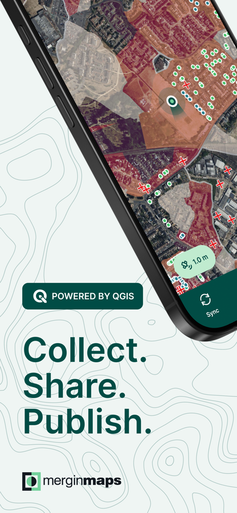
Mergin Maps 앱 화면에 지형 매핑 및 현장 데이터 수집이 표시됨
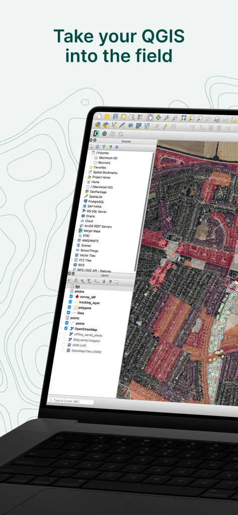
QGIS 데스크톱 소프트웨어 인터페이스가 상세한 위성 지도 및 지리적 레이어와 함께 표시되고 'QGIS를 현장으로 가져가세요'라는 제목이 붙은 노트북
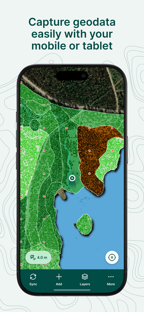
Mergin Maps 모바일 앱에 지리 정보 시스템(GIS) 지도와 토지 피복 레이어, 데이터 캡처 인터페이스가 표시됨
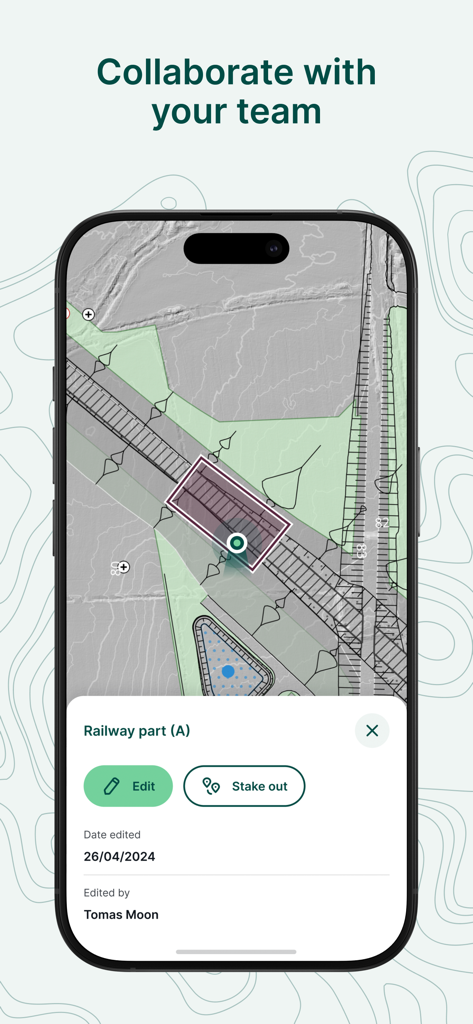
Mergin Maps 모바일 앱 인터페이스에 철도 프로젝트에 대한 협업 현장 데이터 수집 및 편집이 표시됨
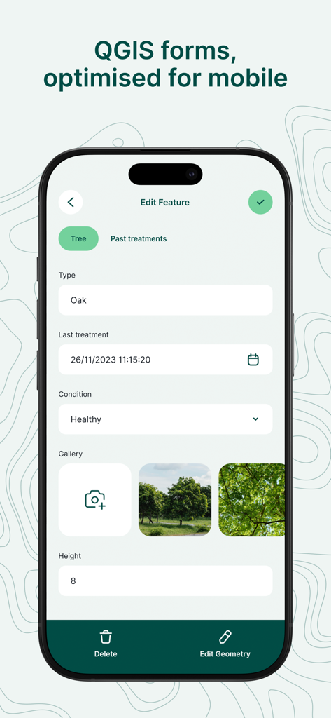
Mergin Maps의 모바일 인터페이스에 나무 유형 및 상태에 대한 데이터 입력 필드가 있는 전문 현장 조사 양식이 표시됨
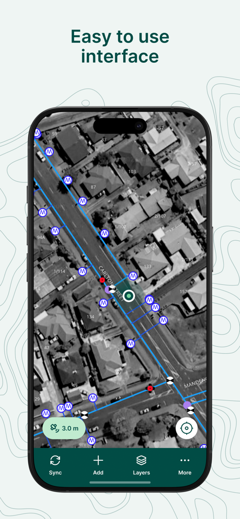
Mergin Maps 모바일 앱 스크린샷에 전문 GIS 조사 마커 및 데이터 선이 있는 사용하기 쉬운 위성 지도 인터페이스가 표시됨
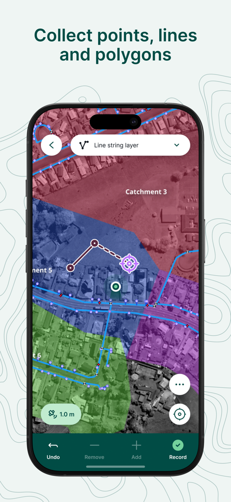
전문 현장 조사 및 데이터 수집을 위한 유색 기하학적 오버레이가 있는 위성 지도가 표시되는 모바일 앱 화면
Mergin Maps 앱에 스마트폰 화면에 구획 데이터가 있는 전문 GIS 지도가 표시됨
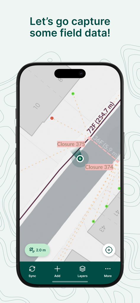
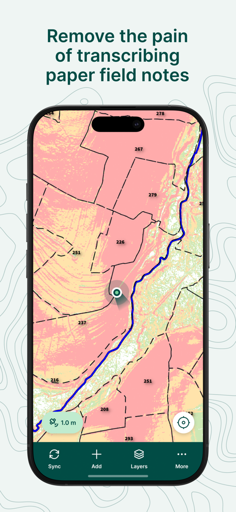
Mergin Maps 앱 인터페이스에 지도에 표시되는 현장 데이터 캡처 및 조사 측정
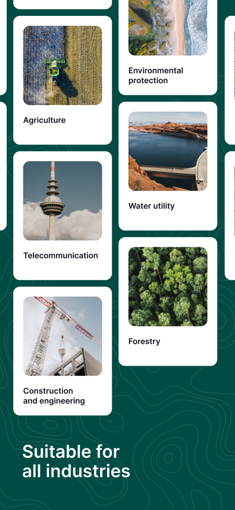
Mergin Maps 인터페이스에 농업, 임업, 건설을 포함한 다양한 산업에 대한 적합성이 표시됨
설명
Download
비슷한 앱
같은 카테고리의 상위 앱

Google LLC

Google Chrome
Google LLC

中国移动(手机营业厅)
China Mobile Online Services Co., Ltd.

Google Authenticator
Google LLC

CNH do Brasil
Servicos e Informacoes do Brasil

Cleanup: Phone Storage Cleaner
DEEP FLOW SOFTWARE SERVICES - FZCO

gov.br
Servicos e Informacoes do Brasil

中国电信-全国统一官方服务平台
CHINA TELECOM Corporation Ltd.

Microsoft Edge: AI Browser
Microsoft Corporation
이 페이지는 앱이나 개발자의 공식 페이지가 아니며, 정보 제공 및 논평을 목적으로 작성된 독립 편집 간행물입니다. 명시적으로 달리 언급되지 않는 한, 해당 앱이나 개발자는 MWM, Apple, Google Play, 앱 퍼블리셔 또는 앱 개발자와 제휴, 보증, 후원, 승인 또는 공식적으로 연결되어 있지 않으며, 이 페이지의 어떤 내용도 해당 앱이 MWM의 서비스를 사용하여 개발되었음을 의미하지 않습니다. 모든 상표, 로고, 스크린샷 및 기타 콘텐츠는 해당 소유자의 자산입니다.