이 페이지는 앱이나 개발자의 공식 페이지가 아니며, 정보 제공 및 논평을 목적으로 작성된 독립 편집 간행물입니다. 명시적으로 달리 언급되지 않는 한, 해당 앱이나 개발자는 MWM, Apple, Google Play, 앱 퍼블리셔 또는 앱 개발자와 제휴, 보증, 후원, 승인 또는 공식적으로 연결되어 있지 않으며, 이 페이지의 어떤 내용도 해당 앱이 MWM의 서비스를 사용하여 개발되었음을 의미하지 않습니다. 모든 상표, 로고, 스크린샷 및 기타 콘텐츠는 해당 소유자의 자산입니다.

mKart Marine Navigation
iPad를 전문가 수준의 3D 내비게이션 시스템으로 전환하세요. 무료 NOAA ENC, 실시간 AIS 교통 정보 및 고급 안전 경고를 액세스하여 물 위에서 완벽한 자신감을 가지세요.
다운로드
22K+사용자 평점
총 평가 수
0개발사
카테고리
Navigation지원 언어
1최신 버전
1.8.727크기
85.5 MB출시일
2020년 1월 28일현대 선장을 위한 정밀 내비게이션
iPad를 전문가 수준의 3D 차트 플로터로 전환하세요. mKart는 공식 NOAA 데이터와 최첨단 시각화를 결합하여 더 안전하고 스마트한 항해를 제공합니다.
몰입형 3D 상황 인식
3D로 해저 지형과 육상 인프라를 시각화하세요. 실제 환경과 일치하는 모델로 더욱 직관적으로 항해하세요.
자동 안전 및 금지 구역
선박의 흘수심을 존중하고 위험한 수심을 실시간으로 강조하는 자동 경로 지정으로 자신 있게 항해하세요.
다음 스크린샷과 설명은 앱의 공식 스토어 목록에서 직접 가져온 것이며 앱 개발자의 자산입니다.
앱 스토어
스크린샷
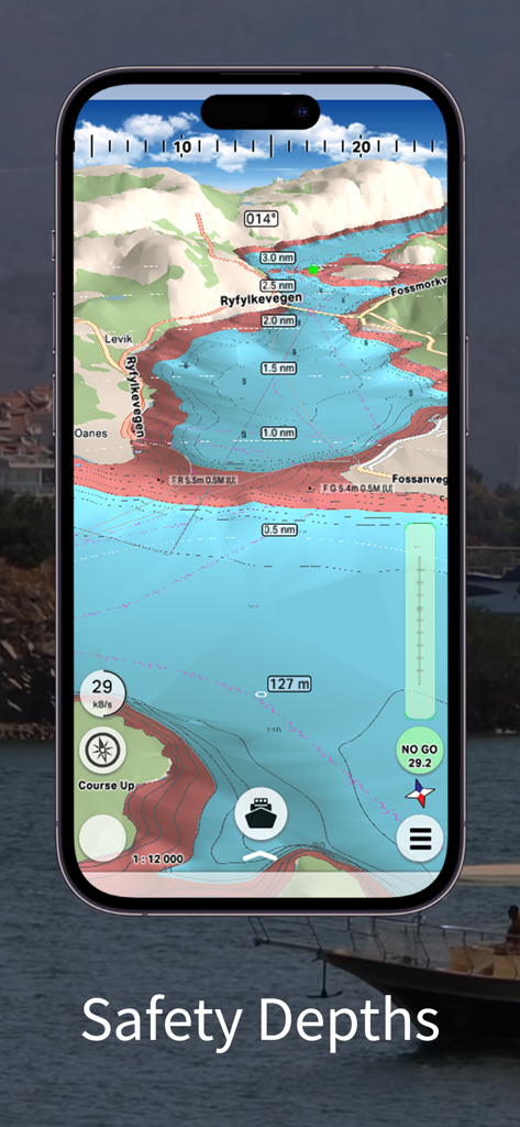
mKart 해상 내비게이션 앱 인터페이스, 3D 해저 지형 및 안전 수심 구역 표시
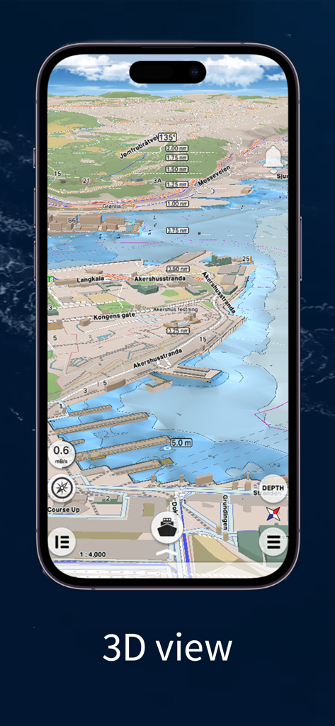
mKart 해상 내비게이션 앱의 건물 및 해저 지형이 있는 해안 항구의 3D 시각화
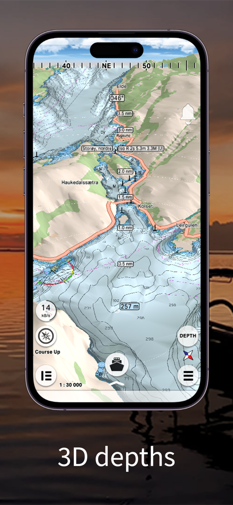
mKart 스마트폰 앱, 등심선과 해저 지형이 있는 3D 해상 차트 표시
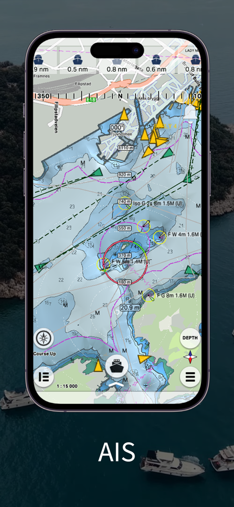
mKart 앱 인터페이스, 스마트폰에 실시간 AIS 해상 교통 및 전문 해도 표시
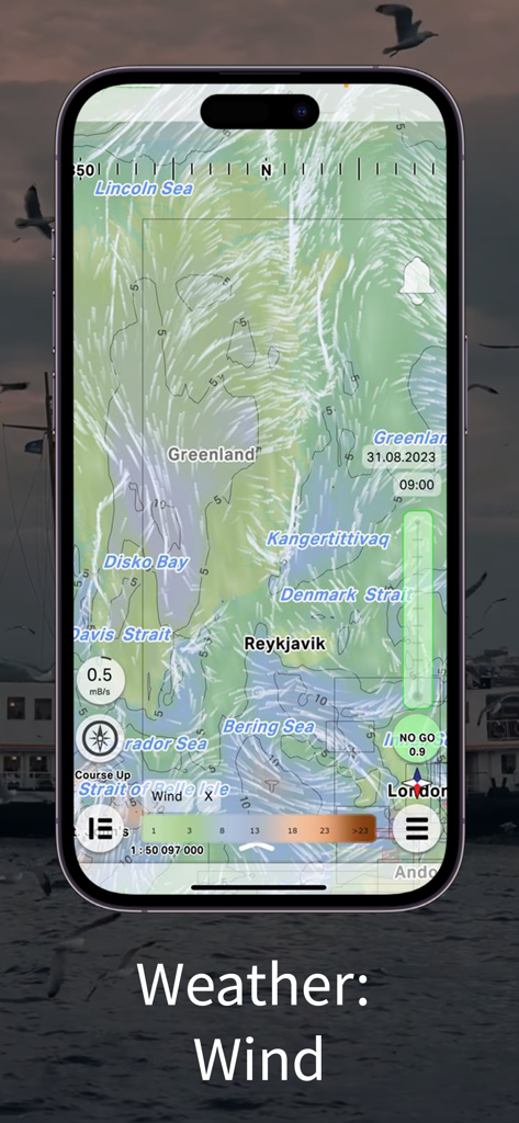
mKart 해상 내비게이션 앱 인터페이스, 글로벌 해도에 바람 날씨 예보 오버레이 표시
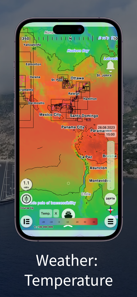
mKart 내비게이션 앱에 북미 및 남미를 보여주는 해상 날씨 온도 히트맵 오버레이.
설명
Download
비슷한 앱
같은 카테고리의 상위 앱

Google Maps
Google LLC

Waze Navigation & Live Traffic
waze

AMap Global
AutoNavi Information Technology Co. Ltd.

百度地图-路线规划,出行必备
Beijing Baidu Netcom Science & Technology Co.,Ltd

Moovit: Bus & Transit Tracker
Moovit App Global LTD

Transit • Subway & Bus Times
9280-0366 Quebec inc.

ParkMobile: Park. Pay. Go.
Parkmobile USA, Inc

腾讯地图-路线规划,导航地铁打车出行
Shenzhen Tencent Computer Systems Company Limited

Île-de-France Mobilités
Ile de France Mobilites
이 페이지는 앱이나 개발자의 공식 페이지가 아니며, 정보 제공 및 논평을 목적으로 작성된 독립 편집 간행물입니다. 명시적으로 달리 언급되지 않는 한, 해당 앱이나 개발자는 MWM, Apple, Google Play, 앱 퍼블리셔 또는 앱 개발자와 제휴, 보증, 후원, 승인 또는 공식적으로 연결되어 있지 않으며, 이 페이지의 어떤 내용도 해당 앱이 MWM의 서비스를 사용하여 개발되었음을 의미하지 않습니다. 모든 상표, 로고, 스크린샷 및 기타 콘텐츠는 해당 소유자의 자산입니다.